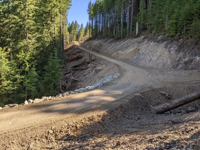
28Dec2023: Active logging has begun in this area.
UPDATE: The S-3000 access road to the Old Mt Mitchel trailhead is now gated at the S-1000 intersection. This adds 2.1 miles one-way to the hike or about 13 mi RT. In addition, DNR is building a lot of new roads off of the S-3000 road, undoubtedly for logging this area. If logging begins in 2024, this whole area will probably close and access to Mt Mitchel from the west becomes much more difficult. I don’t know the status of the inaccessibility from the northside. However, it would still be accessible from the North Siouxon Creek TH (S-1000 road) to Black Hole Falls then north but that would be a really long hike.
Currently, this would be a great MTB or e-bike activation from the locked gate. Using the new road, you can access the Old Trail at around the 4 mi mark which means the old summit trail is about 2 mi to the top, a very pleasant hike to an iconic location for spectacular views and superb HF antenna setup locations.
See my GaiaGPS map at https://www.gaiagps.com/map/?loc=12.9/-122.2328/46.0182&layer=GaiaTopoRasterFeet And the this .gpx track is on SOTAlas web page for this peak.
Here's my .gpx track: http://www.pnwsota.org/content/mt-mitchell-new-gpx-track-oct2023
1st photo of St. Helens just below the summit.
2nd photo of the new road at the former TH.


