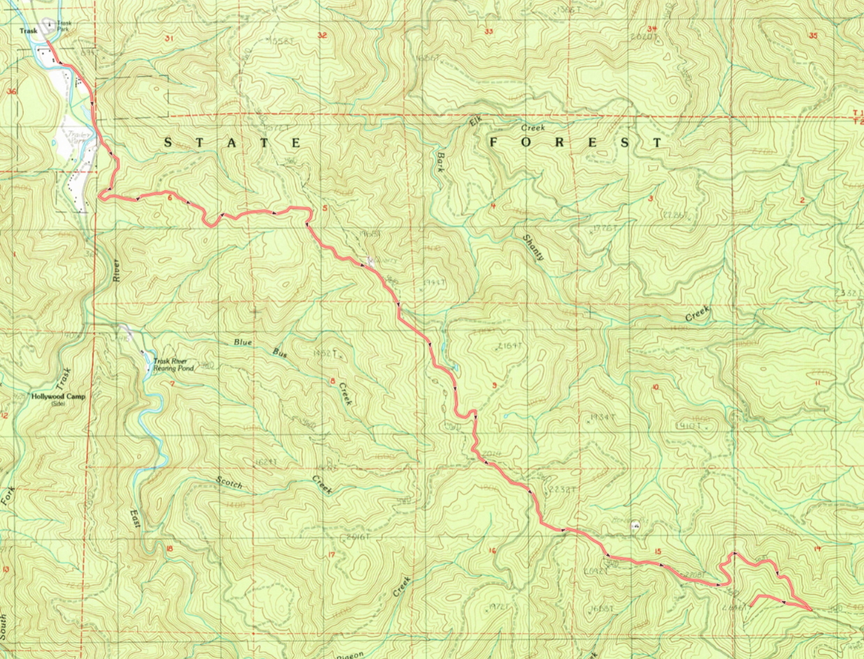
NC-080 is one of the peaks in the Tillamook State Forest surrounding the Trask River valley, along the eastern edge. As such, the most straightforward approach is via Trask River Rd past the Trask River Park Campground.
- Ask Google Maps for directions to Trask River Park Campground. This will most likely mean going out to Tillamook and turning on Olsen Road to travel back east into the Trask River valley.
- Less than a mile after passing the campground, take a left fork onto Old Toll Road at (45.43189, -123.60388)
- Follow Old Toll Road (which is the main road) for about 6 miles
- Take the left fork at (45.39444, -123.53393) when Old Toll Road becomes Big Bertha Rd
- Follow Big Bertha as it winds around the north side of the hill for just over a mile
- Take the right switchback fork at (45.39058, -123.51558) and climb the hill the remaining 1/2 mile
- (GPX available, image of route attached as picture)
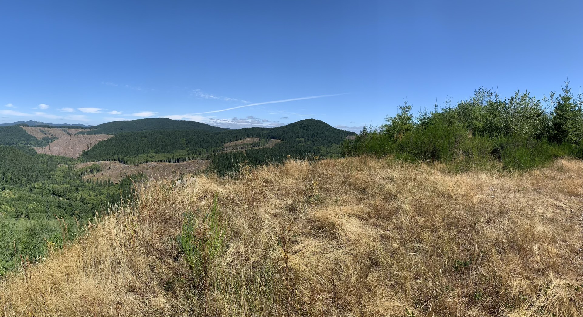
Some of these roads are a little rough, but a carefully driven passenger car should make the trip. The final access road goes right over the summit which is a mostly-open meadow area with lots of room to setup and decent views of the valley to the west. This peak is within throwing distance of Ginsberg Point NC-025 if you're looking for a double activation day.
In the late fall hunting season, Weyerhauser opens the gates to the east of this peak. It's possible to start in Yamhill and drive west through the Weyerhauser parcel and back out into public land here. I'm going to leave that route as an exercise for the reader, but anyone interested can contract me for GPX tracks and pointers about the schedule.