NC-106 is a long drive from Portland, and a bit of a hike, all for one point operating at barely over 2000 feet. If you don't mind the green canopy though, it's one of the prettiest forests I've walked in the NC region.
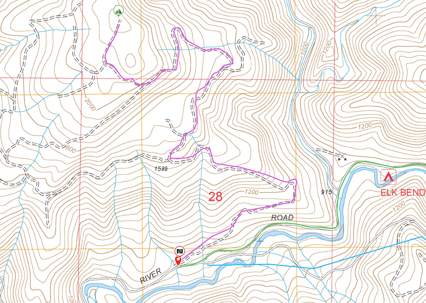
- Starting from Yamhill or Beaver, get onto Nestucca River Road (Nestucca River Access Rd, Nestucca River Hwy); this is the same road to Sheridan Peak NC-009.
- Park on the side of Nestucca River Road at (45.27706, -123.55822), about a mile west of Elk Bend Campground, or 4 miles past the turnoff for Dovre Peak, or about about 10 miles past the turnoff to get to Sheridan (Bald Mountain Rd). Both Sheridan and Dovre would make good paired-peak activations with this one.
- The parking location has a forest road fork that provides some space for cars but terminates in an overgrown gate 200 ft up the road.
- The drive is entirely on paved road, although Nestucca River is very windey and sometimes closed for seasonal repairs. Check latest news at Nestucca River Recreation Area | Bureau of Land Management (blm.gov)
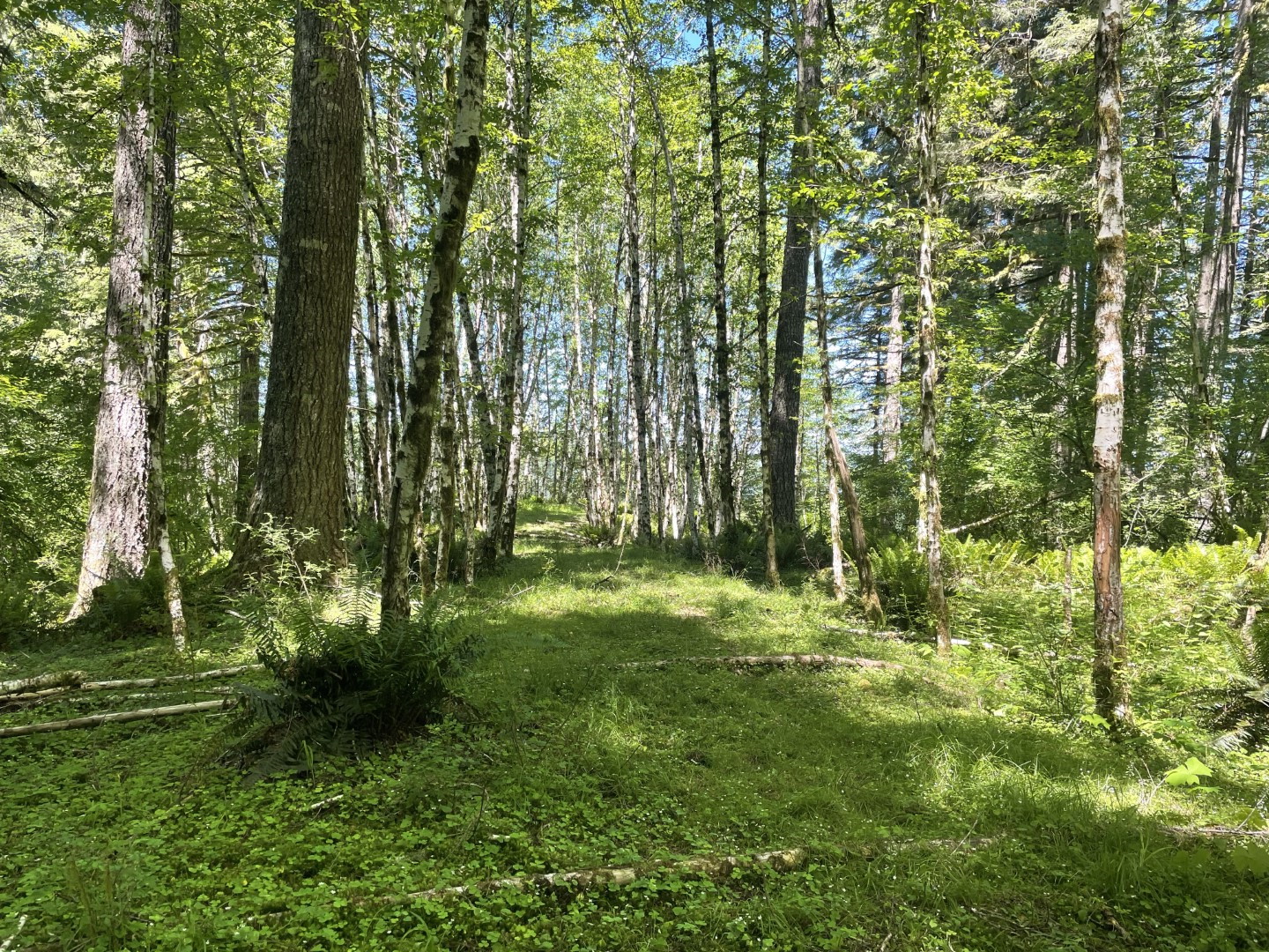
The ~3 mile hike is entirely on what remains of the gravel road bed, with a few inches of dirt and growth over the top of it. In springtime it can a little mushy too, as the local runoff has chosen to go through the road in many places. The route is mostly obvious, but I've captured it on an image below, and can be summed up as:
- At 1.5 miles past the gate, turn right (45.28336, -123.55866)
- At 2 miles, turn left (45.28886, -123.55352)
- At 2.8 miles, fork right (45.28782, -123.56042)
- At 3 miles, turn right (45.28891, -123.56348)
- Total hike up, approx 3.2 miles and 1270ft gain
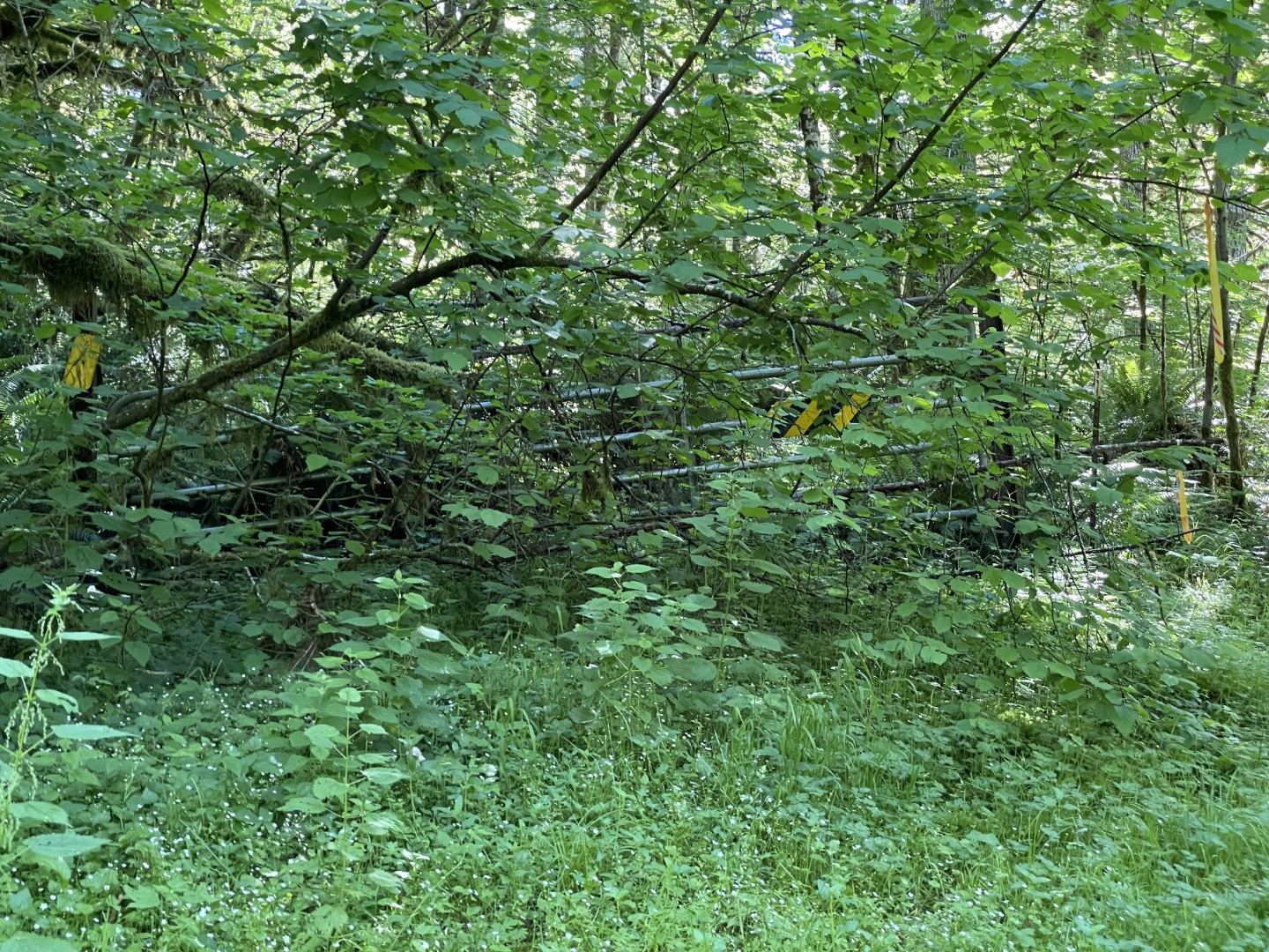
Given the amount of overgrowth and underuse, the road is still mostly clear but I'd advise a GPS with the route in-hand to make sure you don't miss a turn. There are also tape flags interspersed through most of the route (survey or hunting?), but I wouldn't rely on them for guidance.
There is plenty of random branches and blowdown along the path but nothing that requires acrobatics to get through. Early in the route past the gate there is a section where the road has been washed out or utterly overgrown and some side paths have been established. Easy enough on foot (borderline bushwhacking in a couple spots), but not really bikeable.
The summit terminates the forest road in a wide turn around and I found a huge rusty cable as evidence that this was once an active logging area decades ago. It's open enough for big antennas but closed enough to provide no real views. The gravel bed also makes stake tent guying difficult.
Finally, I'd suggest wearing sturdy hiking shoes or boots due to the overgrowth; this is not a basic gravel road walk. Additionally, I'll be wearing long pants if I do it again. I wore shorts but found that walking through long grass in some of the path caused some allergy-type itching later that night. I didn't see any poison oak though.