Note that in August 2020 Mount Tom was posted no trespassing: http://www.pnwsota.org/blog/w7ho/2020-august-22/tom-mount-oregon-locked-gate-and-posted-no-trespassing.
Buck Mtn and its "sister" summit, Mt Tom make a good two summit day, which is how I did it. They are north of Mohawk, OR and accessed from the same mountain/logging roads. They are easily reached from the Eugene/Springfield area. Take the 42nd St exit from I-105 in Springfield, which provides access to the Marcola Rd north. Follow that road to Hill St, and turn L onto Hill. Take that a very short distance to the Mohawk Store. Go R at the store on Donna Rd. Turn L onto McGowan Creek Rd toward the rifle range. From there follow your maps/GPS to the north toward these summits. A fork in the gravel road near the top provides access to Buck Mt to the east and Mt Tom to the north.
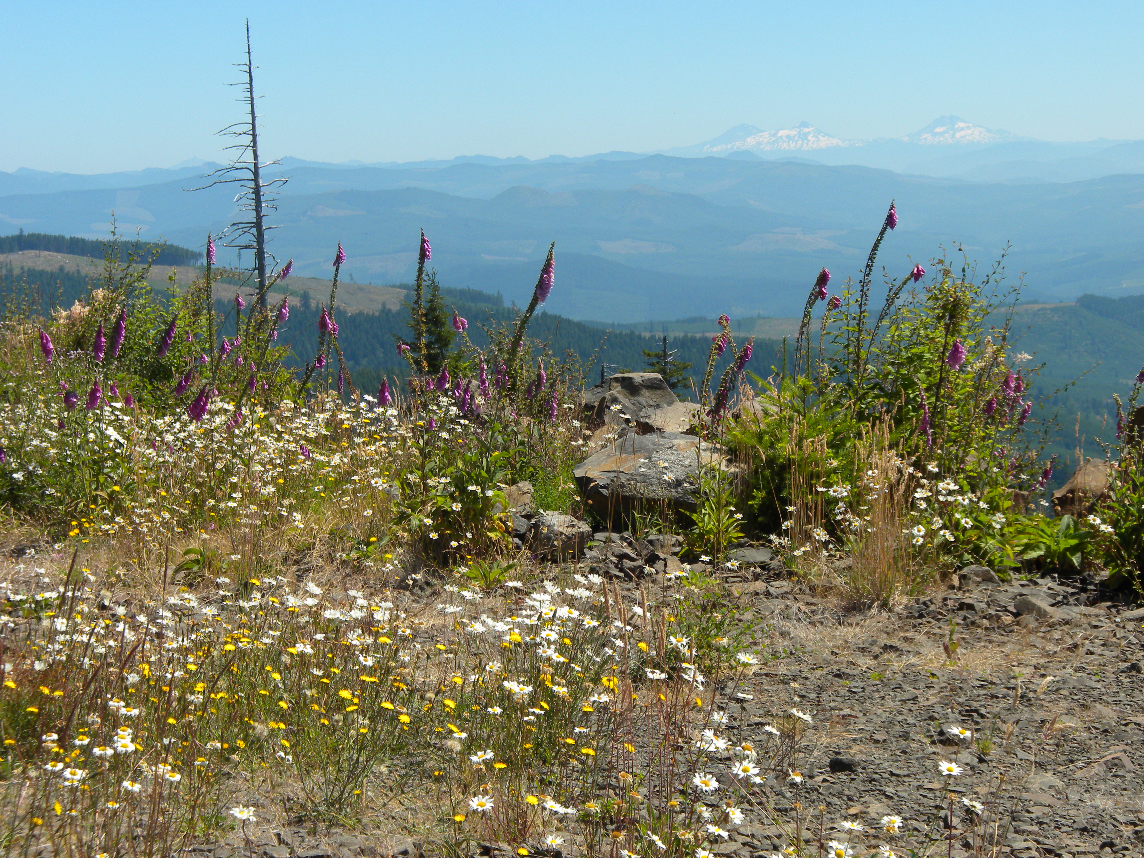
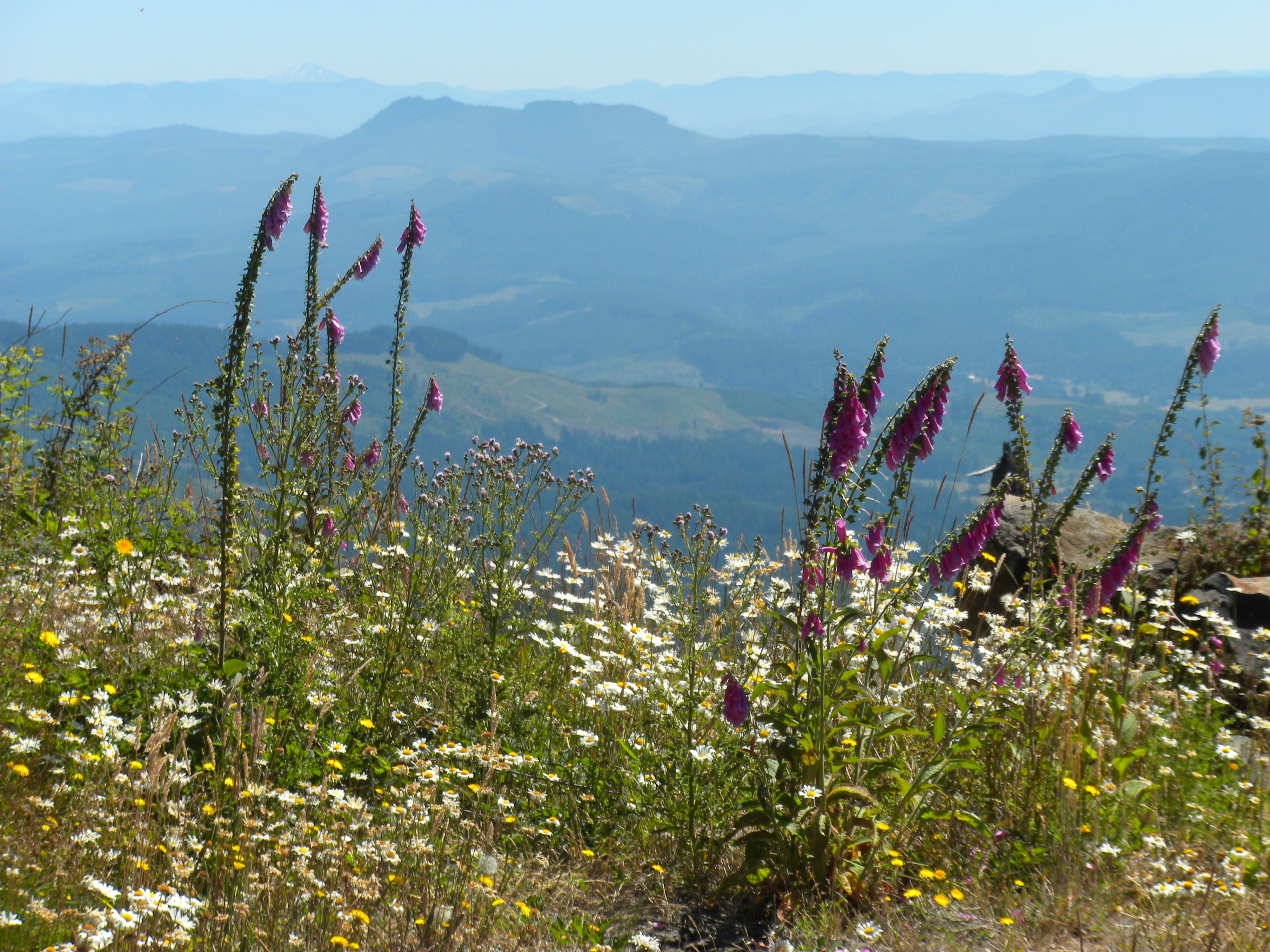
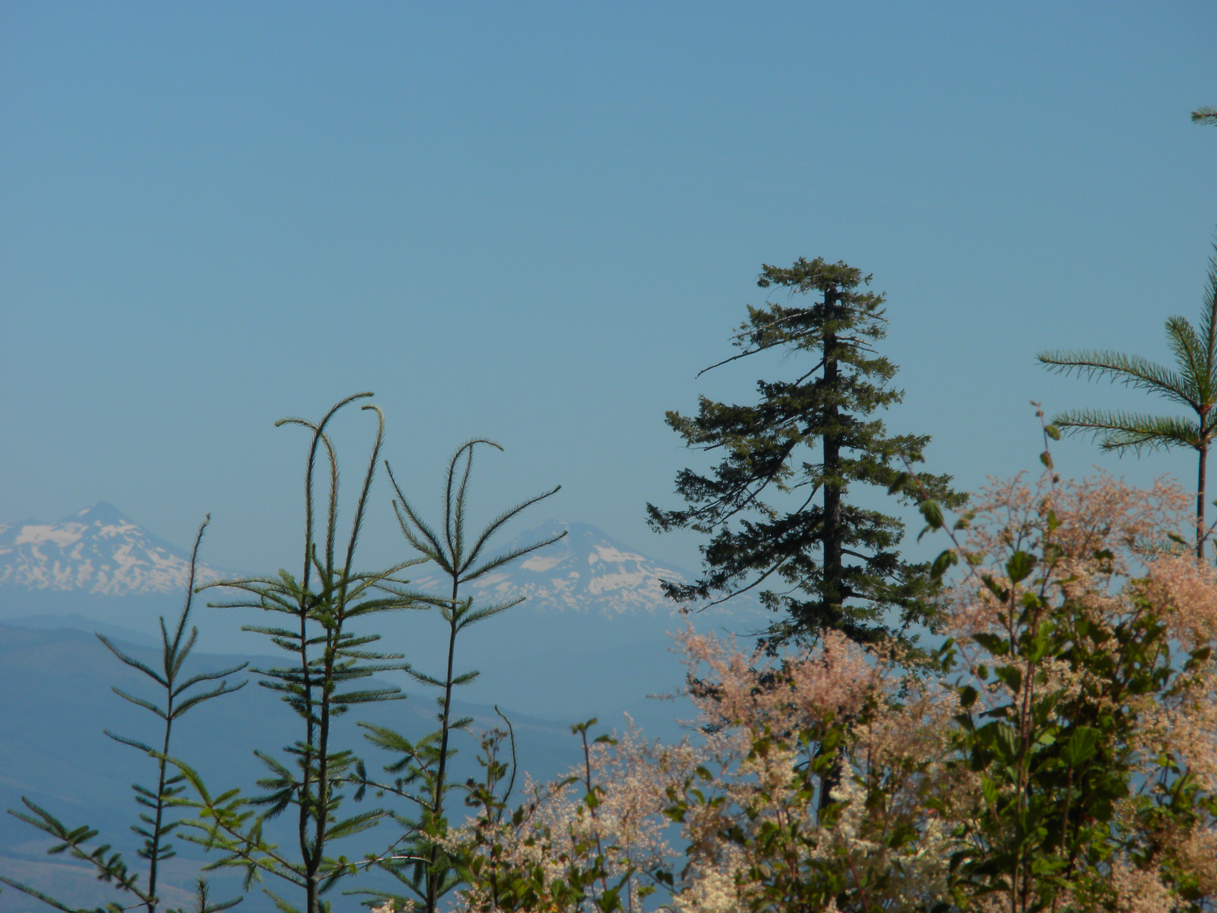
Take the fork to the north and follow it to the summit. The drive is about 40 mins from the Mohawk Store. The Buck Mt trailhead is about 25 mins form the store. You can probably drive all the way to the summit if you choose. There is an old gate about 600 meters from the summit, but it did not look recently used. There is a place to pull over and park short of the summit, allowing a SOTA walk-up. The views are impressive with a number of snow covered Cascade peaks to the east and the Eugene valley to the southwest. The wildflowers and butterflies were impressive, especially the great number of purple foxgloves in high form. Of the two summits, Mt Tom is the nicer: better views, more flowers, no QRN.
The sun and heat was getting to me, and I only had six 20m CW QSOs in about 25 mins, so I skipped 40m. I did have another S2S QSO into CA.