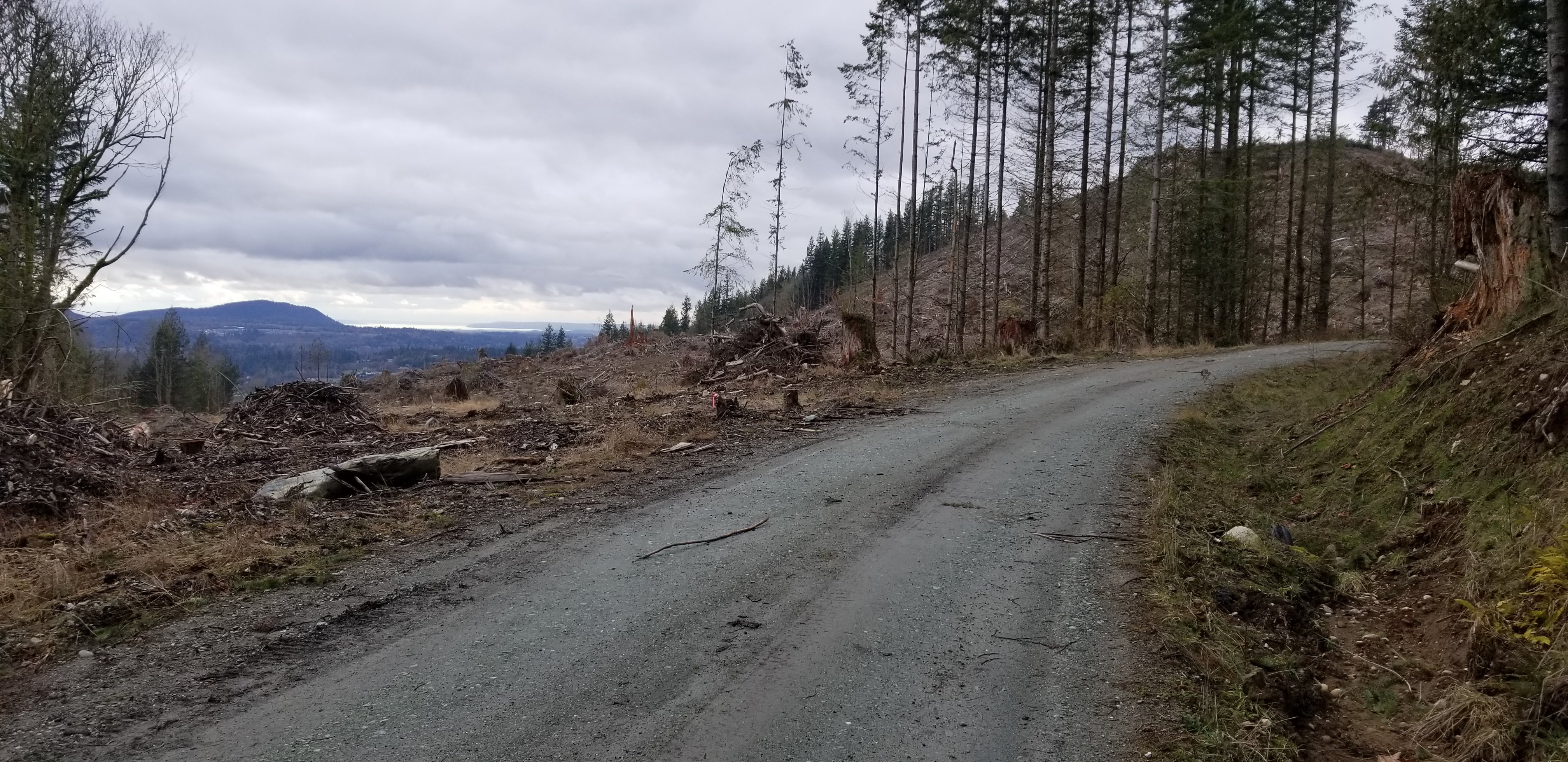
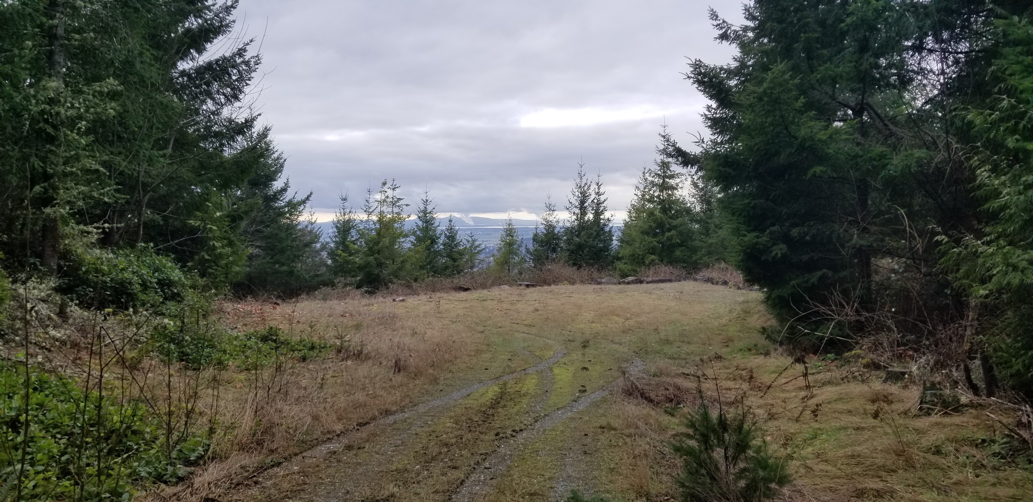
Skagit Gadget is a 1-point summit, located within ~20 minutes of I-5 in Skagit County. Some of the area has been logged, and it is a 4 mile road hike with ~700 ft of gain. Both times I've actived as a second summit for the day, and was thankful to squeeze in enough vhf contacts before a new UTC day rollover. Trees are starting to grow near the summit activation area, but there are some views at summit...and more views hiking up.
Directions:
Depending on whether you are heading north or south on I-5, there are a few options... so I'll start from Hwy 9 just SW of summit.
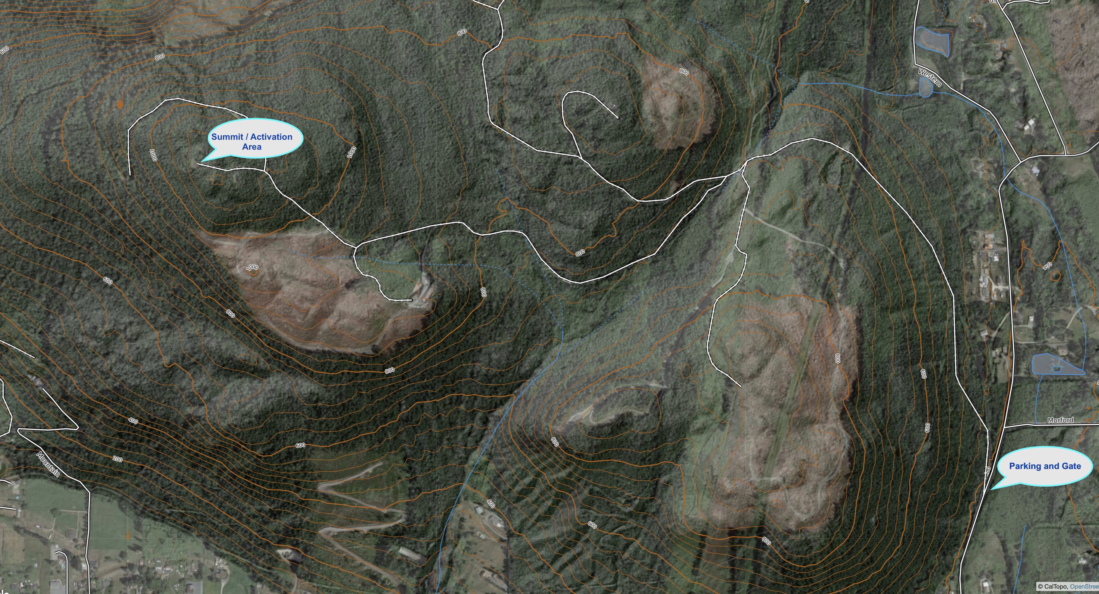
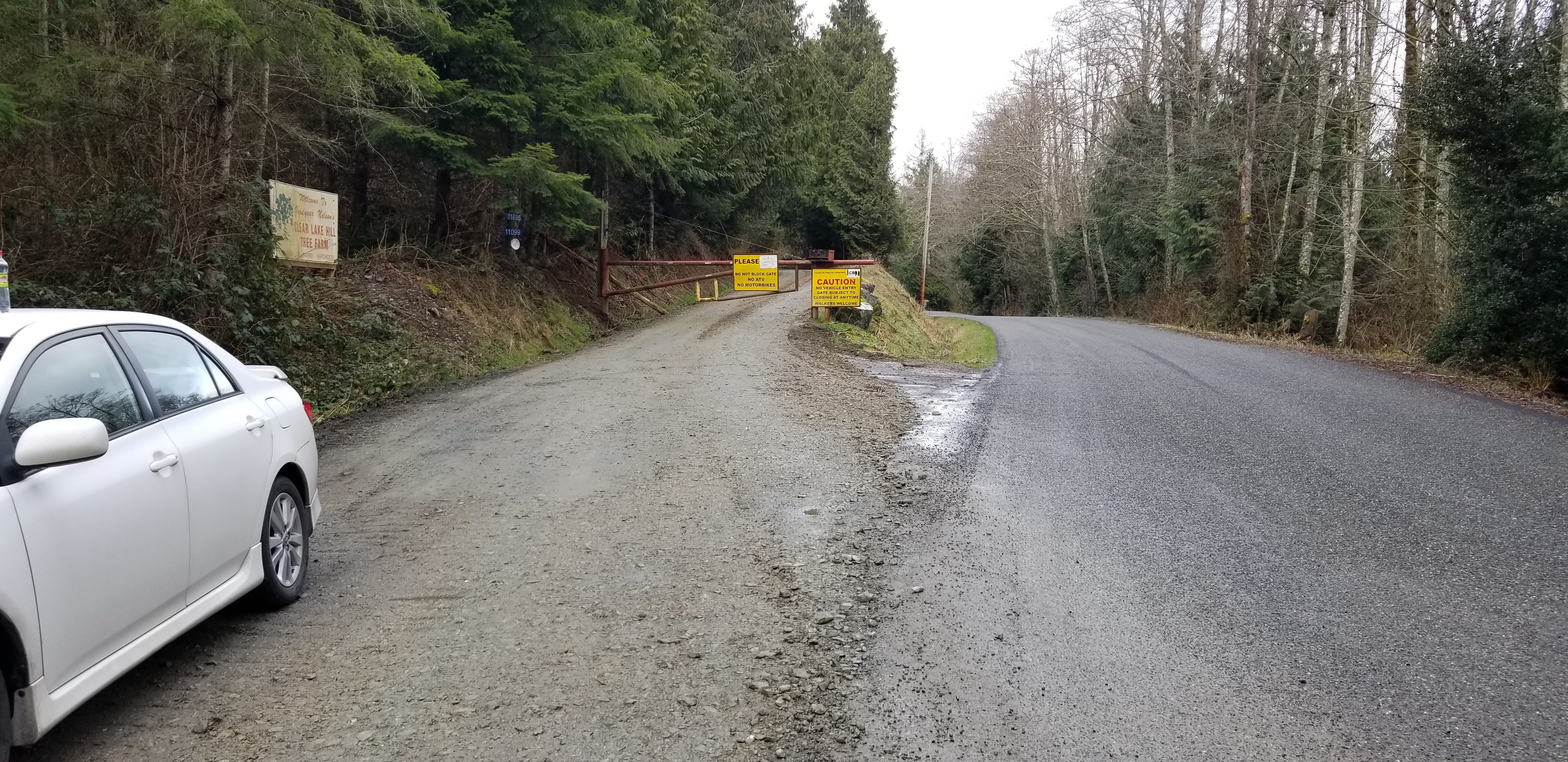
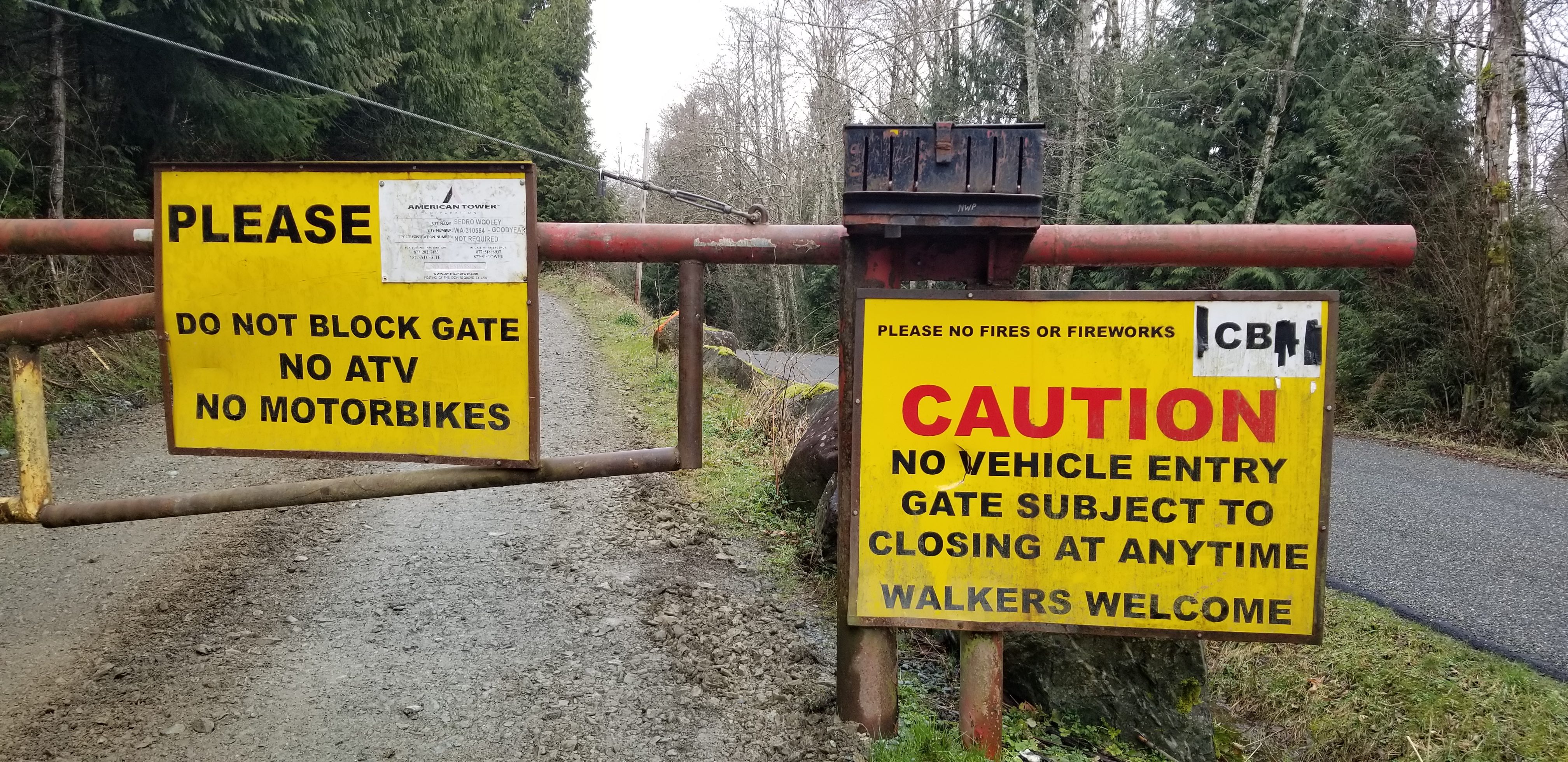
From traffic circle on Hwy 9 (on SW corner of summit), head east 1.9 miles on Old Day Creek Rd. Turn Left onto Morford Rd, and in ~0.2m there will be a gate on the left side of road, and a small area to park. Per signage, be careful to not block gate and "walkers" or hikers are permitted to access the summit.
Hike:
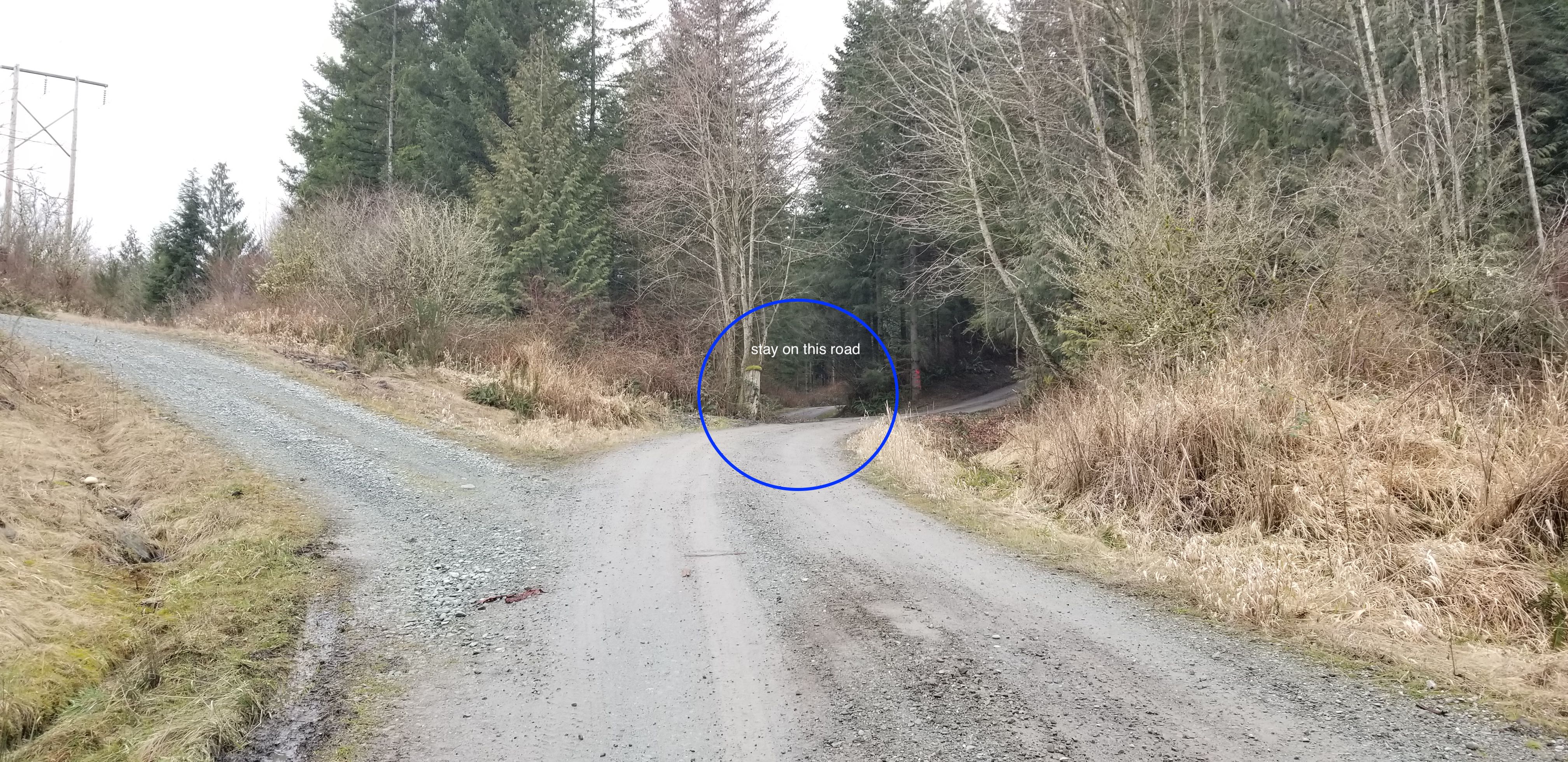
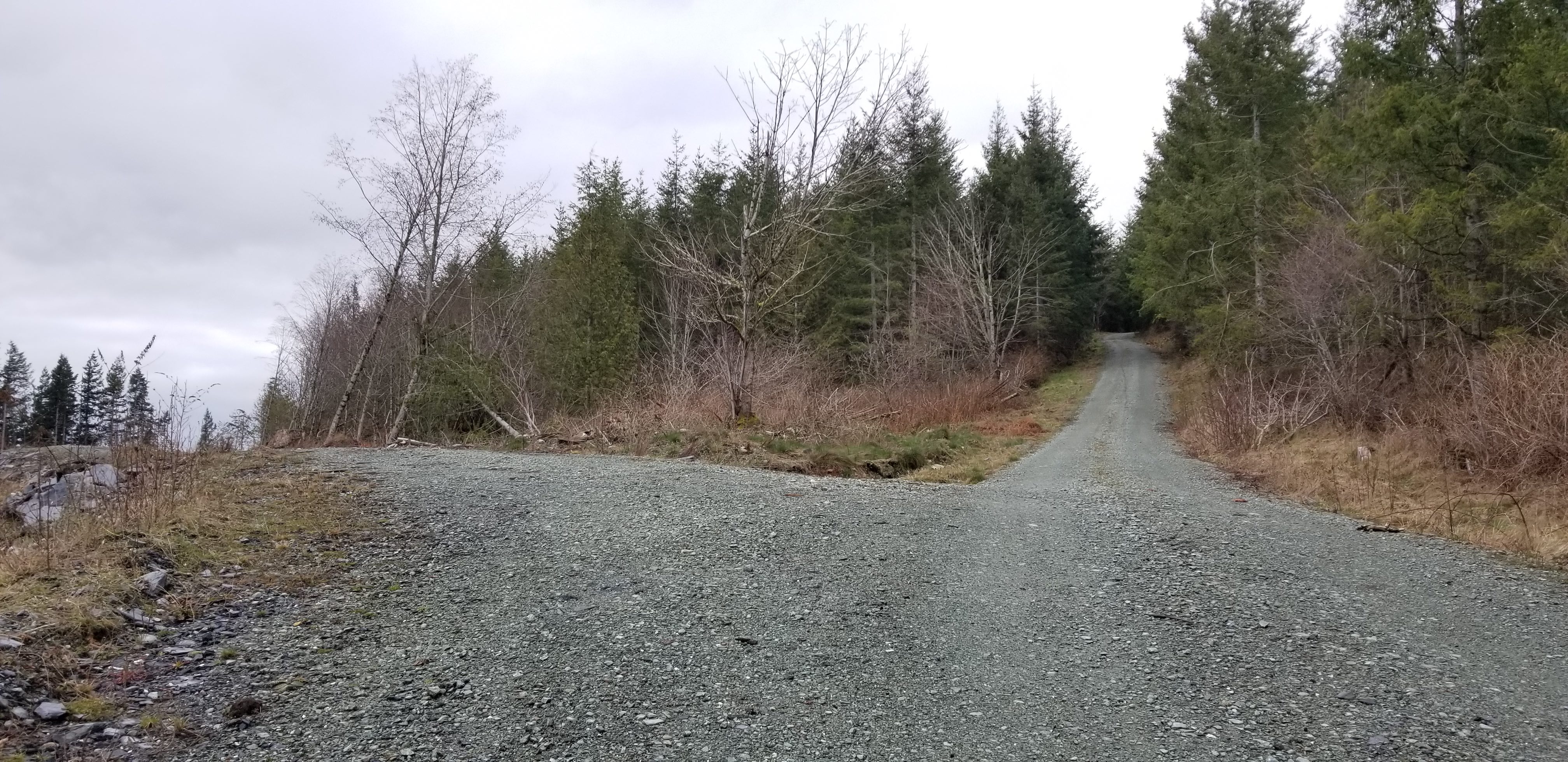
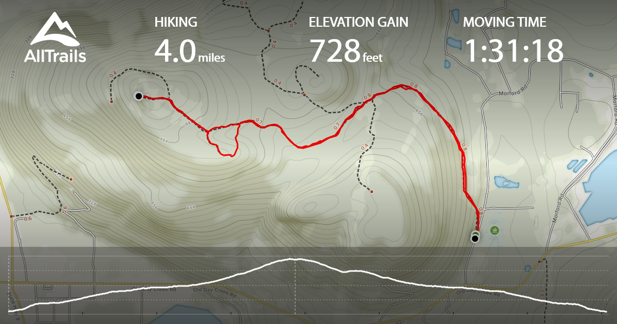
4.0 miles with 728 feet of gain per tracking app, which included a small sidetrip to a highpoint SE of the summit area. The entire hike is on logging roads, and some of the area has been logged. When you get to the area where three roads go left, straight, or right...stay straight. Continue to stay straight (there are ~3 options to turn left), and then turn left once you are near the summit area. Tracking path and map are provided below to help.
Summit Area:
There is a nice open area, with some view just west of the summit. Trees nearby can be used for antennas, and there are nice large rocks for seating.