Eagle Point was a very enjoyable 6-point summit located just southeast of the Hurricane Ridge Visitor Center in Olympic National Park. After activating the very popular Hurricane Hill W7W/NO-086 last year, I wanted to explore a few summit options nearby along the Obstruction Point Road. This road is a well maintained dirt road and is generally open from mid-July through October (it is alway good to check road access via the link below). The road is accessed by turning a sharp left just before the parking lot to the Hurricane Ridge Visitor Center.
https://www.nps.gov/olym/planyourvisit/current-road-conditions.htm
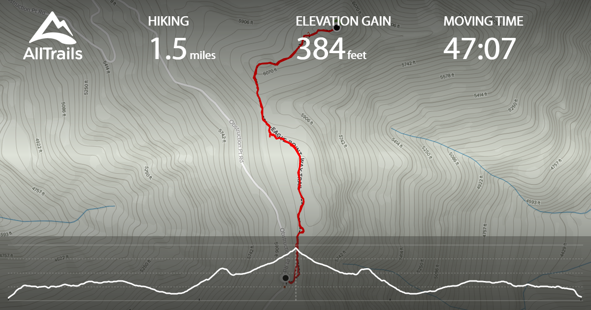
Trail Information: 1.5 miles round-trip and ~400 feet of gain
Some maps show a trail from the southwest to the summit, but I could not find much information about. The Summitpost link below was helpful in confirming this was the best approach.
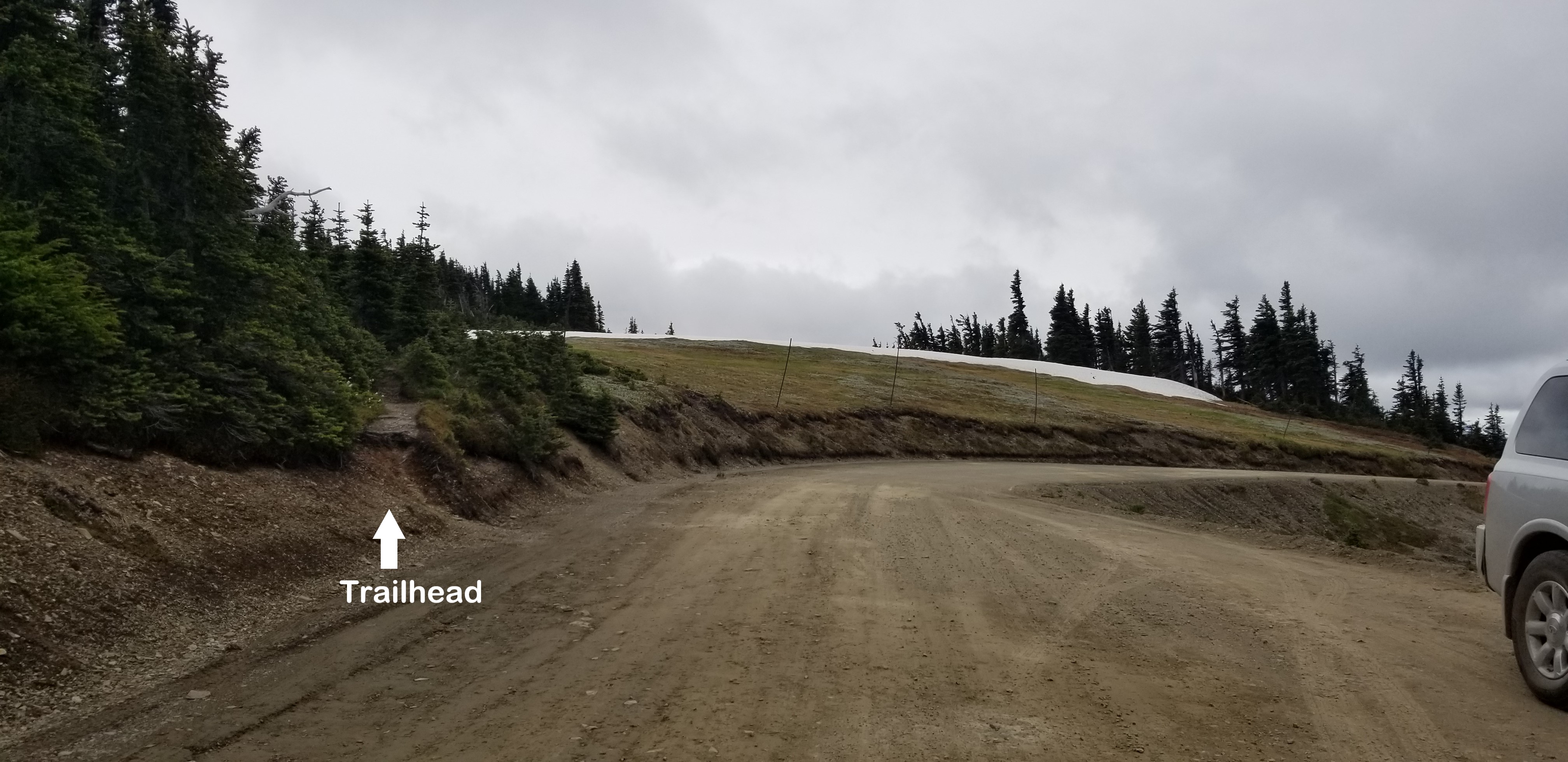
To reach the trailhead, after turning onto Obstruction Point Road drive ~5.5 miles. There will be room on the right for ~2 cars to park, and an unmarked trailhead will be on your left. The trail is pretty easy to follow at first, but I lost track of the trail a few times. It was helpful to have the trail information downloaded on my phone and using GPS, but if you follow the ridgeline it is pretty straight-forward. As of July 3rd 2020, there were only a few small patches of snow on the trail and it was easily avoided.
In researching summit information, this link was also helpful https://www.summitpost.org/eagle-point/536035
Summit and Activation:
The summit is small and exposed with 360 degree views, and I look forward to activating this summit again with better weather. There were a few small trees that you could attach an antenna mast to, but I chose to do VHF/UHF only this time. After quickly making 6 contacts including 2 in Sequim, 1 in Mount Vernon, and 3 in Vancouver ~90 miles away...I decided to head back. After getting a late start on the day, there was enough time to activate the familiar Hurricane Hill. In the future, I will probably activate Eagle Point along with Elk Mountain NO-057 and/or 5645 Hurricane Ridge NO-091 in August or September
Pictures:
1 - After turning onto Obstruction Point Road, drive ~5.5 miles and you will see a faint unmarked trail on your left and there will be parking for ~2 cars on the right side of the road.
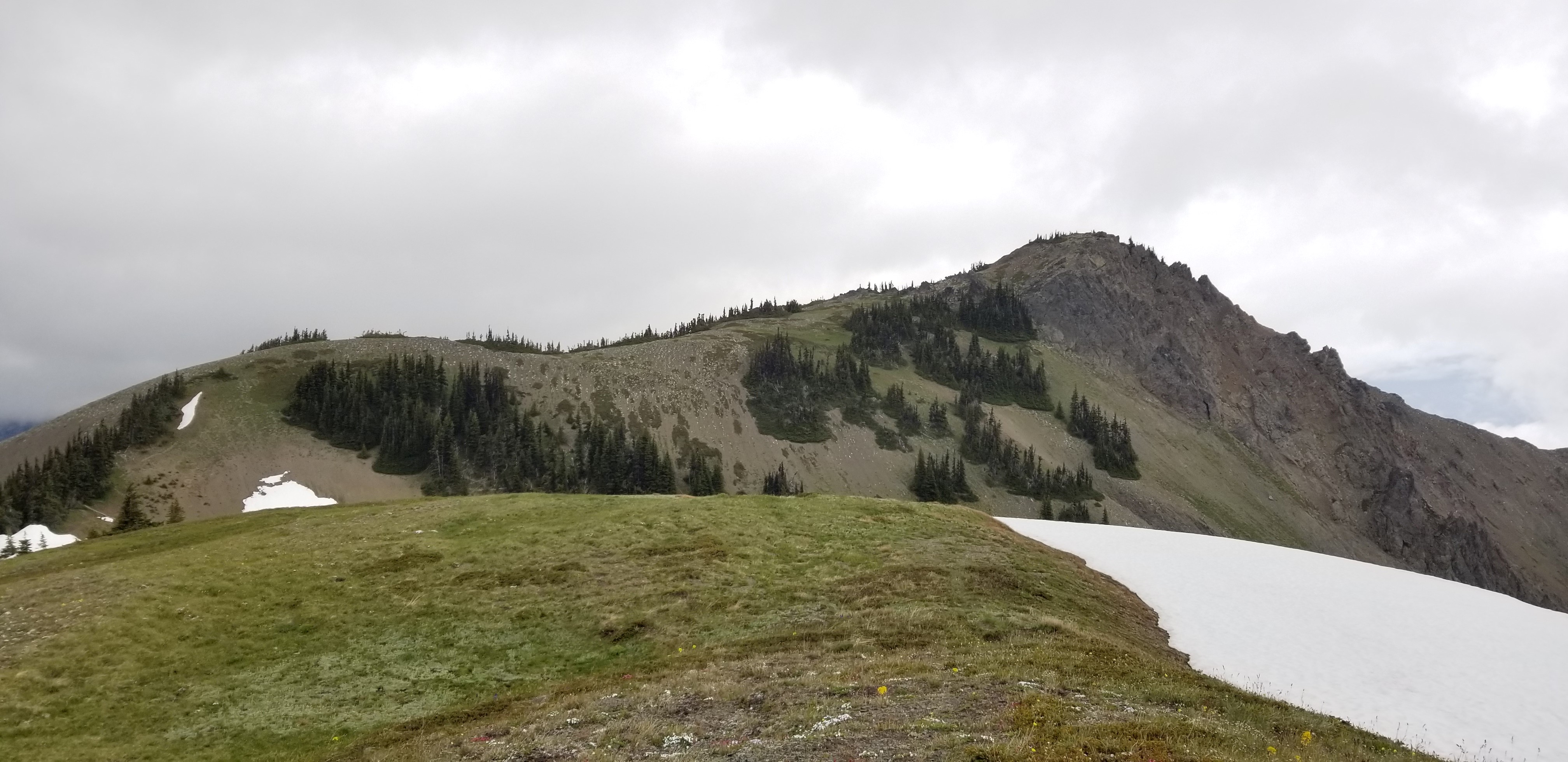
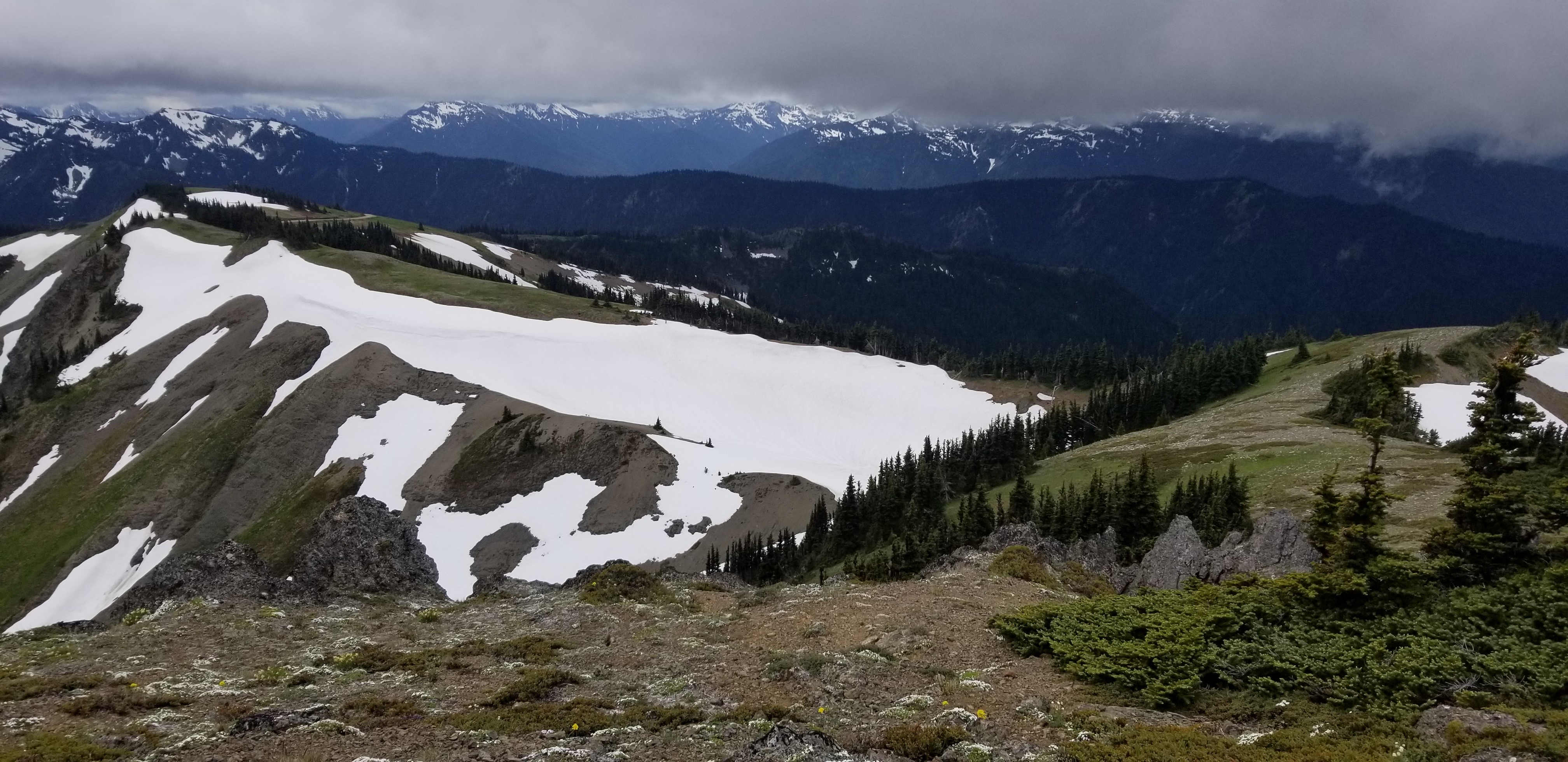
2 - Approximately 0.3 miles into the hike, and looking north toward Eagle Point
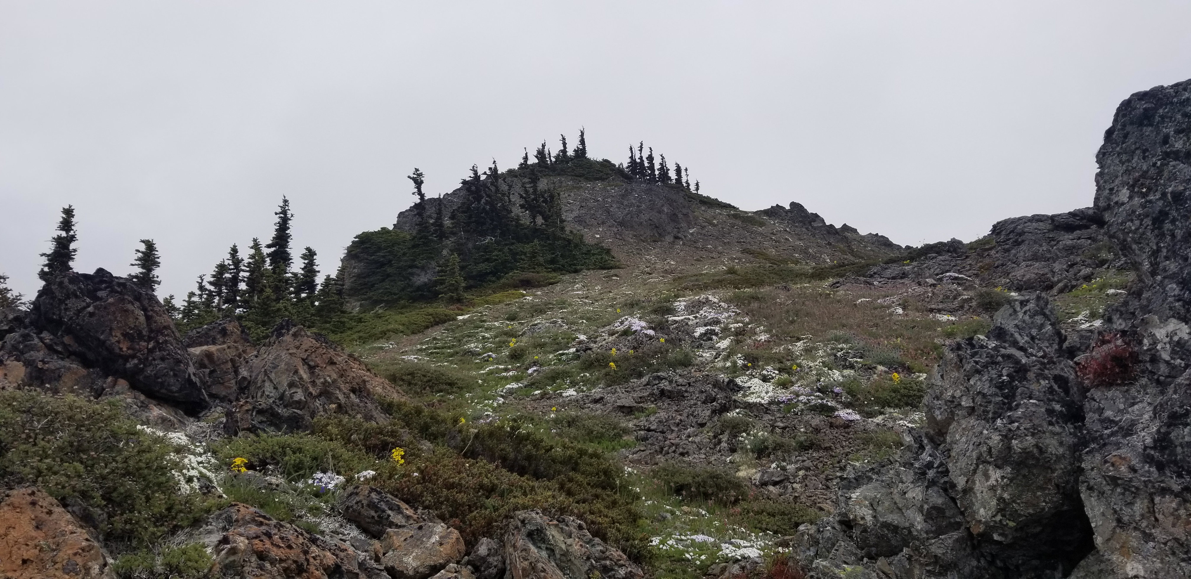
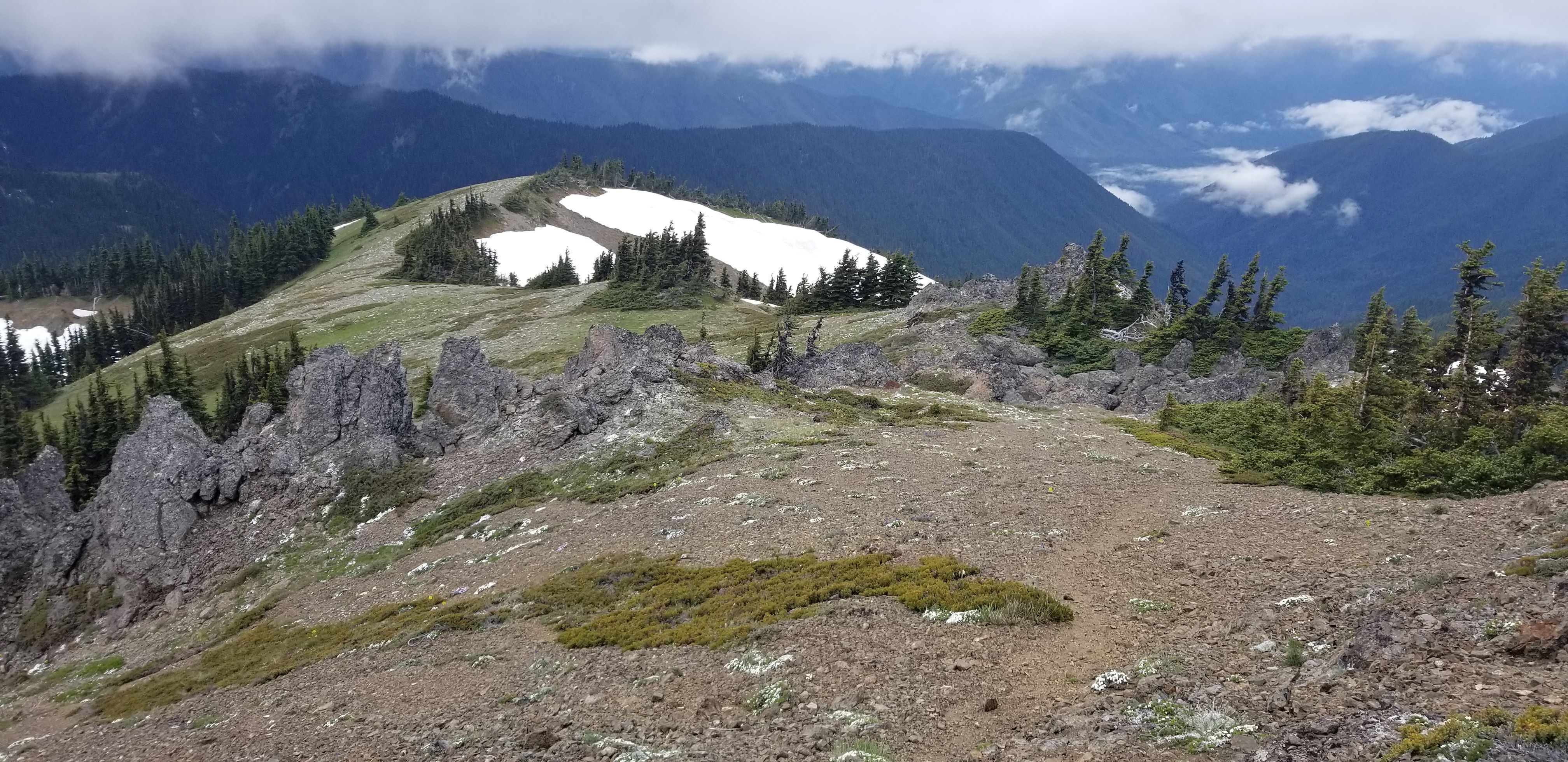
3 - Faint trail and nearing the summit
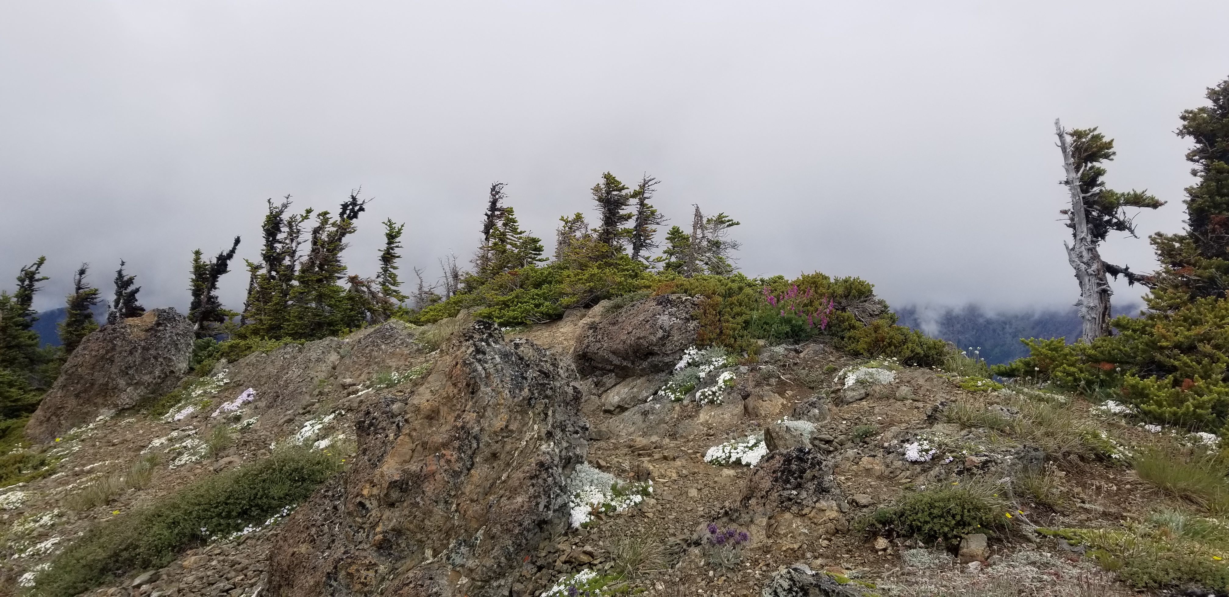
4 - Looking at summit (camera facing north/northwest)
5 - From summit looking southwest at the path taken. From the summit, the trail goes toward the middle far right of the picture. It then follows the ridge to the upper middle left of the picture. In the top left of the picture, you can barely see the road where I parked.
6 - From near the summit, looking west
7 - Summary trail information