This is the most ambitious of the three Tiger Mountain State Forest SOTA summits. It appears to be about six miles (one way) from the Tiger Summit Trailhead parking area and 1600 feet of gain. Using the upper parking lot probably would only save you a few feet of elevation gain and isn’t much shorter. If you use the upper parking lot head east on the Connector Trail and then left up the road. Remember that a Washington Discover Pass is required at the trailhead and that there is an unattractive outhouse at the upper parking lot. Be sure and see Charlie’s blog (KX7L) for his insights into activating West Tiger Mountain – http://www.pnwsota.org/blog/kx7l/2012-june-18/first-activation-june-15.
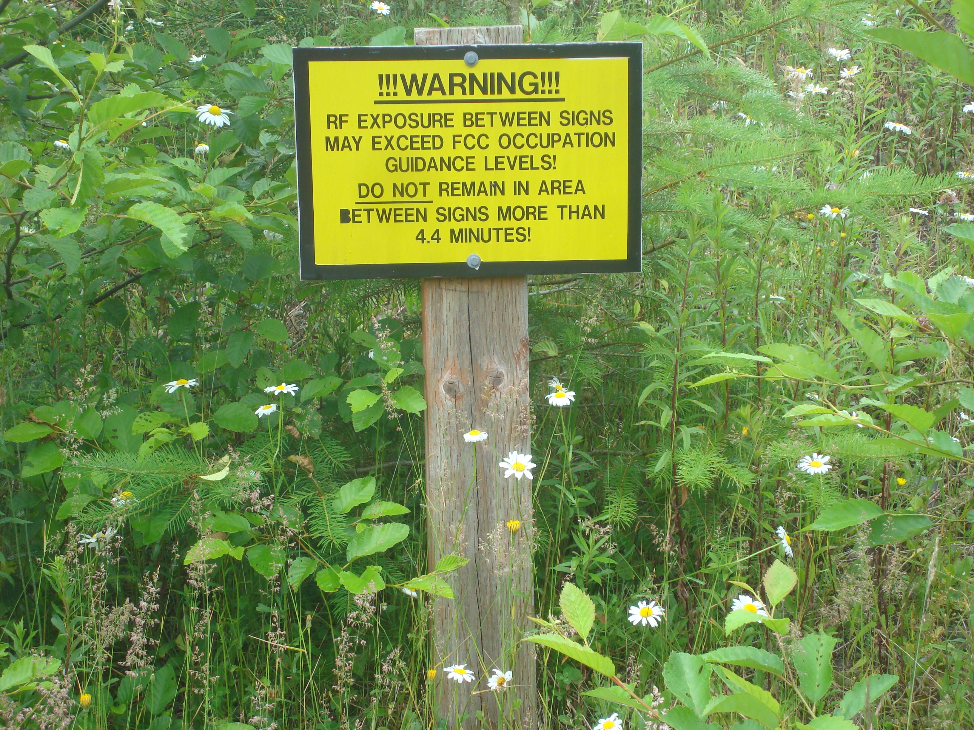
There are three areas with repeaters and broadcast towers on the summit of West Tiger – perhaps eight towers very full of a wide variety of antennas and dishes. No doubt these sites were the source of the S6 hash on 17m and 20m (and also on 6m and 2m!) when using a vertical antenna. Fortunately there was no HF noise when using my end-fed half wave. I think setting up on the west side of all the radio sites might be better bet than where we set up on the east end - after activating we noted some signs cautioning us to limit our RF exposure to 4.4 minutes – not very comforting. Here’s some information on the main transmitter site on West Tiger Mountain – http://www.fybush.com/sites/2010/site-101112.html.
There is only one significant junction in the road with a “T” and the right branch taking you to “Tiger Mountain” (labeled there as “East Tiger”) and the left branch heading up to West Tiger. The main track of the access road leads to the summit – there is no real navigation needed on this activation. But if you use a GPS you might notice that the final West Tiger access road with the fancy gate may not be on your GPS map – however it does head right to the summit. And don't worry that the road loses 600 feet of elevation once you pass the "T" - the last bit does pick up that elevation loss and more to get you to 2,943 feet.