North Coastal's double-oh-seven peak is a two-pointer reachable by a mild forest road hike and a slightly bushwhack-y final ascent. K7ATN has linked to posts on Peakbagger that give good descriptions of the summit logistics including routes, but here's a quick summary:
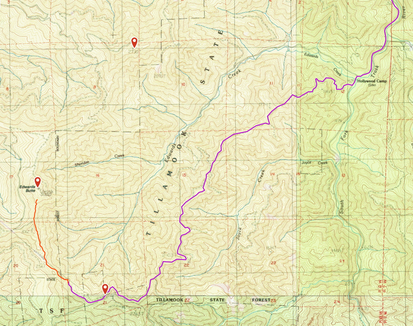
The best driving route goes out to Tillamook and then back into the state forest along Trask River Road. Until around the Trask River Campground this road is paved and pleasant. Shortly after the campground it turns into gravel forest road, some of which have significant climbs. The entire route is passable without much difficulty in an AWD vehicle, but probably not a good idea on 2WD. Topo routing software made for a straightforward journey without any surprise re-routes; I've included a capture of our driving path below.
The last turn is at ( 45.37492, -123.66964 ) where the gravel is left behind and the road becomes more of a dirt-and-mud affair. The Jeep had no difficulties in summer but I can imagine in the off season this short stretch through forest cover could become a bit iffy. Absolute worst case, one could park near the turnoff and hike that half mile of road before parking would be required anyway.
Even the most able vehicle will need to park next to the power line tower at ( 45.37741, -123.67811 ). Just past this point is the end of Tillamook State Forest land and the beginning of Stimson property, so a gate lies just beyond this spot. The usual Stimson access rules and schedule apply.
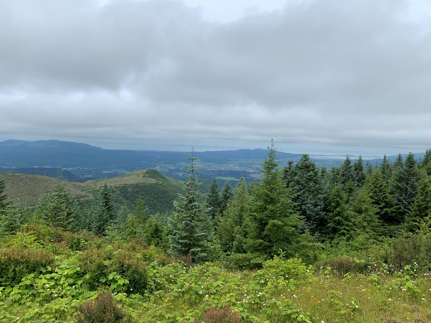
The hike to the summit is about a mile of Stimson access road walking, a very clear path with good views into the valley to the West. The parking spot is visible almost the entire time but your vehicle begins to look very small very quickly. After the stretch of road the route arrives at the base of the final ascent, a somewhat steep bushwhack through some mixed density forest and wild fields for about a quarter mile. We found something resembling a path some of the time, but you might feel you are forging your own through some of the climb. Once the forest thins out near the top, keep to the right/West side to skirt around the first false summit area which has a number of small but dense trees and bushes. Finally the bushes give way to a fairly open summit area. All of this area is well within the AZ and gives plenty of open room to setup antennas. Although invisible though most of the hike along the west side of the ridge, once you get to the summit the view to the east opens up and you can see all the way across the city of Tillamook and into the bay and ocean.