I was brought to Beaty's Butte years ago by Robin N7HAP, a trip that was my first experience of Eastern Oregon, and I fell in love with the area. There is a uniqueness and beauty to the solitude and vastness of this area. I like to make at least one trip a year to enjoy, so Beaty's was at the top of my SOTA list to activate, this was my 2nd SOTA.
Take 140 east until you reach Beaty's Butte Rd, a sharp left before 140 starts climbing Doherty Rim. To my recollection, there is no name on this road but it is listed with name on maps. This is a gravel road with lots of obsidian and lava rock. YOU MUST HAVE SPARES (plural) IN THIS AREA!! (Notice the plural) You will drive about 30 miles total down the gravel roads. When you get close you will see a pinkish abandoned old trailer home to the right at Willow Spring, about a half mile past the pink trailer, turn right. Go another ¼ mile or so and take another right to DL Spring (no markers but on some maps). We camp at DL Spring, which the road basically goes through. Right beside the spring there is a jeep road that goes up to the summit. I have hiked this before and keep in mind there will be no shade and weather can change very quickly. One trip it went from 80s to snow/hail capped mountain in 30 minutes. For the activation we drove part way up. You can drive nearly all the way up to the summit, but keep in mind, it is very steep in portions and is very rough. In a vehicle it will feel like you are going to roll right down the mountain! One rock got the side wall of our rugged truck tire and it isn't the easiest place to change a tire!!This was our 2nd and last spare for this trip so we headed home after activation.
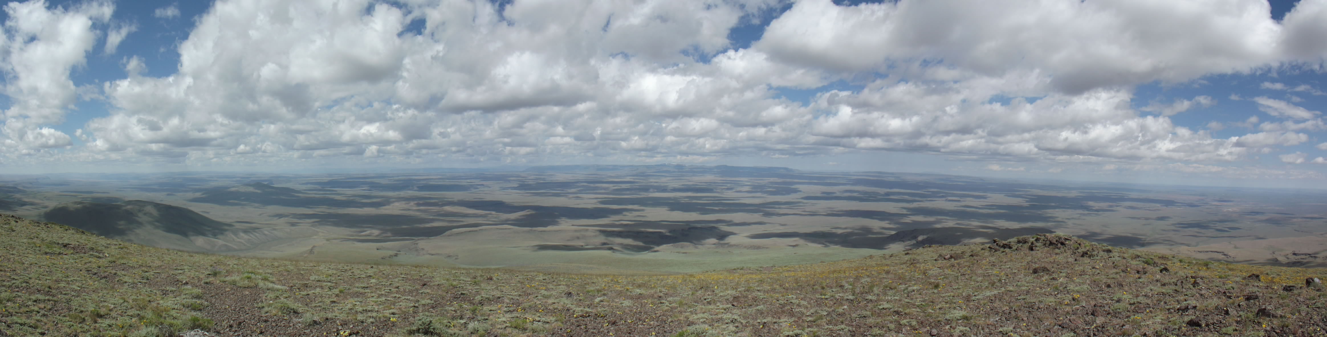
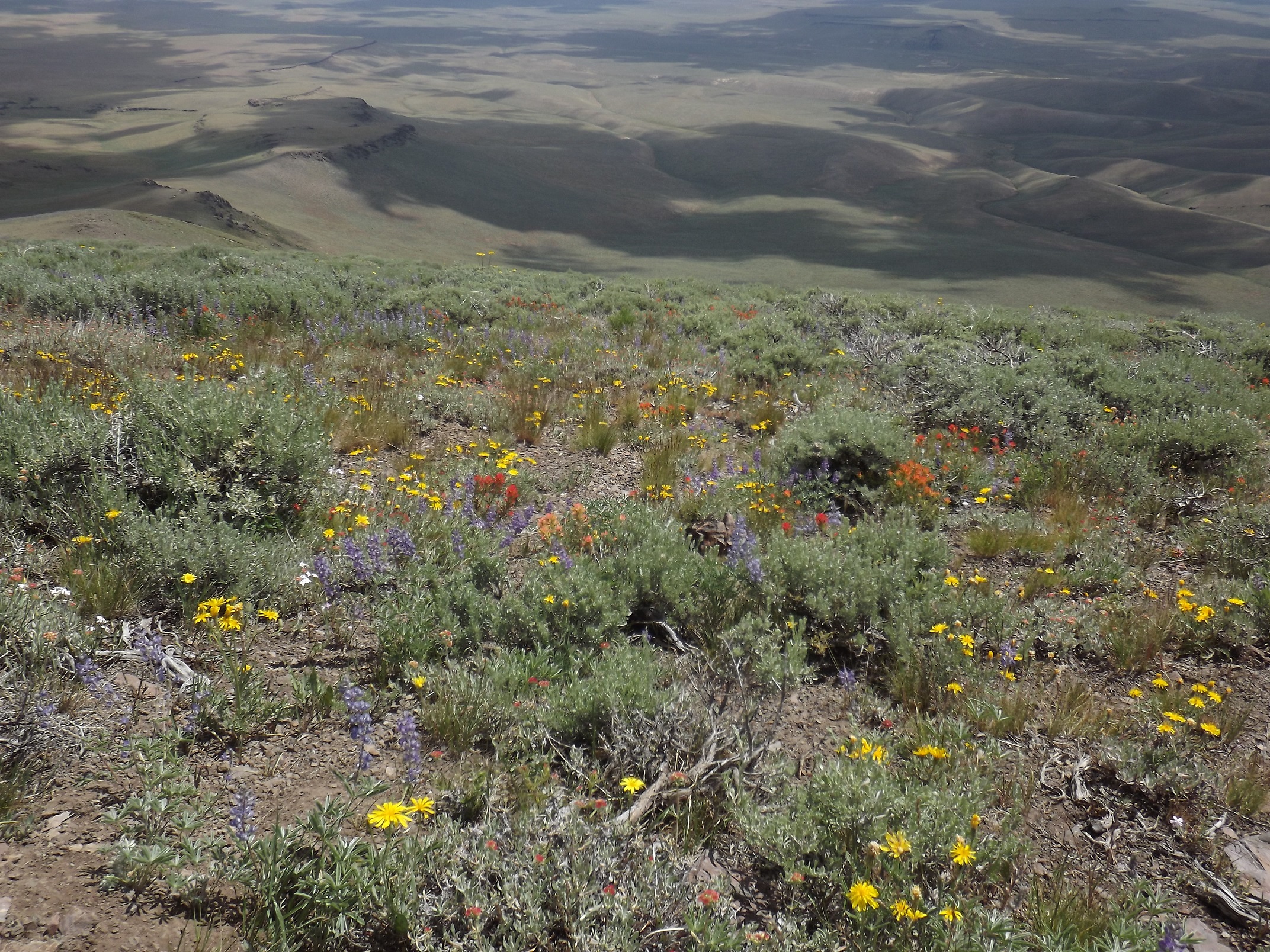
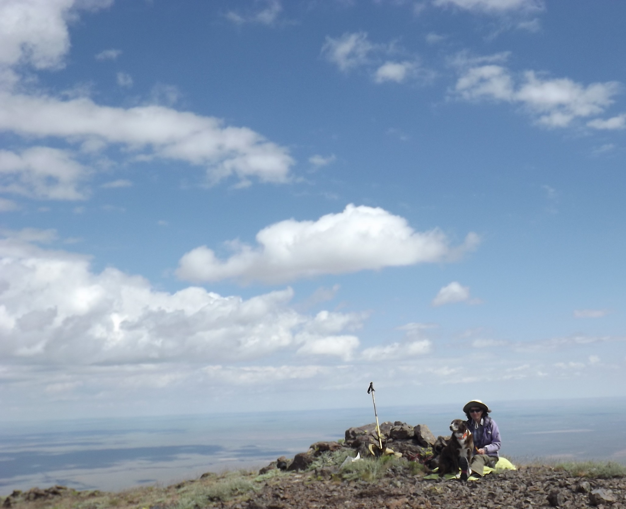
There are no trees on this volcano but plenty of rock and open space to set up. When I did my activation in July, it was the most beautiful I had ever seen the mountain. A good water year brought an abundance of wildflowers and it was clear so you could see for hundreds of miles, nothing blocks the view for the full 360degrees. Weather was nice, going back and forth from a bit warm to cool if a cloud rolled in. It was neat to see a note in the geocache box I wrote 6 years prior, I think the chocolate we left was still there too :). There are usually plenty of cattle near the springs as well as occasional wild horses, antelope and other wildlife including rattlesnakes. If I remember correctly, we had some cellular but not great.