
2011-10-15 Mount Fremont W7/RS-005 CN96DW92
Start elev.: 4291 ft (1308 m)
Max elev.: 7324 ft (2232 m)
Total ascent: 3342 ft (1019 m)
Trip odometer: 11.4mi (18.347km) Up: 5.8mi (9.334km) Down: 5.6mi (8.012km)
Total time: 12h25m Up: 5h33m Down: 2h58m
Video
APRS
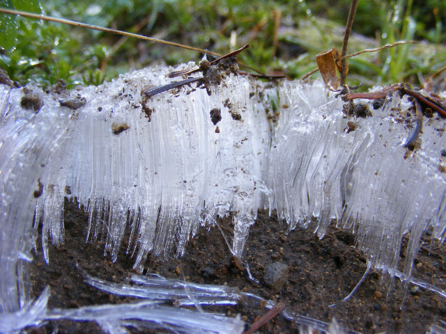
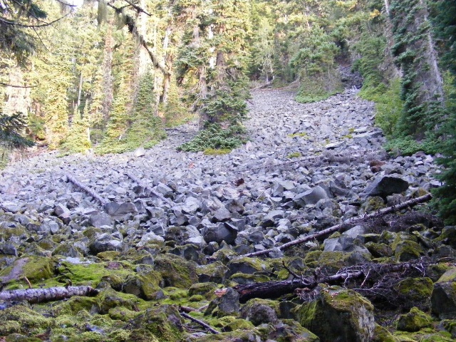
A little back story. I have decided to activate Marcus Peak. On 8th October 2011 drove down to the national park, but the road up to Sunrise point was closed. I did not see any reason why it was closed, as there was no snow on the road, although there was some snowfall at this elevation during the week. Quickly switched my destination to Governors Ridge. This is on the opposite ridge of Tamanos and I was familiar with the route up to the Owyhigh lakes. On my way I came across with this interesting ice formation. Thin ice needles arose somehow from the ground. It looks like something pushes moisture out of the soil and there it got frozen. If you know why and how this forms, please drop a comment below. Interesting anyway.
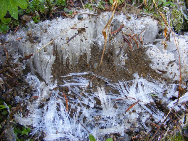
From a little more distance. I destroyed it when I examined what is this.
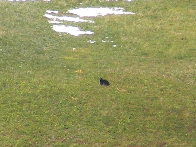
Unfortunately I did not reach the summit, but it was a good hike anyway. Saw 2 bears again, but luckily this time they were a little further away. They were on the slopes of Tamanos. Saw 2-3 eagles and a lot of crows. Counted 26 in one group.
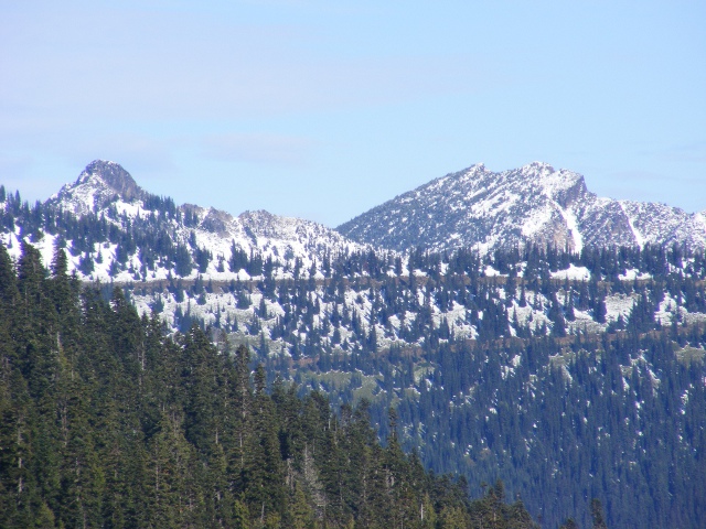
Marcus and Palisades from this side.

I also took a very nice photo of the volcano. So far this is my favorite.
As now I know that the road will be closed. I came up with a plan to do Marcus in 2 days. There is a path which goes up from the White River camp to Sunrise. Fremont is also nearby so I thought I will activate that too. Started with a big bag. Had everything inside except the rope gears. It was around 66lbs. I arrived at the car park early. It was still dark. I did not feel to stumble in the dark so waited in the car for a while. Days got shorter and I have not calculated with this. In a quarter hour another car arrived with 3 hikers and I also started my preparation.
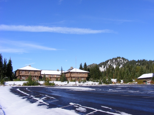
Had a pleasant weather. Took two and a half hours to reach the visitor centre. Awesome weather with bright sunshine and not a single person at the upper car park. I rest for a half hour here. Try to take pictures of kinglets.
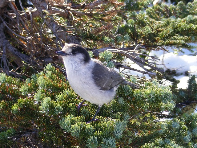
They are jumping all around too quickly for me to get any good shots. I got a better picture of a Grey Jay instead. There were some good place on my way up, but batteries died in my camera, and I only changed them up here.
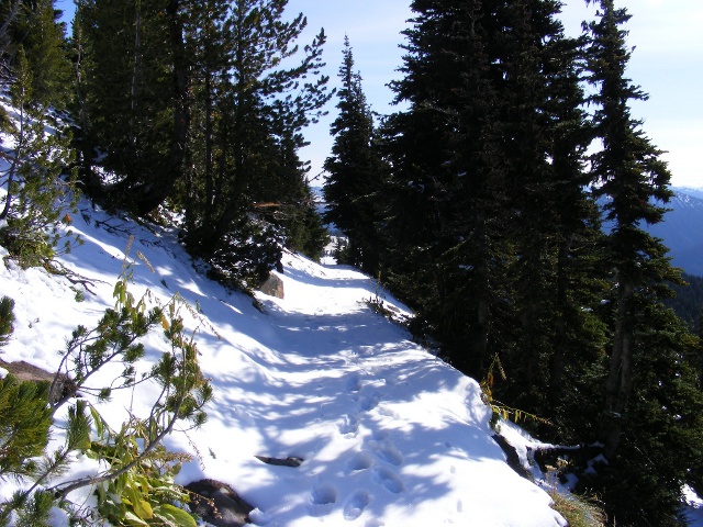
Thank god the three other hikers are also goes the same direction and they break way in the fresh snow. Need another hour to reach Frozen Lake.
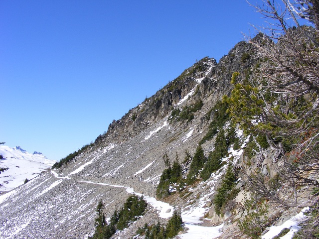
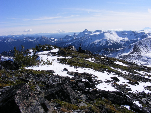
This is a very simple hike if one can start from the visitor centre. Two third of the climb was just to get to the upper car park. From here the path hardly gains elevation. On the right side of the picture it is already Fremont. It has 3 summits. Out of those only the highest is a SOTA summit.
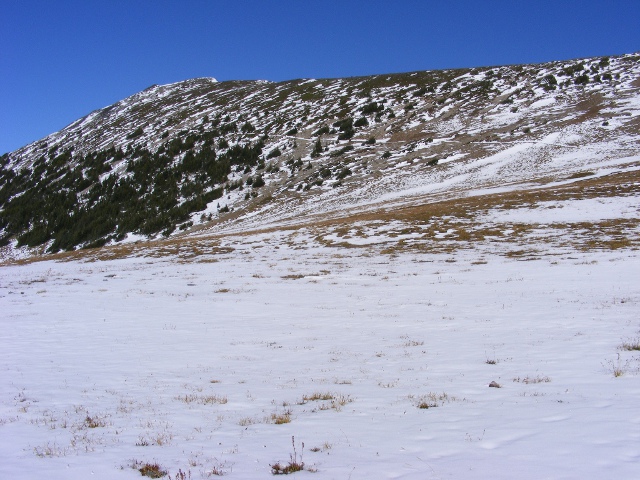
After walking around the lake I stop again for a rest. Nobody comes to this summit. Looks like everyone is doing a roundtrip on the Borroughs range. It is a very beautiful autumn day. Saw approx. 7 hikers. The upper left corner shows the summit.
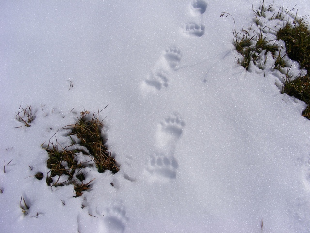
Bear country :)
Frozen Lake, looking back on my way up.
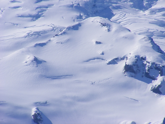
Fresh snow on the glaciers. Would not walk there now alone. A lot of crevasses are covered now. Very dangerous. Left side of the triangle shape in the middle is Camp Curtis, behind the tip hidden there is Camp Schurman. I love Curtis. It has a fabulous view on Emmons. The way down to Schurman is not so good. It is all loose rocks everywhere.
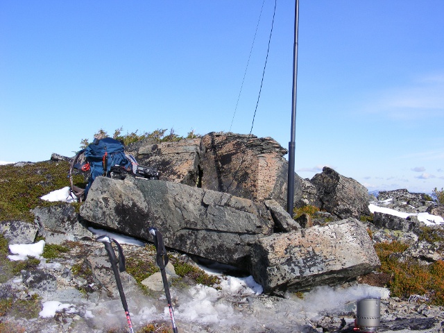
It was a long and tiring hike to reach the summit. There are ladybugs everywhere. I moved some rocks a little to get support for my mast and I guyed it too.
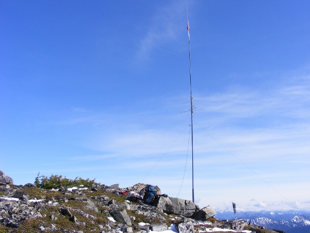
After the station is ready, I start calling, but everything is very silent. In return I have all sorts of batter problems. Maybe over the cold. The video recorder dies after a couple of minutes and the freshly charged internal batteries of my 897 also dropping voltage on maximum power. Well, it is time to buy a lithium one, I guess. Those are lighter and generally more robust than the NiMH ones. Despite of all these problems I was able to make contact with John from Canada. He has a very good signal although he is over 400Km away. On the video you can hear that he also has some problems with transmitting. He told me later in email that his Icom 706Mk2 sometimes drops the TX.
Spent quite a long time on the summit. I enjoyed the view and the nice weather so much. When the sun was out of the clouds it was really good. The radio part was very bad. I made only a total of 5 QSOs. I had Oregon again, that is also over 300Km :). After almost 4 hours on the top I started to pack. I was thinking that I will camp somewhere nearby, but was not confident about Marcus and the battery problems also made me to hike back to the car.
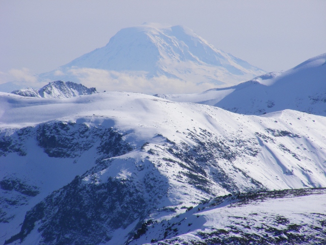
I was much faster on my way down and I also was in a hurry a little to minimize the time I have to hike in dark. When I reach the junction after the visitor centre it is already very dark. Here I switch on my headlamp, which wisely I have put on my neck before started from the top (not like on my next activation). Mount Adams in the distance.
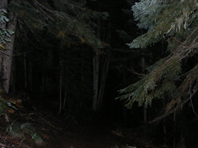
The way down in the dark looked like taking forever. It the coniferous forest it would have been impossible to get down without a torch. Reach the car. There were 3 other cars at the car park if I remember correctly. Almost sure they spent the night up somewhere.
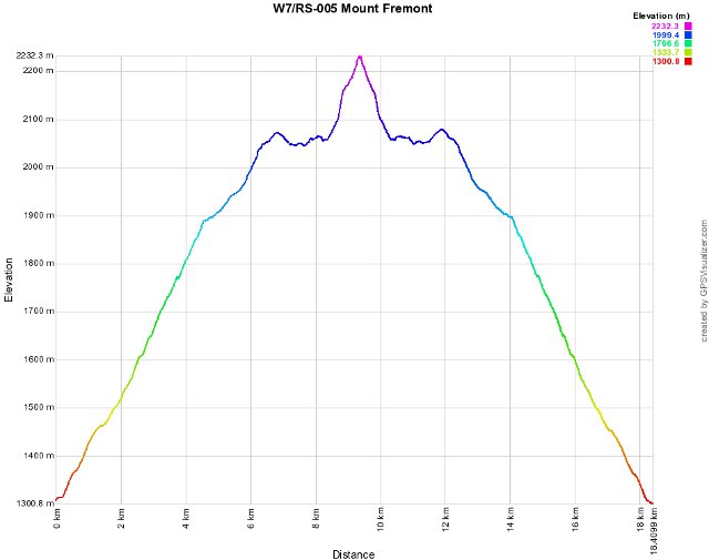
Elevation graph.
This was a very nice hike. I got really tired at the end. Never hiked this much with such a heavy bag, as I always stopped somewhere on the glacier to camp. This summit did not give itself very easily, but at the end I am happy I did it on the longer way. New summit, bagged.
HG1DUL 2011-11-06