
2011-10-29 Goat Island W7W/RS-006 CN96EV22
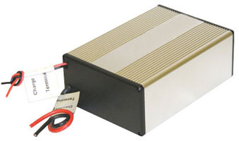
I ordered a LiFePO4 battery, one what I wanted for a while. It is 12.8V and capable of deliver 26A. Capacity is 13.2Ah. This should be sufficient to operate the portable radios on maximum power. It weighs 1.9Kg. Now that I have a good battery, I do not want to carry the 897 any longer with the internal batteries. So it is time to get another radio, a lighter one. I looked around and at the end I decided on the 857. I think ICOM does not have any good SOTA capable radios. The 706 would be good, but cannot buy new it any longer, and I don’t want to wait for a good deal on eBay. I would not like to take the 7000 outdoors. Time to go down south into Oregon to buy a radio.
Start elev.: 3821 ft (1165 m)
Max elev.: 7289 ft (2221 m)
Total ascent: 3924 ft (1196 m)
Trip odometer: 9.8mi (15.771km) Up: 6.7mi (10.782km) Down: 3.1mi (4.988km)
Total time: 11h22m Up: 4h42m Down: 2h51m
Video
APRS
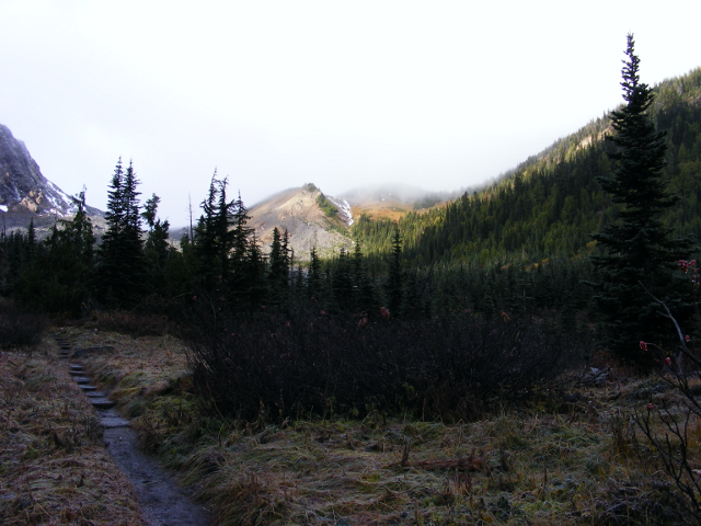
If I am down south I thought I will check out the trail head for Adams. On my way back I popped by the Ranger station and drove up to Cold Springs. I decided to hike up if there will be good weather on the weekend. It looked there will be a 2-3 day weather window before the big snowfalls, but it got shortened to 1 day so I did not even left home. I started towards Goat Island instead, to where I know the route. Transferred the necessary items into my smaller backpack and started on Saturday.
On the morning there was another hiker at the car park. He was going to Summerland. Other than this everything is very calm, this side will be closed on Sunday. I expected a lot of snow thus I put my snowshoes in the trunk. Before I started at the trail head I left it in the car, because the surrounding peaks were not that snowy. Luckily I haven’t needed them. I took my alpine boots with me over the cold and decided not to use it on the long approach. Thus, started the hike in shoes. It was not so chilly, just a little cold. However, I have not felt cold for a long. I was able to do a good pace. The ground was completely frozen.
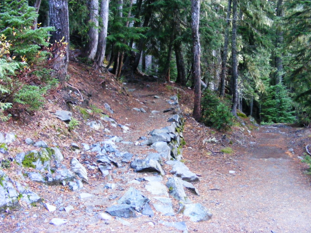
Took me one and a half hour to cover the 3.5 miles to the bridge. On easy ground in the shoes I could walk fast. My plan was to use the riverbed from here onwards. The path goes into Summerland and when I was here during summer the other side was very overgrown to cross the river. All the rocks were covered with a thin layer of ice, so traveling here would be quite dangerous and slow. I crossed over the bridge instead and followed the trail on easy ground.
Sign of bears. I saw some frozen bear poo too. I hope that they are hibernating now.
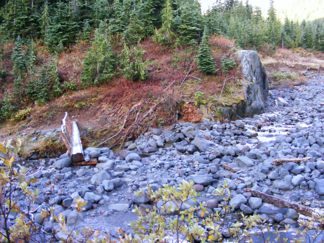
Soon I reach the turn, where the trail starts the switchbacks up to Summerland. I have to leave the trail here and cross the river. I have an opportunity here to cross. It is a little challenging in the shoes on the frozen ground, so I have to be careful. There is a side stream here what I have to cross to reach the actual riverbed. I managed it without a problem. I am heading to the valley in the middle of the picture.
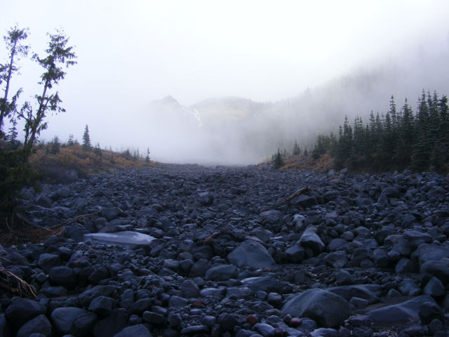
Once I am in the riverbed I can walk pretty fast. I was surprised by this, but the frozen sand between the rocks is godsend now. During summer it was much harder here, sand was like on a beach. The water is between the rocks here and there. Sometimes I have to cross it to keep the pace. Eventually I reach a section where it was too wide to simply step over it. I was looking for a better place where I could have crossed it, but I was not brave enough to get into any dangerous step on the slippery rocks. I throw a big drift wood into the water too, but still could not cross it. It is time to swap my shoes for the boots.
Originally I planned to use the shoes until the grassy slope and swap it there for the boots. Took my knapsack off and quickly changed for the boots. With the boots on water is no longer a problem. I step into the stream and search for stable points. Surprisingly I am able to walk fast in the boots too and soon reach the slope in front of me. This is the place where I saw bears in the wild first in my life this summer. They were quite close. I was enjoying the sun when they walked up. I cancelled that activation, back then. Luckily this time there are no bears here.
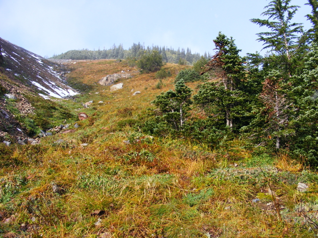
Walking slowly upwards on the steep hill. Clouds are come and go. When the sun is not hidden by the clouds, the weather is just simply amazing. Pleasant temperature and beautiful snowy scenery. Little “T” and the Fryingpan glacier.
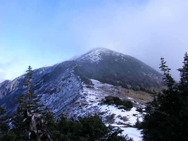
Slowly I reach the ridge line. So far I covered 5 miles in 3.5 hours. From here I will be there swiftly, I thought.
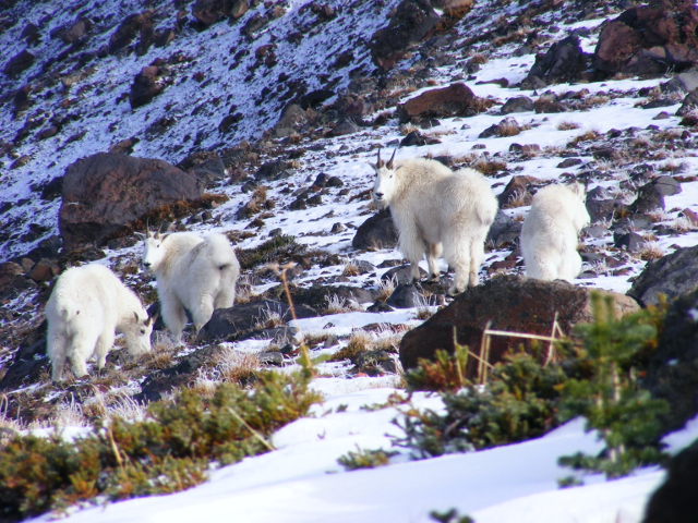
I came across five mountain goats here at the beginning of the ridge. They were on the grass and when they spotted me started walking towards the rocky hill on the left. I walked around them by keeping a huge distance. Try not to disturb them too much.
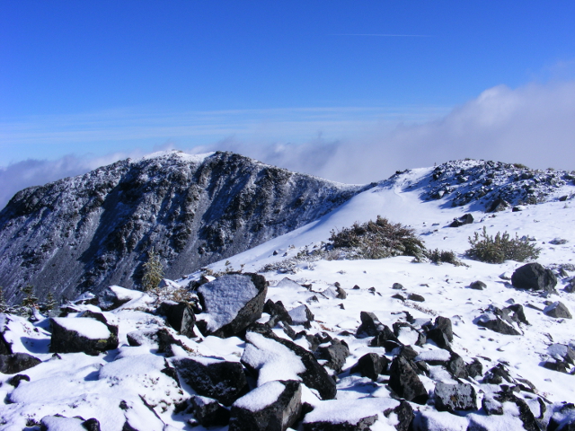
When I thought I just reached the summit, had this view in front of me. Still a long way to go. It is quite easy to make progress on the ridge. The snow cover is not bad at all. 2 to 4 inches on average. Where the wind piled it up much more, but still manageable without snowshoes. I thought it will be much worse, based on my previous visit on Fremont.
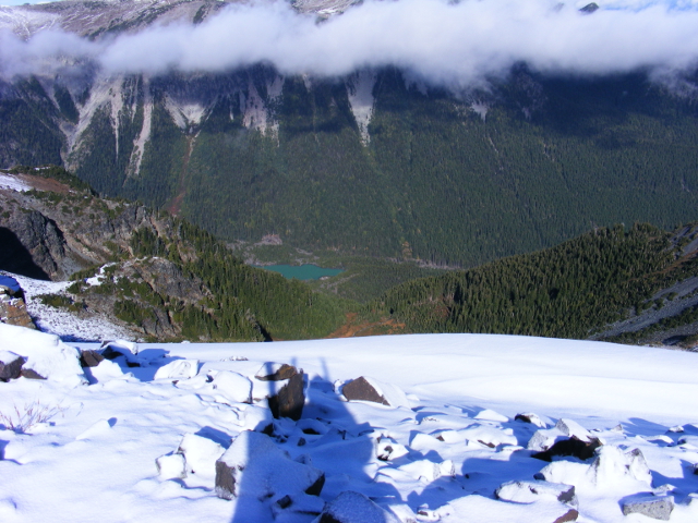
While walking on the ridge, I enjoy the fantastic view this summit provides. There is no wind only a breeze. It is absolutely amazing how unbelievably awesome this autumn weather is. The Valley of White River.
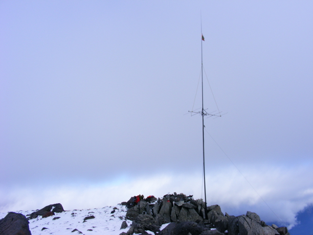
The summit area is huge. There is a proper place for the fishing pole in a crack. I fixed it with some smaller rocks and guyed it two sides. After the station is ready I send an APRS spot that I am on the frequency. Band is kind-a dead, but was able to do 8 QSOs. Did Oregon and British Columbia again. It was very interesting that I heard John from BC the best if I tilted the Yagi almost into the valley. Strange reflections maybe. Heard Oregon on 70cm too and got 51 report. I only copied it about 31. Unfortunately I have a high loss on 432. It is over 2dB.
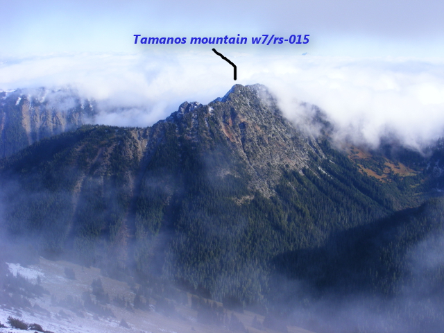
Good view and fantastic weather. Tamanos on the other side of the valley and some clouds.
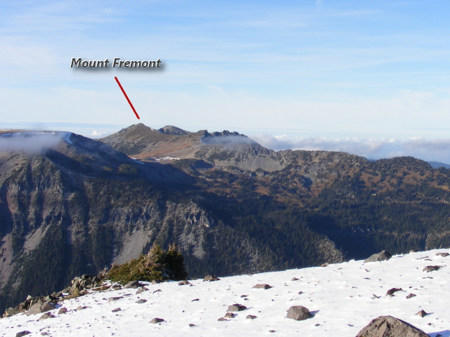
Mount Fremont is there in the distant.
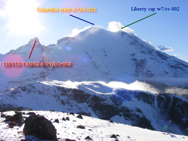
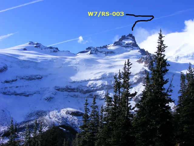
And the volcano in her glory. Three SOTA summits on this picture.
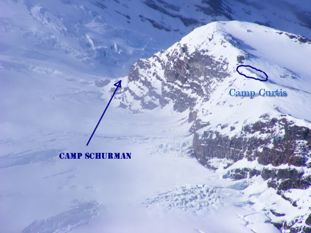
Camp Curtis and Camp Schurman zoomed.
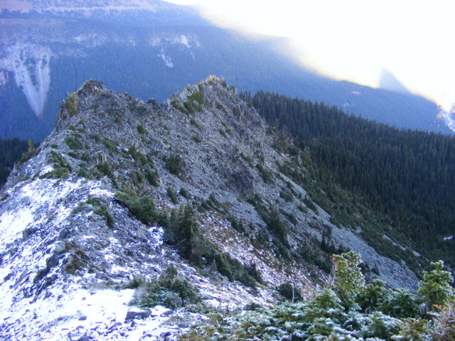
I spent almost 4 hours on the summit. I wanted to start earlier over the shorter days. I did not feel happy about a night hike again. Walking up took a long way, over 6 miles. So I decided to take on another adventure and try to descend via an alternative route. Some trip reports mention an old trail which used to be on the east ridge. Not marked, so it was a strange decision if I take into consideration the time left till sunset. Started on this shorter route. Reach this narrow ridge, and here I turn down to right. Had to be very careful on the slippery rocks. Sat down sometimes to be safe.
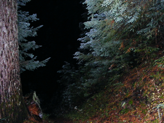
I thought I read that the old trail was on the ridge all the way, but turned down as it did not look safe at all. Home I verified that it was the good decision. The slope down into the valley is very steep. Finally I reach a flat area, what I cross and join on the east ridge. I see no sign of any trail here. Once I am on the ridge, I am also in the forest. The sun is already gone. One place while walking downwards on the ridge, I came across some sections where I think the trail must have been. It is absolutely unusable. Trees are across the trail and small trees growing everywhere. I use some goat trails. Try to keep my heading and it is not easy during dusk in a dense evergreen forest. I wonder if a cougar already behind me in the dark and just looking for the perfect opportunity to bite my neck. Try to protect it with my backpack and make noise on my way. It is almost pitch black now. Only a quarter miles to intersect the trail. This last section looked like took forever. I stopped very often to verify my heading on my GPS.
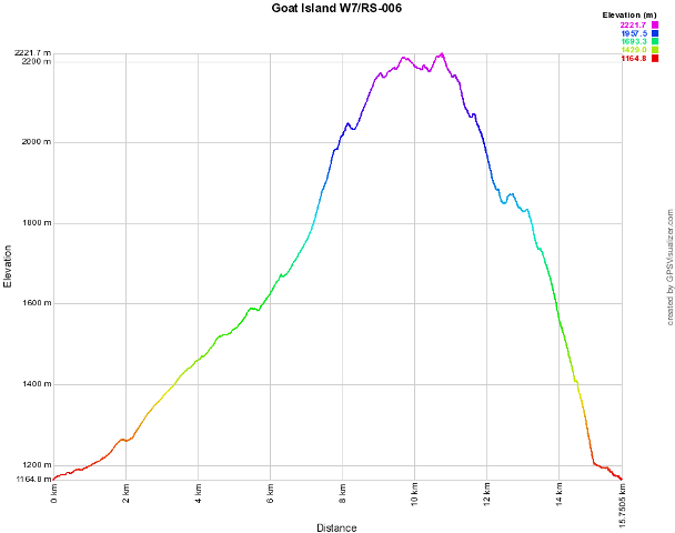
Because of the dense overgrown plants I can only walk very slowly. While it is almost completely dark now I think I just saw a bear in the distance. It is time to get my headlamp out of the backpack. I look for it at least 5 minutes. I should have just put it in my neck when I left the summit, like I did on Fremont. Also take the bear spray in my hand, but with the powerful LED headlamp I figure out it is only a half broken tree section out of the ground. Last yards are very steep and I am really happy when finally got step on the Wonderland trail. I know I am almost there. Elevation graph.
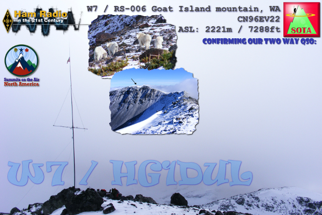
At last I reach my car at the trail head. It is 1905. Packed my stuff into the car and looked the dark tall trees for a while. Listening the big dark forest. Have a strange feeling to be alone away from everything alone in the dark. After five minutes maybe I started the drive back home. My QSL card for Goat Island.
On Sunday this side of the park will be closed. This was the east side of Mount Rainer NP for this year. Next year I want to do Little “T”. I have been there 3 times so far on the glacier, but the final summit is quite challenging. I really loved this side of the NP. It is not that crowded like Paradise. See you White River next year!
HG1DUL 2011-11-12