
2012-06-17 Kelly Butte CN97ge10
After my failure on Ararat, where I only made 3 Qs with my handheld radio on 144 MHz, I am looking for some easy summit. I can only blame myself, as I was too tired to assemble the Buddipole. If it is easy, then let’s do 3 or 4 summits straight away. As always, despite the long and thorough intelligence, things did not work out as planned at the first place. However, I bagged two summits out of the four, but let’s see the details.
Start elev.: 4463 ft (1360 m)
Max elev.: 5420 ft (1652 m)
Total ascent: 953 ft (290 m)
Trip odometer: 2 mi (3.218 km) Up: 1 mi (1.609 km) Down: 1 mi (1.609 km)
Total time: 4h18m Up: 58m Down: 35m
APRS
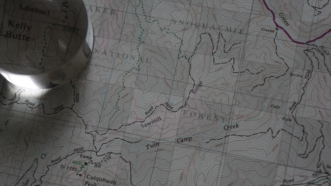
I planned my route at home and also cross-checked with GreenTrail maps. All looked promising and I was hoping that snow will not be an issue at this time of the year. Weather forecast is not really great, overcast and windy. I hope that the high wind will blow the clouds away, or that at higher elevation I will be able to see the sun. Sadly this bad weather did not improve at all throughout the day.
I reach the outer car park without any problem. There was only one section, which was a little narrow because of huge pile of snow on the road. I do not stop here. Let’s see how is the road towards the inner car park. There are some smaller pits, but I think a normal car would also be able to cross them. The road is narrow and only one car wide.
Slightly after half mile I am at the inner car park. Here 4-5 cars can park and you can turn around. I park at the end after turned around. Looking back towards the entry.
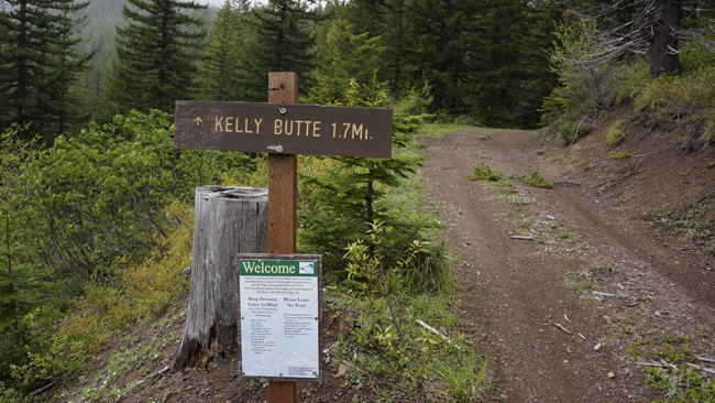
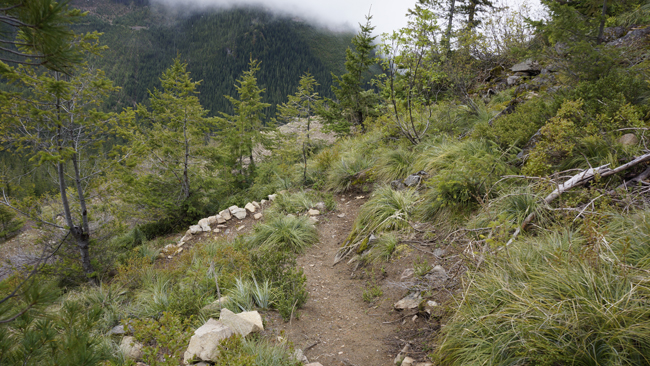
This is the starting point of the trail. It is steep at the beginning, but only the very start is problematic. Put my gear together and start the hike.
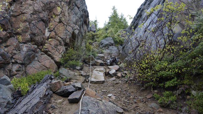
At 0648 I make my way up, with the help of this rope, attached to some trees at the top. It is used, but holds up. You would be able to climb without it, but it actually provides good help as the gully can be slippery. After this section I walk amongst small trees. Sometimes shake some water into my neck from the branches.
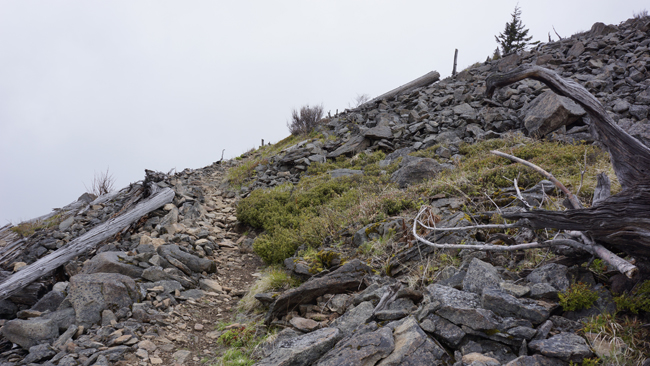
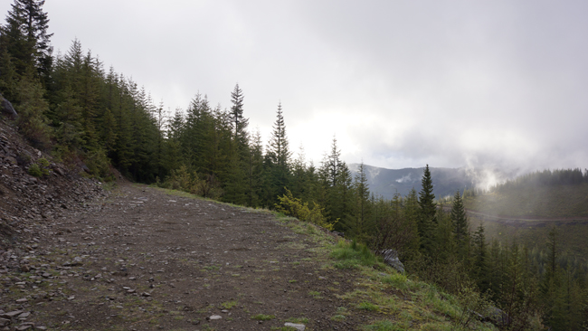
As I progress upwards, the terrain became rockier and less steep. The wind really strong here and I am wondering, how the hell I will set up the Buddipole. I hope there will be some tree or the watchtower will have some usable railings.
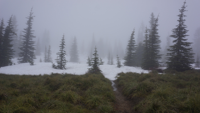
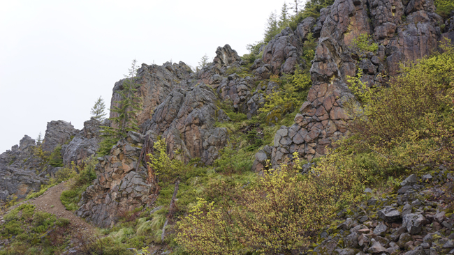
This peak is a plateau with very steep sides. Once I covered the steep side it is absolutely flat. Here some larger pine trees show up sparsely and still a lot of snow. I am not in my winter boots and neither brought crampons, but it is no problem on the flat terrain. Soon the watchtower emerges out of the clouds.
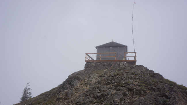
The wind is huge on the top. Luckily the tower, which is a kept fire tower, is open. This is godsend. Temperature is low and now I do not have to be outside in the humid cold air, with the wind. Start building the station. I fix my pole to the railings with the 5 mil cord and also guy it against the wind at two places. To the railings, and a little lower on the ground to the lightning protection wire. After this I start playing with antenna tuning. Locals would like to have 7 MHz and I try to set it up. I had serious doubts from the start, but played a lot with this. I have no luck at all, so I set up on 14. Here there is S8-S9 noise all over the band. Absolutely useless. I have no choice, have to try 2 meter FM again. I do not have the Yagi with me.
I do not really like the FM community. From Ararat I have kept calling at least for an hour, and only made 3 Qs. At least this time I can crank it up to 50 Watts with the dipole, and not 5 W with a rubber antenna. I start calling and Randy K9VD answers on the other end. After this I have some more stations very quickly. This is all Randy’s merit as he asked for stations on his local repeater. While I was chatting with Randy and the other stations, someone issued a warning that I should not use 146.520 for any contesting. I felt bad. I was not even thinking to QSY as the frequency was unused and so far my experience shows that on SSB everyone talks on the “calling frequency”. Later I asked the local “big guns” about this and they said generally it is no problem to have long chats on .200. Of course it is also true to keep the calling frequency free. I will pay attention to this if I have to use FM in the future.
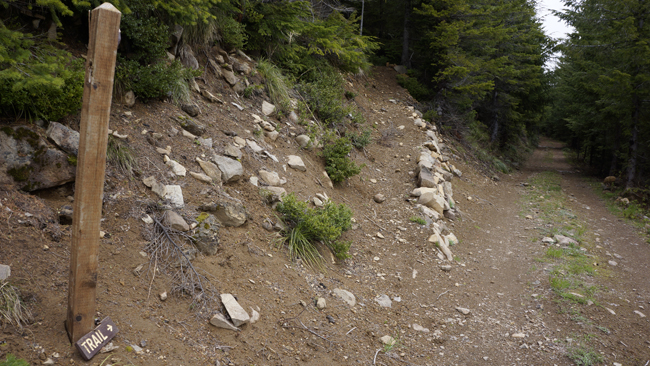
Soon I will disassemble my station and start walking back to the car on the easy terrain. On my way down I top up my water bottle from the melting snow generated streamlet. When I reach the steep section I choose a different route down. There is a newly build trail which is an alternative to the rope section. This starts at the other end of the car park. Only took slightly longer than half hour to get back to my car.
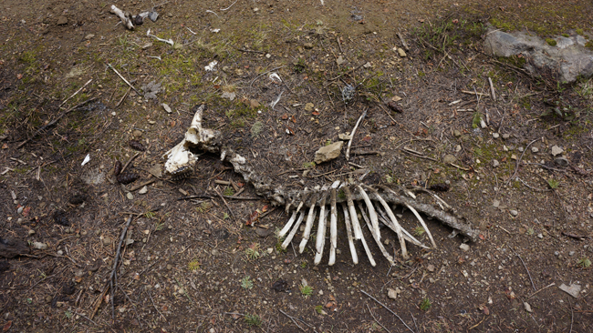
Put all the gear into the car and start my drive towards my second summit for the day. On the way out I saw this goat carcass. I have not seen this while was driving in, must have just driven over it. I got out and took some pictures. Hmm, was it killed by a cougar?
Next time if I am on FM, I will pay extra attention on QSY. Although, I hope I do not have to use it for a while. Many thanks to Randy for all the help to get a successful activation. It would have been better if 14 MHz is usable and if I would had some views, but maybe next time.
HG1DUL 2012-08-09