Baldy Peak was a wonderful and pleasant surprise. I recommend it. The minimum hike is 1.2 miles round trip with about 650’ vertical. The hike can be extended by parking a bit further down B-1000 and hiking up the Buck Creek trail.
I was fortunate enough to be first activator of this summit. I think it was never activated because people were trying to come at it from the Hwy 141 side. Even though there are seasonal access roads, approaching from the East side requires crossing private property. I approached the summit from the West side.
My route was to take a left turn off of Hwy 141 at road B-1000 (45.77646, -121.51211), go 4.6 miles then turn right at B-1300 (45.83357, -121.55265). Continue uphill for 0.8 miles and park at McIlroy saddle where the Buck Creek Trail crosses B-1300. There were signs on B-1000 that a Discovery Pass was required for parking. In Feb, 4WD was needed to get through patches of snow, but overall in good weather the roads are suitable for passenger cars. Some potholes. Here is a link to a helpful map of the area: https://www.dnr.wa.gov/publications/eng_rms_buck_ck_all.pdf
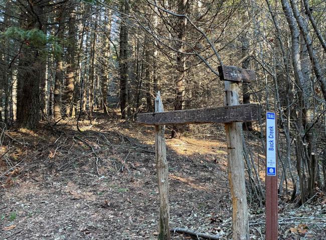
From my parking location, I took the Buck Creek trail a very short distance and my plan was to bushwhack up the ridgeline. Picture below of where I left the trail at 45.83349, -121.53910°. At first the bushwhack was very easy. My heart sank as the bushwhacking started to get thick, but then a wonderful surprise! Mountain bikers have created/cleared a downhill singletrack trail. I located the trail at 45.83333, -121.53795. It is a bit rutted but offers an easy-peasy hike to the top.
As you near the summit you get a spectacular view of Mt Adams. From the summit you get a wonderful view of Mt Hood (Summit pics posted to SOTA Atlas). The summit is treed on one half so Mt Adams is blocked from view when on top, but there is plenty of room to set up and trees to attach a mast. Had full mobile data/voice coverage from summit.


