Why
With the first four peaks in Cascades North being activated, I decided I needed to hatch a plan to hit the next two. This summit is over 8 miles from the nearest trailhead and 4500 feet of gain, and it's almost 5000 feet of gain from our trailhead, so I recommend doing it as an overnight. We activated this peak in conjunction with South Cinder, W7O/CN-005, and I strongly recommend if you put in the effort to do one that you make time for the other. (Chances are good you'd walk past CN-005 anyway - it's right there, just climb it!) This is a wonderful set of peaks, if you are looking for a pleasant backpacking trip with a very manageable day hike. If you want to hike 15 miles with 4000 feet of gain for a single summit, you could summit it in a day, but that's past the limits of my endurance. I prefer this as a backpacking trip.
Getting there
I planned this trip as a two-night backpacking trip with KJ7FXU, with two nights at Swallow Lake. We started from the Marion Lake Trailhead, but you can do it from Cabot Lake Trailhead or approach from Pamelia Lake if you like. To get to Marion Lake Trailhead, proceed 16 miles past Detroit on OR-22 E, and turn left on Marion Creek Road, which goes 4.4 miles to the trailhead. This is a popular trailhead, and a Discover Pass is required. Also, in season, a Central Cascades Wilderness Permit.
The hike:
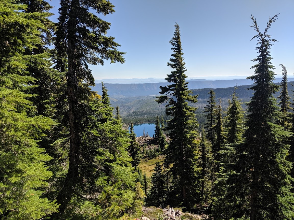
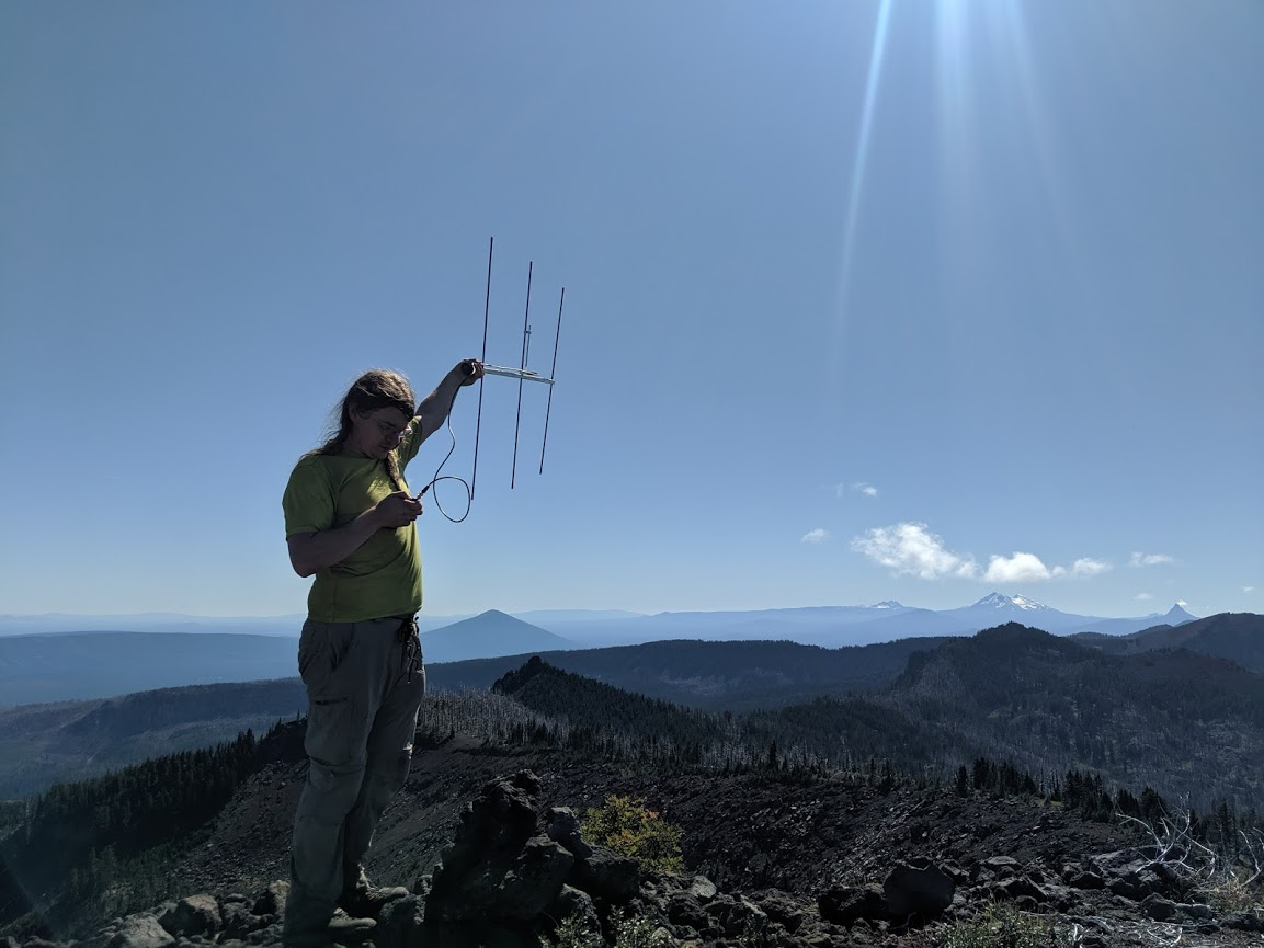
I will only describe the trip from the bottom of South Cinder cone to North Cinder; to get to this point, please read my activation of South Cinder Peak. The hike is otherwise 17 miles and 4500ft gain round trip from the nearest trailhead, at Pamelia Lake, and 20 from the nearest trailhead without pre-registered permits. I recommend following the Marion Lake Trailhead approach and activating South Cinder at the same time, in two or three days. We proceeded down the other side of the saddle a short drop along Swallow Lake Trail to its intersection with the PCT. This part of the trail is pretty well maintained and due to South Cinder as a destination, and the relative flatness of this part, it is much more easily followed than the lower parts. You'll then rise again slightly, to a saddle, where Swallow Lake Trail meets the PCT and Shirley Lake Trail descends down the other side, past Shirley Lake to Carl Lake. The hike along the PCT is beautiful, pretty well-maintained, and relatively flat, with several jogs out to the west to go around prominences along the ridge. At the first such jog, you will be able to look down on an unnamed lake on Whiskey Creek. 2.3 miles past the intersection, along this trail, the trail will be in a saddle, giving you views to both sides, and in front of you will be a ridge rising gradually to the summit of North Cinder Peak. The trail heads down the west side of this ridge, and circles North Cinder; we headed straight, and up the crest of the ridge. This path goes through trees that are on the ridge, but it is reasonably unobstructed. You can, instead, choose to go just a little farther down this trail and then head up along the west side of the ridge, just below these trees, through a meadow, but the meadow may be fragile and sticking to the trees is the best way to avoid spoiling it for other people. I recommend following this ridge; it rises very gently. The ridge turns to rock, which resembles other volcanic peaks with large rocks and scree; you will need to walk up a combination of rock, boulders, and scree for another 150 feet of gain, but this is reasonably easy. Pick your way along the ridge, occasionally scrambling up (or navigating around) rocks, til you get to the summit. Once you get to the top, you have another amazing panoramic view, with South Cinder and the ridge you just traversed to the south, and Jefferson to the northwest; Three-Fingered Jack is obscured. You should have lots of VHF opportunities, but once we activated on VHF we had plenty of time, so we re-upped our sunscreen and I worked through a few contacts on CW. (As an aside, I appreciate everyone who has turned up to work me on summit on CW.) Cell provider: Google Fi (T-Mobile and Sprint).