Sep 2023 Update: Buck Creek Road is closed a few miles from Highway 141 and so the shortest route to Monte Carlo described below isn't available just now. The longer routes appear to be acessable.
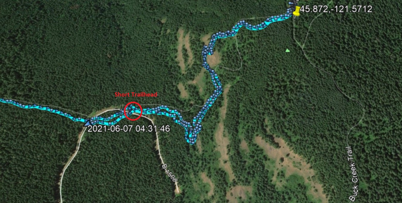
Even More Updated - A shorter way to Monte Carlo that is only about 1.5 miles RT, even if steep in places. This approach will work so long as DNR road B-1500 is passable all the way to 45.8695, -121.579. (NOTE: we did not go this way). Use most of the directions below, but you will go 6.5 miles from Highway 141 to make a sharp right turn onto B-1500 near 45.8449, -121.573 and go about 2.3 miles on this single lane dirt road. The portion of the road we could see could be traveled in a passenger vehicle. There's a pullout opposite the unmarked trail. Below is a 'map' showing where B-1500 intersects the Buck Creek Trail.
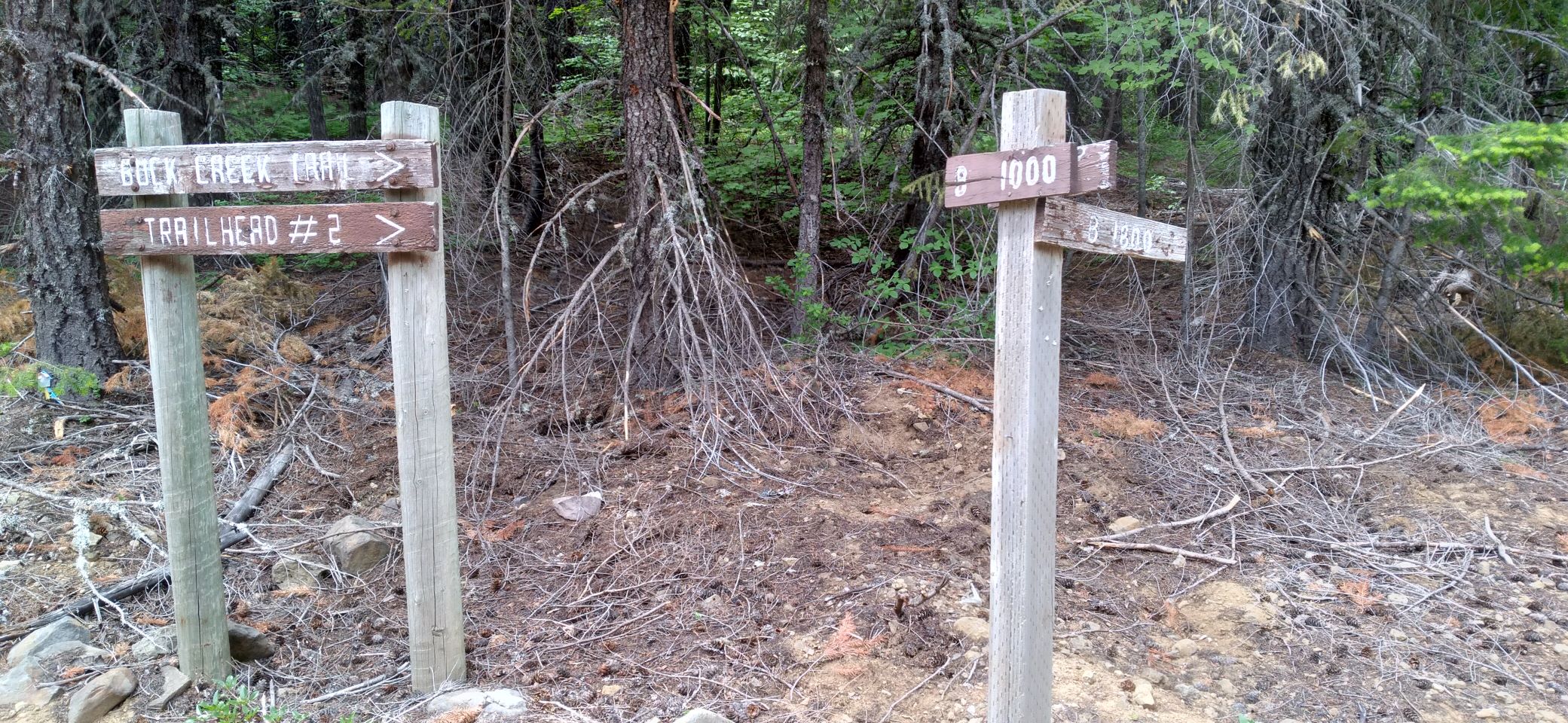
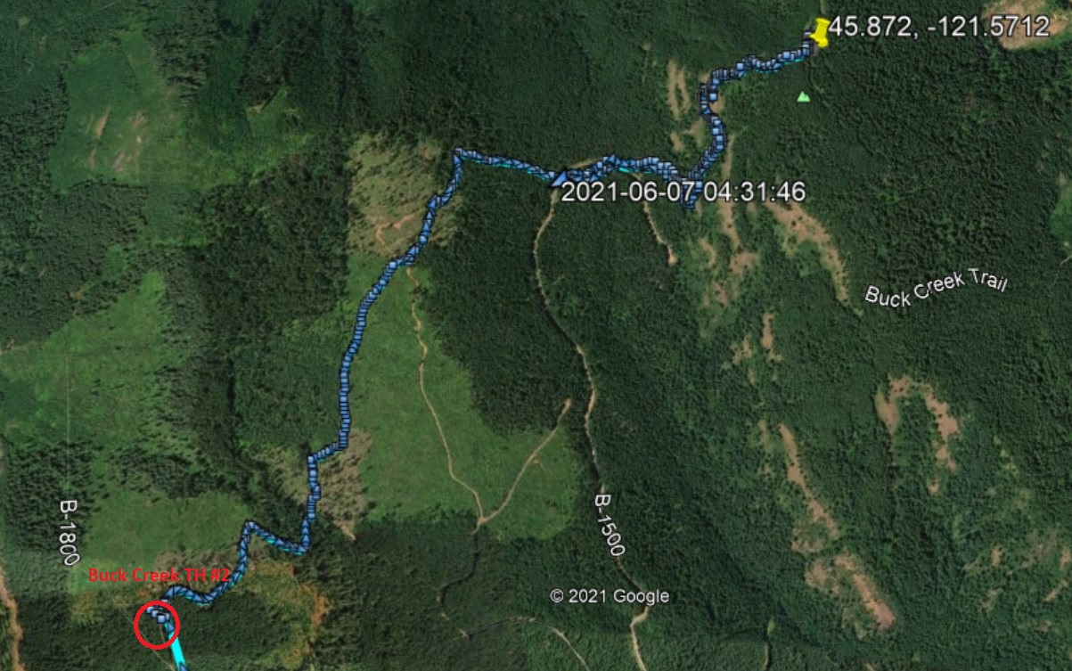
Instead of the shorter route above, if you need a known completely Priusable driving route to the TH, you can find your way to Buck Creek Trailhead #2 and do 4.6 miles RT with lots of up and down. There are a few road crossings for this trail where the continuation isn't immediately obvious - but the trail is there. Below is a 'map' showing the route on Buck Creek Trail from Trailhead #2. (Remember to NOT GO to TH #1.) The directions to TH #2 are here: https://www.oregonhikers.org/field_guide/Buck_Creek_No._2_Trailhead
After crossing the Hood River Bridge, turn left on Highway 14W for Stevenson and Vancouver.
In 1.5 miles, turn right onto Highway 141 Alt. for Trout Lake and the Mt. Adams Recreation Area.
In 2.2 miles, turn left onto Highway 141 for BZ Corner, Trout Lake and Glenwood.
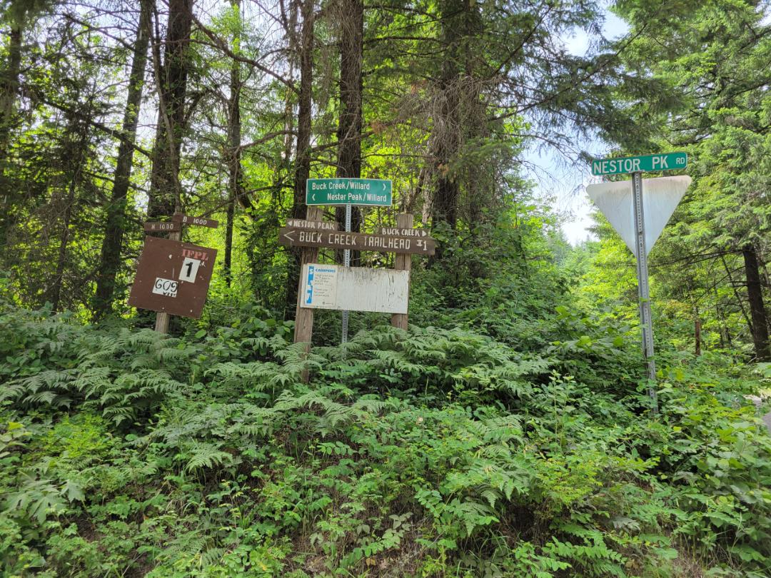
Drive 2.0 miles and make a left turn onto Northwestern Lake Road (Nestor Peak Rd).
Keep to this road for 0.4 miles and come to a four-way junction.
Keep straight here on gravel Road B-1000. Stay on this road for 7.6 miles, winding up out of the Buck Creek valley, then turn right onto B-1800 for Buck Creek Trailhead #2.
It’s 1.5 miles to the trailhead (avoid all roads leading off to the left and right). Discover Pass required.
No 2m FM contacts into the Metro area or Hood River/The Dalles were made from this summit. There are no RF sites on this summit. A good number of trees for antennas.