Looking over the map for peaks in the Tillamook State Forest, it was noted that a named peak hadn’t been activated. “That’s odd,” I said to the sherpas, “it’s right in the middle of a bunch of other peaks that get somewhat regular attention. Something must be going on with that one.” We mapped out our route and decided it would be an excellent adventure on a beautiful weekend with a lot of the usual suspects activating nearby peaks.
To get to Wolf Peak:
- Turn north off of the Wilson River Hwy (State Route 6) at 45.5447 -123.6067
- Continue on Cedar Butte Road up the hill 2.2 miles
- Stay right at 45.5533, -123.6314 and continue on for 2.8 miles
- At the triangular intersection at 45.5766, -123.6401 head right up the hill and turn right
- Continue 0.6 miles
- Stay left at 45.5773, -123.6306 and continue across the ridgeline. Don’t look down.
- Suggest to park at the large landing here: 45.581278, -123.616811.
- Continue up the much rougher road about a quarter mile to the switchback to a variably rutted motorcycle track to the summit.
As a note, there is trail to the summit from the south side of the peak, but we didn’t know where it started.
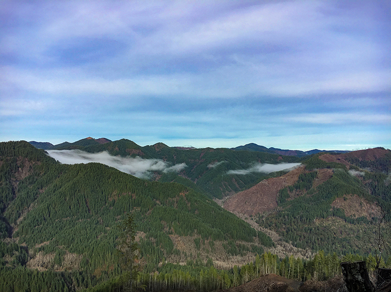
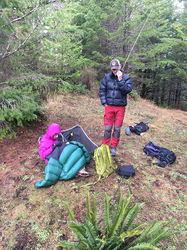
At the summit, there are two open operating areas. If you came in from the recommended trailhead, the second one is the best as it has two large logs, the best view, and lots of trees for hanging antennas. It was a glorious January day with the sun shining down and visibility stretching out for miles. We could clearly see the peaks of Cedar Butte (W7O/NC-018) and Triangulation Point (W7O/NC-005) where other folks were also activating.
The cell reception was excellent from the summit and after a self spot, the pileup rolled in on 20m SSB. I worked through that until I finally reached a tipping point with another party that had hopped on the same frequency with us. After apologizing to the few remaining folks in the pileup, we shutdown the HF rig and turned to wracking up a slew of summit to summit contacts including the guys over on South Saddle Mountain (W7O/NC-002). After an hour on the summit, the sherpas were starting to get cold. We packed up our gear and made our way back down the hill.
Why had Wolf Point not been activated? That’ll probably remain a mystery. It certainly deserves more attention than it has gotten.