Have your recent SOTA activations been way too easy? Does walking on trails bore you? Do you want to earn the Most Calories Burned Per SOTA Point award*? Then have I got the peak for you!
Peak 2788 is a 1-pointer in the Tillamook State Forest. Its closest SOTA summit neighbor is Cedar Butte (W7O/NC-018), just a couple miles away as the crow flies. Peak 2788 caught my eye because it had never been activated. Sure, there were no trails shown on the topo map, but when I traced a route to the summit it said it would only be about 1.1 miles from the nearest forest road. Even though I’d be bushwhacking and the going would be slow, I figured the hike in would take a couple hours max. Turns out, that was quite an underestimation.
Getting There
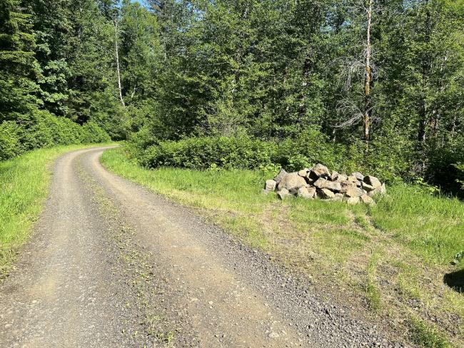
Start by following directions to Cedar Butte, but towards the end don’t take the left turn onto Cedar Butte Road and instead keep heading north on Wolf Creek Road. After about a mile you’ll reach an intersection where you’ll need to make a sharp left onto Kilchis River Forest Road. Follow that for several more miles, and you’ll pass scenic Kilchis Falls on your left. From the falls, it’s under a half mile to where there are a couple good parking spots along the right side of the road. One of them has a large pile of rocks next to it (see photo). There is plenty of level room to pull off the road and park. Total driving distance from Highway 6 to the parking spot was just under 10 miles.
The Hike
My plan had been to hike from the road up to the nearest peak (around N 45.60302° W 123.65925°) and then follow the ridge up to the main peak. While navigating by using the ridge as a visual landmark was somewhat helpful, alas there was no easy “ridge walk” to be had. Multiple crests along the ridge had rocky faces steeper than I was prepared to tackle, so I wound up hiking around them.
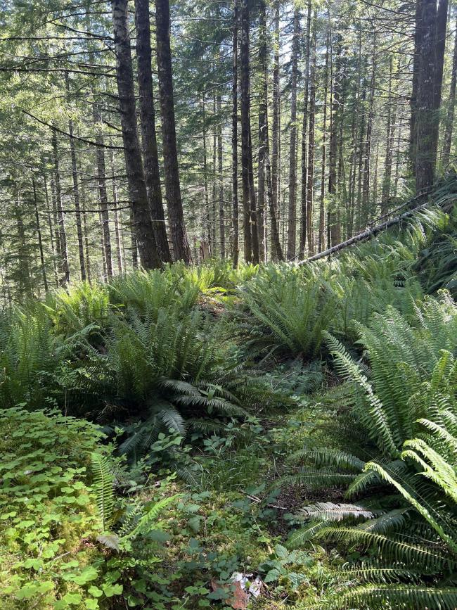
The terrain was generally steep, and if I wasn’t walking up a hill, I was walking at an angle along the side of one. The forest had an undergrowth of ferns – thankfully (once away from creeks) there was not denser brush to contend with. I wore work gloves for the entire hike, and they are an absolute necessity for doing this kind of bushwhack.
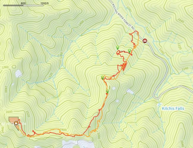
Early in the hike (about a quarter mile up from the road) I found an old, overgrown forest road. I was hopeful that I could follow this west for easier hiking, but it soon came to a dead end (around N 45.60609° W 123.65822°, see map image). I didn’t get to follow it eastward and see where it led in that direction, but it’s possible that it runs down to Kilchis River Forest Road, and if so that would make for an easier start to this hike.
As I got close to the first minor peak, I saw some recent tags on trees, done with orange flagging tape (starting around N 45.60366° W 123.65997°). Again I hoped I’d found a marked trail, and the blazes did continue, but only for about an eighth of a mile, leading to a possible campsite area near that first peak. After that point, there were no more blazes, and I was largely moving through unmarked forest, with the exception of a few small game trails. I would frequently check my topo map app, and generally tried to follow the route I had traced.
I am including an image of my map, but there are probably easier/smarter ways up to the summit, so I don’t suggest that anyone necessarily take this same route! My notion that I would get up to a ridge and then have an easier path to follow the rest of the way up was totally naive. On the map image, the red track was my path going up, and the orange was going down.
The Stats
- Going up: 2.4 miles, 3.5 hours
- Going down: 2.0 miles, 3 hours
- Time on summit: 2 hours
- Total calories burned (according to Garmin watch): 3540
- SOTA points awarded: 1
On Summit
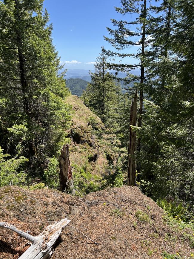
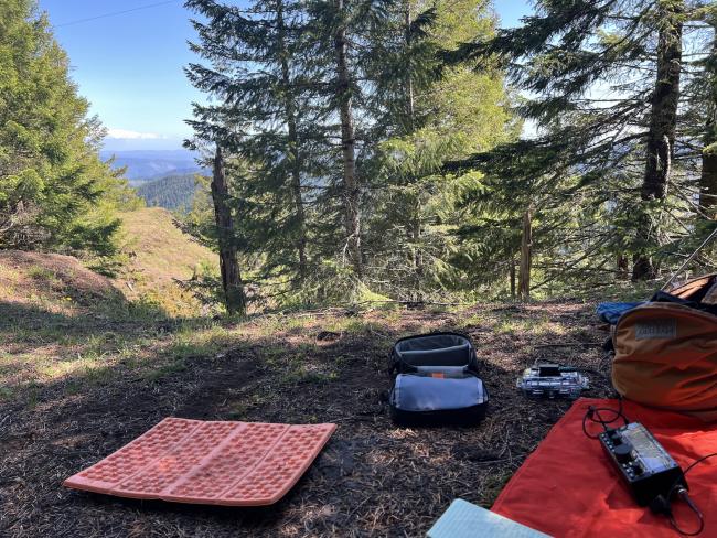
The summit is a mix of bare rock and trees. There is a steep, exposed drop on the south side of the summit. Band conditions were poor that day, so for an HF antenna, I had brought only a “no compromise” 40m EFHW, about 70’ long. I found just enough open space between two trees to string that up. The ends of the antenna were only about 6’ off the ground, but in between the ground dropped away a bit, so the average height above ground was more like double that.
I worked 2m first. I announced the activation on the South Saddle and Mt. Hebo repeaters, but I don’t think I got any takers from those sources. Fortunately, there was cell data service (on the summit only), so I was able to spot myself. I got one QSO from Tualatin, and then with the help of NR7Y’s remote station in Beaverton, I got a couple more. It took a while to find “just the right place” to stand on the summit to make my signal readable, and I was really wishing I had a yagi with me. I then worked HF SSB and FT8, including a summit-to-summit with AG7GP with a signal that was right at the noise floor.
Gear
- Yaesu VX-8 w/Long Ranger antenna
- Elecraft KX2 w/40m EFHW
- Rpi Zero 2w for FT8, connected w/DigiRig
* Disclaimer: this award may not actually exist.


