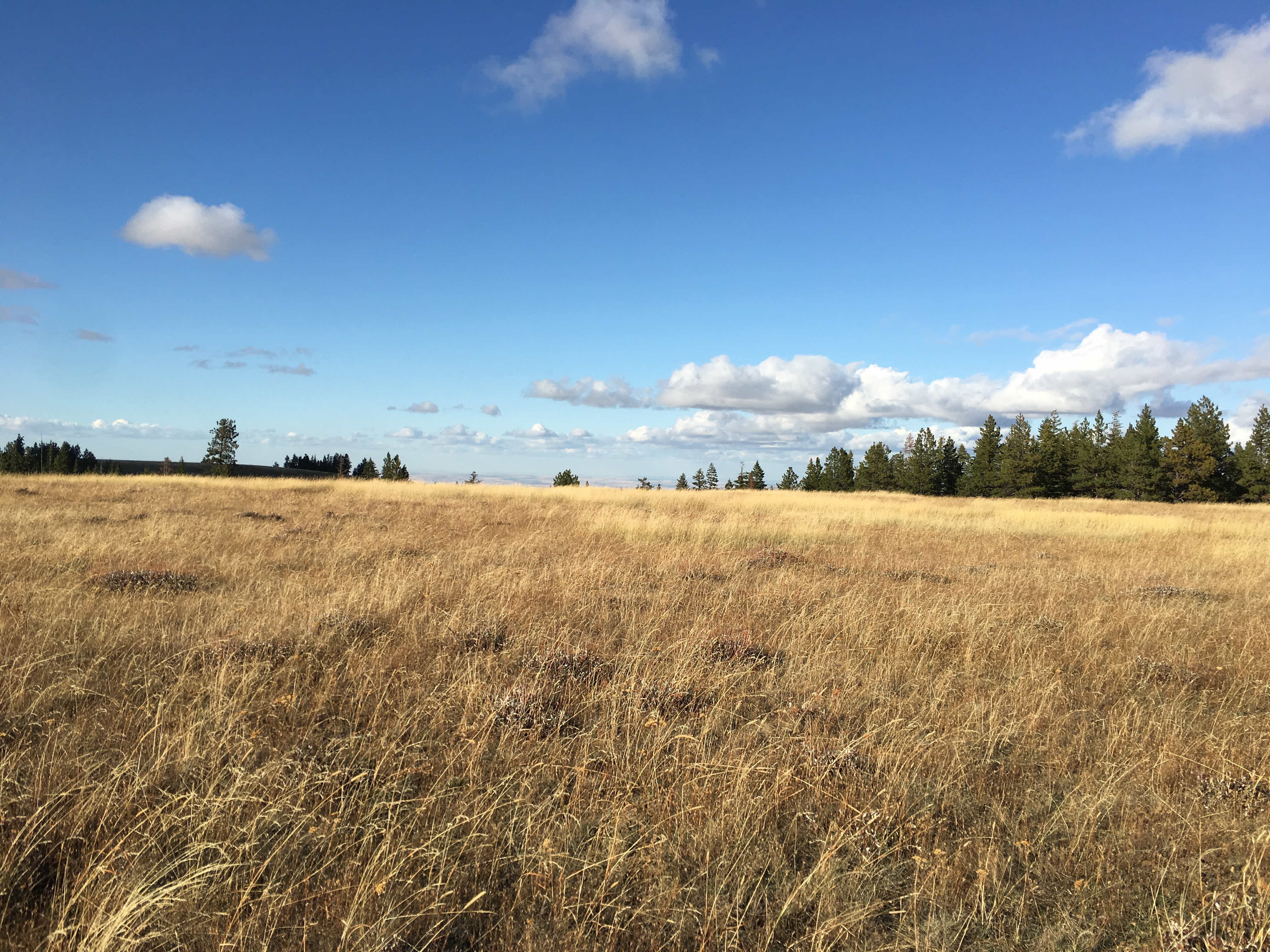
Summit 5230 is located 23 miles (as the crow flies) South of Pendleton, OR. If you have the right vehicle and can tolerate a long bumpy ride in, this can be a drive up summit. It would make an excellent mountain bike-based activation. I would not attempt this summit without a GPS. Once you finally get there, the summit has panoramic views with mixture of rocky meadow and patches of pine trees. It has line of sight to Mt Hood and Mt Adams. I got QSOs on 2M FM in tri-cities, Prosser, Walla Walla and in the opposite direction in John Day.
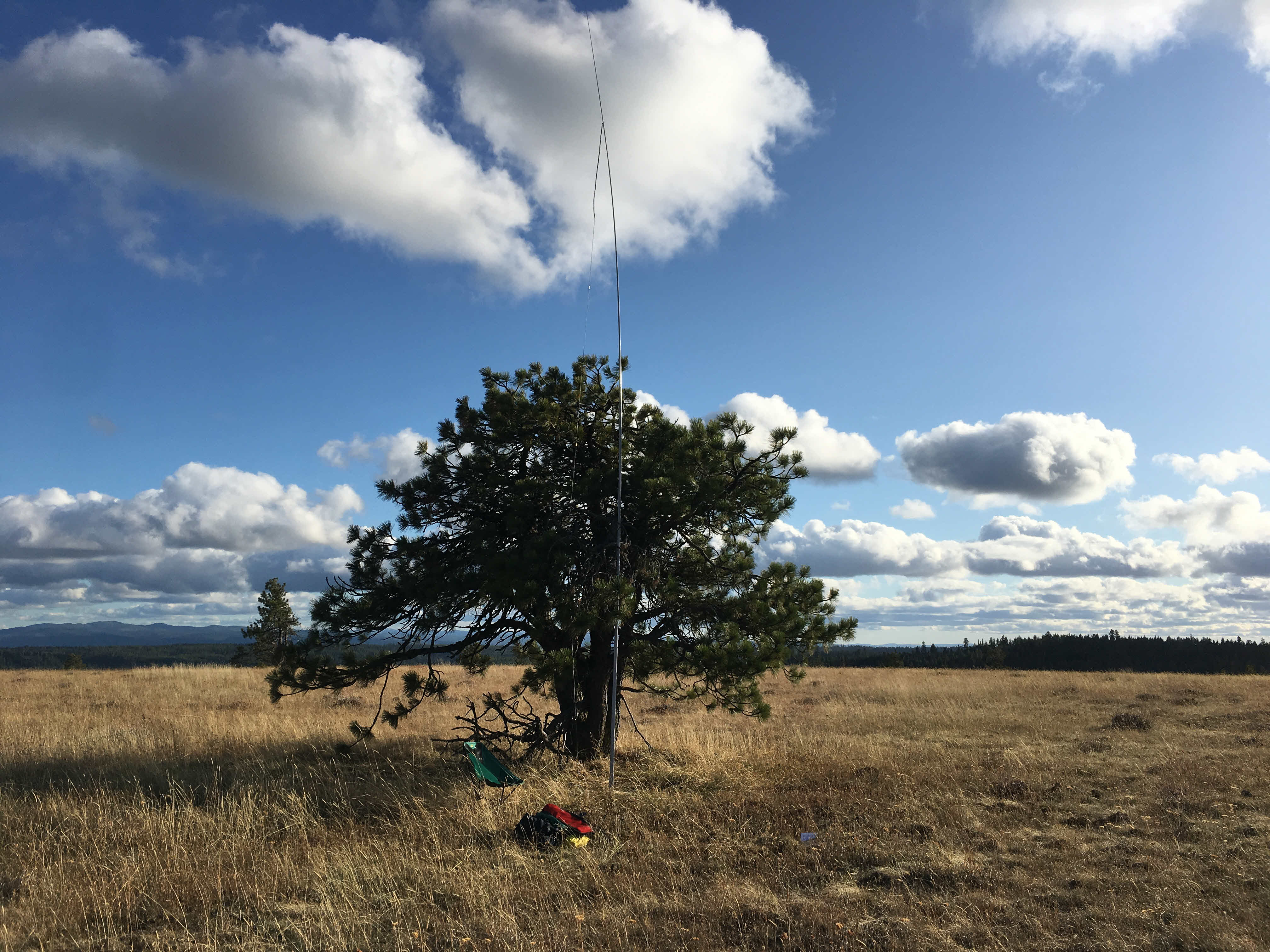
There is a rocky meadow at the top and a lone pine tree stands in nearly the exact coordinates of the summit which is great for stringing an antenna (pic below). There are treed areas surrounding the summit per se, but the activation zone is huge with a very large area at the same height as summit coordinates. I had mobile phone coverage and APRS from the top, but until you get there, no signals on either. Good signal into the Spout Springs repeater on 146.800 -.60 123 Hz tone.
Do not depend on Google maps to route you, it routes on roads that are on private land. Directions below for access via public roads into the national forest. The 23 miles of non-paved access roads to the summit consist of three surface types - all of which will rattle your teeth and test your suspension system. First you get heavily washboarded dirt/gravel, next you get pure rock and third you get nice dirt roads with the exception of massive potholes that will require a high clearance vehicle. There are many turnoffs and most likely several paths to the summit along the way. For mountain bike activation, suggest parking at end of Yellow Jacket Road at the Umatilla National Forest sign for the ride to the top.
Directions:
- I84 to Pendleton, OR.
- At the I84 / Hwy 395 S exit, proceed S on Hwy 395 for 15 miles.
- Left on Yellow Jacket Road
- After 5 miles this road turns to dirt at a Y in the road for Birch Creek Rd.
- Do not take Birch Creek Rd as Google maps will direct you. It is a dead end and access to the forest off this road is private.
- From where the dirt starts on Yellow Jacket Road to the Summit is 23 miles. Follow Yellow Jacket road until you get to the Umatilla Forest sign. This is the transition from washboarded to rock road surface: go straight. This is “National Forest Development Road 5415.” I saw signs only for “NF-015” here and there).
- I took NF-5415 up until a T-intersection with NF-5412 and turned LEFT. NF-5412 turns into NF-054 on GPS, but I did not see a sign. It was 3.7 miles from the T intersection of NF-5415 and NF-5412 to the intersection of NF-5411 (nicely marked with sign). Turn LEFT on NF-5411. This road goes to the summit.
- There are many places along the way to park based on how far you want to hike in. You can drive all the way to the summit if you have a very good off road vehicle. You can park as close as 0.2 miles with decent high clearance vehicle.