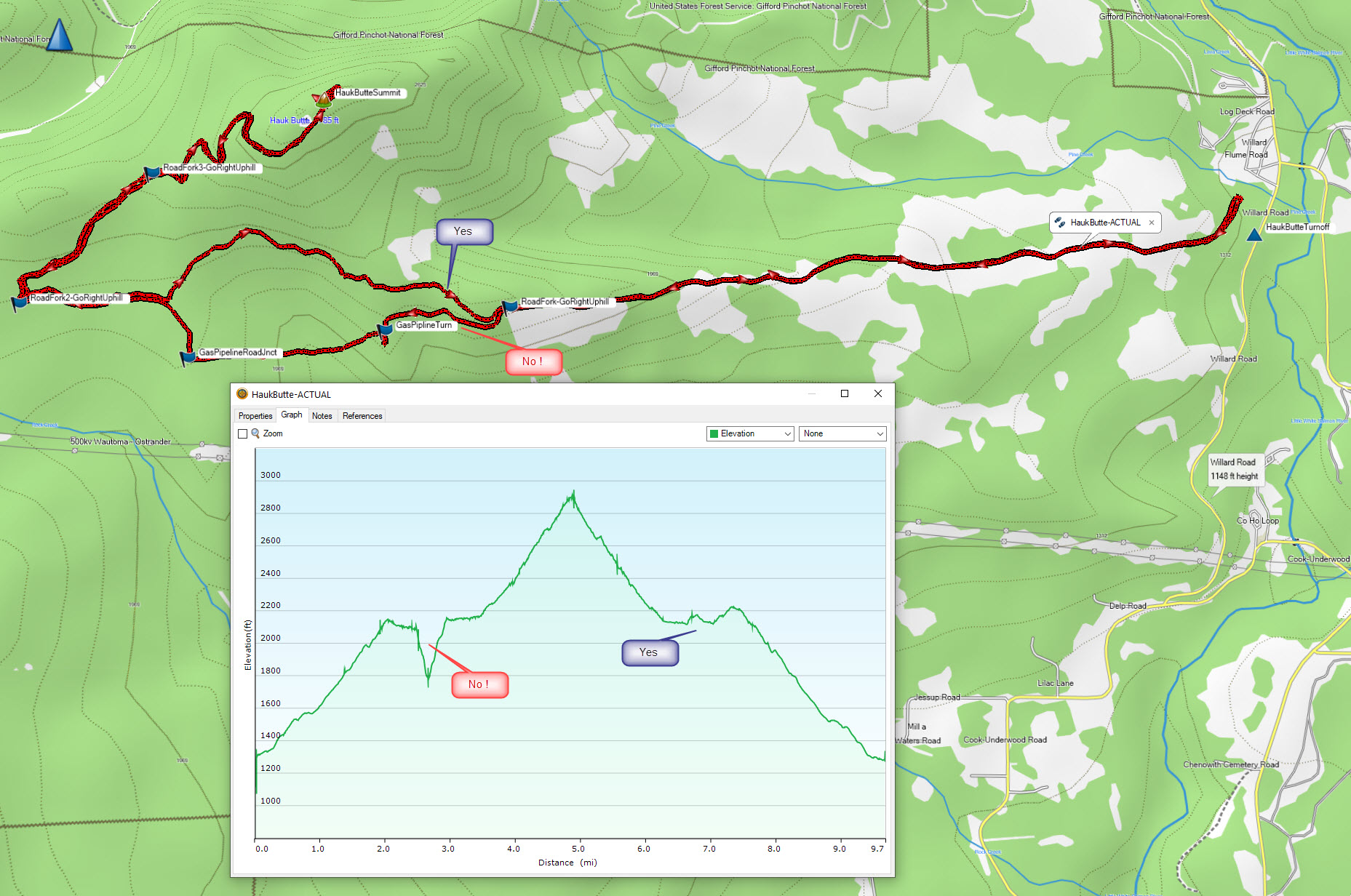
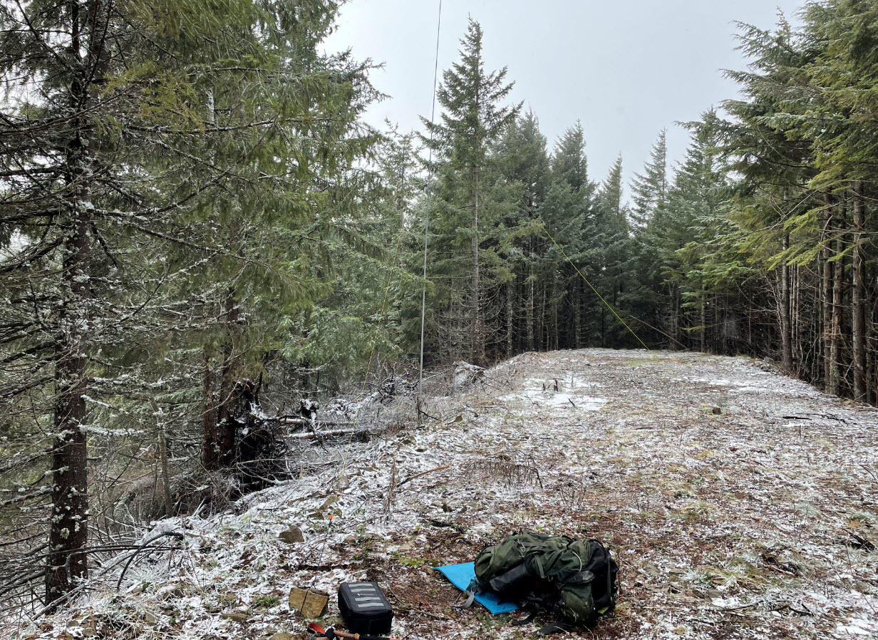
Hauk Butte is a 9.5-mile RT hike with ~2000 ft gain located Northeast of Dog Mountain and Augspurger Mountain north of the Columbia River. Reaching the summit is possible entirely on logging roads, which go right up to the exact SOTA summit. At the summit, you are surrounded by trees on each side of the road as the summit has not yet been logged. This came in handy when I activated during 20-30 mph winds: the trees made a good wind break. This would be a good mountain bike activation.
To get to the trailhead from Portland cross over to Hwy 14 at Bridge of the Gods (toll) and go east on Hwy 14. Go past the Dog Mountain Trailhead and then turn left on Cook Underwood road. This merges into Willard Road then Oklahoma road. I put in “Moss Creek Campground” in Google Maps and used the routing from that. But before you get to the campground, turn left near 45.77682. -121.63146. Just a few hundred feet after turning on this road you will encounter a gate with room to park so you won’t block the gate. Stevenson Land Company sign on gate says no motor vehicles are allowed. I hiked on a weekend day and did not see any other people the entire trip.
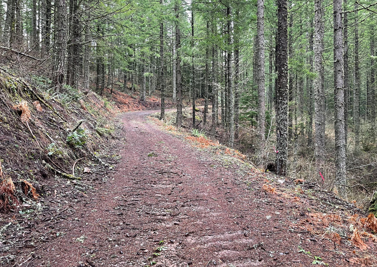
Follow this main logging road. You will be going parallel to a natural gas pipeline and will see markers in the first couple miles. In general, at forks in the road, “go up and to the right.”
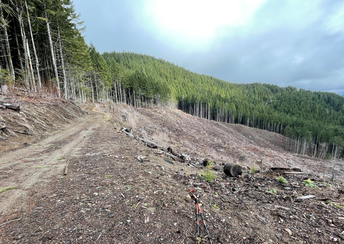
At 2 miles (45.77201, -121.67068) you get to a fork. Go “up and to the right” (photo below), if you take the fork to the left, the road ends and you have to go straight down a 350’ vertical decent and then up a 400’ ascent along the pipeline route to get to the road on the other side. Going “up and to the right” will keep you nicely on a more pleasant route. You will get to a right turn near 45.77225, -121.68703, and forks in the road near 45.77207, -121.69423, and 45.77671, -121.68777 at each, turn right and go uphill (see GPS track below). At the very top is a 180° hairpin turn and you are in the activation zone with plenty of room on the road to set up, and plenty of nearby trees to hang or mount antennas.
On a clear day there may be views from the hairpin turn near the summit, it was socked in on the day I activated. With the wall of trees lining the road where I activated, I did not make any 2M contacts. I was able to make SSB HF contacts on 17 and 20 meters. I had three bars LTE cell service from the top (ATT) and was getting SMS text messages in/out and SOTA Goat alerts no problem.