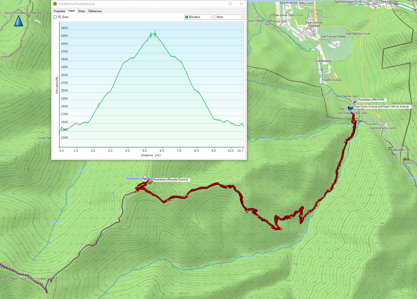
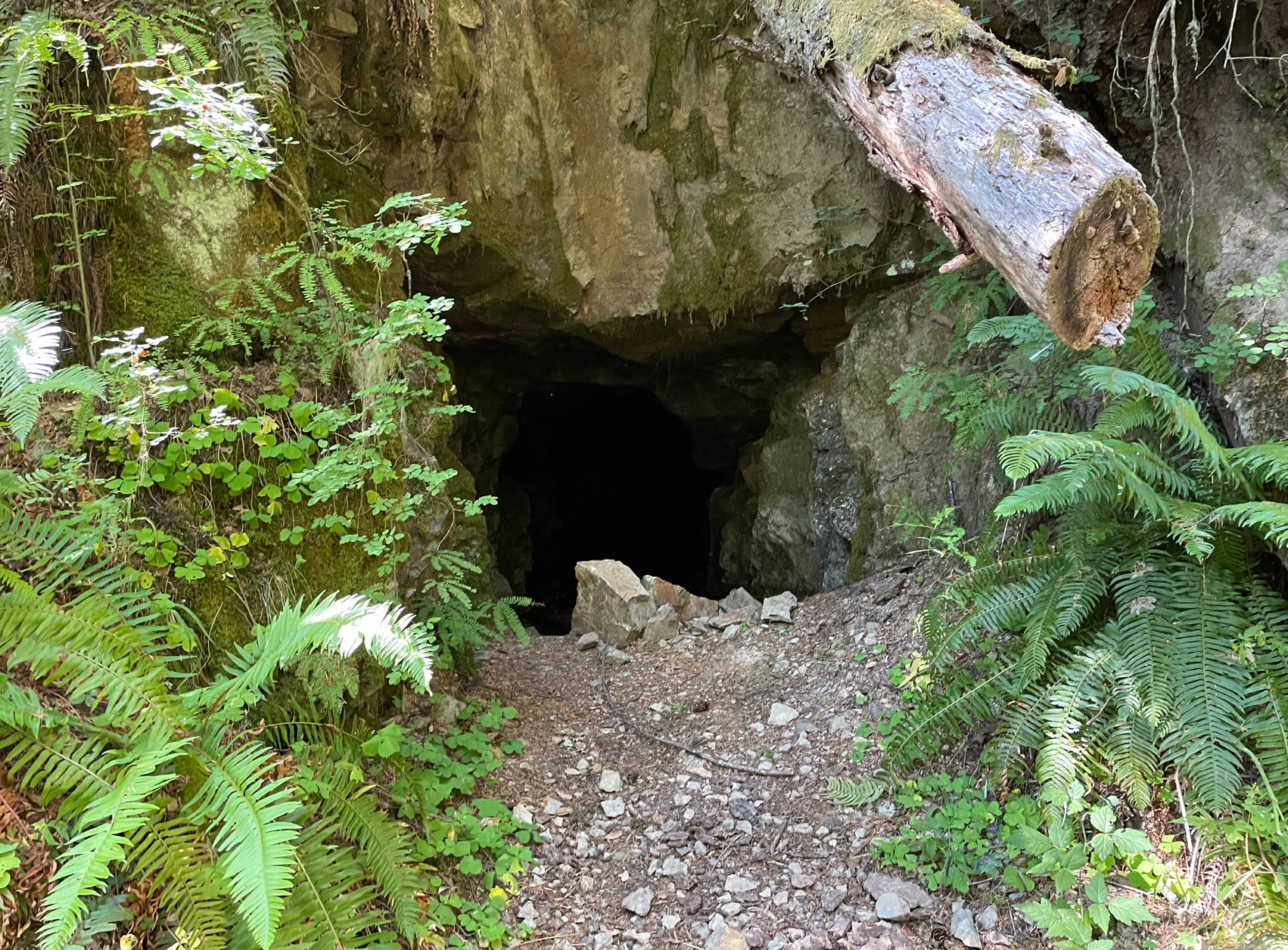
In addition to the two routes to Huckleberry Mountain K7ATN describes, there is a third trail up, the Bonanza Trail. I chose this option for three reasons: I was intrigued by the fact that there was a mine shaft off the trail, it looked like it was a bit shorter than the Boulder Ridge Trail route and I thought that there would be fewer hikers taking this route on this busy Labor Day weekend Sunday.
Here is information about the hike that I used:
· https://www.oregonhikers.org/field_guide/Huckleberry_Mountain_via_Bonanza_Trail_Hike
· Forest Service TH info: https://www.fs.usda.gov/recarea/mthood/recarea/?recid=52848
I was able to park right at the logging road described in the Forest Service web page. There is only room for three cars there with private property signs with No Parking signs in the other areas.
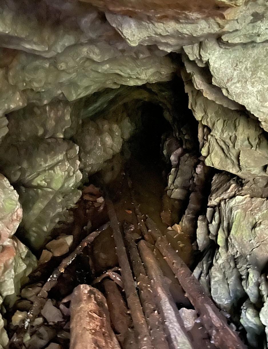
It is indeed 10.7 miles but slightly more elevation gain then Boulder Ridge route at 3655 feet. You are under forest canopy the whole time which is nice for a hot day. I only saw 3 other hikers and that was at the beginning of the trail near the stream. I did see the mine, but it had about 10” of water in it and seemed kind of creepy and did not go very far into it.
This southern route does not have views! You are in a canyon on the South side so don’t see much. Also, if doing this route in the spring when the steams would be running full of water, it may be a bit challenging to get across them. There are four water crossings.
For as hard as this hike is, if I could, I’d make this one a 4 pointer!