One of the most gorgeous hikes I've taken in Oregon, it's clearly popular during the 'summer' season but we had it all to ourselves this spectacular November Sunday. Note that there are four "Huckleberry Mountain" in the Oregon ARM - one of them is also in WV and is also 2 points - make sure you get yourself to the right one.
Although some hiking sites report this at 10.5 miles RT, we found it closer to 13 miles - and 3400 feet of gain. So it will take you some time - it's a full day to activate this one.
Take Highway 26 east from Sandy about 15 miles to approximately milepost 39.2 and turn into the Wildwood Recreation Site on the south side of the Highway. In the off season you will need to park on Highway 26 and hike an additional half mile to the trailhead. Note that the Wildwood Recreation Site also has day use and a restroom - a trailhead pass or fee is required here during the 'on season'. However, since this is BLM land the NW Forest Pass is not accepted here.
Note that there is also access to Huckleberry Mountain from the south and Wildcat Mountain - see Kiri's report to get started from that side: http://www.pnwsota.org/blog/k7kah/2013-june-13/wildcat-mtn-or.
For the most part, the trail is well-graded and smooth, but it is long - 13 miles roundtrip if you can drive to the trailhead and 14 miles if you park at the gate. It's also 3,400 feet of elevation gain. Despite the workout, you may find it busy during the summer season - the large parking lot is a giveaway. However, we saw not a soul for our November excursion in weather that could not have been better.
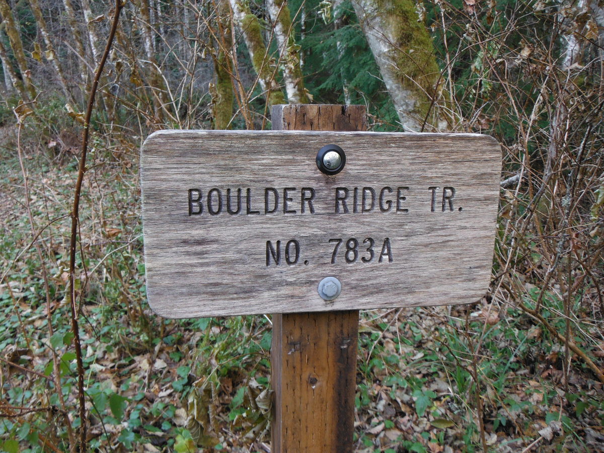
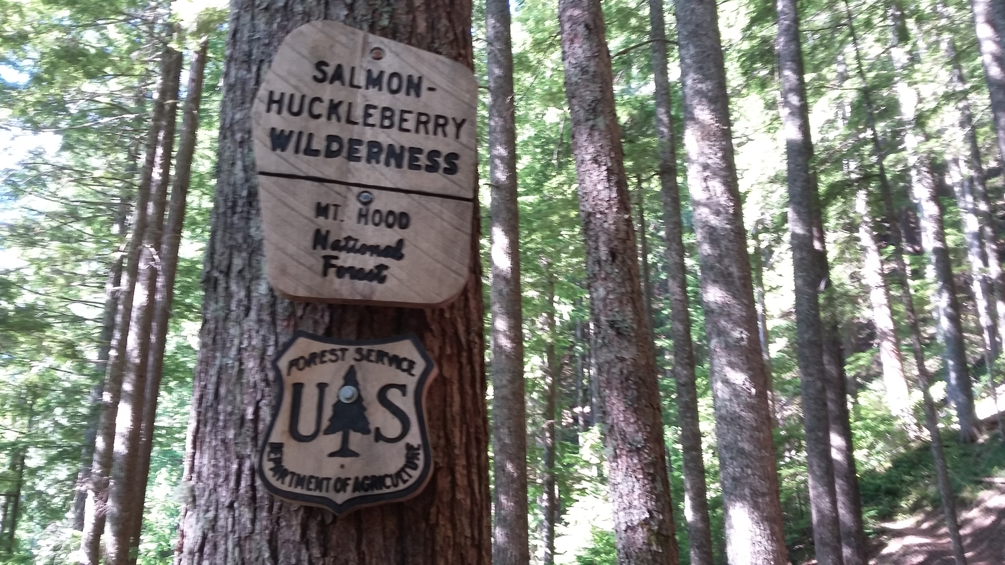
Starting on the paved access trail north of the restroom labeled Boulder Ridge Trail, cross the Salmon River and continue to the sign for the Boulder Ridge Trail. Here you'll begin climbing and eventually will start switch backs (about 10 of them) to gain the ridge. You'll eventually enter the Salmon Huckleberry Wilderness and continue along the ridge to the summit.
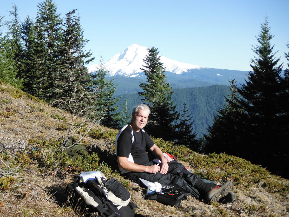
Near the 'end' of your hike you'll come upon a rocky prominence with great views of Hood, Adams and Rainier where most hikers will stop and have lunch. But as any good activator recognizes, this is not the activation zone - the summit proper is about a third of a mile farther along the trail. About 0.10 miles before the summit there is a small saddle that IS in the AZ and has a view of Mount Hood (but not the others) - this is a nice place to operate. A GPS may help you identify the summit here.
With a temperature inversion going on we had an extraordinarily pleasant time in the sunshine during our shirtsleeve activation. It was close to 60F at 4400 feet while it was in the low 40s back in town and the ground was frozen where we were.