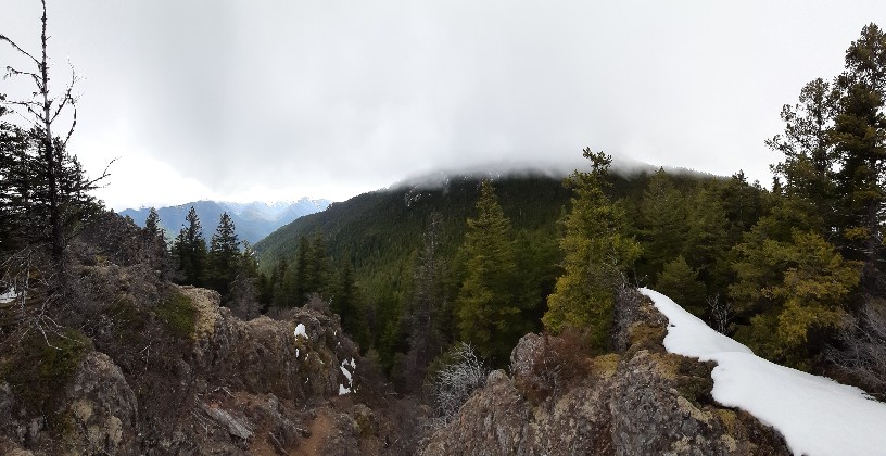
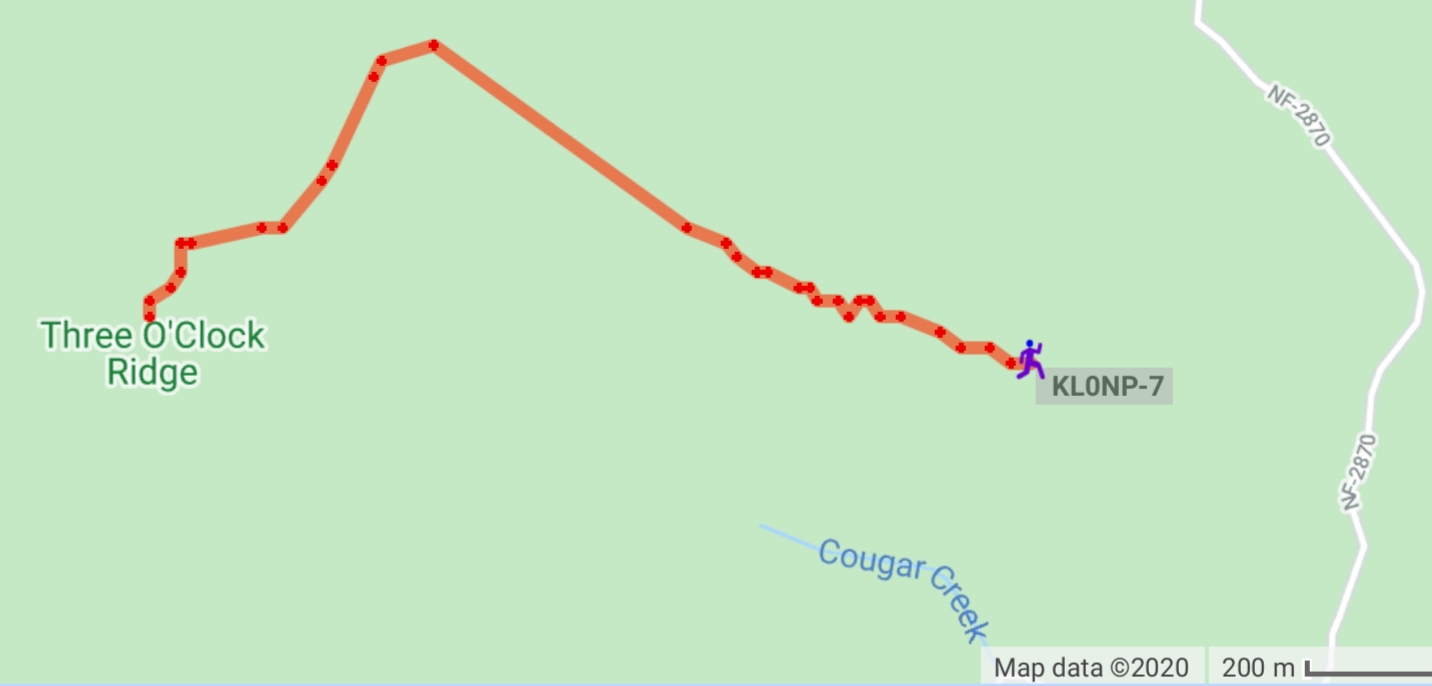
A short, but scenic 2.6 mile round trip hike. Mostly it follows well defined elk paths, some minor scrambles over rocks, not quite class 3. One could stay in the trees to either side of the ridge and avoid the rocks.
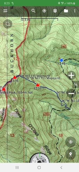
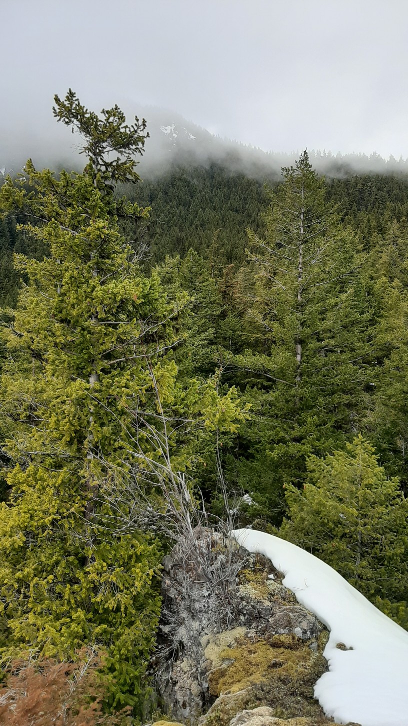
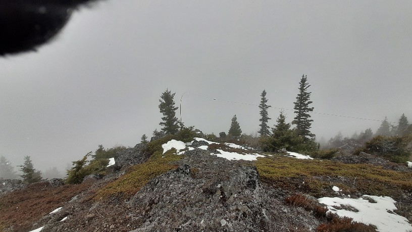
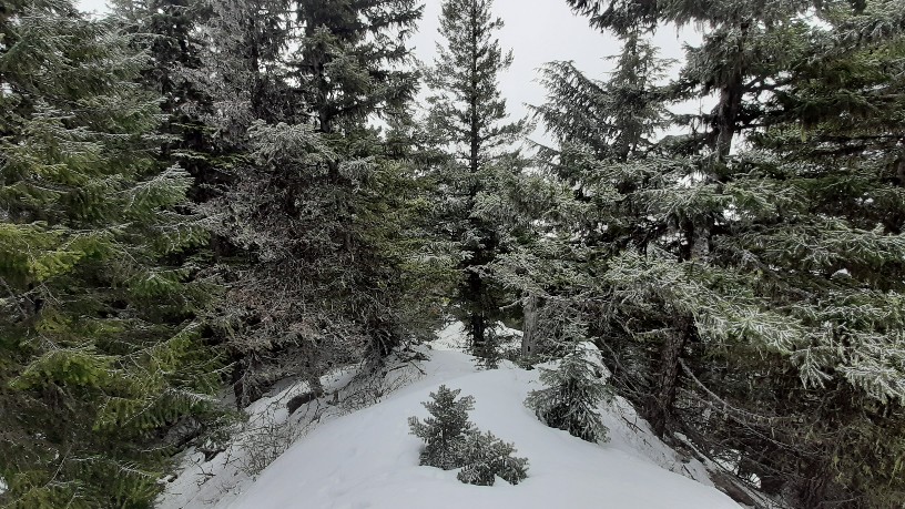
I started a 1145, and Backcountry Navigator logged it as 4.5 hours including over an hour on the summit, with about 1900 vertical feet. Plenty of parking at a large turnout--commonly used by folks for camping or campfires. Follow the ridge up well defined elk trails to another logging landing. With the right vehicle, one could drive to this upper landing (not with a Prius, I tried). Then continue to follow an elk path up. The area was logged long ago, so it has grown up enought that climbing is not hampered much by brush or such. Above the landing it becomes old grown and more open. The elk path peters out, but the ridge remains easy to follow. There are a few minor ups and downs over rocks. One can stay in the trees on either side of the ridge, or scramble up the rocks/snow where there are great views and spots to rest. I didn't encounter snow until about 4000 feet elevation. It was fairly consolidated, so I only sunk in 6-12 inches. Until about 4700 feet. Then I sunk in well over my knees, and I couldn't make it straight up, but had to do a bit of traversing at an angle. This only lasted about 200 feet vertical, then I made my way to the south, just below the summit. The more southerly aspect had more consolidated snow, which was easy to climb. The summit has a few trees that can be used to string up an antenna.
If you study the map, there are two ridges that lead to the summit. I thought about going up 3 O'Clock Ridge, but is would have been slighly longer, and not as much room to park where that ridge intersects the road.
I made a bunch of 20 m contacts (1500 local time) and a few 40 m with my Mountain Topper 3 band rig and 20/40 end fed antenna. I made a few contacts with 2 m on my Anytone 878 using the stock antenna, but more using my 3 element yagi. I was picked up easily by the APRS system while hiking using my stock antenna. I got spotted by the RBN with my 20 and 40 m CW, but I was able to post using the internet when I switched to 2 m.
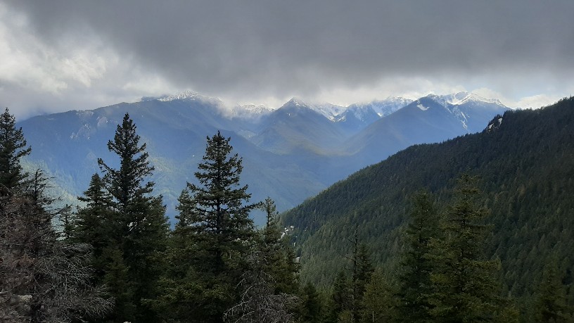
I didn't get great views at the summit as I was in the clouds, and it was snowing. My signal reports were 229-449, a bit less than usual, but I had my antenna pretty low and strung up on the west side of the summit running NE to SW. So the summit blocked some of the "Cool Waves" from heading east, but I got Port Angeles well--Mark K7NEW almost blew me off the mountain with his QRP rig. Part of that was due to my new Koss noise isolatiing earbuds--they block the wind but they can be too loud sometimes.
It was my first time running at 20 WPM on CW--After the Level 2 CW academy I can copy call signs at that speed no problem, but I still am not quite ready for ragchewing at that speed.