It was raining steadily as we left the Willamette Valley Friday morning. Radar showed that a band of showers were over our activation site but we pushed on being always optimistic (heck I'm a QRPer, I've got to be optimistic!) We arrived at the Maxwell Butte Snowpark parking lot ahead of schedule. I figured that we would be on the summit in a couple of hours, maybe an hour ahead of time. Optimistic, like I said...
You get to the Maxwell Butte trailhead by driving to the end of the parking lot and continuing on road 080 for another 0.25 mile. There the road takes a right bend, look straight to see the trailhead registration box. This is the beginning of the Maxwell Butte trail #3391. This area requires a Central Cascades Wilderness Permit.
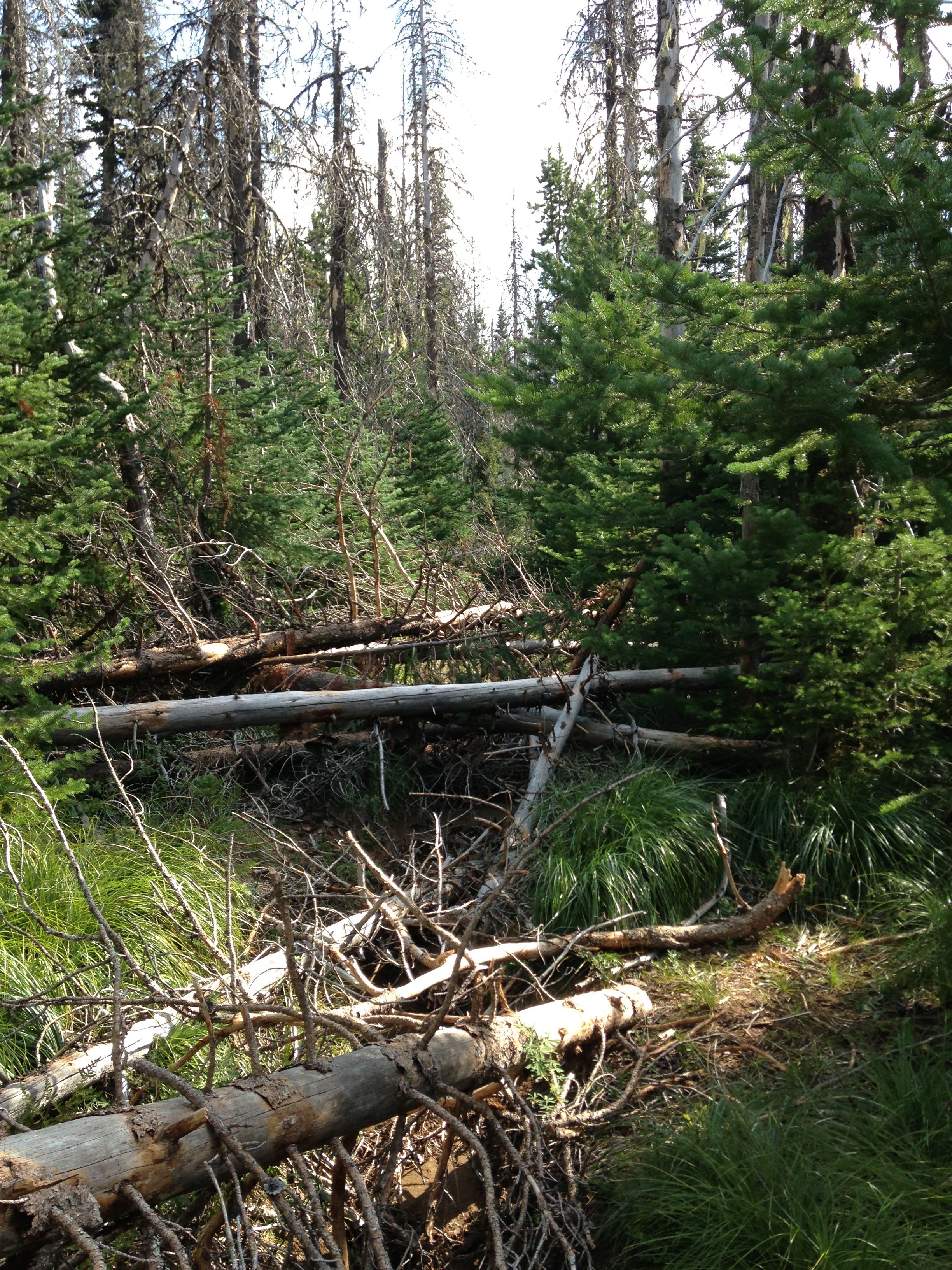
The trail begins very nicely; well graded and smooth. The forest here is really nice. Its more "wet side", thick fir and fern forest instead of dusty, rodeo-booger, ponderosa pine. After a little ways, and a few blowdowns, you enter the Jefferson Wilderness. Here, the fun begins.
The trail steepens but is very reasonable in slope. What is unreasonable and gets progressively worse are the number and density of blowdowns. Its really, really bad. We kept hitting more and more, but each time felt that it was about to get better. "Surely that was the worst of it". "I bet that was the last of it." "That's got to be the end of it." Optimists to the end. We pushed on as the skies cleared and the temperatures warmed. We began to sweat....optimistically of course!
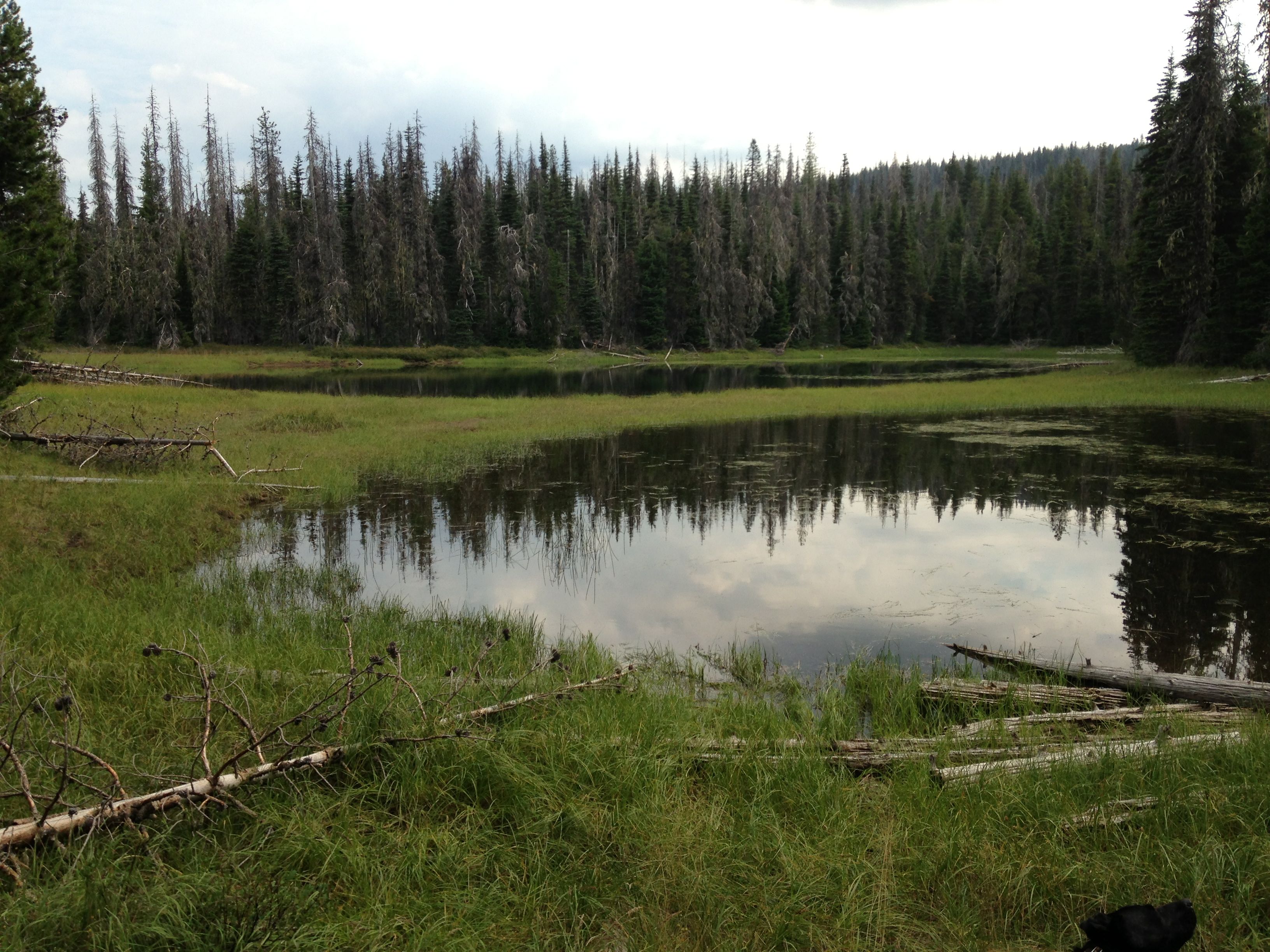
It does not get better until the trail turns right just before Twin Lakes. Twin Lakes are two small, shallow but nice lakes for mosquitoes to breed. Everybody has to live somewhere! After this turn the trail has fewer blowdowns. However, the trail becomes very rutted. The trail assumes the cross section of a "V" that is about 24-30" deep. Your feet must be put one in front of the other to walk in it. As such, we spent a lot of time walking off the path. From here to the summit there are only about 36 blowdowns to go. Ah ha, we knew it would get better, its only been four miles of blowdowns!
Bugs were not a big factor. More mosquitoes around the lakes but they were not to persistent. We put on DEET after a few bites early on and never had a problem the rest of the day.
Approaching the Butte, the trail steepens and the blowdowns stop. The trail is nearly washed out scree and a mix of marbles to bowling ball size bearings for you to skate on. It dosen't last long however and the views get much better.
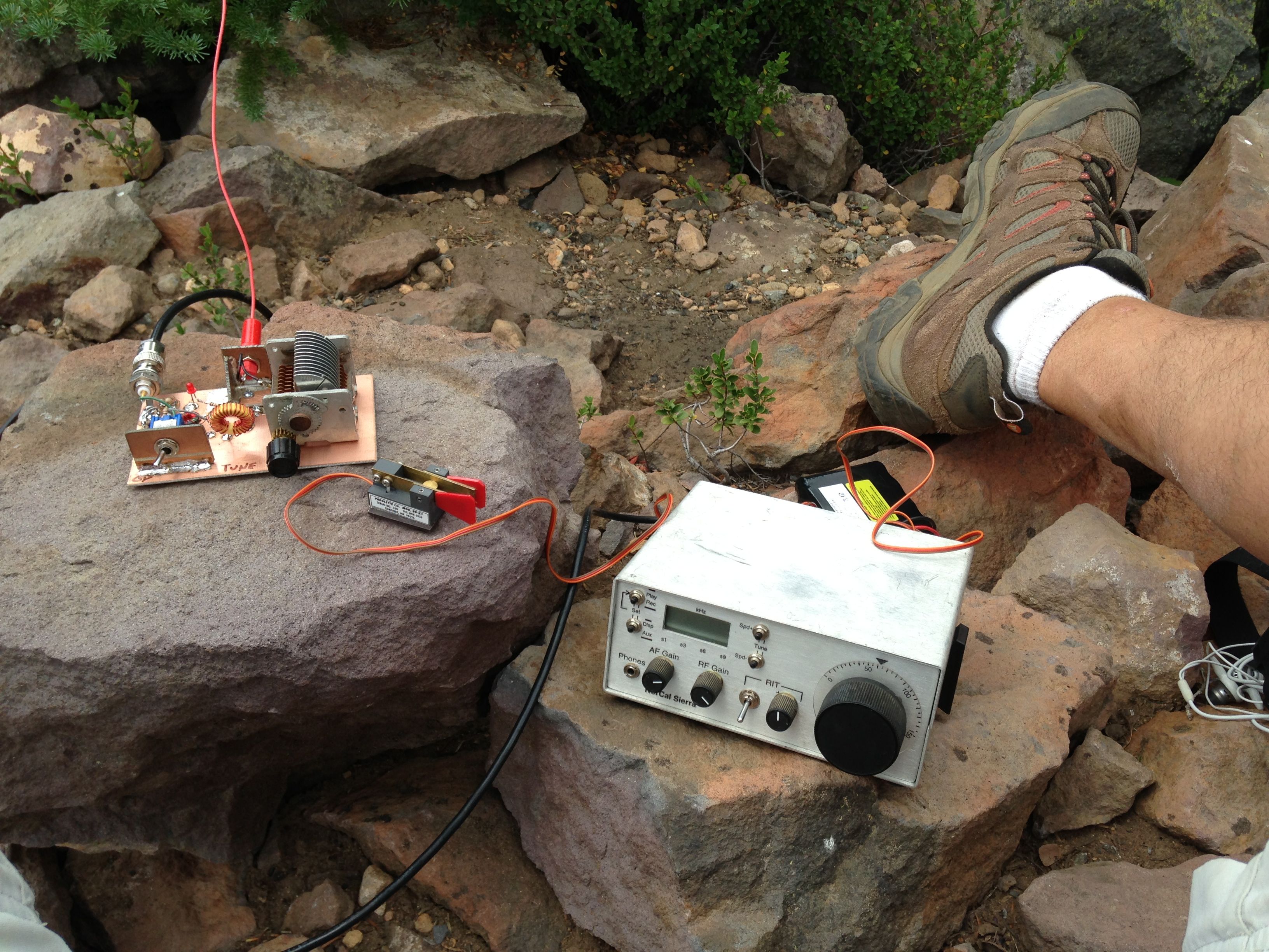
The summit is, well, a summit. Its a jumbled pile of rocks with a few scattered trees. Actually, a pretty small summit. However, it does have sufficient rocks and trees to put up a dipole or EFHW. I used a small fir to attach my 10m mast to. It worked great. Directly to the east however is Three Fingered Jack standing considerably higher than Maxwell Butte. I supposed it would probably clip out much of my low angle signal to the east. Naw, be optimistic! Actually it worked just fine. Optimism rocks!
20 meters seemed to be in pretty good shape and I worked 23 stations in 40 minutes. Many loud signals. Thanks to the awesome chasers out there working the peanut whistles in the mountains.
On the way back down, we counted the blowdowns. We did not think anybody would believe us. A pretty accurate count of 148 blowdowns was tallied. I'm not talking trivial stuff you can just step over. We took many detours, crawled under some, over others, beat a lot of brush. By the time we got back to the car, we and the dog were really tired. BTW, its a 10 mile round trip from the snowpark parking lot, not 8 miles like some say.
I don't recommend this trail. Going up and back we traversed 296 blowdowns in 10 miles. Thinking back about it, we must have been crazy... or optimistic. The trail was in really rough shape due to water running down it and creating big ruts. It would be very easy to get hurt on the blowdowns. It would be easy to slip or fall on one of the fir "stobs" and end up with a sucking chest wound. Not safe. I'll try to inform the proper authorities. If the blowdowns were removed, the trail would be rough but reasonable. As it stands, I would not go back. If I had to, I'd call for a helicopter at the summit!
All this said, we had a great trip. We took our time, stepped carefully and went slowly when we had to. Our average speed was just over 1.5mph! The view was great, the gear worked well and the chasers were ready. On the way back home, we stopped for burgers at the Marion Forks restaurant. This sure beats any day at work. Ya just got to be optimistic!
Postscript:
This morning 8.19, I called the Detroit ranger district station and reported the trail condtion. They were unaware of the number of blowdowns and appreciated the report. I was told that trail repair is often scheduled months in advance and it would probably be some time (next year?) before a crew could be dispatched to remedy the situation. So if you find a trail in bad shape, let the Forrest Service know and eventually they will get to it. - RT