Applegate Peak is located within Crater Lake National Park. It was named for Oliver Applegate,
an early Oregon pioneer. There is no established trail to this peak but it may be accessed via
a southern route directly from the Rim Road as described by K7ATN, or from Garfield Peak as
described here.
The trail to Garfield peak begins behind the Crater Lake Lodge. Hike to Garfield peak, take a look
at the lake, then backtrack about 50 yards to where the trail rounds the south end of the peak.
Head downhill SSW there through the loose rocks, pumice and scattered trees on the shoulder of the
peak. Do not attempt to descend directly towards Applegate peak.
As soon as you see a clear path, angle back towards your left into the meadows leading towards
Applegate peak. The best path here is to stay just outside (right) the trees hugging the edge of
the cliff. Follow the trees towards the summit cross country. Its a little over a mile to Applegate
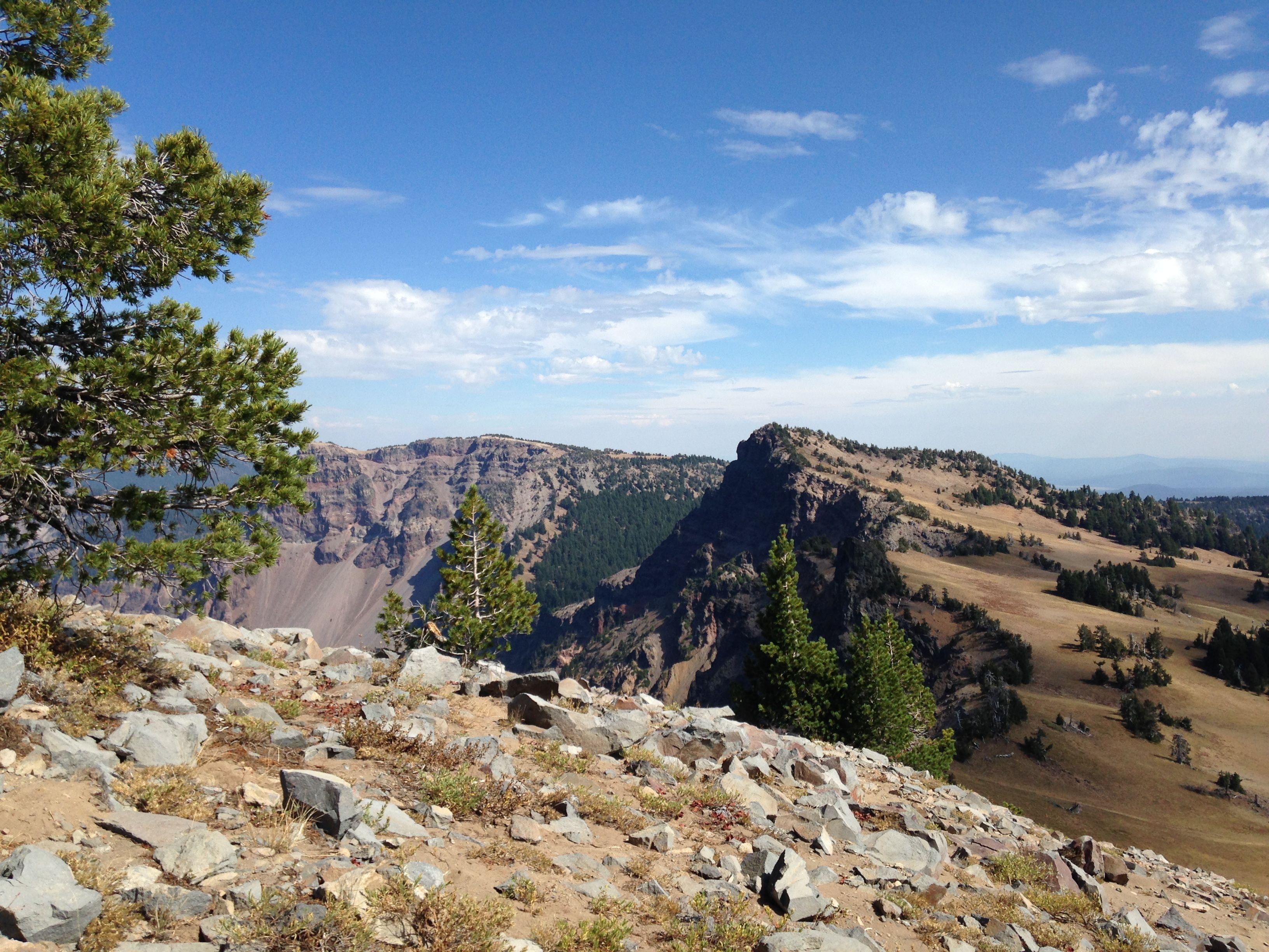
from Garfield. The last few hundred yards ascending Applegate Peak are steep with loose, deep pumice.
The summit is a small, tree studded rock outcropping with a deadly drop off to the lake side. Take
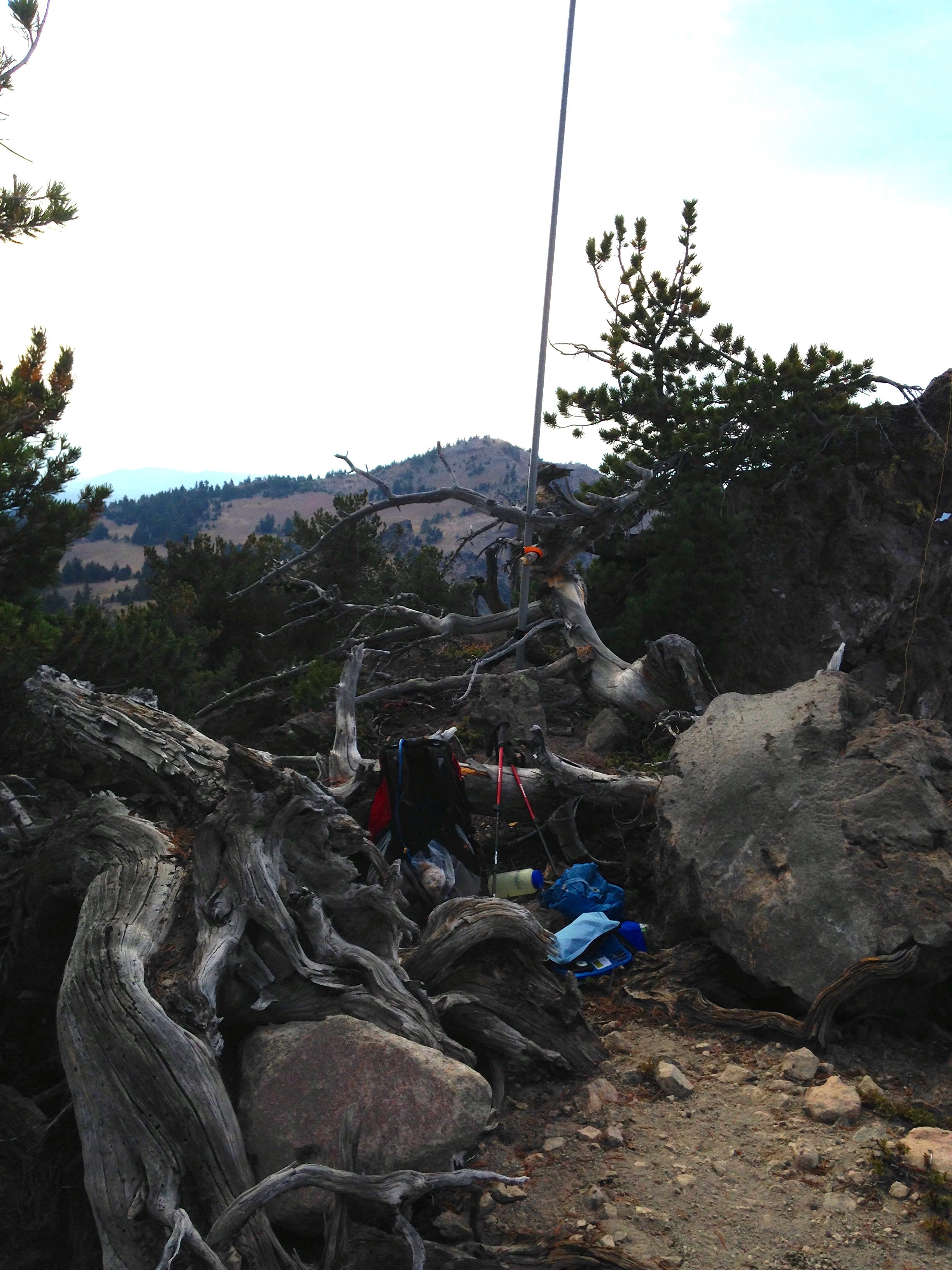
care and move slowly on the summit. There are plenty of good trees for EFHW antennas. An inverted
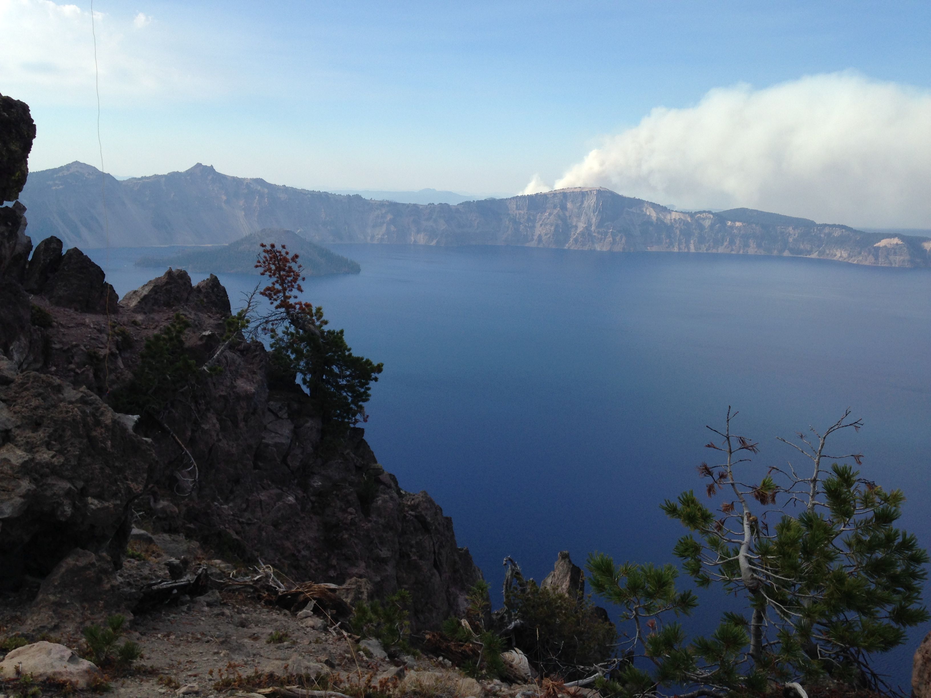
vee would be a real challenge on this summit. The views are jaw dropping as any in the park. Good
views are had to Dutton Cliff, Mount Scott and Garfield Peak.
I can't speak about which path, the southernly one (K7ATN) or the one described here, is easier.
The climb from the lodge to Garfield peak is from 7100ft to 8054ft. You then drop to 7700 ft and
back up to Applegate Peak at 8126ft. Total gain about 1400ft. Altitude gain from the rim road to
Applegate Peak is from 6800ft to 8126ft, or about 1325ft. The trail to Garfield is solid and
well maintained and may be better footing than the longer slog up from the south. On the other
hand, climbing back up Garfield after summiting Applegate is a bummer. But hey, at least you have
choices! Next time, I'll take the southern route for kicks.
A description of both paths may be found at: http://www.summitpost.org/applegate-peak/915699
Even though I activated this peak late in the day, contacts were plentiful and easy. You have a
clear shot in any direction. The operating position is cozy once you are seated and comfortable.
I think this was an excellent peak.
Remember that this is a national park and that everything is protected - trees, rocks, soil. No tying antennas to trees or putting stakes in the ground. Broken Arrow Campground at the south end of Diamond Lake is a convenient and plesant place to stay compared to the NPS campgrounds: https://www.recreation.gov/camping/campgrounds/231979.