In the last few years, I've developed a desire to activate the top 10 summits in the
Willamette Valley region. Miller Mountain is in that list but I've put it off because
its so far from the valley. Its located in south-central Oregon, closest to the town
of Chemult. I guess the placement algorithm treated it like a lost sock that you can't
throw away but you're not sure where to put it.
My approach to Miller Mt. was to take US Hwy 97 south towards Chemult, Oregon. About
0.5 mile north of Chemult, FS 9772 heads west. This road is also marked "Walt Haring
SnoPark and Miller Lake". If you are heading south and pass the Chemult ranger station,
you have gone too far.
Turn onto FS 9772 heading west and reset your trip odometer. As you pass the snopark, the
paved road becomes a very wide gravel road. At 3.2 miles from Hwy 97, bear right onto
FS 5840. FS 5840 is a dirt road but it's in pretty good shape. It was very silty and
extremely dusty on this dry day in September. With care, a passenger car could be taken.
Continue, staying on FS 5840 which has very few spur roads. The correct way is most
obvious. 5.0 miles up FS 5840, road 560 goes to the left. There is a spring here.
Continue on FS 5840. At 6.7 miles, pass road 490 on the right, and at 8.1 miles, pass
road 450 on the right. I parked exactly 10.0 miles from Hwy 97, roughly due east of Miller
Mountain very near the crest of a shoulder of the mountain. There was a very slight pullout
and a Boundary Monument sign just off the road there.
There is no trail to the summit. This is strictly a cross-country approach of about 2.6km
or 1.5 miles in tall timber. You should have a good map, compass and GPS to navigate.
Although the topo maps show a ridge to follow, the incline is initially very slight and
in the big timber you can barely make out which way is uphill.
Head roughly due west ascending along the slight ridge. The forest is pretty open with
little brush and is easy to walk in. The grade is not steep. Once in the timber, there
is no way to take distant bearings since the forest is tall. GPS/compass and dead reckoning
is the only way.
The primarily pine forest gives way to mountain hemlock and higher altitude trees. As
you approach the first smaller summit the forest becomes filled with more fallen trees
and rocks. You will probably begin to see the steeper north side of the ridge appearing.
I saw lots of bear, elk and deer scat in the area. Seems strange to me as this is very dry
country and there is little browse in the deep forest.
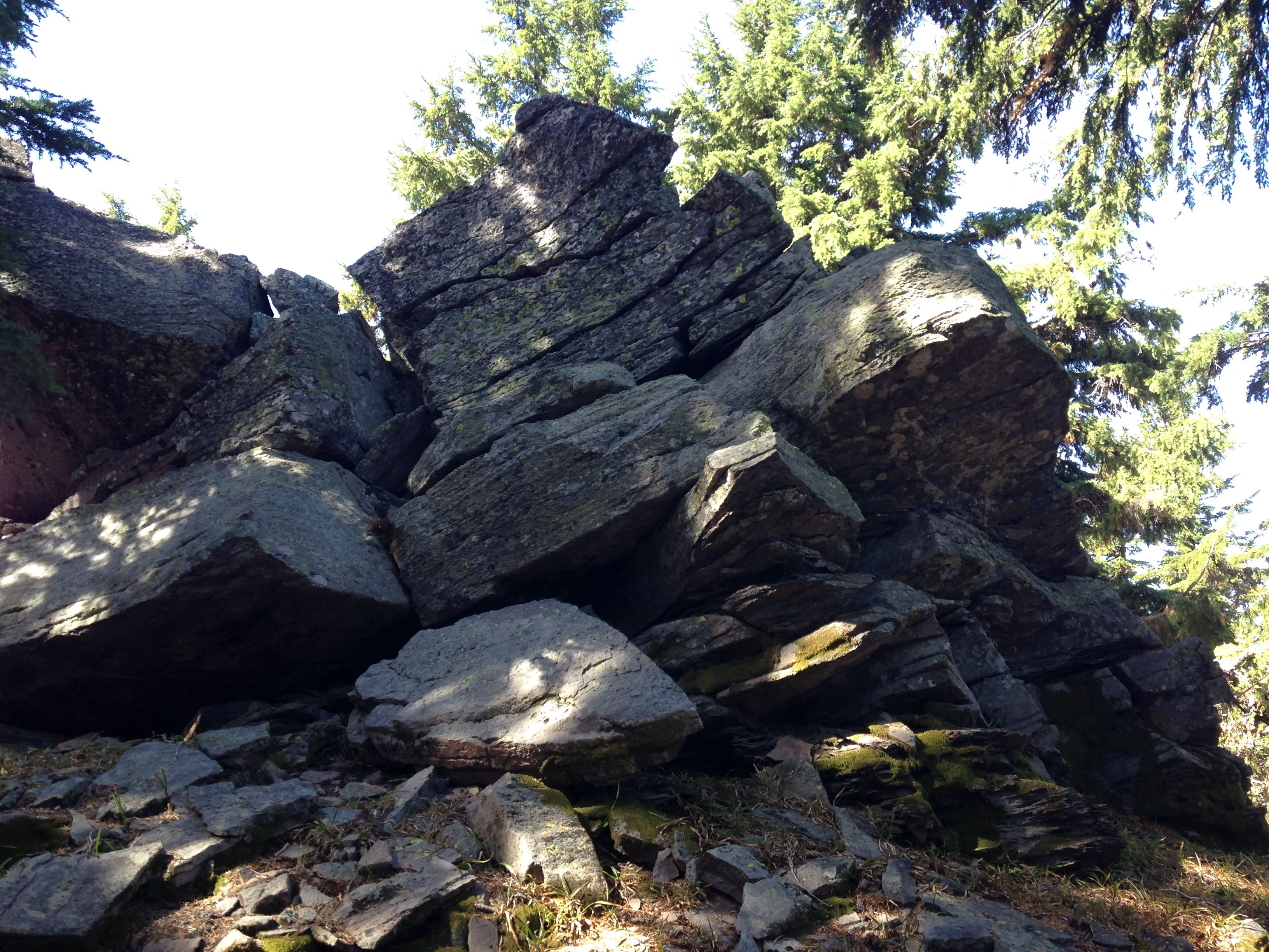
A large rock marks the first smaller summit. It would be a really cool operating position
and a striking setting, except that its not the summit! Go directly over the smaller summit
to the saddle between the summits. Don't try to skirt far down either side of the ridge it
as the terrain on both sides becomes quite steep.
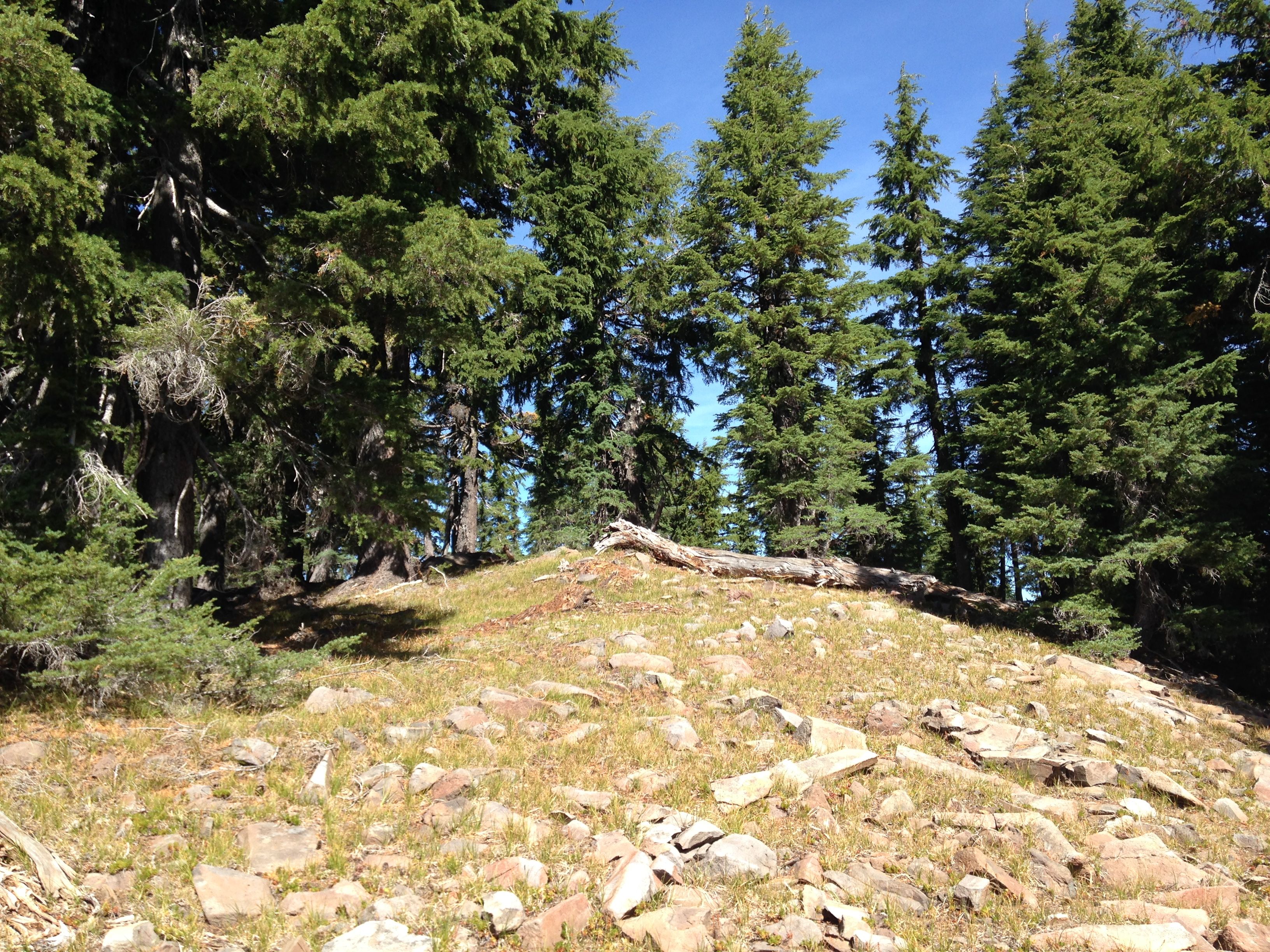
The actual summit is above a small scree field. As you approach the summit stay to the left
(southwest side) and ascend through the grassy area instead of getting your hair combed by
the thick hemlock trees. I left a small cairn on the summit. No other marks of human passage
were evident.
The summit is a nice operating position and pretty. Abundant yellow jackets and bald-faced
hornets were buzzing around. They seemed curious but not aggressive. When you stop moving,
they quit bothering you so much. It seems that they just get that way this time of year.
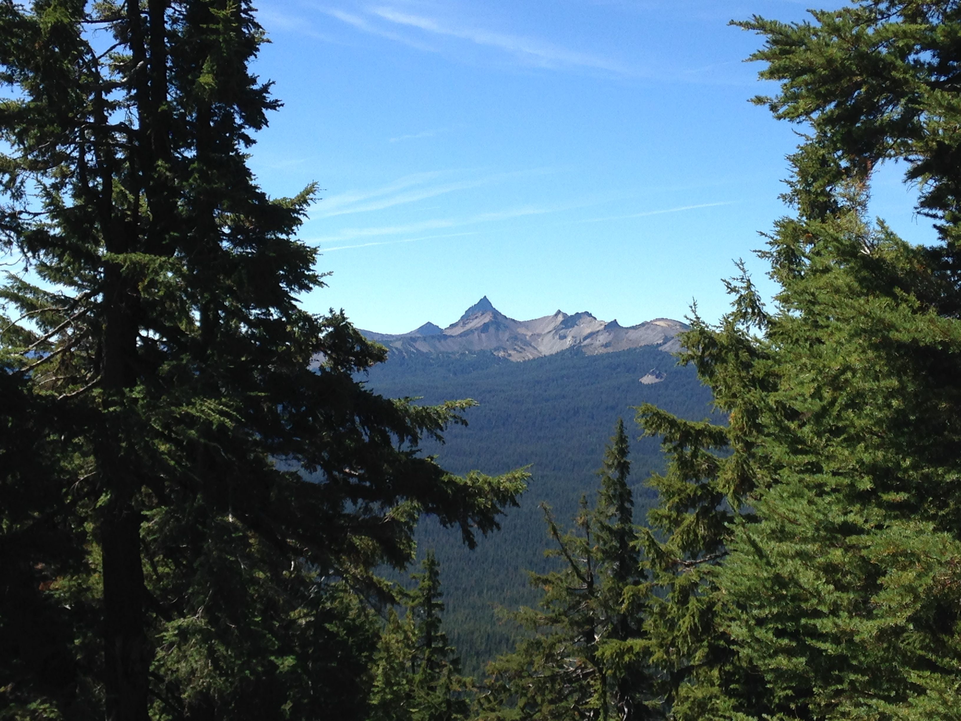
There are plenty of good trees on the summit for EFHW or dipoles. There is no view from the
exact summit but the trees are not too thick either. There are good views off the south side.
All in all, this was a really nice hike with pretty forest and terrain. Be sure to be
comfortable with cross-country map/compass/GPS navigation before you go here. Its a great
summit and I'm sad its so far away.