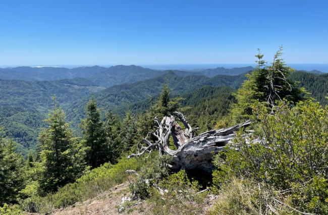
NC-069 is one of the handful of 2 pointers in the Oregon NC region, located in the Tillamook State Forest. It's fairly remote, past Cedar Butte or Triangulation depending on the route you choose to take, but it can be paired with either one in a day. It requires a short but strenuous climb with bushwhacking, and rewards you with a nice open summit area with good views of the surrounding peaks and valleys.
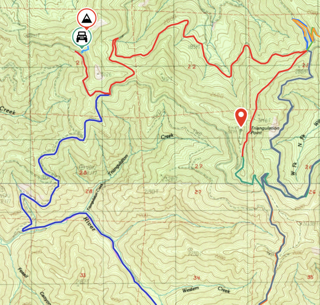
To reach 069 from Triangulation nc005 (distances given from Triangulation intersection at 45.62829, -123.64352) - Red route on the map below:
- Continue on the forest road that parts to the north-northeast
- at 1.1 miles (45.64148, -123.63197), turn sharp left at the fork onto FB 8n Rd
- at 2.5 miles (45.64230, -123.65058), take the left at the fork
- at 3.8 miles (45.64307, -123.66545), take a sharp switchback left at the fork
- at 4.6 miles (45.63606, -123.66696), take the rightmost of the roads in the fork
- at 5.1 miles, park on the side of the road (45.64106, -123.67194)
This route is a little rough in spots, but any vehicle that got to Triangulation should do fine getting here as well. Don't go any farther past, the road gets worse in this area past the parking spot. If you are in a passenger car and barely getting over the rocky spots, you might want to park at the earlier intersection.
To reach 069 from Cedar Butte nc018 (distances given from Cedar Butte "parking lot" at 45.58270, -123.64621) - Blue route on the map:
- Proceed north on Wolf Creek Rd; the road almost immediately forks, stay to the left to remain on Wolf Creek
- at 1.1 miles (45.59524, -123.63940), turn left at the fork onto Kilchis River Forest Rd
- at 5.3 miles (45.61889, -123.68256), turn switchback right
- at 7.6 miles (45.63606, -123.66708), turn switchback left
- at 8.2 miles, park on the side of the road (45.64106, -123.67194)
This route is really smooth and lovely for the first 5 miles (Kilchis River Forest Rd). However, the last leg with the most elevation gain is also heavily populated with erosion berms in the road. A passenger car will have an extremely hard time getting over some of these without careful manuvering to avoid bottoming out.
These routes are also available as GPX from sotamaps.org and SOTLAS.
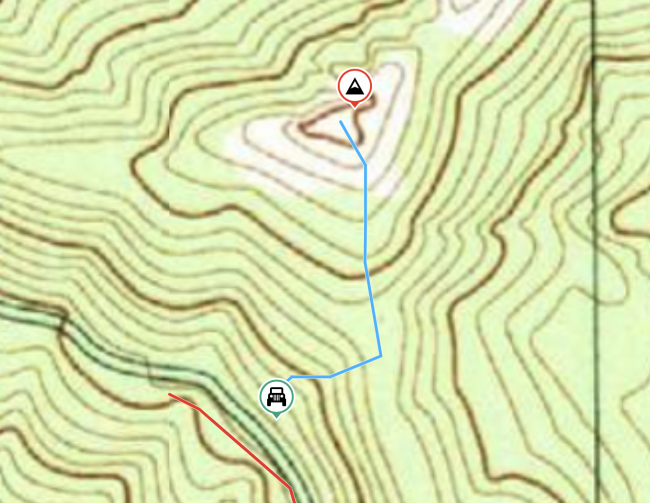
Once you reach the parking spot, begin ascending roughly northwest towards the saddle; there is a relatively shallow area in this spot wheras the rest of the embankment alongside the road is very steep. There are a number of game trails to pick your way up to the saddle, then follow the saddle line roughly north for the final ascent. This area includes a band of heavier vegitation so keep an eye out for game trails; I found myself mostly to the northwest (right) side as I did the approach, nearly following the rocky ridge dropoff, your path may vary. The bushwhack emerges into an open rocky summit with plenty of surrounding trees to use as antenna supports and guy tie-offs, plus a lovely view.


