Trail access to Round Mountain is good, but the last 100 meters or so of vertical is not. Cell service at the parking lot and on the summit is present, but spotty in between. I heard good strong signals for APRS on the summit. A comfortable skill set with crampons and ice axle will certainly make the last 100 meters or so pleasant. I have summited twice, once in winter on skis, and once late spring. Lots of snow still in June hence my recommendation to use crampons and ice axe. Not totally necessary, but certainly easier and easier on the vegatation. While on the summit, I scouted for a summer/fall bushwack route. That may be a bit longer, but looks doeable.
Round Mountain is found in Garibaldi Provincial Park via the Elfin Lakes Trailhead in Squamish British Columbia. As of June 23, 2021 a day-use pass from BC Parks is required. Day passed my not be required in winter, but chains for vehicles are. Winter conditons need to be checked before a winter attempt. I know of no complimentary descriptions of the road conditions in winter.
In the summer and late fall, water is available from streams lower on the trail. The first landmark is the Red Heather Hut or day shelter, for most people a comfortable 2 hours, with gear. Care from this point for summer and late fall hikers, there is a summer trail and a winter trail. If the summer route/trail is chosen and because it is less steep, the assent starts a bit lower in elevation.
I have only summited with plenty of snow coverage, and from the winter trail. Some maps show trails/routes from the summer trail, but I have not noticed them when hiking the summer trail. The assent is straight forward, check your positon, look for the summit, head up and keep within your abilities, plus it will take longer than expected. My last summit hiking times are, trailhead to Red Heather Hut, 5km(3 miles) in 2 hours. Red Heather Hut to summit 2.5 km(1.5 miles) in 1.5 hours. Snow on the trail started at about 2km(1 mile) or so up the trail.
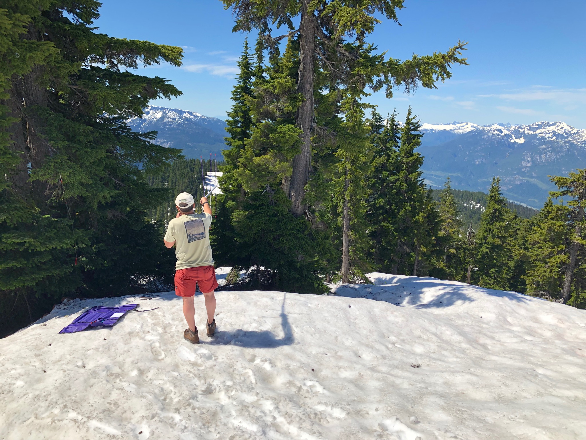
Once on the sub-alpine summit there is plenty of space for a small party of 2-4 to set up and operate. On a sunny day protection from the sun can be found under the stunted but still tallish trees. I arrived on the summit just about 11:00amish, a bit passed my scheduled start time. I was late. My operating plan was shot and I quickly got on the air, fumbling for everything, even a pen to write down contact info. I had three contacts by 11:40am and stopped for lunch. Just as I was packing up, and looking at taking the beam apart, I heard some activity. It was KJ7RTO on Church Mountain, W7H/WH-135. Contact number 4 on my first SOTA activation, and my first S2S QSO.
First Photo: looking westward toward the Tantalus Range.
Second Photo: Mount Garabaldi in the background. Sharks fin poking out at lower right of Garibaldi. Columnar Peak is behind the beam.
Third Photo: Dropping down from the summit, Fast and Light.
Fourth Photo: Joining up with the summer trail and looking forward to Boston Pizza in Squamish on a 30C SOTA day.
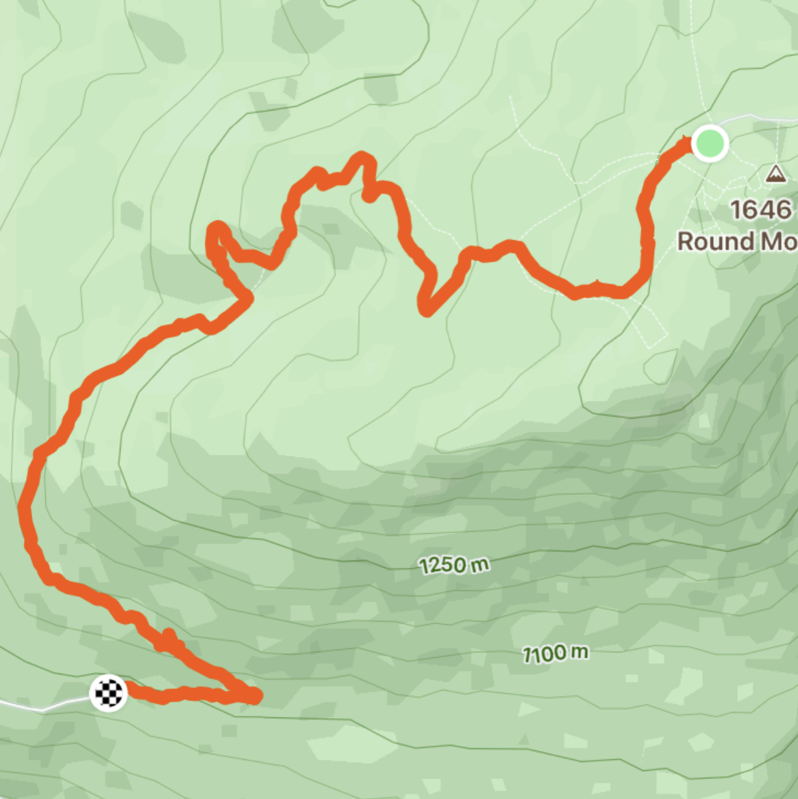
Fifth Photo: A Strava plot of my route down from the summit, 6.3km starting at photo 4