McClellan Butte had been on my list the last year or so as challenging hike, due to the last section required to get within the activation zone. I've watched the video below multiple times, and it provides helpful trail and summit information...along with an alternate parking/hiking to shorten length. The video also captures the summit scramble and views from the summit.
https://www.youtube.com/watch?v=VXoGEuyaKow
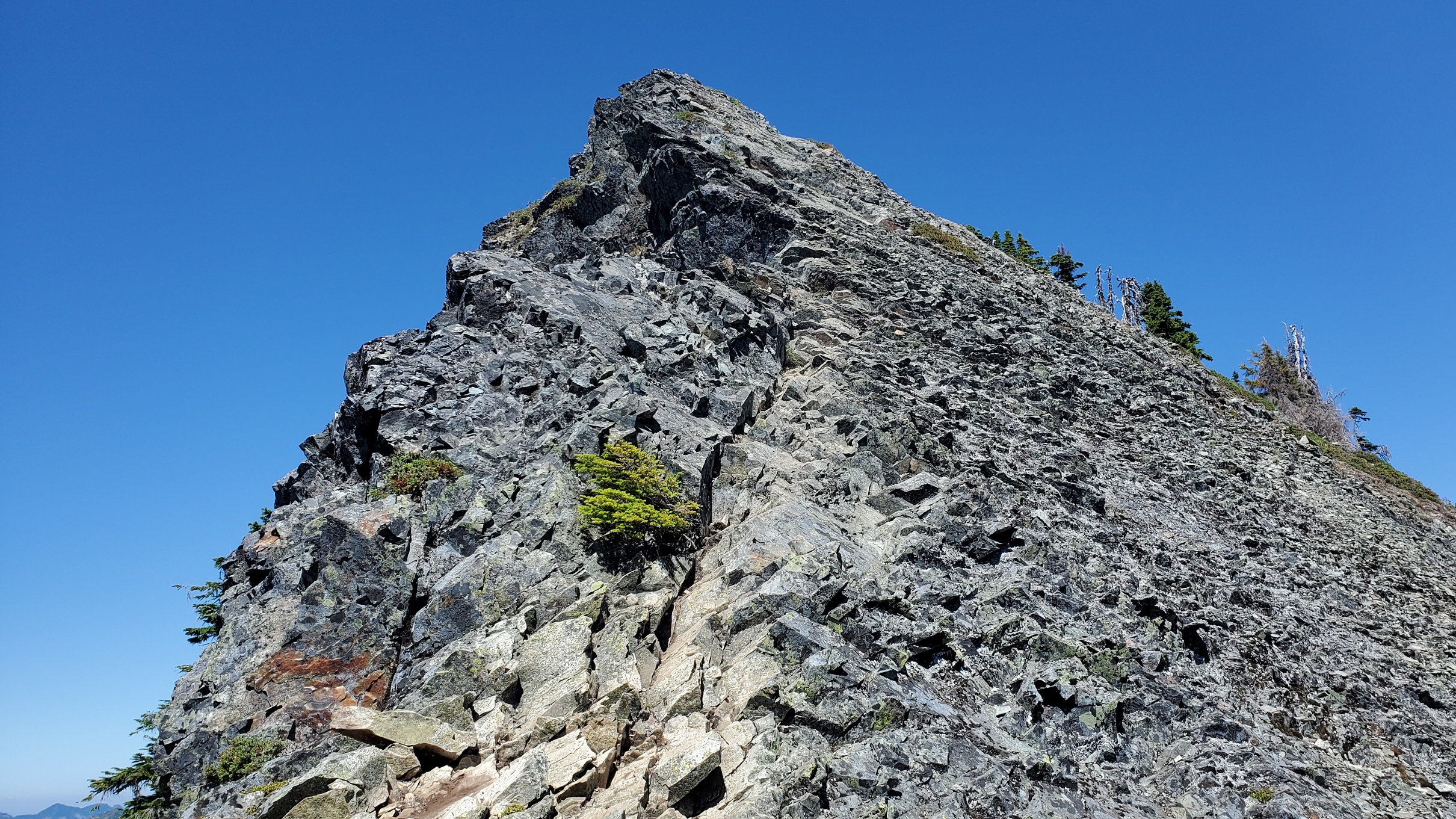
After completing 99 unique summits, thought I might try activating McClellan Butte as #100. (-: I also wanted a longer hike with good elevation gain, and decided to give it a try. To get within the activation zone, you need to get through a shorter exposed section. In looking at CalTopo and other maps, the start of this section is ~40 feet below the elevation needed to get withing the activation zone.
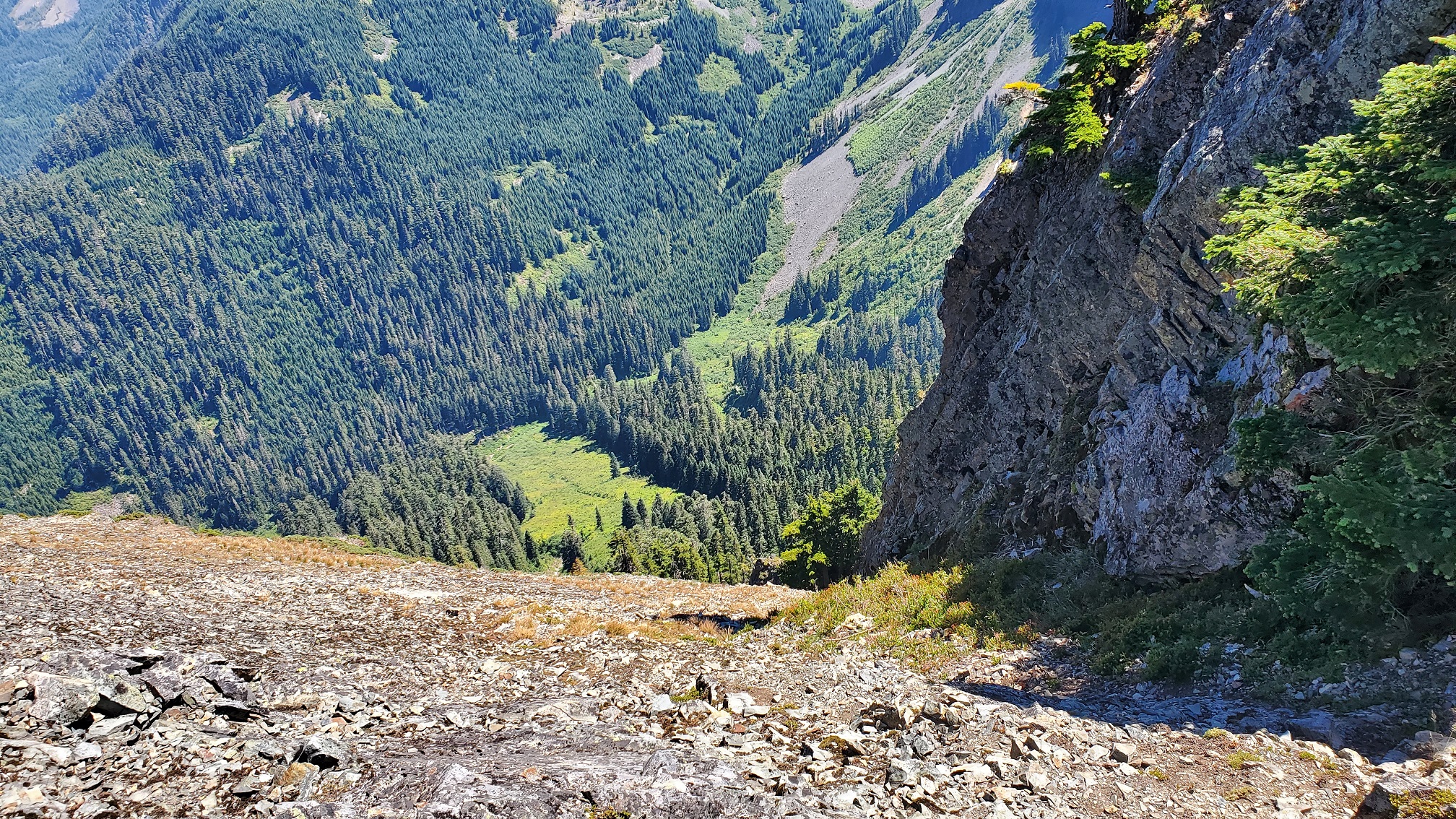
A few SOTA Goats have completed this summit multiple times, and some hiked prior to SOTA. One good humored tip for this summit from a Goat was "just don't look down". (-: Another SOTA Goat mentioned they haven't activated due to exposure. An elemenatary school friend sent me a picture of her holding her small dog taking a selfie with her husband during this section. I'm relatively new to hiking in the last 3 years, and am more comfortable in situations that I was less comfortable early on. After a long hike up (next time I might take the shorter hiking option to be less tired), I attempted this section a few times. Watched as a few others climbed it...and while others chose not to. Maybe less than 50% of the people who climbed up while I was there chose to continue on to the summit? In summary, be safe and know your limits.
How to get there/Parking Info:
From WTA, "The main McClellan parking lot is on the south side of I-90 at the West Tinkham Road, Exit 42. Turn right at the stop sign at the end of the ramp. Pass the Department of Transportation facility and continue a hundred yards or so. Turn right into the parking area. Directions to the alternate parking area on the primitive logging road is for the intrepid to find on their own."
A Northwest Forest Pass is requred.
There is an alternate route discussed in the YouTube video link above which shaves ~ 4 miles off the hike, and approx. 600 feet of gain. One SOTA activator mentioned they have used this access option in the past.
Hiking Information:
I tracked at 11.3 miles total and 3,645 gain (and then another ~100 feet to get to summit). By starting from the alternate road (limited parking along gravel road), it will reduce the hike by 4 miles total and at least 600 feet
https://www.wta.org/go-hiking/hikes/mcclellan-butte
https://www.alltrails.com/trail/us/washington/mcclellan-butte-trail
There are amazing 360 views from this summit, and it is a popular hike. The summit is relatively small and rocky, and as of Jan 2022 there have been very limited HF contacts. Nearly all contacts are 2m, and likely recommended when activating this summit.
As part of my 2021 SOTA overview, I spoke briefly about this activation attempt...and the link below will take you to the specific section in the video.