During the first week of October, I was delighted to receive an invitation from accomplished SOTA activator KR7W to accompany him to the not-yet-activated Huckleberry Ridge summit. I expected to take my HB1B along, but testing my equipment, the day before our outing, I managed to toast something inside while trying to get a good antenna match. So I petitioned Rich to let me pack along his trusty KX3 as an alternative to the HW7 he was planning to bring for his own use.
We took National Forest road 75 off of WA 410, and it was a nice ride all the way to Haller Pass, where there is an intersection of several roads. From there, the ridgeline leads southward, through a wooded area, to a saddle and then to the summit of Huckleberry Ridge.
We chose not to explore a two-track road that went to the east of the summit we were heading for, although it might've eventually gotten us where we wanted to go. Looking at Google Earth later, it seemed to me that this road leads to a trail head, with the trail then proceeding south and west back to the ridge line.
Instead, we took a more direct, southerly, wooded route from our parking spot at Haller Pass. This track was like a road (in fact, Google Earth labels it NF-322), but very uneven and paved with chunks of black basalt the size of various milk cartons -- a good place to turn an ankle, and seriously undriveable. After about .15 miles of this, we found ourselves on a cleared saddle with views to the east and west and looking South along the ridgeline up to the forested peak of Huckleberry Ridge, about 400 feet in elevation above.
At this saddle, a trail came in from the northeast, probably leading back to the end of the 2-track road. A boot track led south, horizontally across an old clear cut on the west side of the mountain, presumably to rejoin the ridgeline as it descended on the south side of the peak. We followed the boot track for about .2 miles, until we reckoned we were below the peak, and we looked for a way up. We simply chose an promising opening in the trees and brush lining the boot track, and headed as directly up as we could, dodging around old timber left in the clear cut, new trees, and warrens of rodent burrows (marmots?). The slope was steep, and trekking poles were extremely helpful.
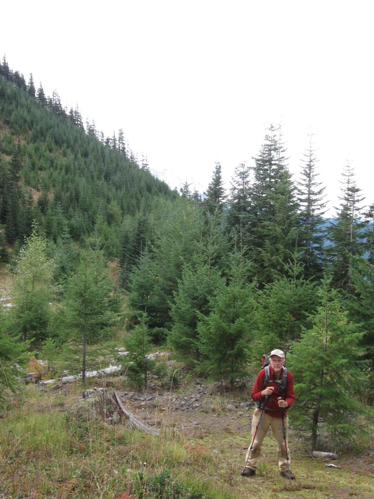
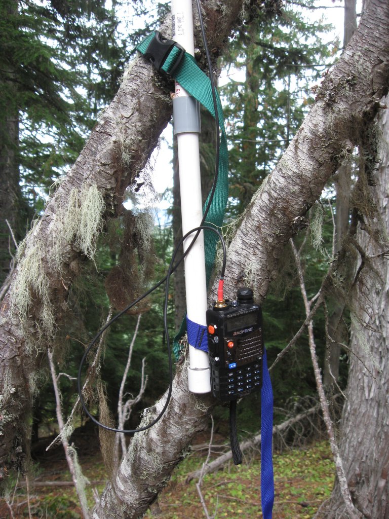
The old clear cut ceased a short distance below the summit, so we found ourselves in pleasant forest again as we neared the top. A precipitous drop off the other side made it clear when we had arrived. There was some dead, fallen timber, the ground was soft with pine needles, twigs and old bark, and the trees gave a sense of shelter. There was no wind, and the temperature was a comfortable 60F or so. Rich set up a 44ft doublet running north and south, with a telescoping mast putting the apex at about 18 feet above ground (and some 5025 feet ASL). Meanwhile, I put together a collapsable 2-meter half-wave dipole Rich had made from sections of PVC and elastic cord. Lashed vertically and about 6 feet off the ground to some fallen timber, my first call with this antenna and a 5W HT on 146.52 netted a QSO with N7KRN on Camano Island, a good 75 miles to the north!
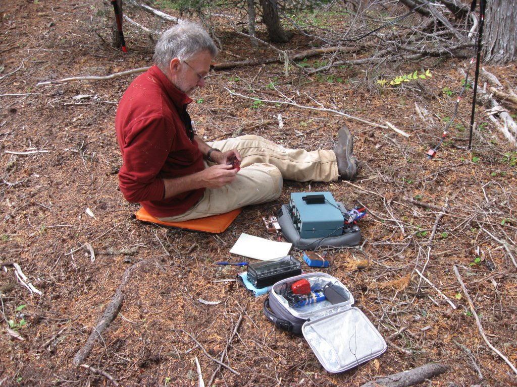
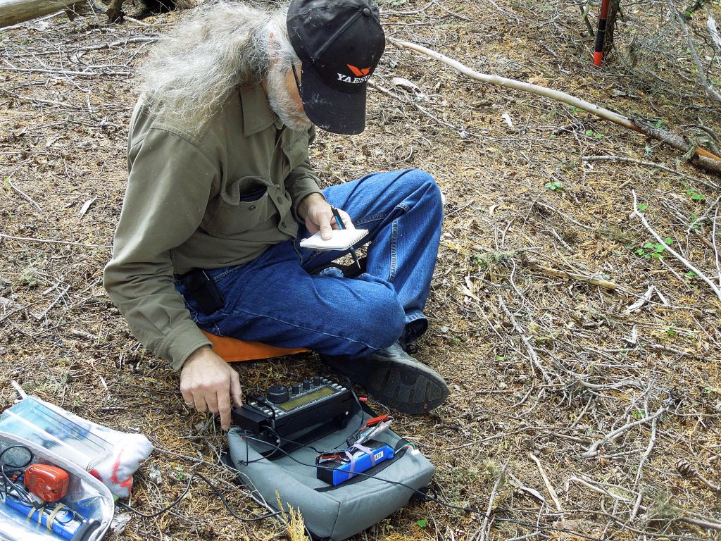
Meanwhile, Rich was setting up the old Heathkit HW7 (in which he has pretty much replaced the receiver section). I listened while he worked his first contact, K7NDE on 40M, with 2 watts. There was NO noise, neither from the radio nor the surrounding woods, and the received signal was clear and beautiful. Rich went on to make several more QSOs on 40 and 20M. Then he set up his KX3, and I had a turn at the key. In about 30 minutes I worked 20 stations on 40M, 30M and 20M, reaching WA, OR, CA, AZ, TX, TN, NC, VA, QC and IN. As the "pile up" died down, I noticed I was shivering. The sun had disappeared behind clouds, and a cold breeze had come up from the west. I grabbed a windbreaker and a bite to eat before starting to help with the take-down.
With packs loaded once again, we more or less plunged down the hillside, hoping we would end up at the boot track in about the place we started. We came pretty close, and the descent took much less time than the climb up. I did snap one of my trekking poles when I slipped on ground cover and pulled hard on the pole, which was sunken a foot deep into soft earth piled up by burrowing rodents. It was still long enough to use on my up-hill side as we descended.
Huckleberry Ridge is only a short hike, about half a mile each way, but the vertical portion to the summit is a bit steep and without trail. There are some old, silver-grey stumps and left-over timber and a rock outcropping here and there to dodge around, and it's common to suddenly find yourself on very soft footing thanks to the busy (but invisible) rodents. The young conifers growing-up in the clear cut are fresh and green. There are no hardwoods to speak of, although we did run across occasional, tiny, bright, fall-yellow maples. The summit is a pleasant spot, and there are some nice (but with the trees, not exactly panoramic) views to the east. W7W/RS-055 is a nice place to set up a station for a mid-day SOTA activation and a bit of lunch.