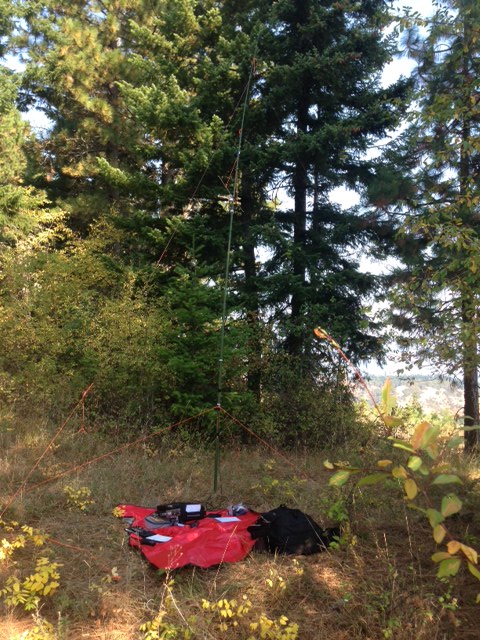
Middle Mountain Oregon W7O/CN-075 is a pretty easy activation. From Hwy 26 travel approximately 28 miles north on Hwy 35 towards the town of Hood River. At 28 miles turn left (west) on Gilhauly Road. Shortly after turning on to Gilhauly Road there is a forest service gate that is normally open but just be aware of its existance. Travel 1.6 miles on Gilhauly Road. At 1.6 miles you will come to a fairly wide delta shaped "Y" intersection. Keep right at this intersection. NOTE: only a couple hundred feet before this intersecton you will come to a gravel road taking off to the right and this gravel road is NOT the one you want. From this gravel road intersection however you will be able to see the delta shaped intersection you are after ahead of you. After taking the right at the delta shaped intersection continue another 1.6 miles. At aproximately 1.6 miles, the summit will be on the left side of the road. There is a jeep trail on the right with enough room to park at the entrance and be out of the way for your trek up the hill. It is about a half a kilometer hike up a moderately steep hillside to the summit. There is no trail. The hillside is covered with knee to waist high brush and grasses. There are a some stands of young trees here and there. The hillside has been logged off at one time or another and there is a fair amount of debris you have to navigate through or around but its minor. Hiking boots and long pants highly recommended. After leaving Hwy 35, all roads are dirt and in decent condition at the time I went up there. You could make the trip in almost any vehicle aside from a Lamborghini. HOWEVER, this is summer. Judging by the composition of the road I would guess that with any significant rain it could get a bit slimey. There are a few moderately steep inclines with small ruts and some rock that would cause traction problems for 2 wheel drive vehicles in the wet weather. The summit is treed right at the summit but not so heavily that you cant run out some wire. Be aware that there appears to be a fair amount of OHV activity in the area and there is a jeep trail crossing the summit. If you run out a wire or guys, be carefull not to cross this trail with them as it could have disasterous results if somebody comes roaring up the trail. I think this jeep trail would make this summit almost a drive to location from another direction but due to the severe fire hazards at this time and the tall grass on the trail I did not attempt it. Didnt want to be dragging a hot exhaust system across the dry grass. Verizon cell service was good there for this trip and I was able to self spot / text easily. On a prior exploratory trip I got no service to speak of. I dont know if this was due to a technical problem or that the service is just spotty, but on the day of my activation it was solid all day. For travel time calculations, from the small town of Welches Oregon it takes about 1.5 hours to reach the summit combined drive and hike time. It is a very scenic drive into this location with great views of Mt Hood. No great views from the summit itself but you can easily see Mt Rainier Washington to the north on a clear day through the trees. 73 and thanks to all that made this activation a success. My first activation, and the first activation of Middle Mountain.
Joe, WB7VTY