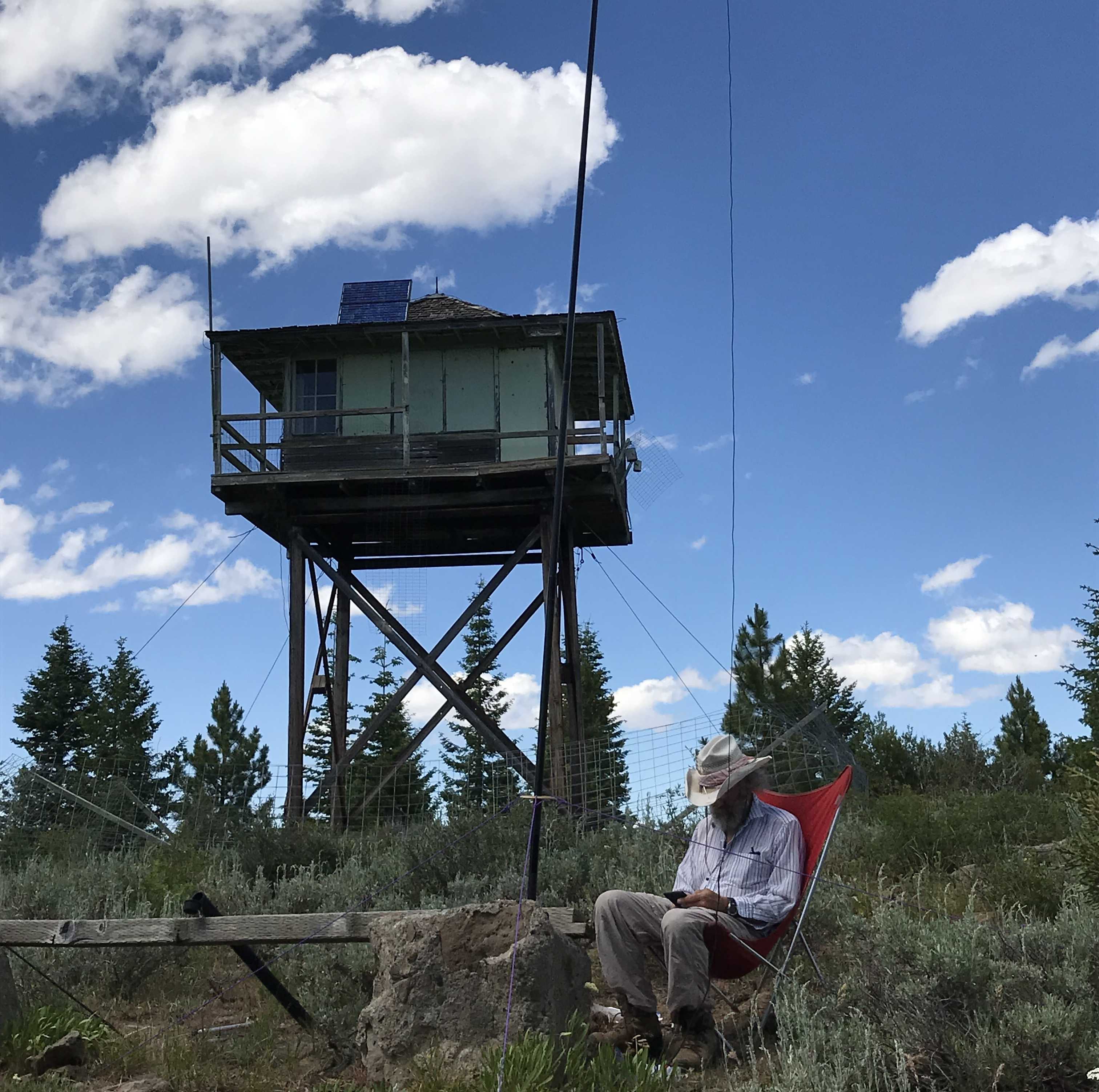
Black Butte may be a drive up. It is a six point former lookout in Grant County. Don't get it confused with the Black Butte near Sisters.
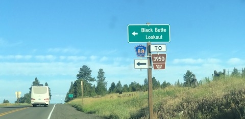
To get there get on 395 from US 26 going North. The first turn of interest is 15.5 miles north of Mt. Vernon Oregon. Turn west off of 395 onto 3950. There is a clue thanks to a road sign that says Black Butte Lookout. Here the activator will find a smooth wide gravel road, but cool your jets! In only 0.9 miles a left turn is required on 3955. This is an all weather all vehicle road not quite as grandiose as the former. Proceed up this road 2.8 miles to a split. Take 3956 at this point. 3956 is the road all the way to the top. But caution. In 0.9 miles there is a sharp left turn that keeps you on 3956. Not sure what going straight gets you. From here it is about 2 miles to the top. The road at this point requires a high clearance vehicle. In another half mile you may want 4x4 or feet. There are plenty of places to pull over so go as far as your comfort level and vehicle capability recommend. There is a loop at the top so if you make it all the way there are no issues with turning around. The summit is an abandoned lookout and it is quite flat on top. Plenty of room and trees for whatever antenna configuration suits your pleasure.