Peak 2730, NC-077, is an unnamed peak in the coast range. It is on Stimson land and so is accessible in accordance with their recreational use policies. I’m calling it Gold Creek Peak, because it is the high point between Gold Creek and North Gold Creek. It is also called that on Peak Bagger. It is located between SOTA summits: Gold Peak, NC-020, and Edwards Butte, NC-007.
Brian, NR7Y, and I did peak 2730 in combination with Edwards Butte, W7O/NC-007. Total miles was about 11.5 RT and total elevation gain was 3800 ft. We did it on mountain bicycles, or a lot of the time beside mountain bicycles. There was a lot of hike-a-bike and some bushwhacking for the final push. Of course, how much depends on how you go. Brian and I took slightly different routes to 2730.
To get to the start of the ride follow the route Brian describes here: http://www.pnwsota.org/blog/af7md/2020-july-29/edwards-butte-or-july-2020
If you are only doing Edwards then just follow that route. However, if you want to do Edwards and Gold Creek Peak then turn left at 45.3868, -123.6858 instead of proceeding up to Edwards. The reason for this is that there is a road almost to the top if you go around the peak and approach it from the north.
That turn is at 45.3956, -123.6858. Follow this steep road up to 45.39212, -123.6866 just before you get to a landing. Believe it or nuts, there is a pretty good game trail that goes from there to the summit. It is about a ¼ mile and 150 ft elevation gain to the top.
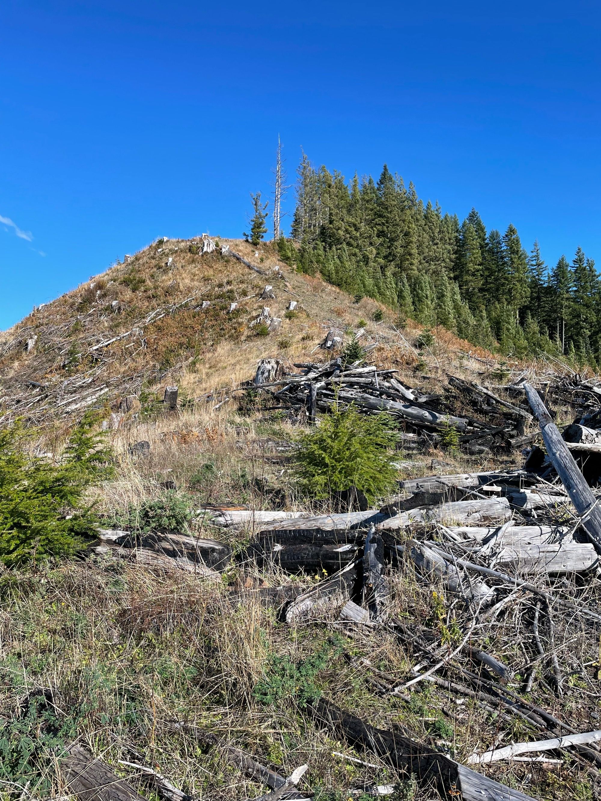
To get to Gold Creek Peak, return to the intersection and go on the really chunky, road north. From here two paths diverge in the woods. Brian rode to 45.4061, -123.6696 and turned off the main road onto a direct path to the top from the south. He ran into a wood pile at 45.41035, -123.66853. Here he left his bike and hiked about a ¼ mile and 300 ft. elevation gain to the south end of the activation zone. I missed this turn and rode on to 45.41303, -123.6728 where I turned right. This road goes all the way to the top and so I activated from the north end of the activation zone. This incurred a 2.5 mile RT distance increase and a few hundred feet more elevation gain. However, it was rideable to the top. (Well, rideable from the top. lot of hike a bike on the way up.)
Final note on access. There were several pickup trucks driving on the roads we were riding on. Brian did some research after and found that there is a special juvenile hunt in that area that allows vehicular access.