WW7D and I were in Skamania County for the WA state QSO party (Salmon Run). This was one of two summits we visited on Sunday of that weekend. Neither of us realized it at the time, but this was the first activation of this summit.
Termination Point is a great little summit! There is a steep boot path from the end of the road up to the summit - a little faint and bushwhacky in some spots. The hike is very short - something like 1/2 mile and ~100' of elevation gain.
There is a small metal cross at the summit, marked 'Heyer'. It isn't a very large summit, but we were able to deploy a 54' end-fed antenna using one of the trees on the summit. We were using my KX2 and made 38 QSOs on 20m CW between us. Quite a few S2S contacts. Only a single 2m FM contact. Probably not the best summit for 2M unless you have a good antenna!
Neither of us had cell service (AT&T / Verizon), but APRS worked great.
I suspect the view from this summit would be outstanding, but we were in the clouds on this very wet day.
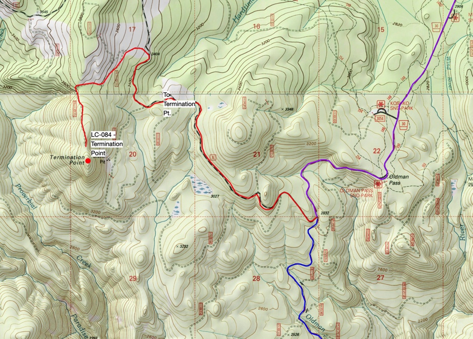
Getting There:
Take Meadow Creek Road to NF 31. Head west on 31 until you get to 110. Take a left on 110. 110 will start to head south and you will arrive north of the summit. In total, it's 4 miles off Meadow Creek Rd.
The roads are good until you take that left on to 110. We encountered a giant mud puddle that would stop most cars (not a problem for our dual-sport motorcycles) about 1/2 mile before the end of the road. At the end of the road is a turn-around and space for several cars to park.
See map attached to this post.