WW7D and I were in the area for the WA State QSO party (Salmon Run). This was the 2nd summit we did on this extremely wet Sunday in late Sept.
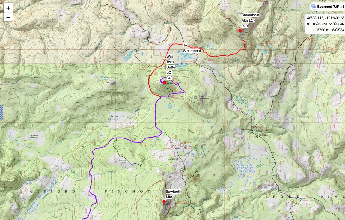
The road up to West Twin Butte is really fun... if you are on a motorcycle! The last 1/2 mile of this road is heavily rutted out, and would be a challenge for a high-clearence 4x4. Most people will probably opt to park lower down and walk up the road.
The hike from the end of the road to the summit is super short. Probably 1/4 mile and 60' elevation gain. If you find your self bushwhacking like we did, you didn't go the right way =) We did find the proper trail on the way down.
The summit is great. There was a fire lookout here from 1935 to 1963. All that remains is some concrete and steel.
https://www.firelookout.com/wa/westtwinbutte.html
I bet the view is amazing on a sunny day. On this day, it was raining torrentially. We deployed a tarp over our operating position and hunkered down. Using my dipole and KX2 we made 22 QSOs between us on 20m CW. We made 2 contacts on 2m FM.
Both our phones had some marginal service on this summit (AT&T / Verizon).
After you do West Twin, head NE and do Steamboat LC-020. We were planning to do this, but ran out of time.
Getting there:
Head north on Meadow Creek Rd / NF 30. A big section of this road is a good gravel road, the rest is paved. Suitable for any car. Take a left when you come to NF 24 (big intersection with a stop sign). At the base of West Twin where NF 24 turns to the west, you want to go east onto NF 2480. Follow this road until it gets too gnarly for you.
The final turn is a left on to NF-031 and then a short bit to a parking area below the summit. We rode dual-sport motorcycles all the way to the end of the road.
See map below. Also shows how to get to Steamboat... no extra charge =)