
This is an easy, accessible road walk in a state forest that includes just a little bit of a bushwhack into the activation zone. It is a perfect "second summit" if you are activating near Elbe, WA.
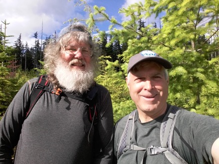
Etienne (K7ATN) emailed me a few weeks ahead saying he would be in S. Pierce County, a few miles from Eatonville on June 24. Hiking with Etienne is one of my favorite ways to activate, so we made plans to meet at Pack Forest for a pleasant hike to the Pack Forest high point (W7W/RS-068).
On that morning, I did a little poking around on SOTAMaps and got the intel on nearby "3220 End Fed Hill" W7W/RS-063. This unactivated summit is in the Elbe Hills State Forest (pdf map). The intel suggested that one could drive to a gated road and then hike that road about 1.5 miles into the activation zone. In fact, I explored activating the summit last year on the way back from High Rock (W7W/PL-029) with my buddy Dave (KI7YQV). With no intel except cell phones, we made a spur-of-moment decision to see if we could find the summit. We didn't find it, but drove around enough to realize it shouldn't be difficult with a little more information.
Etienne and I met a little after 3pm, and I proposed that we activate "3220 End Fed Hill" instead of the Pack Forest HP, and he readily agreed. We jumped into my truck and were off to nearby Elbe.
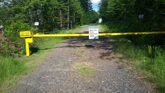
The entrance to the state park is pretty obvious, just northwest of the town (46.7677, -122.1964). A Washington Discover Pass is required.
We noticed that the roads are misplaced on most maps, including OSM maps, the various map layers on my Garmin GPS, and my Tom Tom car GPS. I had a vague recollection that this was an "issue" when Dave and I had visited a year earlier. With a bit of sleuthing and some guess work, and with the help of a printed satellite image, we found the gated road. For future reference, USGS maps seem to have roads place properly.
Basically, follow the main road (the "Elbe Truck Trail" or "5 Road") for just over 5 miles, where you will find a gated road in good condition on the right (gate 515). There are ample places to park near the gate without blocking it at 46.8007, -122.1628.
From this point, hike the road ("6 Road"). Stick to the main road and continue past the first turn-off on the right. Or, if you are into exploring, it looks like this first turn gets you close to the activation zone on the north side of the summit. You would probably end up doing some bushwhacking.
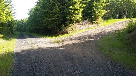
We continued straight past this first turn-off. At 1.1 miles, there will be a second turn-off on the right. This is the road to take. It circles around to the south side of the summit. Note that the road does drop a bit of elevation before the second turn.
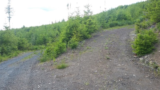
After about 0.6 miles, the road takes you up to the edge of the activation zone. Follow game trails around the slash and light brush into the activation zone, and find a nice stump to activate from.
I should mention that there are hiking trails that cross the road along the way. It looks like the Apple Cup Loop trail can be picked up on the right side of the road just past the gate, take it across one road, and turn right on the second road that heads up to the activation zone. We didn't do it that way, but it might be more interesting than a road hike.
Two meter QSOs were a little challenging from this location. Etienne and I broke out our HF equipment, split up the bands, and quickly made enough QSOs to complete the activation.
I've uploaded a GPS track of the road trip plus hike to SOTAMaps. The hike is 3.2 miles round-trip, with an elevation gain of about 350'.