
Bald Hill (W7W/SN-183) is at the high point found at the south end of Lord Hill in Snohomish County. Most of Lord Hill is a Snohomish County park. However, the actual summit is just south of the park on a private residential property.
A perineal topic of conversation among western Washington activators is whether or not one can access the SOTA AZ of Bald Hill from public lands. Older topo maps clearly show private property starting at 600’ for a summit at 737’. If these maps are correct, one cannot activate the summit without going onto the private property.
That said, newer elevation data, like those incorporated into open streets maps (OSM) and SOTL.AS suggest that the activation zone (AZ) can be readily reached on public lands. The summit elevation is 225 meters, and the OSM topo map shows a small area of public lands that are above the 200m required for the AZ. Even with this ambiguity, the summit has been activated 14 times by late August 2023.
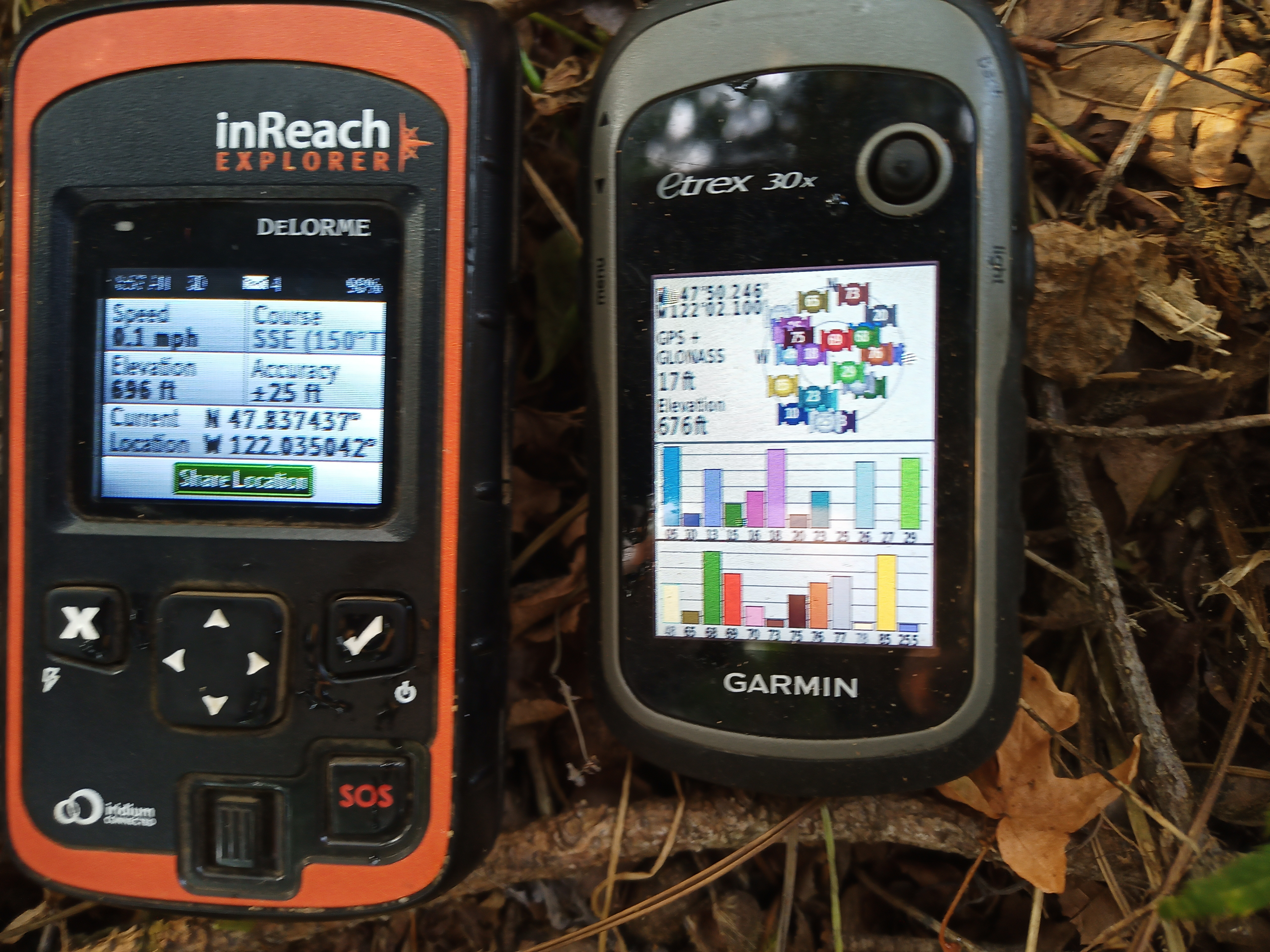
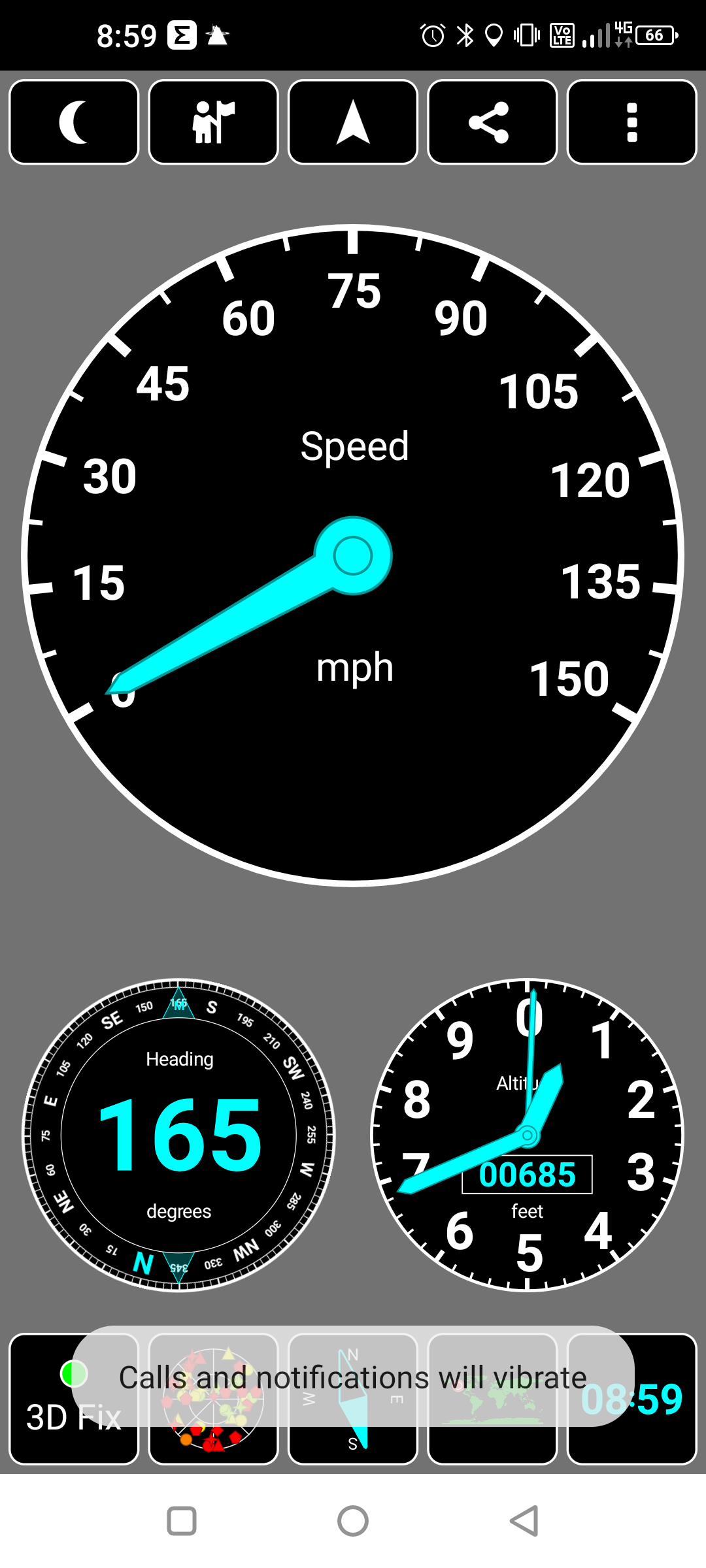
I found myself with a free day in late August 2023, so I decided I would check out the situation myself. I brought along three different types of GPS receivers to take some measurements. The first was a Garmin eTrex 30x that uses GPS and GLONASS satellites and uses wide area augmentation (WAAS) for better accuracy. The second GPS was a Delorme Inreach Explorer. I believe it only uses GPS satellites and doesn’t have WAAS augmentation. Barometric elevation was not used, as that would have required calibrating the device with a known elevation and barometric pressure in advance. So only GPS elevation was used. The third GPS was my Ulefone Power Armor 13 Android phone that uses GPS (US), GLONASS (Russia), Beidou (China) and Galileo (EU) satellite clusters for determining position. It can make use of 20 satellites with a reasonably unobstructed view of the sky.
Before heading out, I used CalTopo to draw in the property lines on the eTrex. I used these lines to make sure I did not cross onto private property. Coordinates of the property boundary were taken from the Snohomish county interactive parcel viewer. One can right-click on the map to get coordinates. I also outlined the portion of the AZ on public lands according to OSM topo maps.
The hike to the "candidate AZ" was uneventful. I bushwhacked a short distance from the Loren’s Ridge Trail toward the property boundary closest to the true summit. After crossing a deep depression within the OSM AZ area (perhaps an old railroad bed?), I arrived on a small shelf that was a few feet below a large flat area. This lower shelf (47.83743, -122.03504) is where I took GPS readings and set up my activation. Here is the view to the south from that spot (click for full size image), looking onto the private property. The residence, built close to the high point of the summit, was visible through the trees (the tan structure left of center between two trees in the photo). I am sure I was within 50’ of the elevation of the house, and probably closer to 35’. 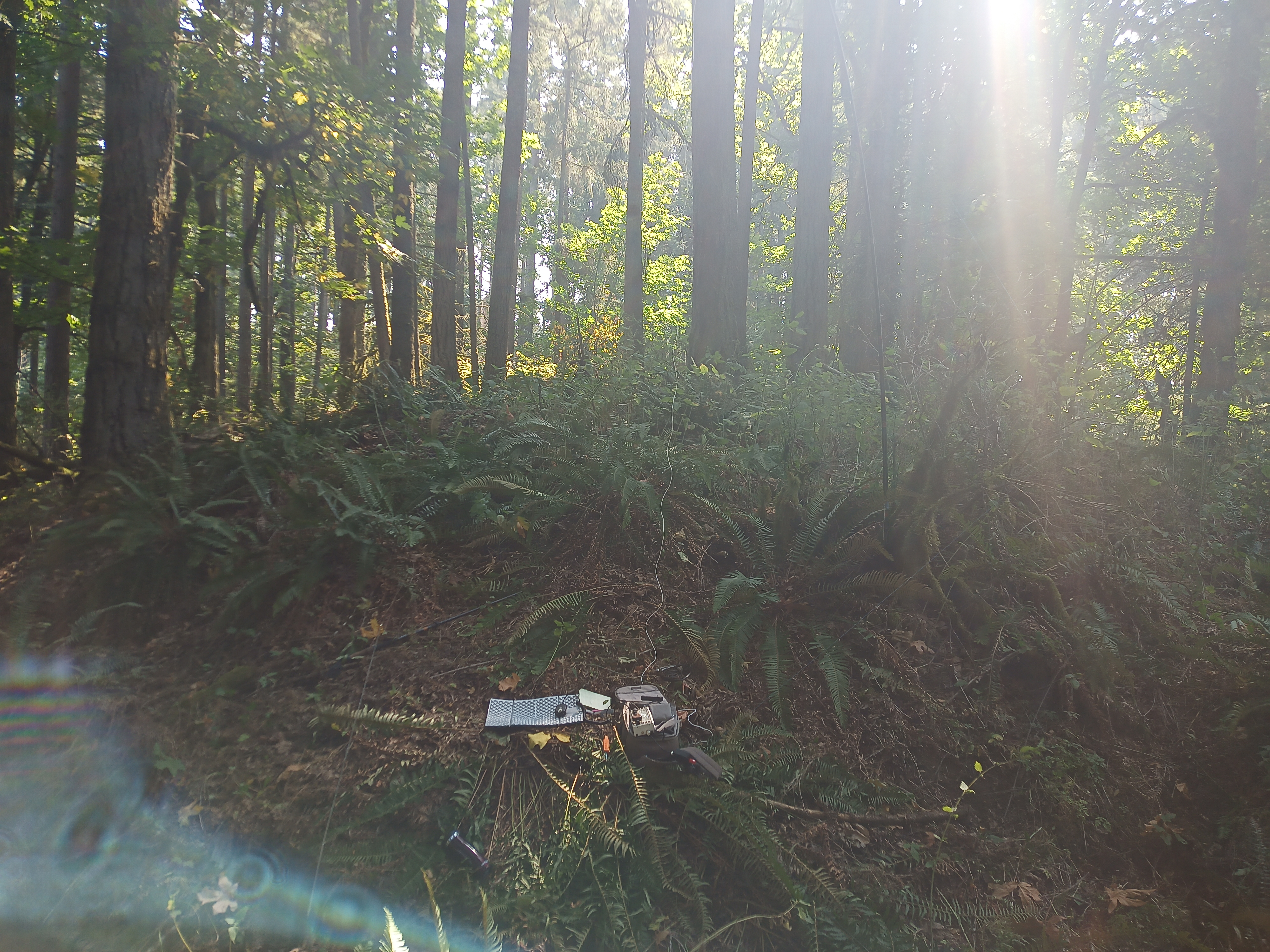
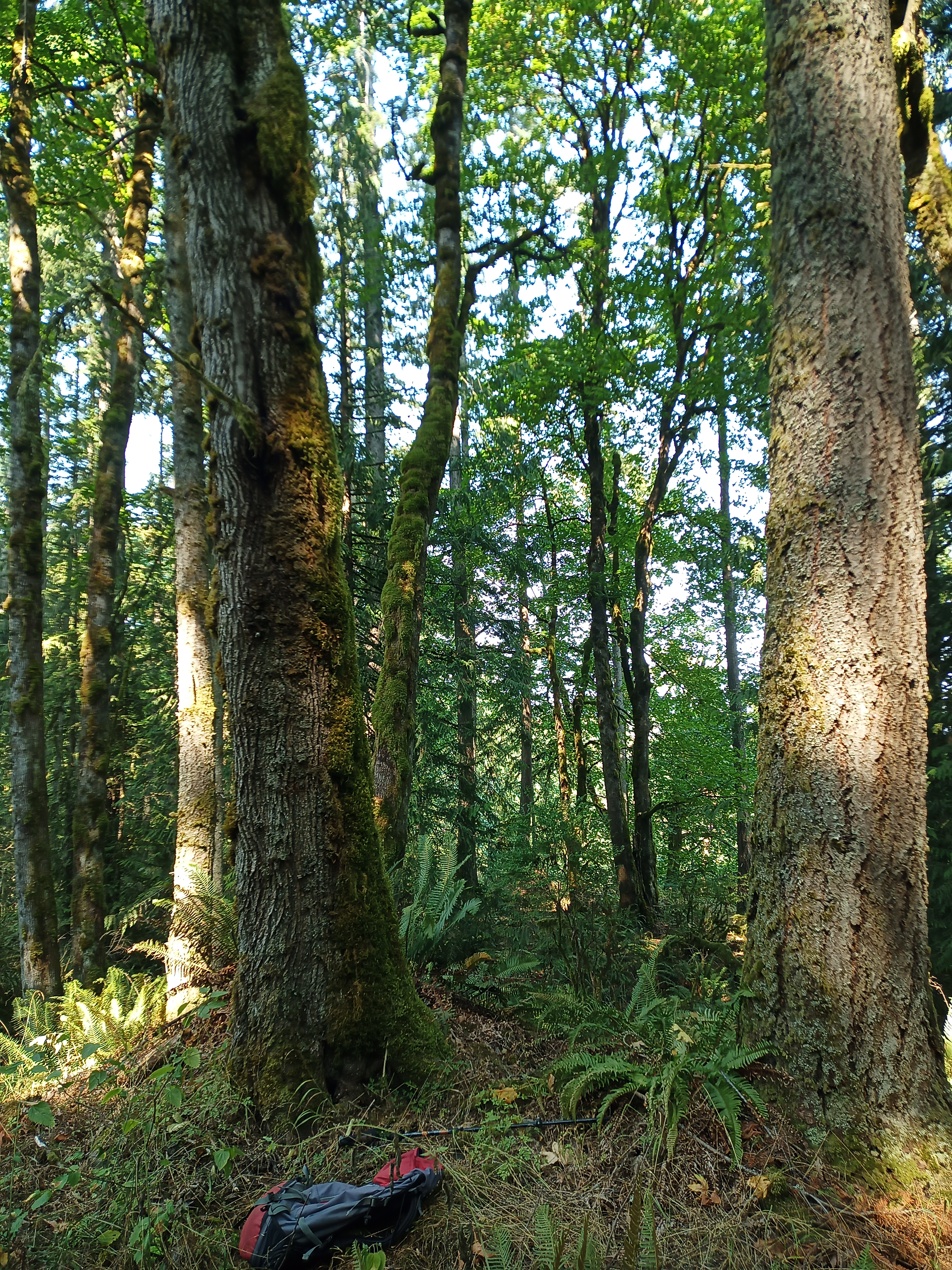
I activated from the lower shelf, as it minimized my visibility from the residence. I am sure I was on public property, but it could be disconcerting for the property owners to see someone traipsing about near their property line. Essentially, I tried to keep a low profile. For reference, here is the view to the north from my AZ. In this photo, I am facing away from the house. This spot is a pretty good activation location, and I encourage future activators to find it.
I pulled out my three GPS devices and laid them on the ground for a couple of minutes, and then snapped a photograph of the Garmin and Delorme devices and took a screenshot of the GPS+ screen on the cell phone. The Garmin read 676’, the Inreach read 696’ and the cell phone read 685’. All the readings were within the 656’ needed to be within the AZ.
Elevation measured by GPS is not accurate enough to guarantee that I was in the AZ, but my confidence was boosted by having three receivers with different hardware all placing me in the AZ. Those GPS readings, combined with the OSM topo map placing me in the AZ, and my visual impression of my elevation relative to that of the house all combined convince me that I was on public property and in the AZ.
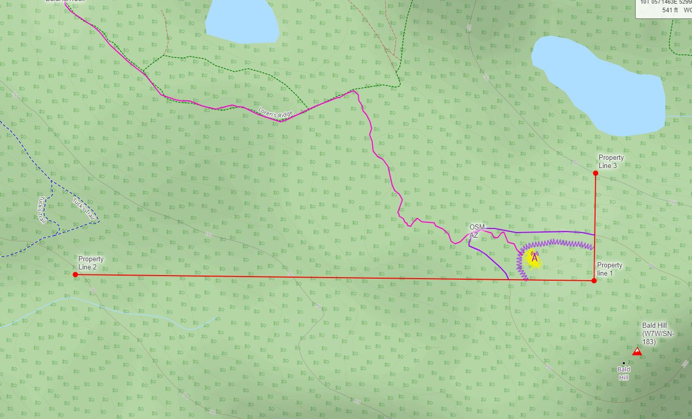
Here is an OSM map showing where I was. The AZ is indicated by the A symbol. The yellow point cloud was created by the Garmin GPS mostly sitting in one spot. The red lines are the borders of the public property. The purple line is OSM’s idea of the AZ. The zig-zag line is my estimation of where you can be sure you are in the AZ. You can download a GPX file with all of these landmarks and the track here.
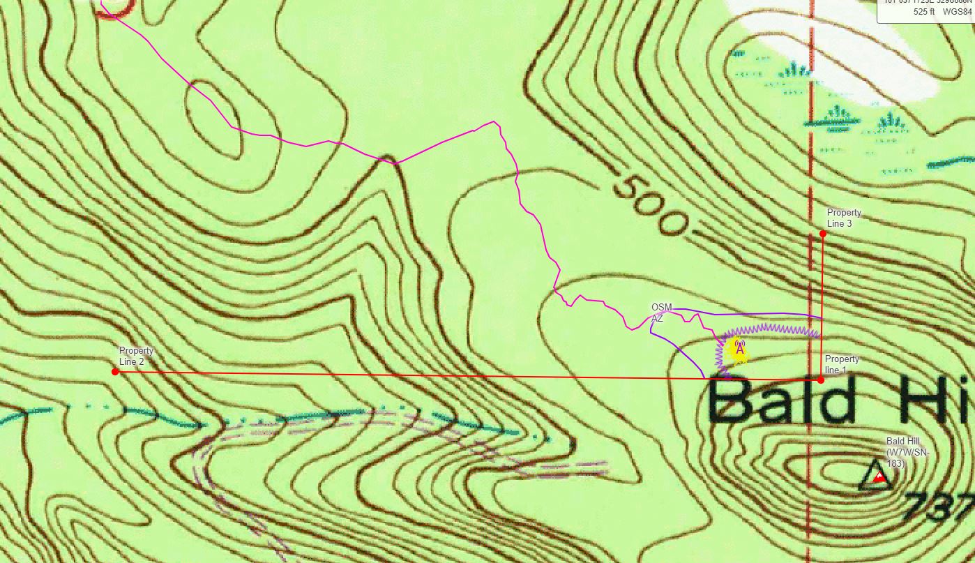
For reference, you can look at the scanned USGS topo map with the same landmarks. By this map, the edge of the AZ would be almost 200’ below the summit. But, my eyes confirm that I was definitely much closer to the summit elevation in this spot.
The bottom line is, Bald Hill can be activated from within the public park. I recommend that activators go out of their way to be considerate of the property owners--keep your distance, don’t make a lot of noise, and maintain a low profile.