Pine Mountain east of Bend, Oregon is a beautiful and relatively isolated summit in the summer. However, there is no defined trail so you have to find your own way through low density pine forest and scrubland.
In his earlier trip report, KG7AV states: "Many folks go up to the observatory, take the road about a mile further, and hike approx 3/4-1 mile along the ridgeline to the summit. I chose to turn off on East Basin Rd, just before the final switch backs to the observatory start, and head east along the north facing slope. There was an open place for parking on a promontory just below the summit − the 500 foot, 0.25 mile banzai route.”
The so-called “bonzai” route sounded a little steep to be fun, so I decided to do the ridge line hike. There is nothing too difficult about this route, but since there are no defined trails you have to know where you are going and find your way through the pine forest. If you want to do a quick activation of Pine Mountain, though, you are probably better off with KG7AV’s bonzai route. The remainder of this trip report will describe the ridge line hike that I took.
Most hiking reports that I could find for Pine Mountain typically start the hike at the Pine Mountain Observatory. However, as KG7AV alluded to you can save about 1.8 miles of hiking (round trip) if you start your hike a little past the observatory. Assuming you are heading east on Highway 20 from Bend, shortly after mile 26 turn right onto County Road 2017, which is marked by a green sign pointing to Pine Mountain Observatory. Follow County Road 2017, which turns into Forest Road 2017, for 8.2 miles to the Pine Mountain Observatory (Google maps may have the wrong location for the observatory). Continue driving for 0.9 miles past the observatory to a pull-off on the left side of the road. Just before you reach the pull-off, you will see a barbed wire fence which terminates at the road. Park the car just past the barbed wire fence.
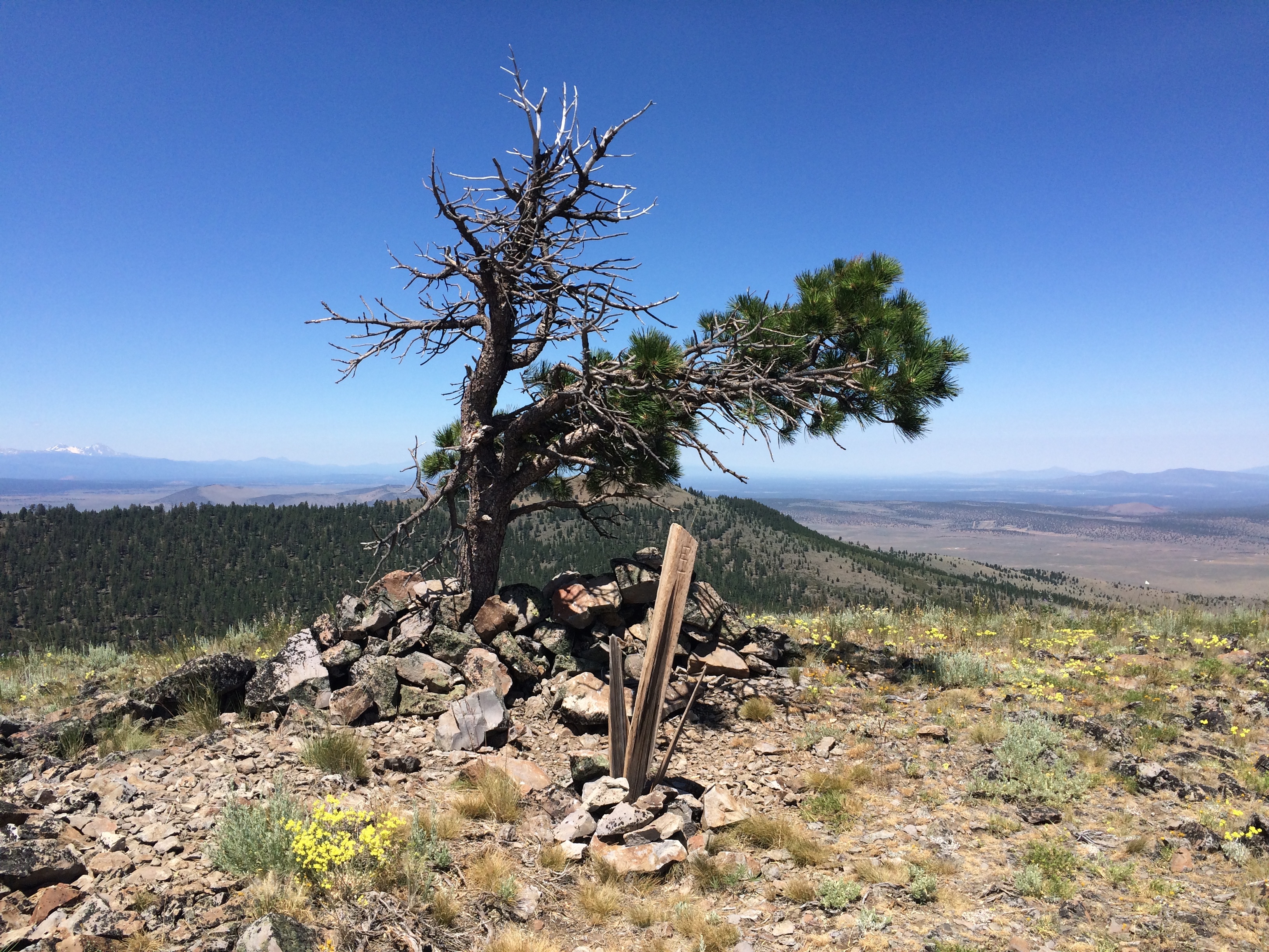
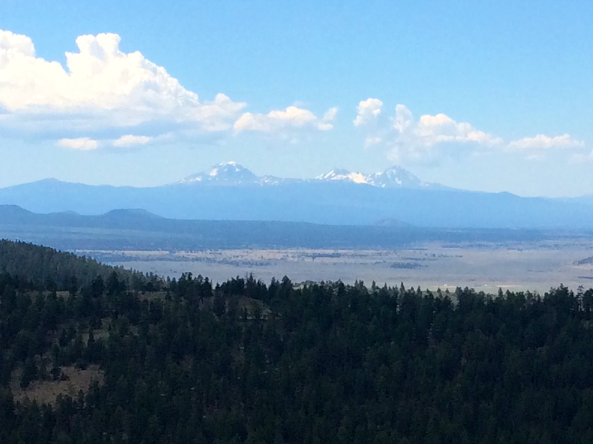
Backtrack along the road until you can get around the barbed wire fence. There are no posted keep out signs. I am not sure the reason for the fence, since the published hiking routes for Pine Mountain run along the inside of the fence line. Anyway, once around the fence, follow the fence line a short ways through the pine forest (heading northeast, the original direction you were traveling by car) until you see the ascent for the ridge. Head towards the ridge and begin your first ascent. I stayed on the south side of the ridge line and there were plenty of worn foot paths to follow. The ridge top is a craggy peak with black rocks. Continue hiking northeast along the ridge line. You will come to a grassy hill which marks your second ascent. The top of this hill is not the peak of Pine Mountain, but just a shoulder. After passing this hill you will drop into a saddle with more pine forest and then make your third and final ascent to the summit. On the summit of Pine Mountain you will find a broken wooden summit marker and a lone, scraggly pine tree. The 360 degree views are magnificent.
The total one-way distance traveled is about 1.1 miles from the parking area. The net elevation change is about 500 feet, although there is a little up and down along the way so you are actually climbing a bit more than this. There was no cell coverage on the summit so plan accordingly.
I did not have a GPS with me on this hike so it took me a little extra time to find my way. Despite that, I really enjoyed this hike and activation. Hopefully, these directions will make it more straightforward for future activators.