
2012-02-12 Tumtum Peak W7W/RS-059 CN96br59
I could not go out for a long time. I had a lot of problems and was afraid of avalanche danger. Previous weekend I went out for an expedition hike towards Ararat peak. Avalanche danger was low, with declining tendency. Despite this I still did not want to go on any steep open terrain. Many would not think that even a small amount of snow can kill you.
Start elev.: 2442 ft (744 m)
Max elev.: 4712 ft (1436 m)
Total ascent: 2552 ft (777 m)
Trip odometer: 6.25 mi (10.058 km) Up: 3.25 mi (5.230 km) Down: 3.0 mi (4.828 km)
Total time: 10h10m Up: 3h50m Down: 1h55m
Video
APRS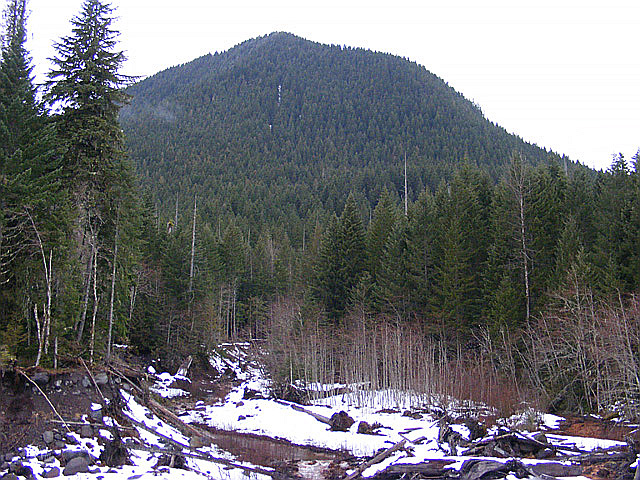
My primary goal is to explore the trail to Ararat and to get out a little from the city. In the deep snow I progress very slowly and did not reach the summit. There were some steep sections towards the end. I hoped that I can do these three peaks during bonus period. Although, I was not sure about Copper and Pyramid peaks. There is another peak nearby, Tumtum. This is a steep one and fully covered, but at least I can try my HF setup for the first time.
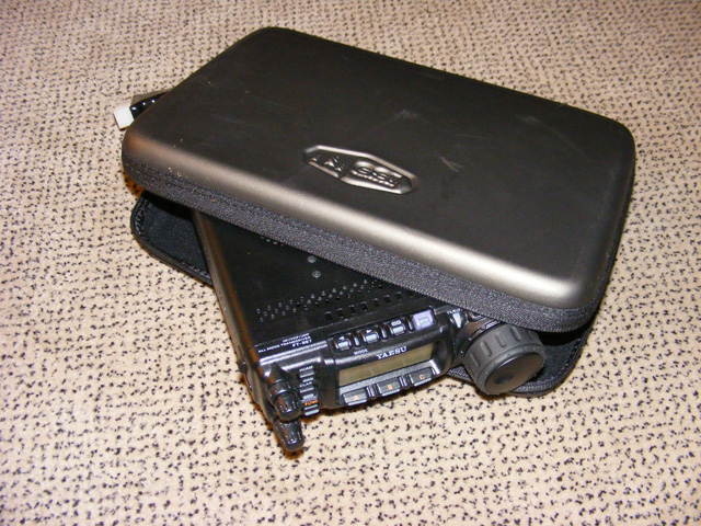
Some time ago at REI, I saw a camping kitchen set. The box looked like will fit the 857. I took out all the cutlery from the inside and tried to fit the radio inside. It is a perfect match. Cool. Everything was on a velcro sheet, so it was simple to get them out. Now I have good carrier for my radio. I also need a good dual band yagi, what I can assemble in cold temperature also. Something with magnets maybe.
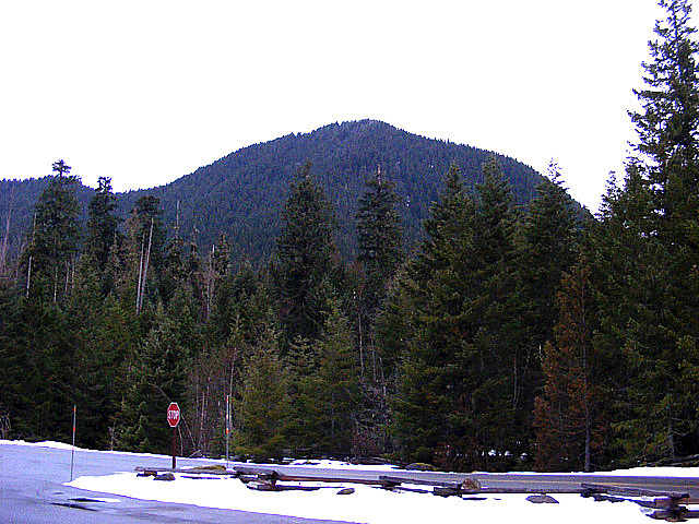
I left the city on time. Maybe just minutes after five. Quick McDonalds for some calories and let’s go south. During summer usually I visited the other side of the park. Thus I use my GPS to navigate towards the park. As I get nearer I found my way around. I used the GPS mainly for the exits on the highway. When I arrive at the car park, I looked towards the peak and concluded that it is still pretty steep. Did not get any flatter during the last week. :) I already planned my route at home.
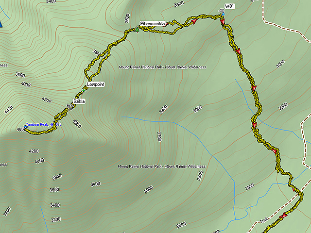
Until the spring which comes out of a tree I will use the path. From this point I go on the contour to the col. Then straight up to the ridge and finally to the summit. I had some doubts about this trip. On my way down from Goat Island I encountered some thick vegetation. Bushes and big dead trees slowed me down significantly. That time I was walking downwards, so if I will have similar terrain here, then I am in serious trouble. Here in the USA there are no markings on the trails, at least here in Washington. Find your way around is very important when the path is covered by snow. At lower elevation I have no problem. I can easily follow the trail. A lot melted away compared to last weekend. Pack my gear quickly and start from the car park.
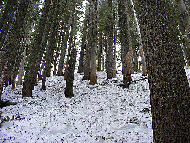
Temperature is around 32F. I feel a little cold when get out of my car. Again I managed to overdress a little. Almost always do this. Only should have get on my Icebreaker wool sweater, but I pulled up another layer too. Zipped my trousers also all the way to the top and wrapped my shemagh around my neck. Well, I only walk some hundreds yards and started sweating a little. Very bad during winter. Snow condition also very unpleasant and slows me down. On the first step it feels solid, but when have all my weight on one leg it sinks a little. Then when I push my step forward it slips. Energy draining to walk on it. I had some thoughts to put on my snowshoes, but because I know that the bridge is not that far and inside the coniferous forest won’t be that much snow I choose to keep on suffering.
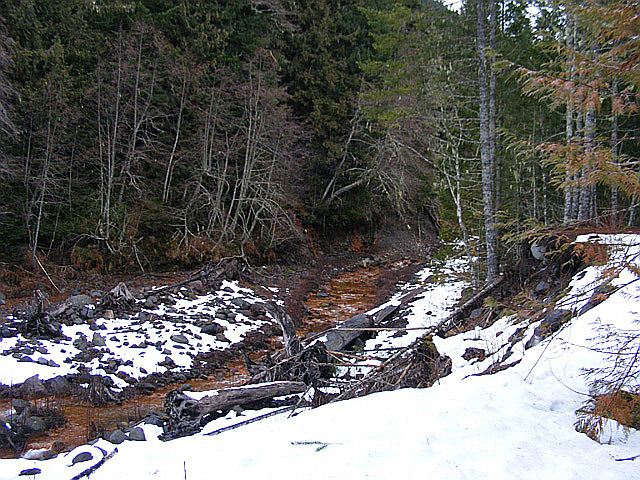
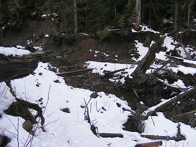
The path goes in level next to Kautz creek. There are thin pine and birch like trees on the sides. Ore makes the river sludge red. After about 10 minutes of walking I have realized that I forgot to switch my GPS on. Switched it on quickly. I attach it to my backpack’s shoulder strap, so it is always in my reach. After half hour and one mile I reached the bridge. I felt it way much longer over the bad snow conditions.
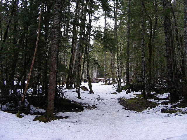
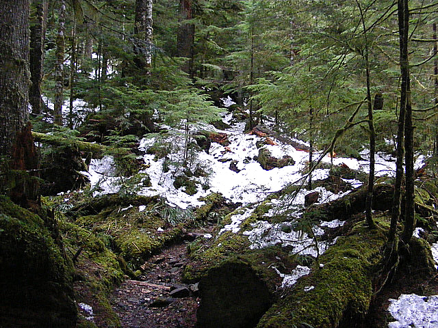
I enter the "real" forest by crossing the creek over two log bridges. The trail winding amongst huge tall trees. Not much snow on the path, which is good. I can travel faster. Last weekend it was all covered in snow.
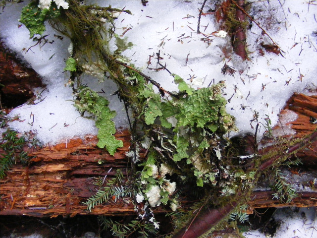
Hmm what is this? Lettuce on tree branches? :)
Well this trip report is not really scenic. It was overcast and I was inside the forest during the whole journey. The peak is also covered. Not high enough to be over the tree line. As I am progressing higher and higher on the trail, the underwood also clears. This is good news for me. Near the spring, which comes out of a tree I leave the trail and proceed into the unknown. I use my GPS to navigate. This is accurate enough and very convenient. I have a hard map and a compass with me also. Just in case. Don’t want to be like the guy, who started out for some snowshoeing above the visitor centre and people were looking for him for 3 days. Got lost in whiteout. It is difficult to navigate in such conditions with a compass also, and he did not have any. There were a couple of fatalities also this year. Mainly over avalanches. Four guys still considered lost, and at least 6 unlucky. So be extremely cautious!
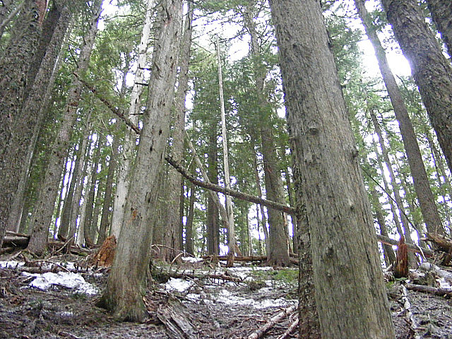
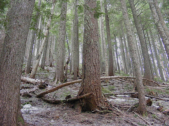
This route is 100% avalanche safe. You are inside a forest all the way, and there are no open slopes above. I am looking out for dead branches and half collapsed trees, like this on the picture.
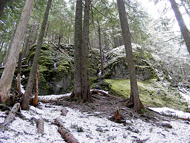
At higher elevations I encounter more snow. Especially on clearings. Sometimes I sink to my knees, but did not use the snowshoes at all. Passing by this cool looking rock formation while wandering amongst the trees.
The slope is getting quite steep at the upper section. It took two hours for me to get up to the ridge from the spring. Another half hour from here to the summit. The other side is much steeper. It would be extremely difficult to climb that side. However, because the big drops I can peek out from the forest.
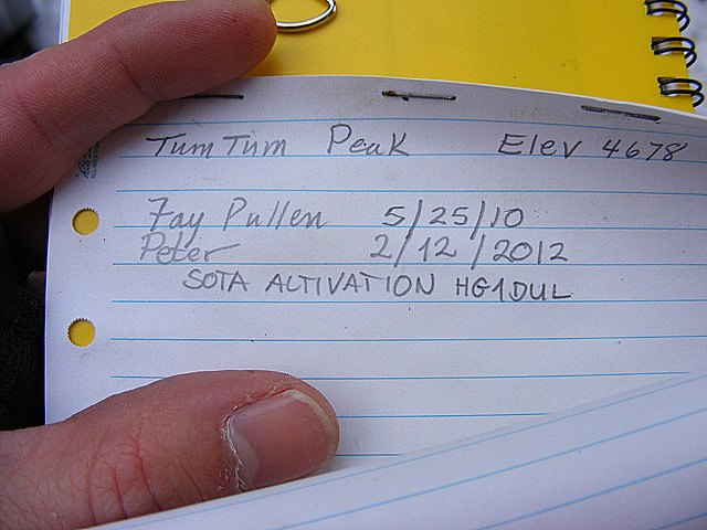
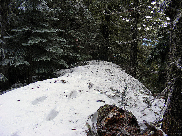
The summit top is friendly and open a little. There is a dead tree in the middle, and some other ones on the side. Deep snow and a summit register. Registers are quite unusual here in the national park. Out from four summits only Palisades had it so far. This is a seldom visited summit that is for sure. I am not surprised. It is very steep and no view from the top. Only one entry from 2010, I guess the chap who put out the register. After my activation I also wrote an entry into it.
On the top after enjoying that I could put my knapsack down and having a short rest, started unpacking my gear. Changed my wet t-shirt and put the wet one on my trekking poles to dry. I fix my pole against the dead tree trunk right on the top. This is the first time for me to use the Buddipole. I brought an antenna analyzer with me to play with the setup. I am not able to set the SWR properly. Although it is fairly easy, I discovered later during the 10 meter band change. When the analyzer shows 1.5 the meter inside the radio still goes out a lot. Maybe the battery inside the meter does not like the cold. Anyway. Start on 20 meter. I look for a free frequency and send out my APRS message. This time it made up on SOTAwatch. I also put up an alert before for this activity. I call CQ a lot without any luck despite using all power available. I hear a lot of stations very well, but it seems they do not hear me. After a while then I got the first Q. He is a chaser and he also spots me. After this I got some more stations quickly and I change band to try out 28 MHz. I made two Qs here. One is from Atlanta, Georgia. This is not bad. I go back 14 MHz to call more CQ, but nobody replied. At the beginning I tried to log with my ball point pen but this temp it was not working well. I forgot to bring my pencil with me. It is inside the car where I left it. Fortunately I could borrow the one from the register :).
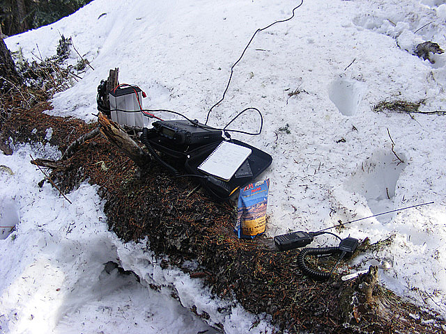
I did not bring my dual band Yagi intentionally. I knew that this summit is covered and wanted to try out my HF gear in action. It is possible to configure the standard Boddipole for two meter also. It will be a simple dipole only, but it is better than a rubber duck. Before packing up, I set it up on two and call out on SSB. Nothing. Change to FM and manage to contact three stations with some pain. Hmm, looks like a J-pole is better. However, never tried. I am happy to have some VHF Qs too.
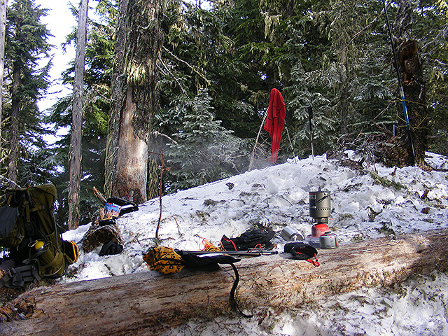
The stationary position makes me feel cold. During my breaks, when not calling or playing with the gear, I started to boil water for my food. I ate Spaghetti. The hot food will warm me from the inside. Very nice. Not even using my “emergency” feather jacket. For a short period even the sun powered through the clouds. Time to leave.
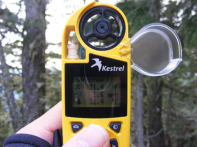
Spent 4.5 hours on the summit in about 32F with a small breeze. I enjoyed it very much. Next time have to bring something to sit on though. After packing up my radio gear I focus on eating. I am feeling very cold now and shivering a little. I am not concerned over the daylight at all. The snow will provide plenty reflection inside the forest also if I cannot make it out on time. Not worried about this this time.
I descend carefully at the steep sections. Speed up on whenever I can and I set a good pace. My time down is two hours less than up. The last mile after the river crossing looked everlasting again, but at least the snow was already crusty a bit.
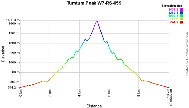
Elevation graph.
This was a real fun during winter. Thankfully it was not really cold and I avoided any precipitation too. Now I see that I will not make any bonus point in this season as there are a level 4 avalanche danger out there again. The bonus period is almost over. Maybe next season. Tumtum is only a four pointer, so no extra point for this. I recommend this summit during the winter. It is a very safe walk and a good exercise.
HG1DUL 2012-03-09