
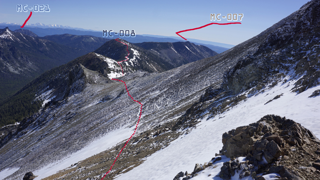
2012-06-27 W7W/MC-008 CN96jt26
I leave Seattle with grandiose plans. Three days, three eight pointer on the east side of the Cascades. This side is not that wet, as in theory Rainier blocks most of the moisture. Rainer rain shadow. Thus, trails melt out much more quicker over less snow. Forecast is quite bad for the first day, but all sunny for the rest. Again things turn out little different than planned originally.
Start elev.: 7122 ft (2171 m)
Max elev.: 7518 ft (2291 m)
Total ascent: 2278 ft (694 m)
Trip odometer: 6.6 mi (10.622 km) Up: 3.3 mi (5.311 km) Down: 3.3 mi (5.311 km)
Total time: 10h46m Up: 4h10m Down: 3h46m
APRS
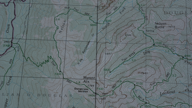
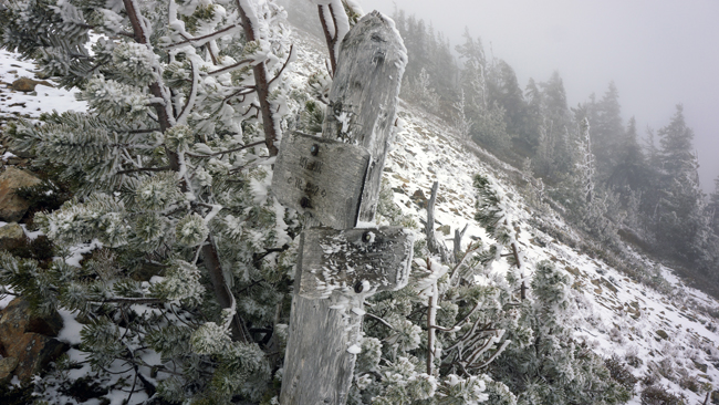
I read a lot about Aix and explored the trailhead in advance. I have not expected any problem around the start. My plan was: First day climb up to the ridge and camp somewhere near Aix. Second day move camp to Iambic and activate Nelson Butte. Third day move out and activate Aix. I have not found a lot of reports about Nelson, and nothing about Iambic (West Nelson Butte). This is going to be a true pioneer journey into the unknown.
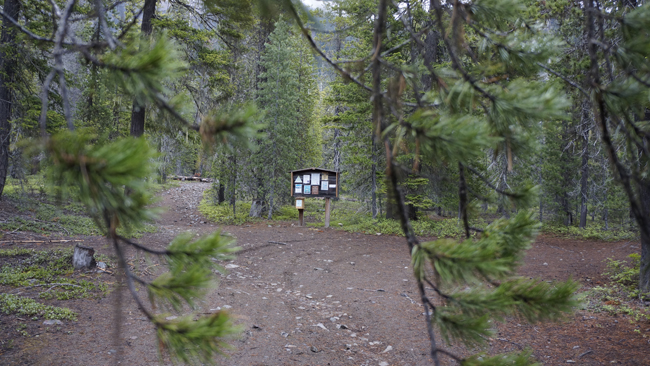
I have not planned an early start, as I had the whole day to gain access to the ridge. Wet, overcast weather welcomes me at the trail head. I fill out my registration card inside the car. This is required sometimes in the National Forests to create stats about trail usage. Start the hike at eight o’clock with my 70 pound backpack. Tent, plenty of food, clothing and of course on top of this the full radio gear.
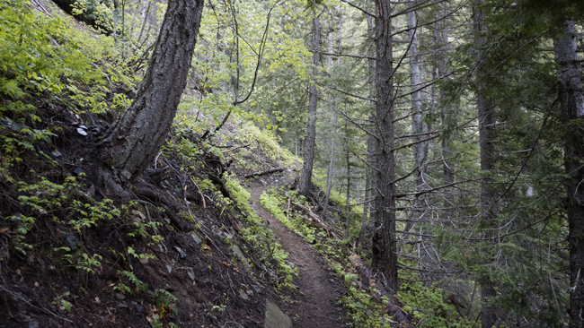
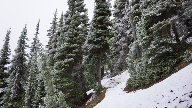
The trail starts out in level, with only a slight ascent. When I enter the forest I see, that no trail team was here yet. I have to circumnavigate some big fallen trees. I cross over a stream and start my zigzags upwards. I walk very slowly. This is my first big-pack tour in this year and I have not been at the gym either for long. Temperature is ok, and no wind so far.
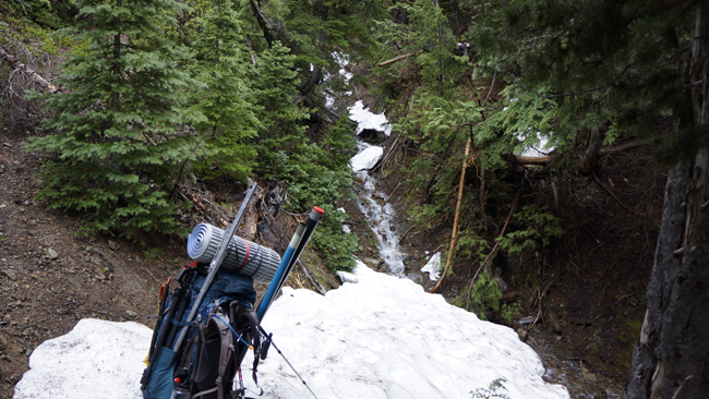
I knew that this trip will require a long approach. Thus I am walking in my shoes. The boots are hidden in my backpack at the top, so when needed I can swap the shoes quickly. I am passing by some small waterfalls, where some could top up bottles. For a long I travel near to a mountain river, but most time I cannot see it. You can hear its tumbling noise. Around 5400 feet I meet with the first significant snow patch. Here I stop for a while to rest, but have not changed footwear. I have to cross water here again, but the other side looked dry, and thought only have more snow here because it is more open.
Soon after the crossing I have to change it, though. There is a lot of snow in front of me. Somewhere more, sometimes less. Sometimes the trail becomes completely dry again as I make progress upwards. I can follow the trail fairly easily. Mainly because the switchbacks are melted out.
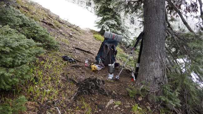
Around 6260 feet I feel very tired and I stop one place for a longer rest. Because it is just after 1300 I decided to have lunch. Although it is June, the weather here still kind-a kindly rough. Sometimes I encounter some falling snow too. I put my backpack under a pine tree and start melting snow. I do not remember what I ate, but I know it was really god as it kept me warm from inside. I drank the leftover warm water and continued my hike. This stop took one hour ten minutes. At this point I was on the trail for six hours and twenty-two minutes and covered only 3.6 miles with 2500 feet elevation gain.
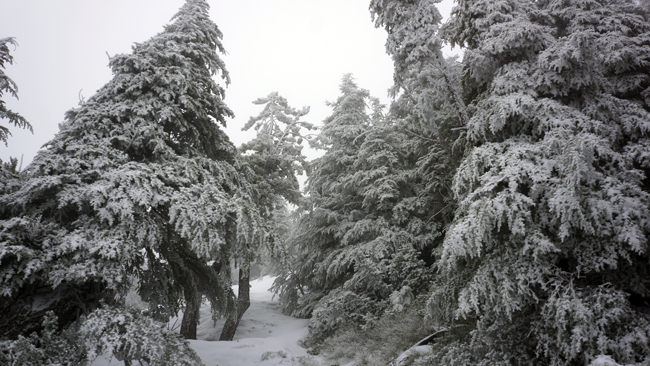
As I got higher and higher, often lost portions of the trail because of the snow. The higher elevation also brought stronger wind. I slow down completely. I stop at a leveled section and put on my crampons. The snow is in very good state and I do not break in. Everything is frozen. Two hours already past after my lunch, when I made a decision. I stop wandering amongst the trees and will start walking straight upwards to the ridge. This was a good idea at that time because there is a path on the ridge too, and it is very easy to walk on the snow up. There was only one problem. When I got higher, the snow got less underneath me and I found myself in a middle of a short mountain pine forest. I broke through the snow with every step.
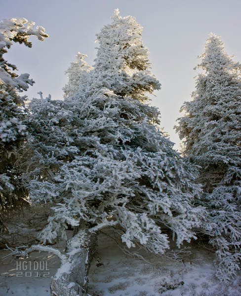
I have to cover less than 500 feet, but it took me over 30 minutes. The wind was very strong on the ridge. It is 1700. I feel very cold and there is no good place where I could set up my tent. I thought there will be more snow here and I can dig it in. Yepp, I took this picture at the end of June. “June gloom” at its full force. Finally, after forty minutes I choose a place on the other side of the ridge. Visibility is very low and I am very careful not to be on a cornice. I did not want to awake to sliding down inside my tent.

Pitched my tent near to some short trees. I was below the ridgeline and completely out of the wind. Make some food for dinner and some tea with honey. The tent hardly flaps, although the wind is very strong. I could not sleep a lot during the night. Woke up many times and drink a lot. The tea with the honey is super tasty. This will be my standard cold weather drink. Woke up for a gorgeous morning. Quick breakfast and some packing for the trip. I check out the tent’s position and the snow condition.
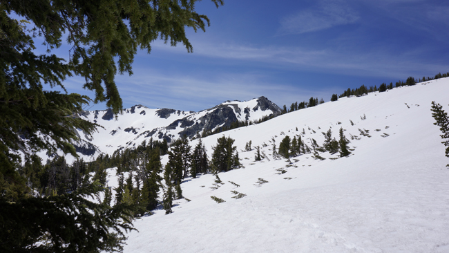
Eventually, because I was quite tired and the route looked very intimidating under Aix I decided not to move camp. My plan for the day is, if possible, reach Nelson, but at least Iambic. Leave camp at 0825. The view is absolutely fantastic so as the weather. This is more like June weather for me.
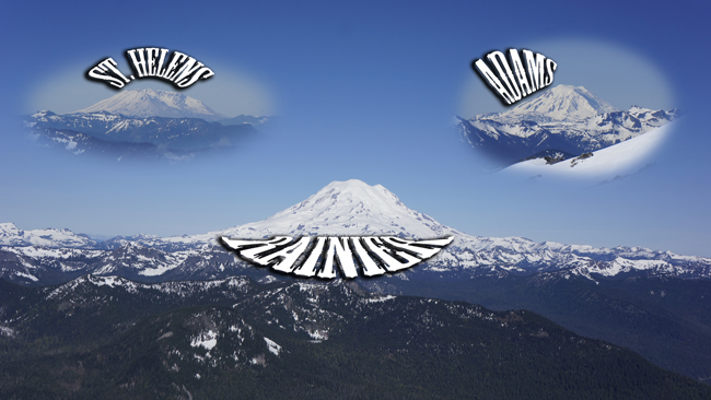
Ridge walk provides a three volcano view. They look very cool.
Looking towards the sun as I progress along the ridge.
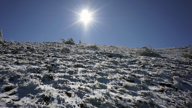
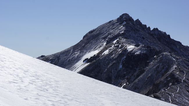
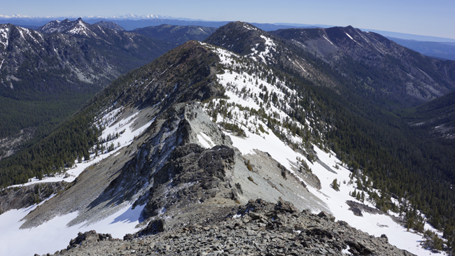
Not a lot of snow here on the ridge. I can go at a good pace. Bismarck at the background and Adams in the far distant.
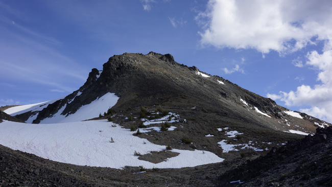
One of the first looks on Aix. I should traverse to left somehow. Does not look simple.
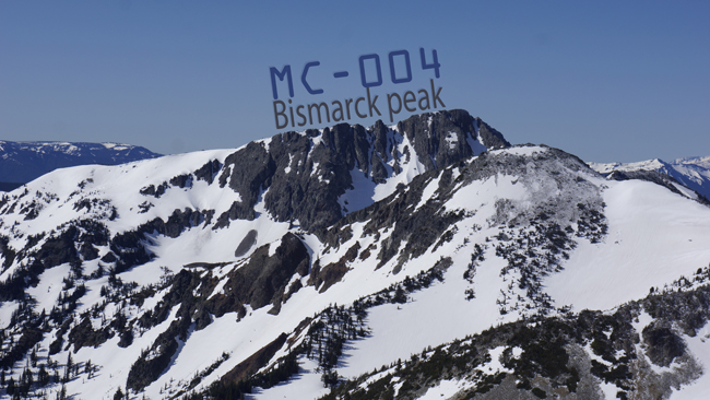
What a cool looking peak and what a fantastic name! Bismarck! :D
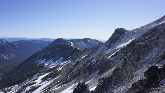
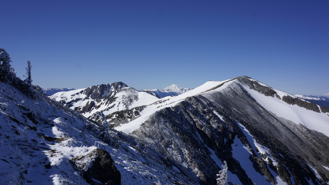
I have to go this direction. Towards the end of the ridge there is Iambic and further away Nelson Butte on the right. I shoot this on my way towards the base of Aix.
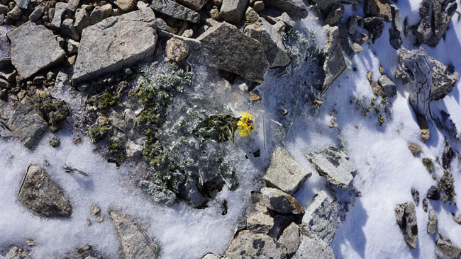
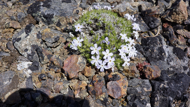
Beautiful mountain flora in inhospitable environment.
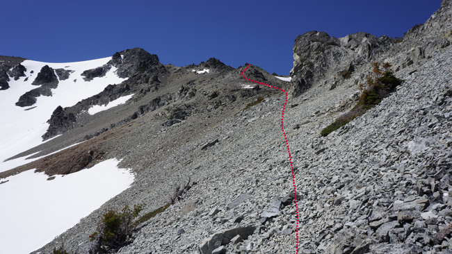
Took me one hour and ten minutes to reach Aix’s base. Here I was looking for a good place to get myself onto the steep rock field. One point I almost lost my balance on a rocky section, but finally I managed to reach the steep field safely. I do not like it. It is steep and very loose. I choose my steps carefully and try to follow some goat trails. After twenty minutes I reach the north ridge of Aix.
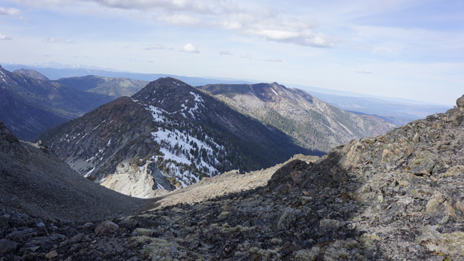
Here the terrain levels out. I explore how I can progress further. Aix, looking back from the flat section.
I walk into this wide valley and carry on downwards.
This valley takes me to northeast ridge. Here I descend a little and stop for a rest. I take some pictures and apply some sunblock cream. I enjoy the sun, when suddenly a fighter jet flies by. It looked like it was lower than Aix. It had a nice sound. It appeared so quickly and I could not take a footage. After a twenty minute rest I continue my journey. I climb down till the black rocks, where I turn right. Up to this point the ground was quite ok. Rocks are solid, not loose.
The rocks, which are looked black from top, are the ones you can see on the right side of this picture. There I turned down onto this grey rock field. This is more loose, but nothing serious. However, because of its steepness going down you have to choose your steps carefully. This rock field soon covered by a lot of snow. I continue my traverse on snow, which actually very easy this time.
I got the sun from the right and is very strong. It is eleven o’clock when I stop at a shady spot to put on my crampons. Scenery is very good. Fresh air, wonderful colors and silence, nobody around. My initial plan was to go on top of the ridgeline, but I did not feel to climb it now. On the other end I should have descended back anyway, before climb up Iambic. If there is no snow here, then this traverse could be hard though. I have no idea how the underlying terrain look like. This long traverse took me fifty minutes.

The way up to Iambic is completely snow free. I stop at the base and took off my crampons. I left them there on the snow. I will pick them up on my way down. From here another half hour to the summit. I do not carry on towards Nelson. That is another 1.5 miles from the summit. Luckily there is a big snow patch on the summit where I can deploy my antenna. No guy lines required.
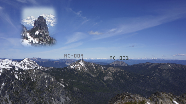
Hiking into this remote area will reward you with a fantastic view on a clear day. Towards north there is Old Scab and Sloper, or a more common name Buffalo Hump. It looks very intimidating from this point, but Beckey says it is only class 2. Also on the picture unmarked, Longwire.
Took a lot of pictures at the top and started to build my station. I sent out an APRS spot and Barry appeared on the frequency almost immediately. We also made a small experiment on how will he copy me if I reduce the power to 5 Watts. He said that he still can hear me, but not an easy copy. Later I also experience what he could have heard. N4EX QRP station is trying to reach me, but I cannot copy his full callsign. After some unsuccessful try I put him back on the queue to work with others. When other stations disappeared I call him again and this time we made a successful contact. Fantastic. I start calling out CQ and suddenly a German station comes back. Woohuuu this is superb with the small Buddipole. This is my first Q from Europe. Looking forward to my first Hungarian station. Lots of cute little flowers on the peak.
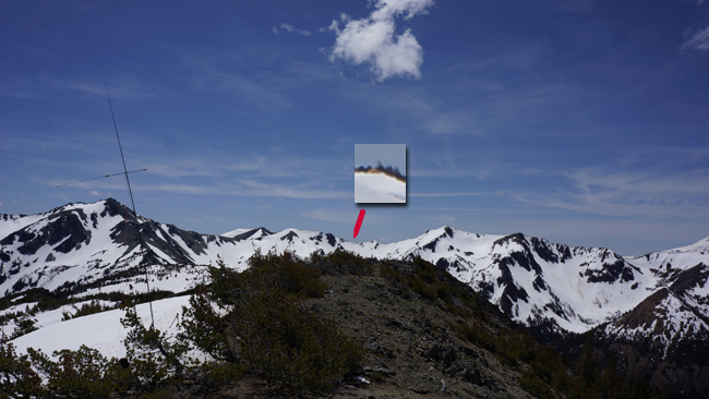
This was a very nice SOTA. I have to end it though I would like to stay longer. I do not want to cross the steep loose rock field underneath Aix in the dark and afraid that the trip back will also take long. Pack my stuff and start the hike back to my camp. It is 1525. Eventually I managed to cross the field with only some small sliding down. I dug my feet deep into the rocks and tried to make steps. When I reached the main ridge I had a quick thought to climb Aix quickly for a short activation, but I walked back to my tent. I will activate it next day, I planned. I arrived back at my tent at 1911. The yellow spot magnified is my tent. It’s position depicted by the red arrow.
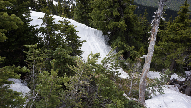
Next morning I did not want to get out of the sleeping bag. Slowly I get out and after breakfast I start packing. I only put the necessary gear into the backpack and cache everything else under the small trees. I still do not feel to start. I watch the clouds and they are moving very fast. When I walk out of my cover I feel that the wind is again very strong. It is a good enough excuse for me to cancel on Aix :). Pack everything and start the hike down with the big and heavy bag. I will be happy to come back here. This is a very nice area. On my way down sometimes huge snow walls slows me down. I have to circumnavigate them. The height of this on the picture was up to my neck.
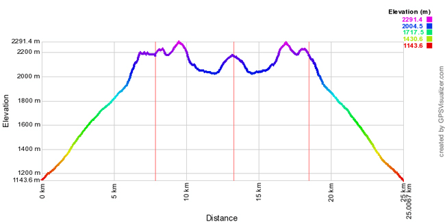
I cross some fresh snowshoe tracks on the lower section, but did not see the hiker. Meet with two older chaps later, who are on a reconnaissance hike for a later summit attempt. I gave them some intel and continue my descent. Elevation profile for the whole hike.
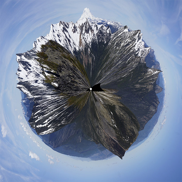
I had some fun with Hugin.
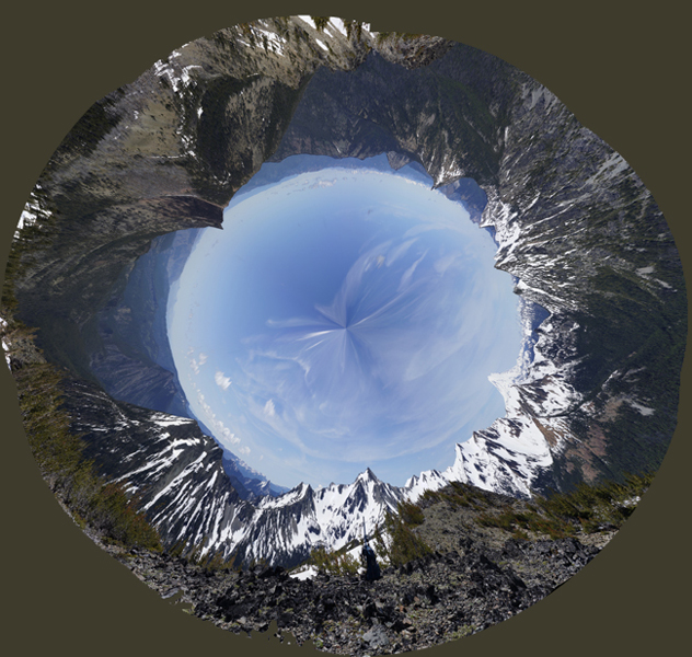
Here is another one. I decided to shoot panoramas in the future. I started from my campground at 1100 and took me 3.5 hours to get back to my car. I was exhausted at the end.
On my way home I explored the area. I searched for trailheads to Old Scab and Nelson Butte. To obtain these three summits in a long weekend is not impossible. I recommend you to visit this area for an extended stay when there is still snow on Iambic. During summer the inner part is very dry and you do not want to carry two days worth of water with you. Being in a good shape is also a plus. It was a very adventurous hike. I am also very happy about the Eu QSO. One summit bagged instead of three.
Full hike stats:
Start elev.: 3752 feet (1144 meter)
Max elev.: 7518 feet (2291 meter)
Total ascent: 5831 feet (1777 meter)
Trip odometer: 15.3 miles (24.623 km) Up: 8 mi (12.875 km) Down: 7.3 mi (11.748 km)
Total time: 2d6h37m Up: 1d4h35m Down: 23h11m
HG1DUL 2012-10-13