UPDATE JUNE 2018 - Road 27 has deteriorated to the point that getting to the trailhead may prove challenging even in a Subaru Outback. It's certainly unpleasant and rough and slow going. So much so that you may want to hike a few more miles and have an easier time getting to the northern trailhead.
ZigZag Mountain is a worthwhile hike with great views and a nice operating position. The road from Highway 26 on the south side presents challenges to passenger cars and although it looks like three miles on the map it's actually five miles and took me 40 minutes to traverse.
The hike for the most part is straightforward, with a round trip distance of about 8 miles and an elevation gain of 1200 feet. However, the last eighth of a mile or so to the summit proper is a challenging uphill bushwack, perhaps requiring occasional crawling under branches and good navigation to find the trail on your way back down.
About one mile east of Tollgate Campground on Highway 26, head north on Road 27. The pavement is short lived, and so is the decent gravel road, degrading into a rocky, potholed dirt track for the most part. A high clearance vehicle is recommended. At the very end are two trailheads - East ZigZag Trail and Burnt Lake Trail #772. No trailhead pass is required although a free, self-served Wilderness Permit station is a few hundred yards up the trail.
Take Trail #772 which continues up the nicely graded abandoned roadway for about 2.6 miles through second-growth forest. There are some brushy patches that might make you wish you wore long pants. Then the Devils Tie Trail, #767, goes northwest for about 0.4 mile and climbs to join the ZigZag Mountain Trail. Head west here and climb over about one mile until the trail skirts the north side of ZigZag Mountain.
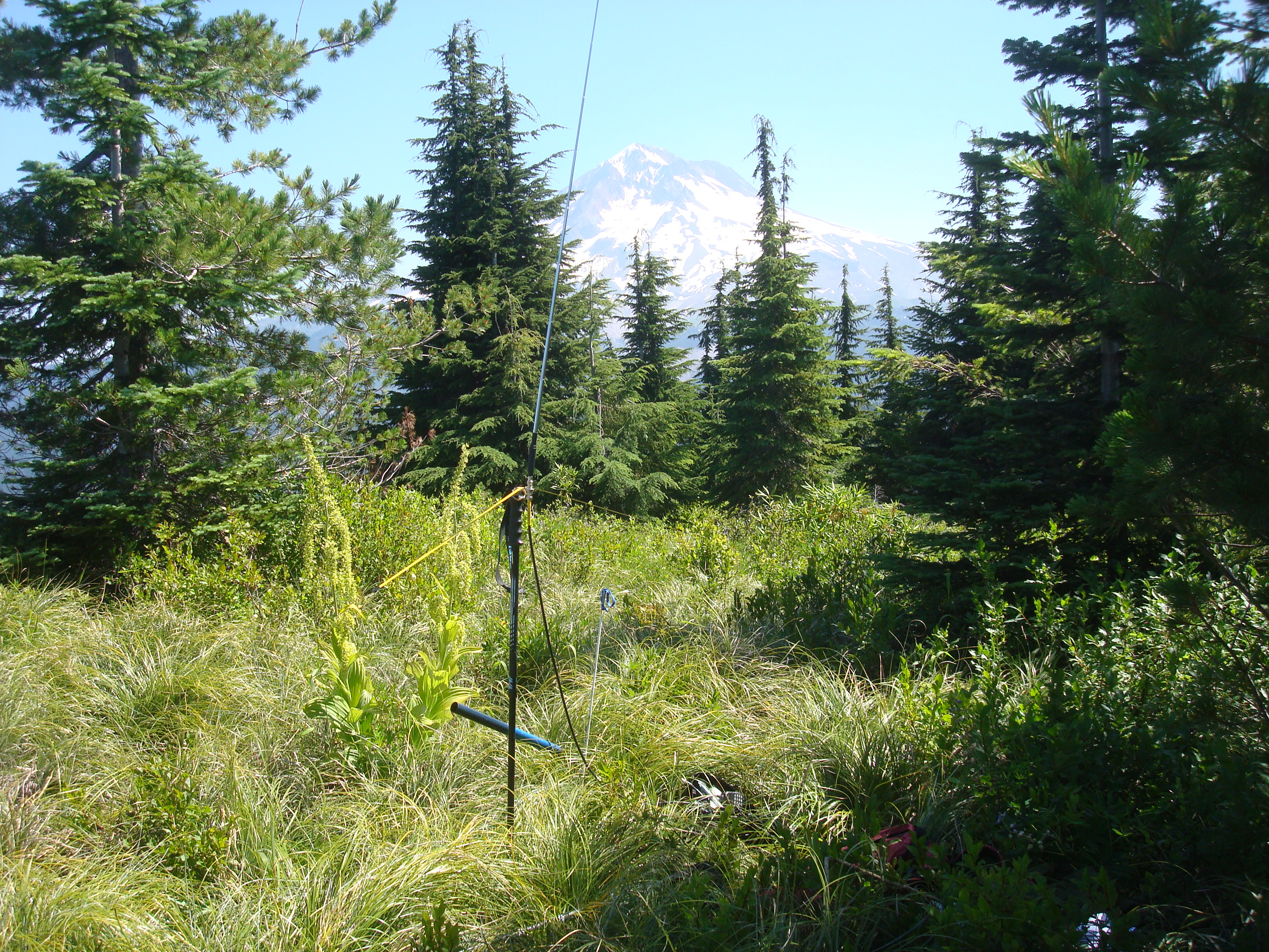
Here is where a GPS will be very useful (and you did record waypoints at the parking lot and trail junctions, right? And the coordinates for the summit proper?). As the ZigZag Mountain Trail comes closer and then moves away from the peak you can decide how you want to approach the summit itself, The trail is still several hundred feet below the summit and outside the activation zone. I marked a waypoint where I left the trail and proceeded up through the brush to the summit. Perhaps this is another place you’d want long pants – I gathered several nice scratches on the way up and back. There may a climber's trail to the summit, but I found no evidence of one and elk aren’t great at maintaining trails. The summit is worth visiting as it is open in most directions and has a spectacular view of Mt. Hood. There are a number of trees on the perimeter that could be used for antennas.
Have a care in descending the summit through the brush to be sure to return to the trail and your vehicle - a GPS waypoint set before you left the trail is VERY useful here.
There is also access to ZigZag Mountain from the northwest via trail #773 – this starts from Riley Horse Camp accessed off NF-18. It appears to be two miles longer round-trip for hiking, but I have heard that the road is well-graded gravel, suitable for passenger cars. A NW Forest Pass is required at that trailhead.