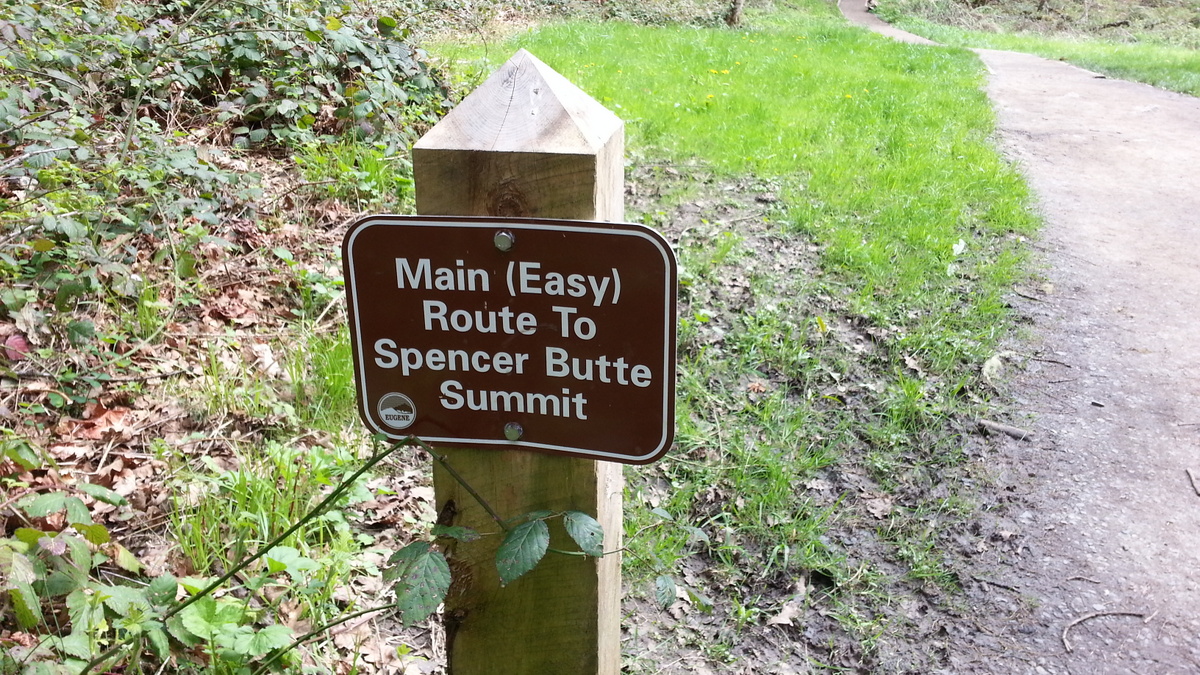
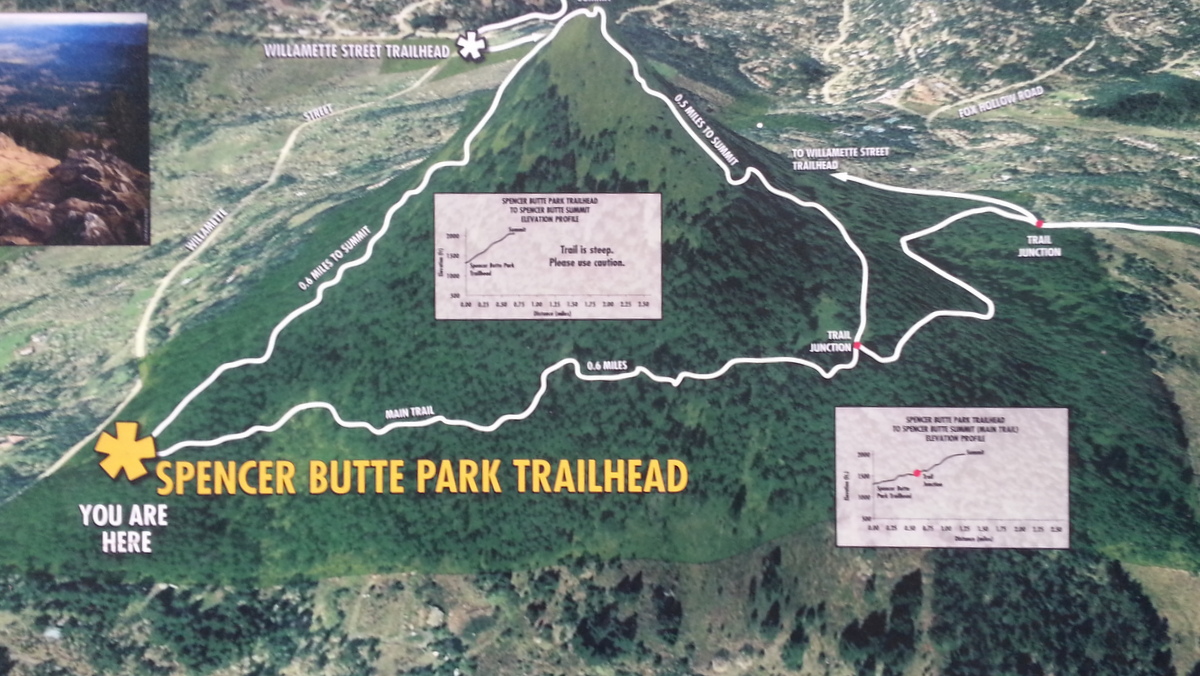
Spencer Butte is a Eugene city park about four miles south of downtown. The address for the most convenient trailhead is 85401 South Willamette Street and the trailhead parking lot is well signed as the Spencer Butte Trailhead. This trailhead has the shortest routes to the summit.
From this trailhead the summit is about 700 vertical feet and 1.1 miles on the "Easy" trail - there is a much steeper 0.6 mile long trail to the summit to the left - we choose the trail on the right. There are many social trails when you near the summit but all lead to the top. At the most confusing point when you begin to move from under the tree canopy to open rock you might keep more to climber's right and look for the wooden fencing - this is the easiest path.
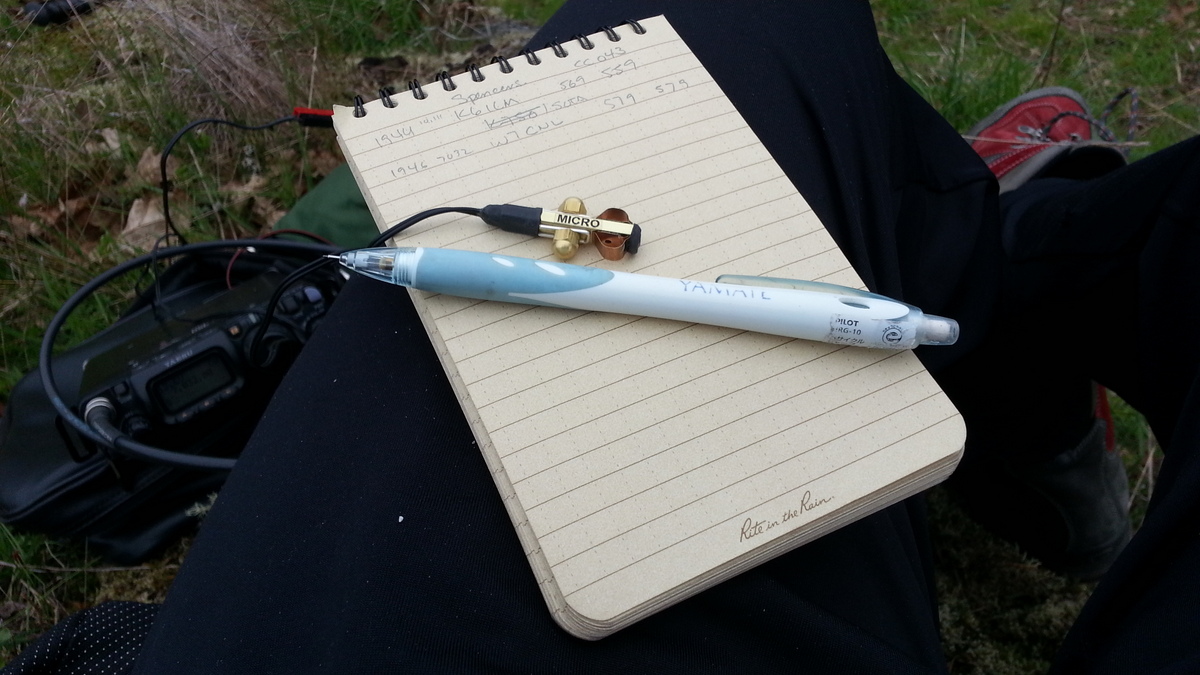
I was able to use the incredible and tiny KK5PY Micro Paddle for the first time on this activation. It's pictured below. It has a very light touch and I'm itching to take it on a trip where every ounce and inch counts. It's a beautiful tool for CW in the field.
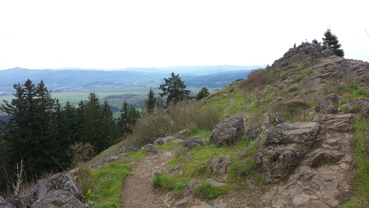
The views from the top of the lower Willamette Valley are excellent and there are a number of good operating positions away from the crowds on the summit proper. HOWEVER, do have a care to avoid the poison oak.
More information on the park can be found here: www.eugeneoutdoors.com/spencer-butte.