Here's a near drive-up south of Estacada with a hike as short as a quarter mile and 200 feet of gain. Or, you can park sooner along the access road and have a bit more of a walk if you prefer. Along with Oak Grove Butte you might consider a double activation of W7O/CN-021 - Mount Lowe or W7O/WV-009 - Bull of the Woods.
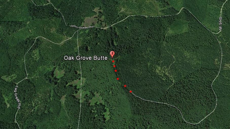
From Estacade, proceed south on Highway 224 until it turns into FS-46 at the Ripplebrook Guard Station. You'll be turning left onto FS-57 0.6 miles past Ripplebrook. After another 0.6 miles, you'll be leaving the pavement of FS-57 for John Creek Road. After about 5.5 miles on this road, you'll be turning right onto an unmarked and unnamed road. There are no particular landmarks here but it is 0.74 miles from the summit of Oak Grove Butte and you'll be heading away from the summit at this point.
(We found John Creek Road blocked by logging activity and came in Tag Creek Road that is the next left turn about 0.75 miles down FS-46. Tag Creek Road is a bit rougher than John Creek Road and ends up intersecting John Creek about 1.1 miles from the unmarked and unnamed road leading to Oak Grove Butte.)
This unnamed road curves south and then west to approach the summit for 1.25 miles. You may be able to drive all the way to the "trailhead", or park somewhere along in a wide spot (recommended) before the road end. After the road ends it turns into a rough and steep jeep track for the last 0.25 mile to the summit and the last bit is a path up to the top. There is an antenna installation here - some sort of passive repeater and an old tower base. There are good places to sit and set up with some small trees for antenna support.