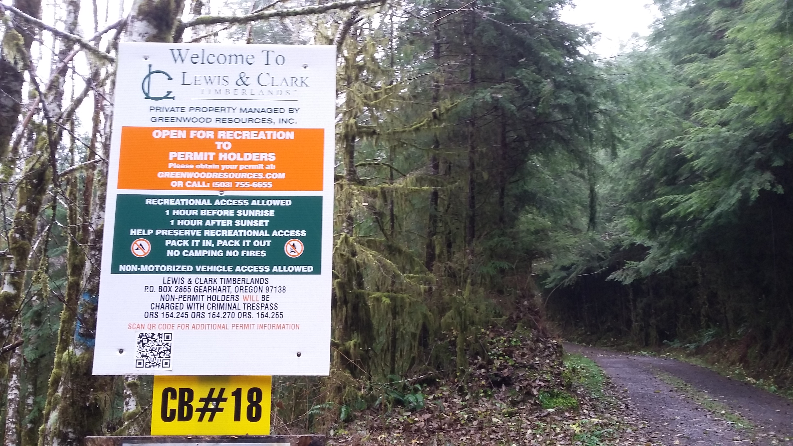
“Bah,” said Scrooge, “Humbug.” At least that was what we thought to ourselves as we looked at the weather forecast for the weekend. The Weather Channel splashed the headlines of a series of epic storms that were lashing the west coast. Regardless, the lead sherpa was determined to get the family out of the house. There would be no sour moods for us! “There is hiking to be done, geocaches to be found, and a summit to be activated!” she proclaimed. (Note that the landowner is now requiring permits for access - see https://nncpermits.com/Permits/PermitDetails.aspx.)
Surprisingly, she suggested a hike to the top of Humbug Mountain, a peak that stood close to the well known Saddle Mountain State Park. She had done her research and found that it consisted of a lightly visited private forest area with a little more than a five and a half mile round trip to the summit. A string of ten geocaches had been placed along the route to the top. Best of all, the peak had a summit that had yet to be activated.
To get to the trailhead, make your way to a nondescript logging road just off of US-26 at 45.9047 -123.6864 (near mp 13). There is room here for only a couple of cars to park. A gate marks the entrance to the Lewis & Clark Timberlands property. Please note that this area can and has been closed to the public with no warning - see this trip report. There are no markers to help you navigate once you’ve passed the initial gate. Stay on the major route and when in doubt, go up. The most confusing intersection is near the beginning. Take a left and continue upwards from here. The path to the summit takes roughly 2.7 miles.
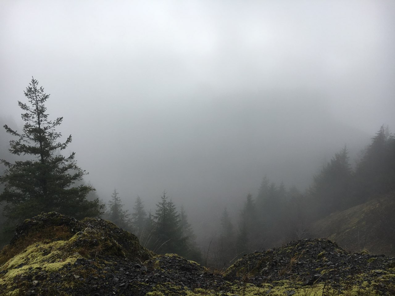
Within the first half mile, we started wondering to ourselves if we had made the right decision to come out. The wind and rain, while not heavy, made the journey seem daunting. But we forged on with the comfort of having good rain gear and warm layers underneath. The route itself cuts through a number of clearcuts and passes gargantuan rotting stumps from the glory days of Oregon’s early timber boom. We had read that the views were fabulous from the road, but there wouldn’t be much joy for us in that regard as the clouds wrapped the mountain like a cocoon.
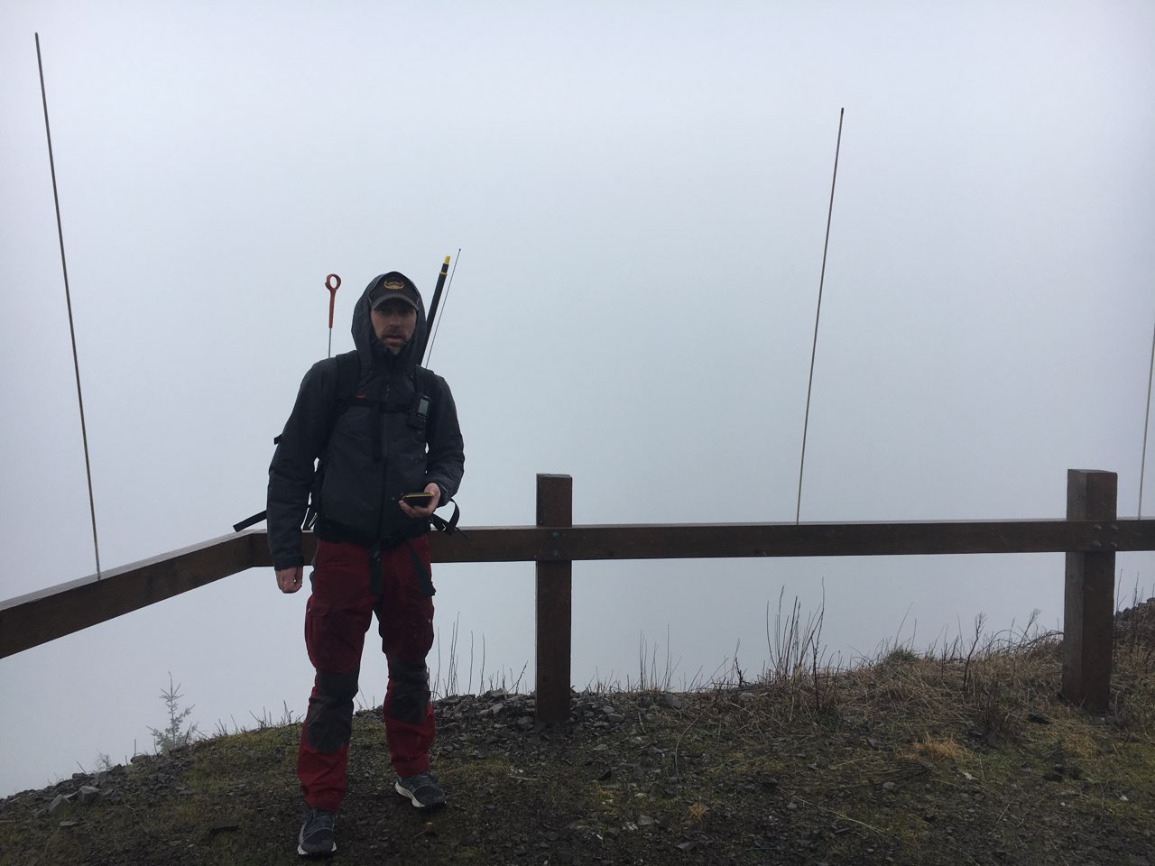
As we made our way up the road, we listened to the coming and going participant chatter of the weekend’s VHF contest. Nearing the summit, we walked past the twisted remains of an old communications tower and then made final push to the newer communications equipment at the top. The radio noise died out and was replaced by the audible buzz from the microwave towers. It took only seconds as we stood in the blasting gale to realize that the towers created a cone of RFI that killed our reception.
We made our way back down to where the remaining hulk of the old communication tower lay and hoped that we still were in the activation zone. To our eyes, it appeared that we had only lost about 50 feet of elevation. The HT was alive again. This would have to do. The rainfall had increased to a solid downpour and the ridgeline focused the wind’s energy on the slot between the trees. We had good cell reception and I cast out a spot on 2m knowing full well that it probably wasn’t necessary – there were a number of contesters actively exchanging grid information on 146.52. In just a minute we had our four contacts. There would be no HF action today. We scurried back down the road to our warm and dry car.
We imagine that this peak is worthy of the hike (and series of geocaches) alone on a clear day. The photos we’ve seen of this hike show its status as a hidden gem. But whatever is emanating from those towers on top is serious stuff. “Bah,” said Scrooge, “Humbug.”
Don't get this summit confused with the South Coast Humbug, W7O/SC-192 - that one is also a wonderful experience.
NOTE FOR MAY 2020 - Car broken into parked at trailhead - looks like it may happen ocassionally.