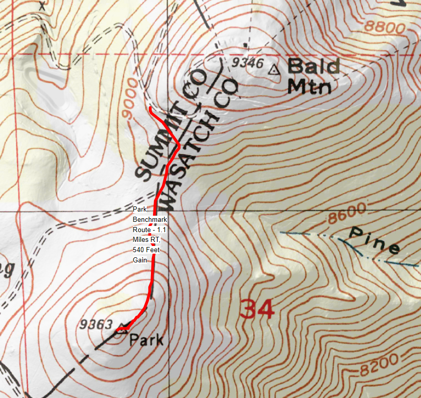
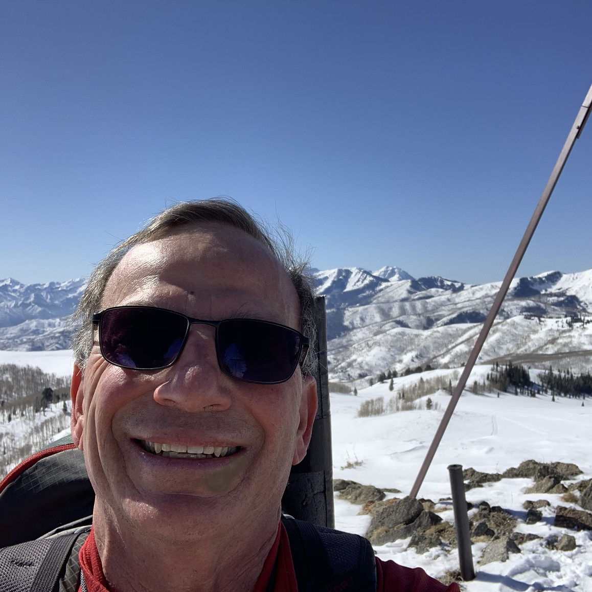
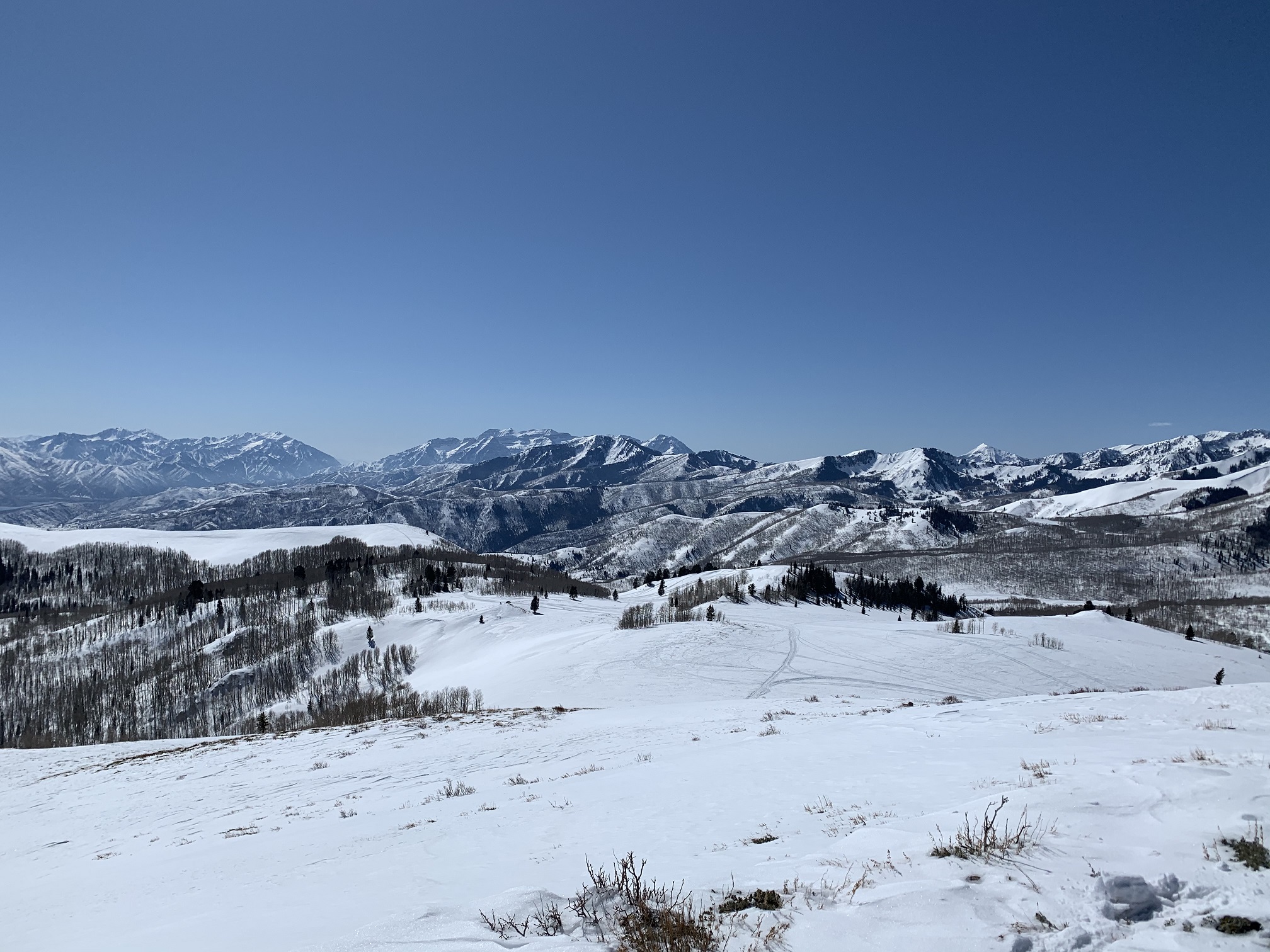
On March 4, 2020, I accomplished the first SOTA Activation of Park Benchmark, Utah. While researching the vicinity of Park City, Utah, for a downhill ski trip, I was very surprised to learn that this easy to climb peak had not been Activated before. Park Benchmark, W7U/SM-042, has an elevation of 9,363 feet, and fantastic 360 degree views of the mighty Wasatch and Western Uinta Mountain Ranges.
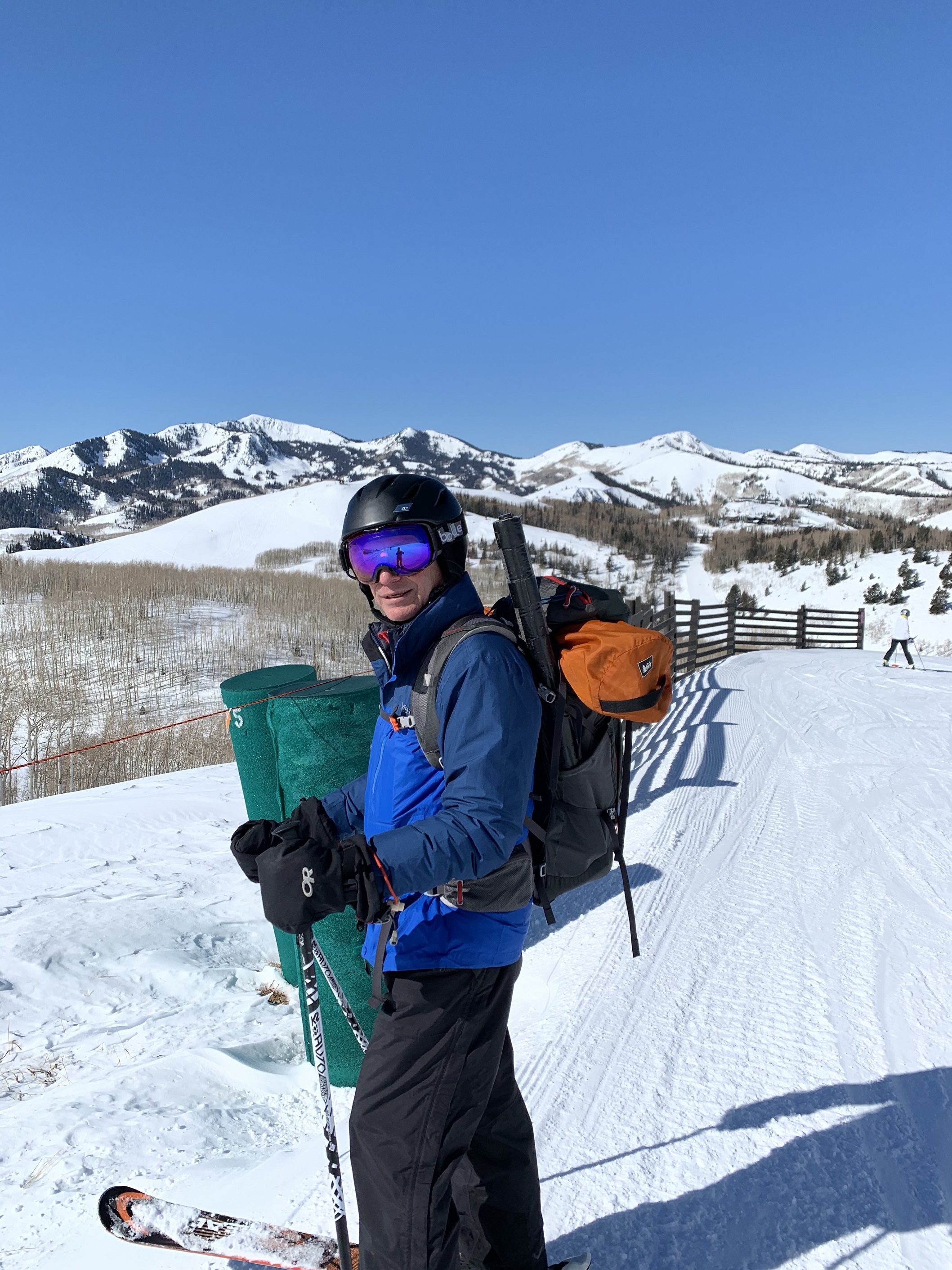
As I learned that Park Benchmark was only approximately 1/2 mile outside the boundary of Deer Valley Ski Resort, where we planned to downhill ski, a plan began to form in my mind. I had Activated SOTA peaks in the winter before, by accessing from downhill ski areas. Namely: Mount Bachelor in Oregon (W7O/CM-005) and Lone Mountain in Montana (W7M/BR-005). However, both of these peaks are nearly surmounted by ski lifts or gondolas, and their summits are easily reached in ski boots. Park Benchmark is different, in that it is outside the ski area boundary. The hike requires either AT Backcountry Skis or snowshoes to reach, unless one enjoys post-holing for 1/2 mile in each direction. Since I don't own AT skis, I opted for snowshoes. This necessitated skiing with a heavy backpack, containing not only radio and essential winter safety gear, but snow boots and snowshoes...a bulky mess, but manageable given my determination.
From Deer Valley Ski Resort Base (see Map & hit Back Key to Return):
http://cdn.deervalley.com/web/sitecore/maps/WinterTrailMap.pdf
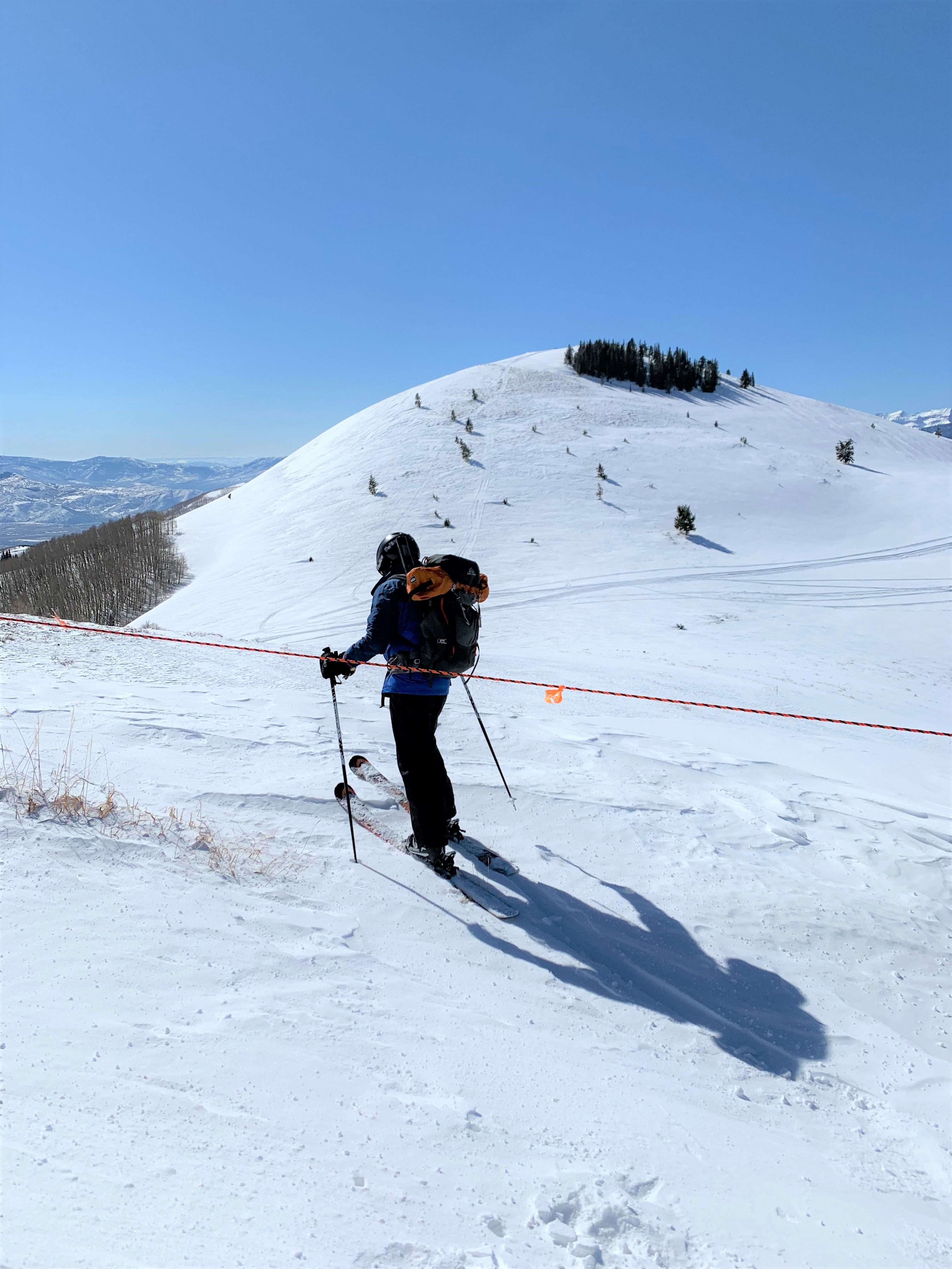
Take Silver Lake Express & Sterling Express chairs to the top of Bald Mountain, approx. 9,400 feet. One can either change to snowshoes at this point, and drop downwards toward the pass between Baldy and Park Benchmark, or ski down Homeward Bound run to a point just before the wood fence and green snowmaking valve cylinders (picture), to begin the hike. I opted for the latter, in order to be less conspicuous. Location here is: 40.6077, -111.4850.
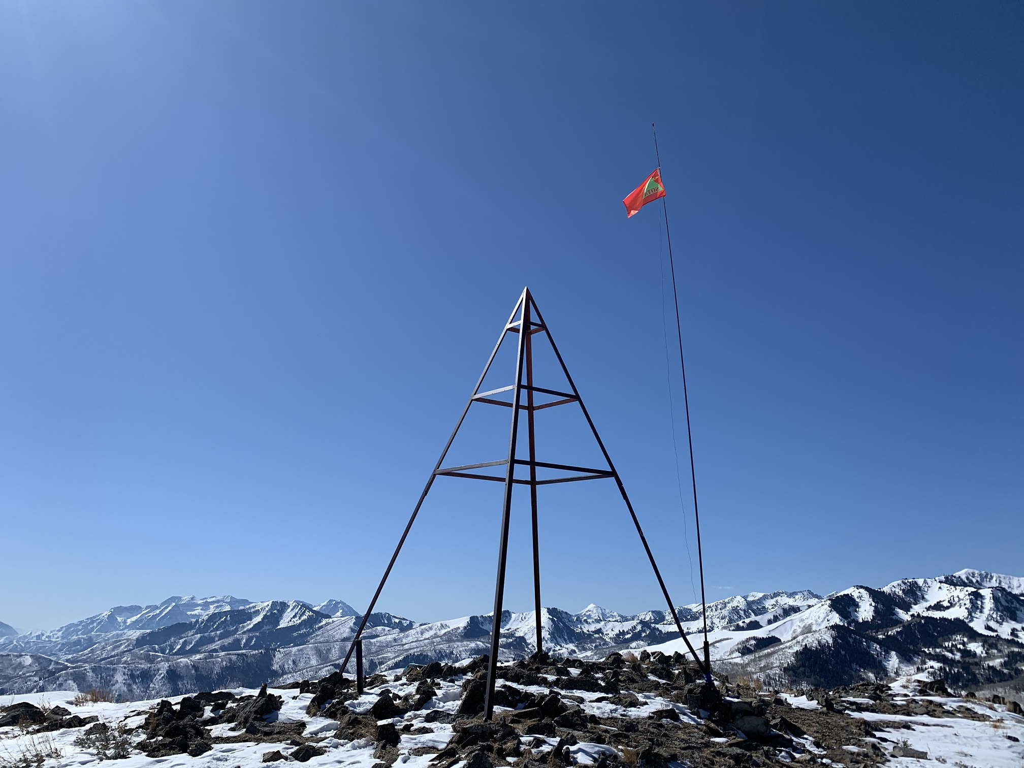
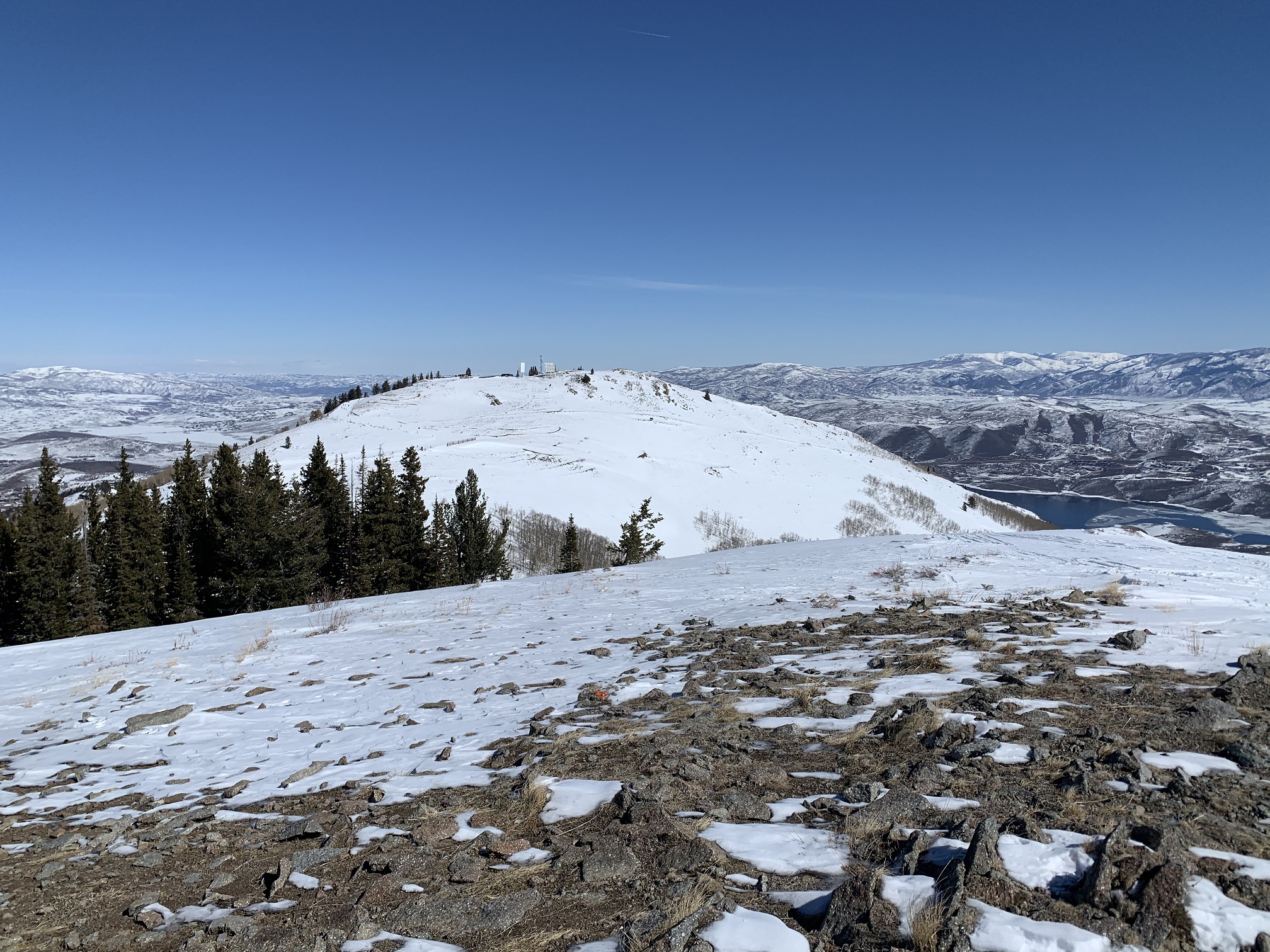
I dropped about 20 vertical feet below the ski run, changed to snow boots and snowshoes, and got ready to summit. In sunny and cool weather, it took about 28 minutes to snowshoe the 1/2 mile and approx. 400 feet gain to the summit. There is a large iron pyramid structure there, that is over 20 feet tall! Aside from the many crosses I have seen on European summits, I don't remember a more impressive summit icon. There was very little wind, especially where I set up on the lee (North) side of the summit. The views were spectacular, and it was hard to break away for the Activation.
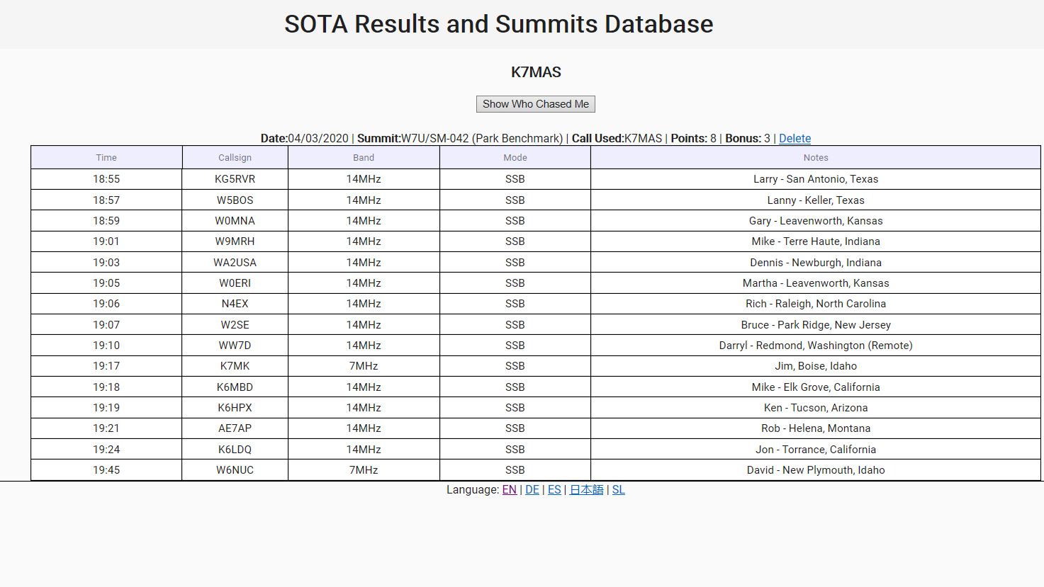
After spotting myself, I quickly had a mini-pileup, despite the relatively poor band conditions. In 50 minutes of operating I made 15 contacts on 20 & 40 meters. I was happy to work Darryl, WW7D, the Association Manager for W7W SOTA. He took the time to work me remotely form work, controlling his home station over the internet, after seeing my spot. It was so pleasant out in the sun, that I enjoyed a bit of rag chewing, describing my surroundings and great weather, to anyone that would listen. I tried 2 meters fm for a while, but it was a total bust, and I was glad I had not depended on that band / mode for contacts.
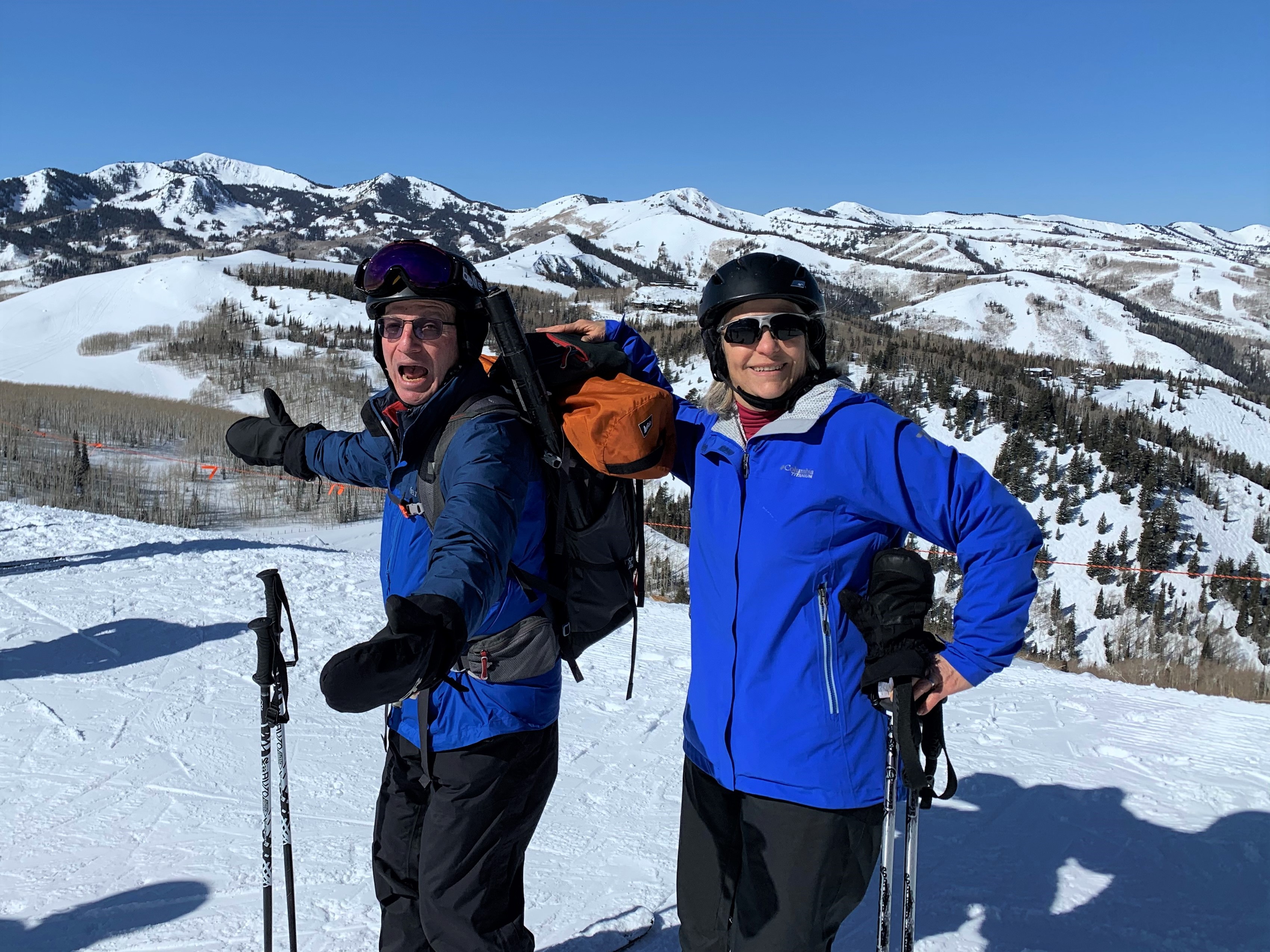
Soon it was time to head back to the ski area, and meet up with my XYL, who was having fun skiing the packed powder and excellently groomed blue runs. After changing back to ski boots and skis, it was a full 2,000 foot ski descent on Homeward Bound, Ontario and Solid Muldoon runs. It took about 15 minutes to reach the base, despite the unwieldly lump of gear on my back.
Thank you to all of the Chasers! I appreciate each and every SOTA contact. List attached.