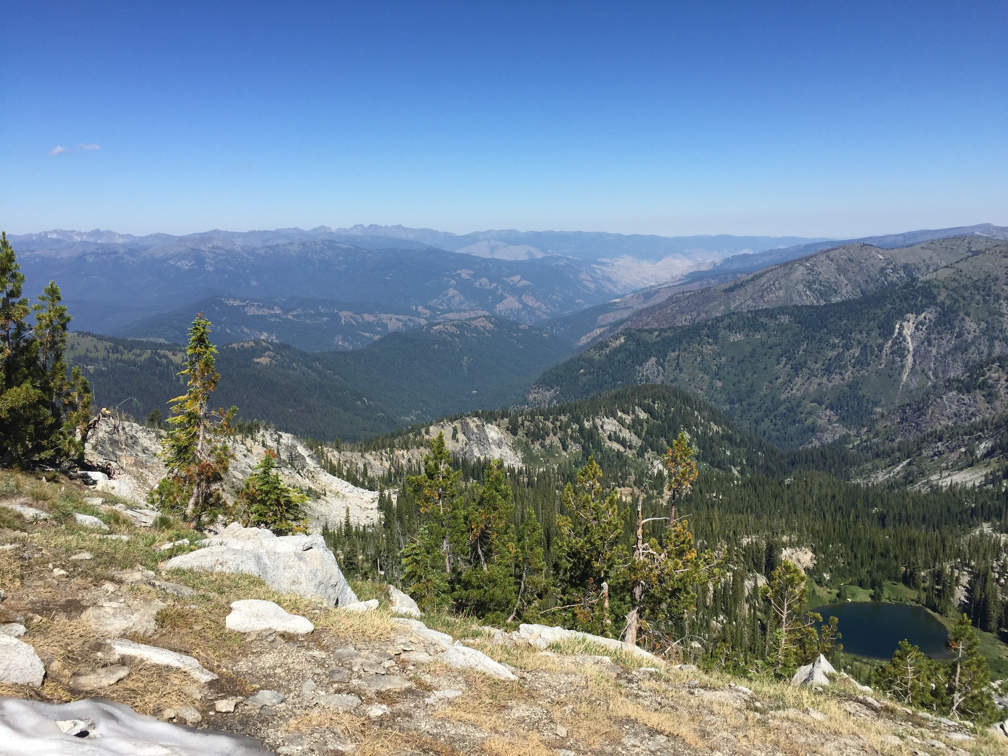
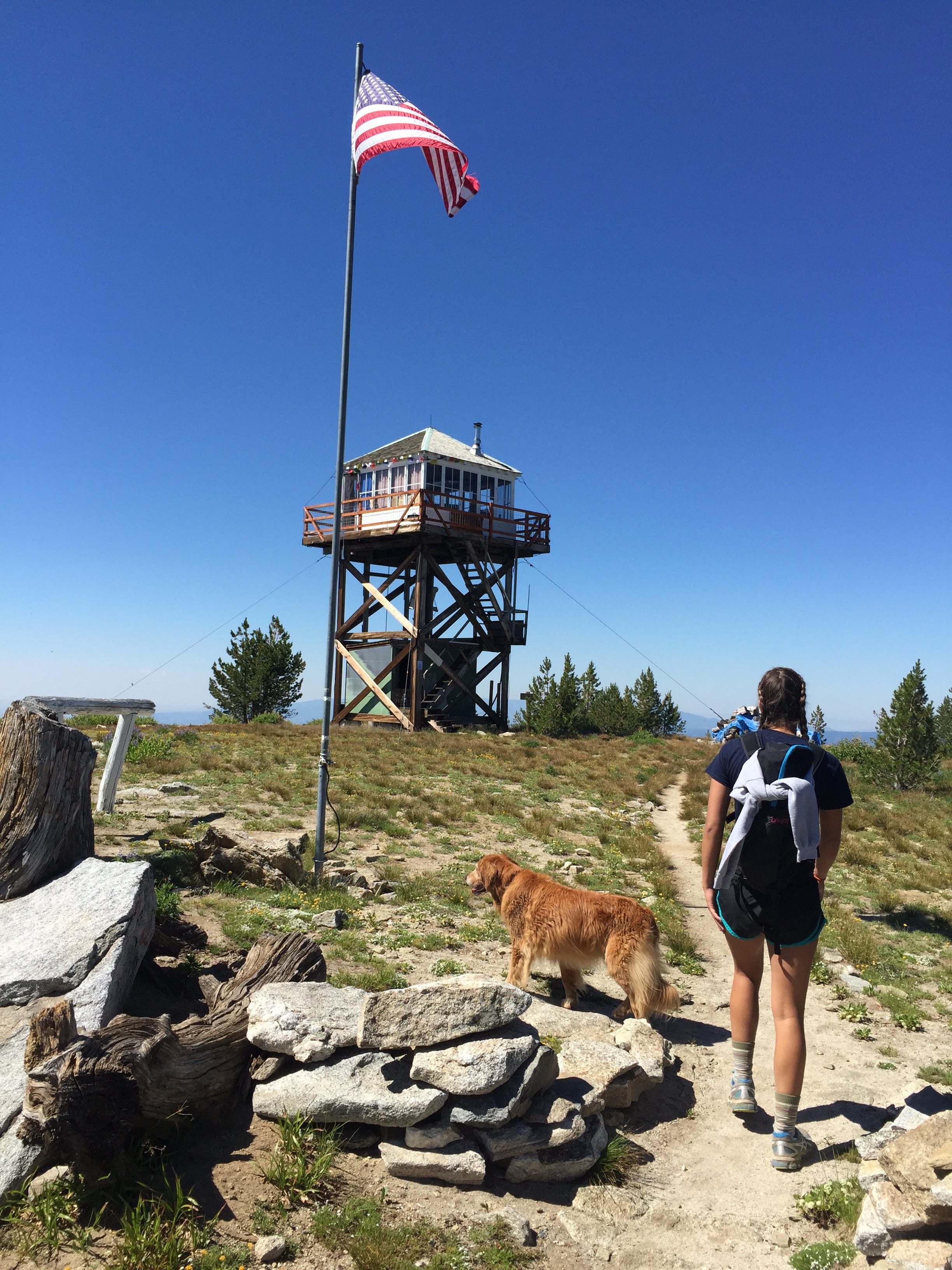
This was my second activation of Granite Mountain which is NW of McCall Idaho. Although strenuous due to a consistently steep grade, the views from the summit are spectacular. Granite Mountain has a twin summit. The trail will take you to the south summit with the fire lookout tower. This is not the SOTA summit, but is well worth a few extra steps to get the view off the south side. After a quick visit to the fire lookout, turn back to the north and you will see the slightly higher SOTA summit a short distance away.
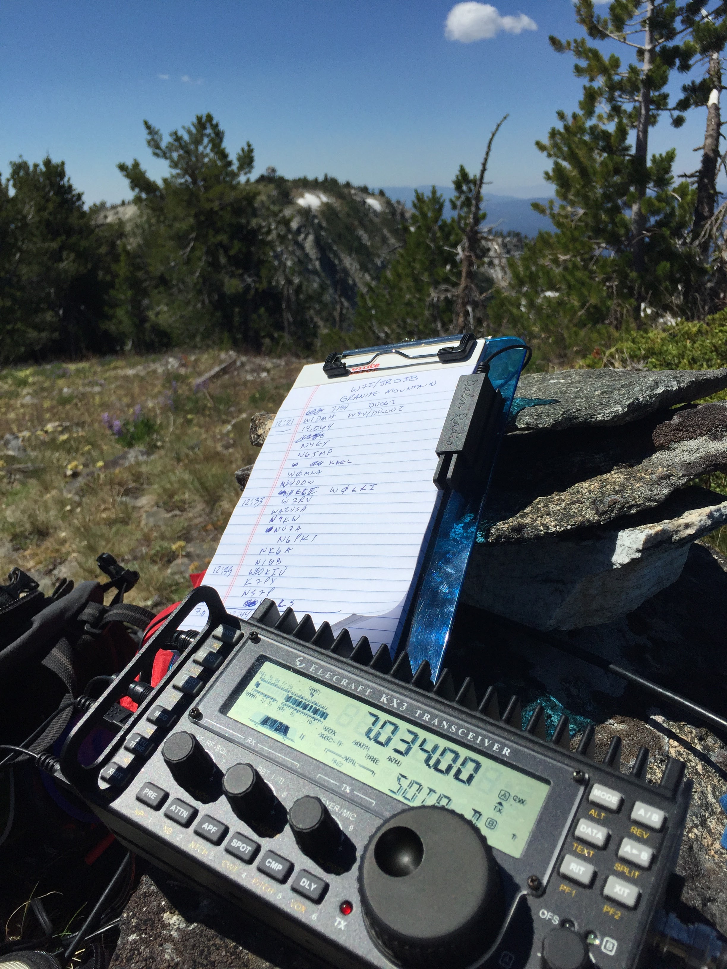
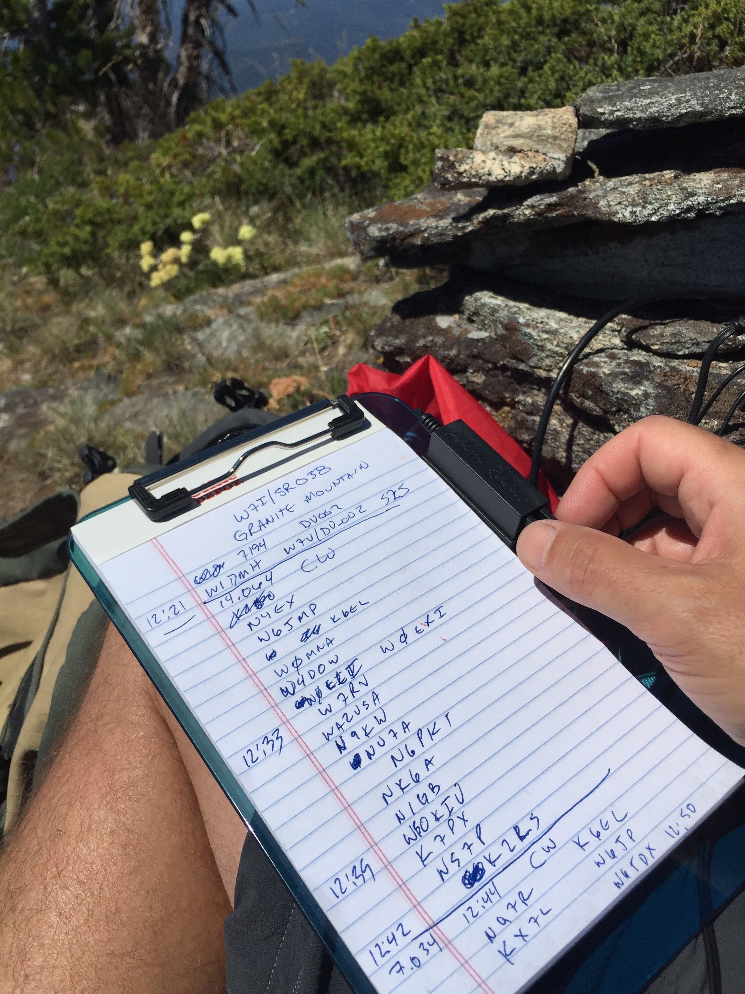
It’s a quick trip down to the saddle then a short bushwack over good ground up to the SOTA summit. There are a selection of short stumps and snag trees to strap a SOTA pole onto. Probably can even get away with tossing a wire over the tree just below the summit. This was another one of my 100% CW summits as I am working on my CW skills. No problems working all the regular chasers on CW. I made a quick trip to 20M SSB, but no takers. 20M and 40M CW was enough to put quite a few in the log. This was also the maiden voyage of my clipboard paddle holder. Found inspiration on the web for this, but basically just a couple metal washers double-stick taped to the clip board to hold the tiny, but awesome pico paddle from Palm.
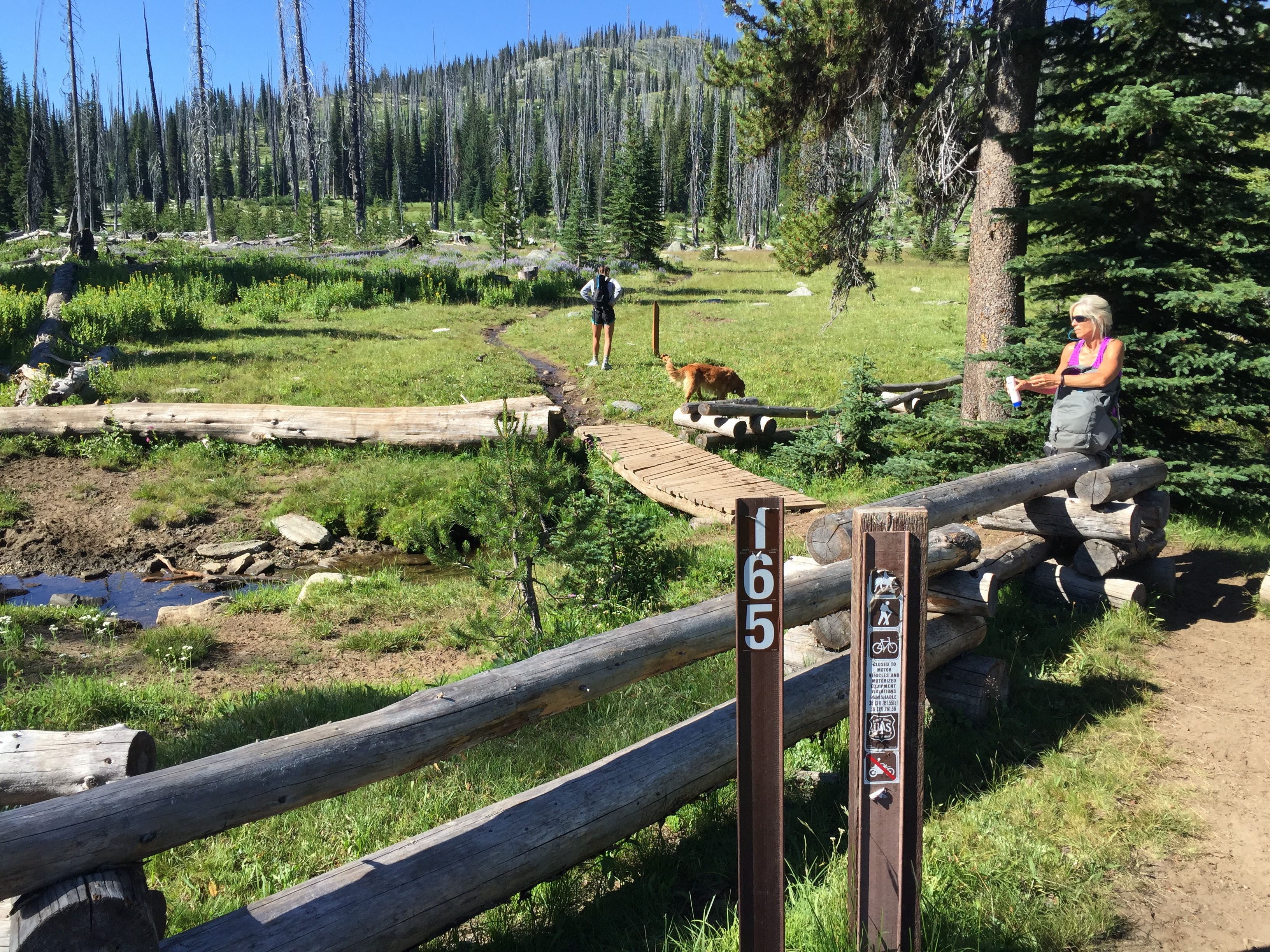
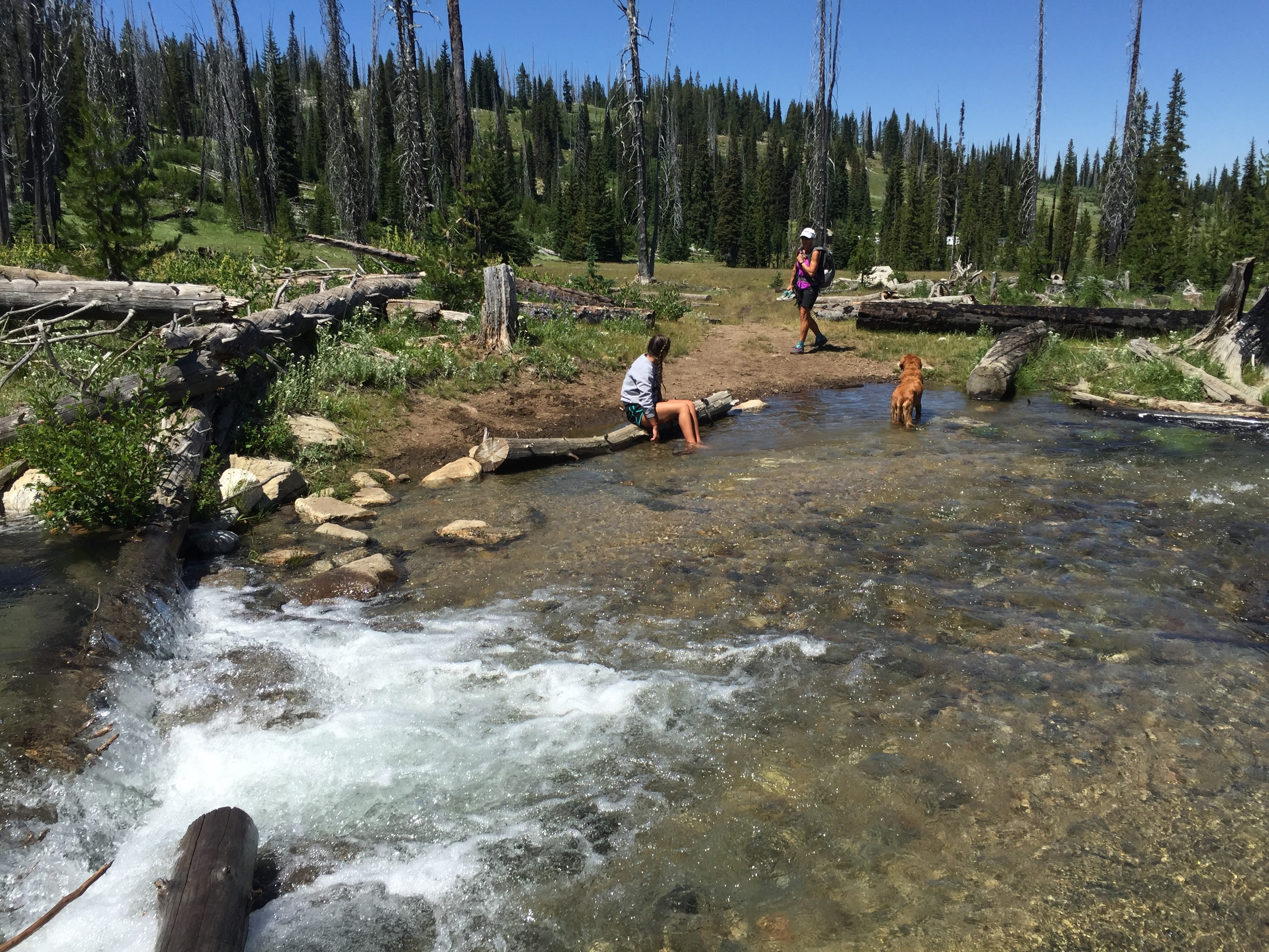
At the start of the trail you will cross a couple of streams. This is great for our dog to get a drink and cool down in. No other water higher up on the trail, but there have been a few remaining snow patches on my two summit activations. Crossing the streams is easy with plenty of big logs to walk across.
Please see my previous activation report for more information: http://www.pnwsota.org/blog/k7mk/2015-september-10/granite-mountain-idaho-june-2015
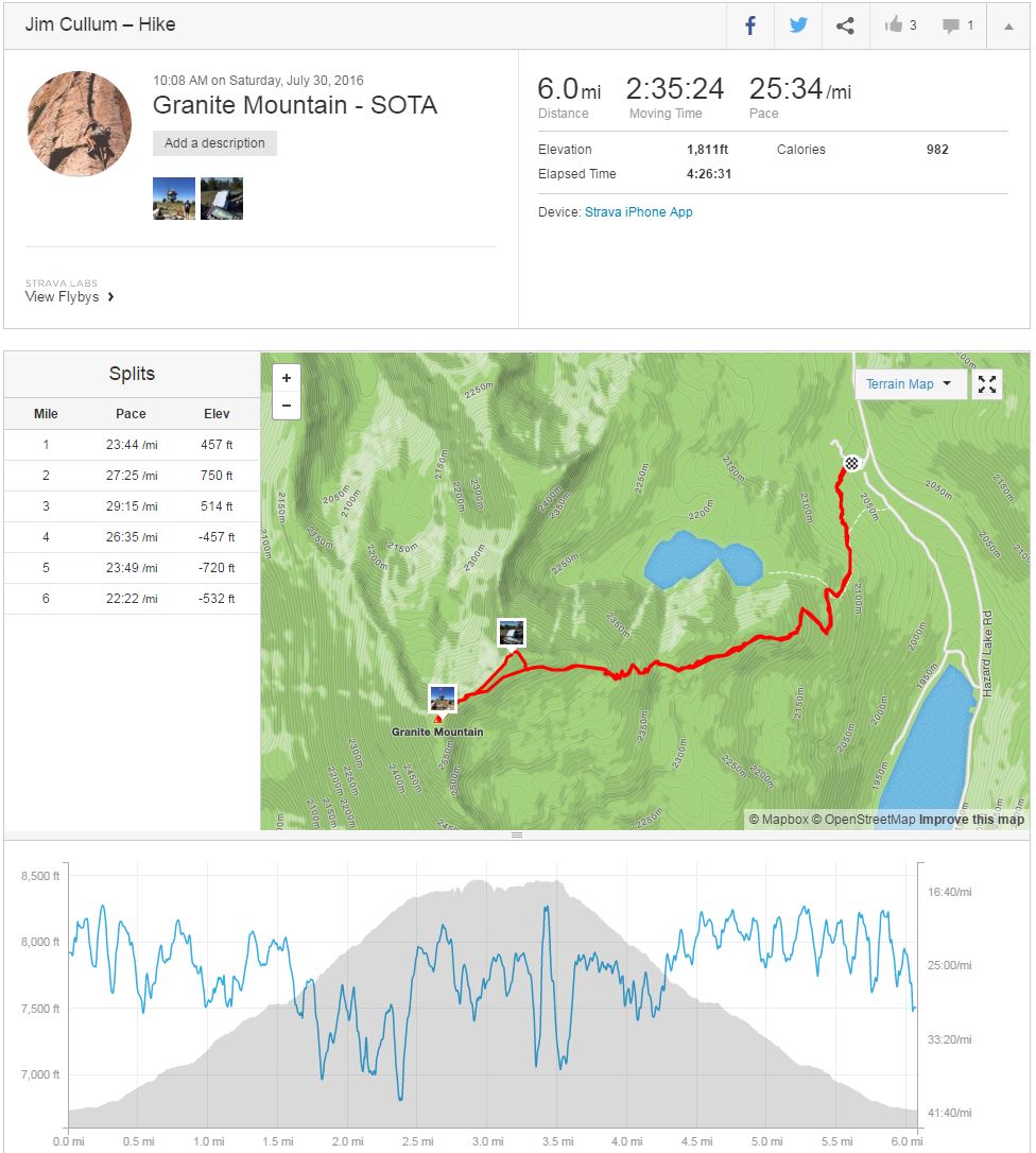
Also, here’s the strava report from this activation: https://www.strava.com/activities/658985601
Google map to trailhead: https://goo.gl/maps/BCDMRg7SChs
GPS hike track (download GPX): https://drive.google.com/open?id=0B4QAwgHA56oiQUwzNlRmSFJXcFU
This is a recommended activation if you are in the McCall area. AT&T and Verizon coverage is workable at the summit and most of the trail. APRS should be good as the digipeater is 30m line-of-site to the south. The dirt road to the trailhead is always in good condition and you can whip along at 40mph on the straight sections. You could camp at the trailhead or along Goose Lake if you wanted. There is also a pit toilet at Goose Lake.
73 de Jim/K7MK