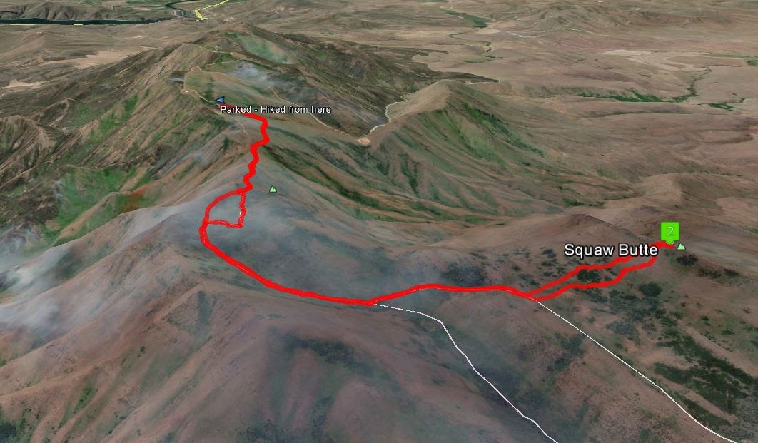
One of a couple Squaw Butte's in Idaho, this one near Emmett Idaho was activated on a pleasant Spring day. Heading North out of Emmett Idaho, you can connect to a dirt road that leads you to the top of "Squaw Butte". However, the highpoint is about a 2 mile hike from where most passenger cars will need to park.
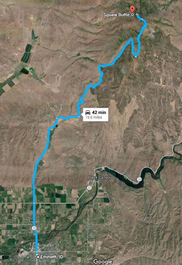
To get to Squaw Butte, head north out of Emmett Idaho on the main N/S street (Washington Ave / Hwy 52). A few miles N of town, at a stop sign, Hwy 52 turns to the east and heads to Horseshow Bend. Continue straight (North) on the same road which is now named Van Duesen Rd. Just before the road turns to dirt, take a right on Butte Rd. After about a mile, turn left at the T and head up the hill. The gravel road should be passable by most passenger cars, but does get steep and rocky in some sections. A SUV or truck is recommended. When you gain the ridgeline there are various commercial towers dotting the ridge as well as a fire lookout. This ridgeline is generally about 50ft lower than the actual summit which is about 2 miles to the north. Turn left when you hit the ridgeline and drive as far north as your car allows. It gets pretty rocky so it is just better to park at the first tower site and start walking.
If you had a very capable Jeep, RZR or 4-wheeler you could take the road/trail that leads to within 1/4mile of the summit. It gets very rocky and rutted in spots so you are better off walking unless you are sure of your gear!
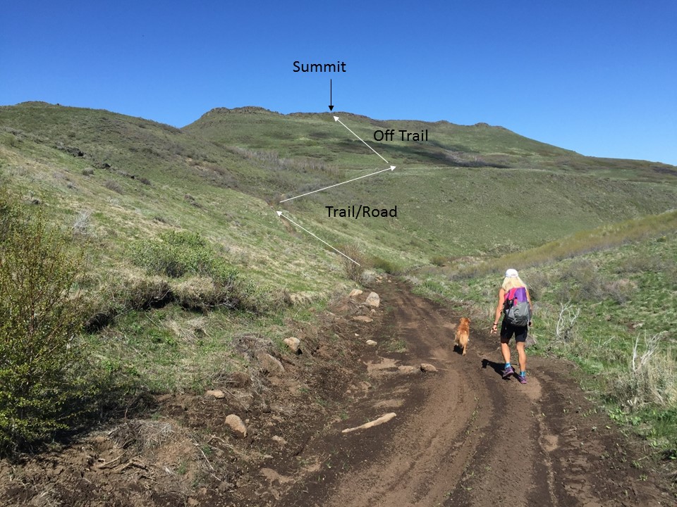
As you travel along the road from the first tower site to the second tower site, a road will drop off to the left. This is the road/trail to the summit. There is a small place to park at this intersection, if you are still driving.
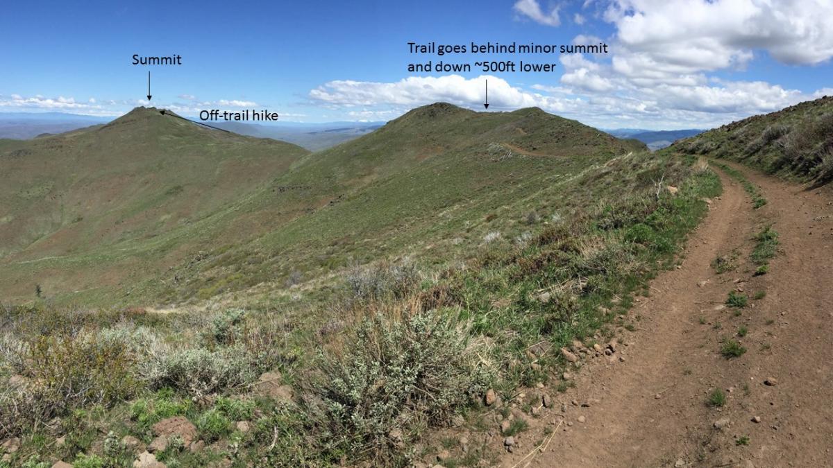
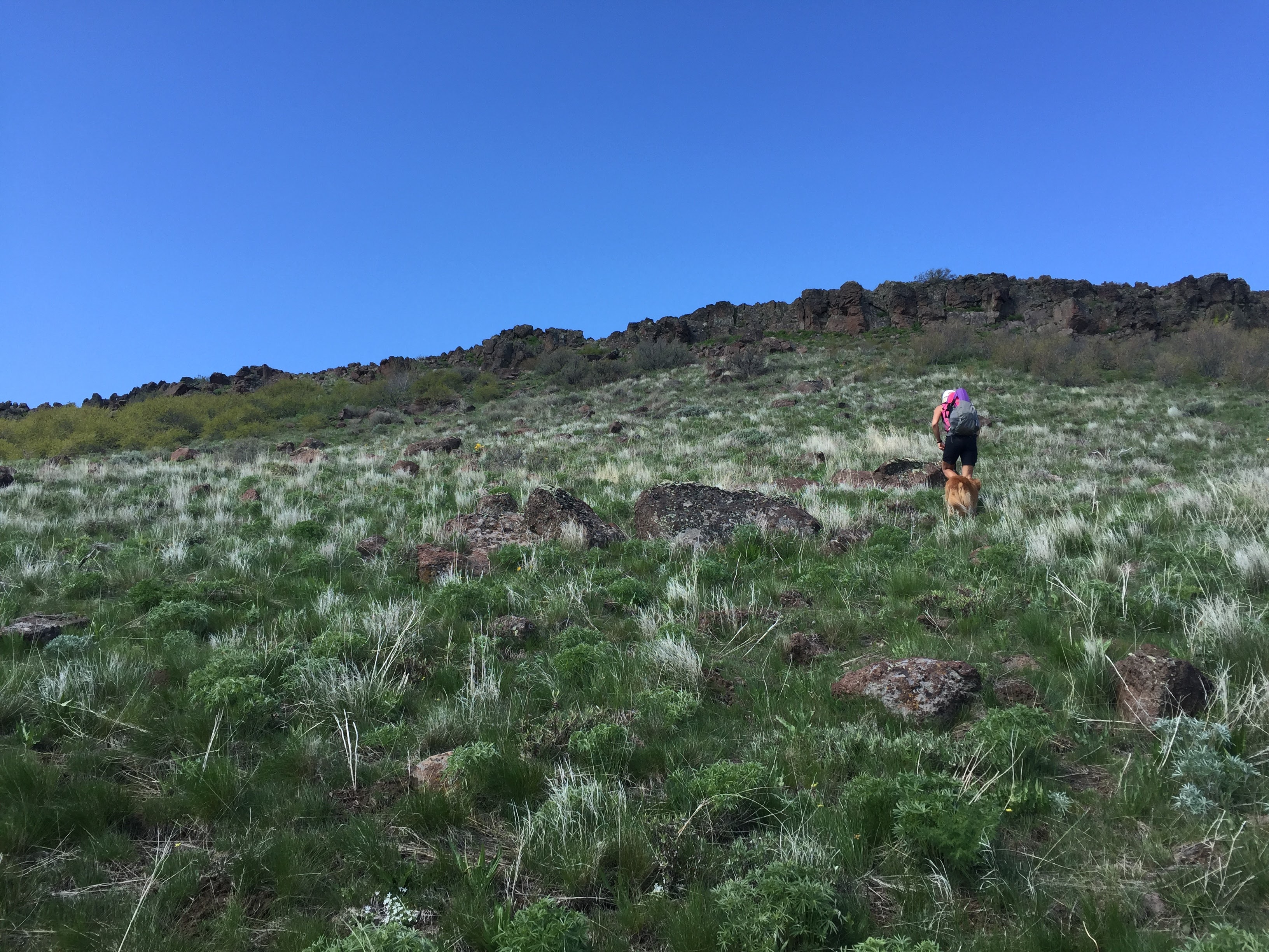
You will have a nice view of the summit until the trail turns to the right and starts to drop down. It is conceivable that you could maintain your elevation, but there are some pretty thick bushes guarding the path to the summit. Best to just follow the 4x4 trail down and around the corner. When you can see the summit again, notice a trail taking off to the left. Follow this trail up to the summit. At some point you will need to go cross country and head for the high point on the ridge.
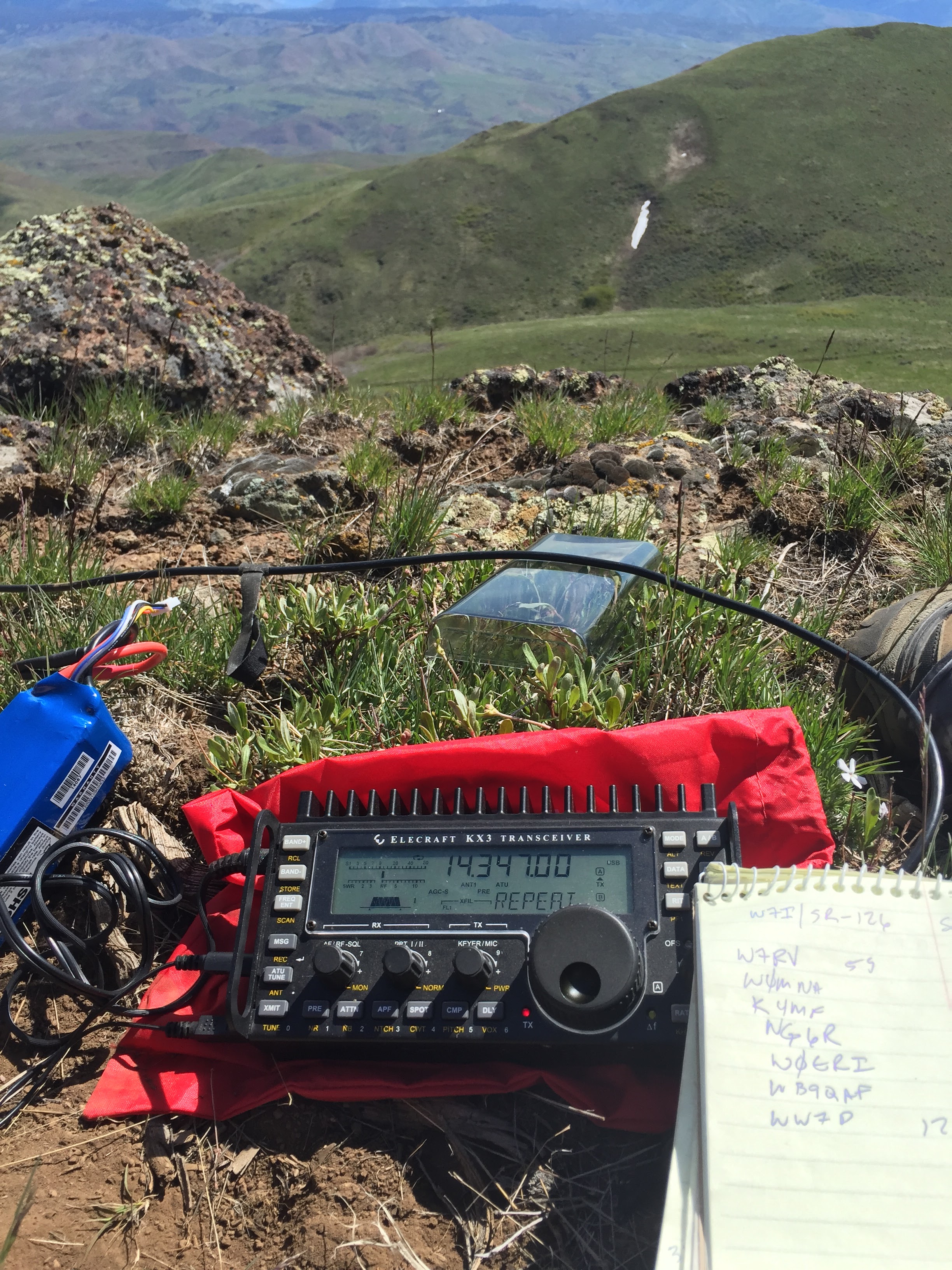
Follow GPS to summit point and/or look for the benchmark. There is a small summit register as well. Cell service from the summit and on the way to the summit was pretty good with Verizon. Very spotty with AT&T, but somewhat usable from the summit. I'm guessing APRS coverage to the 2 repeaters (Snowbank and Cinnabar) would work just fine.
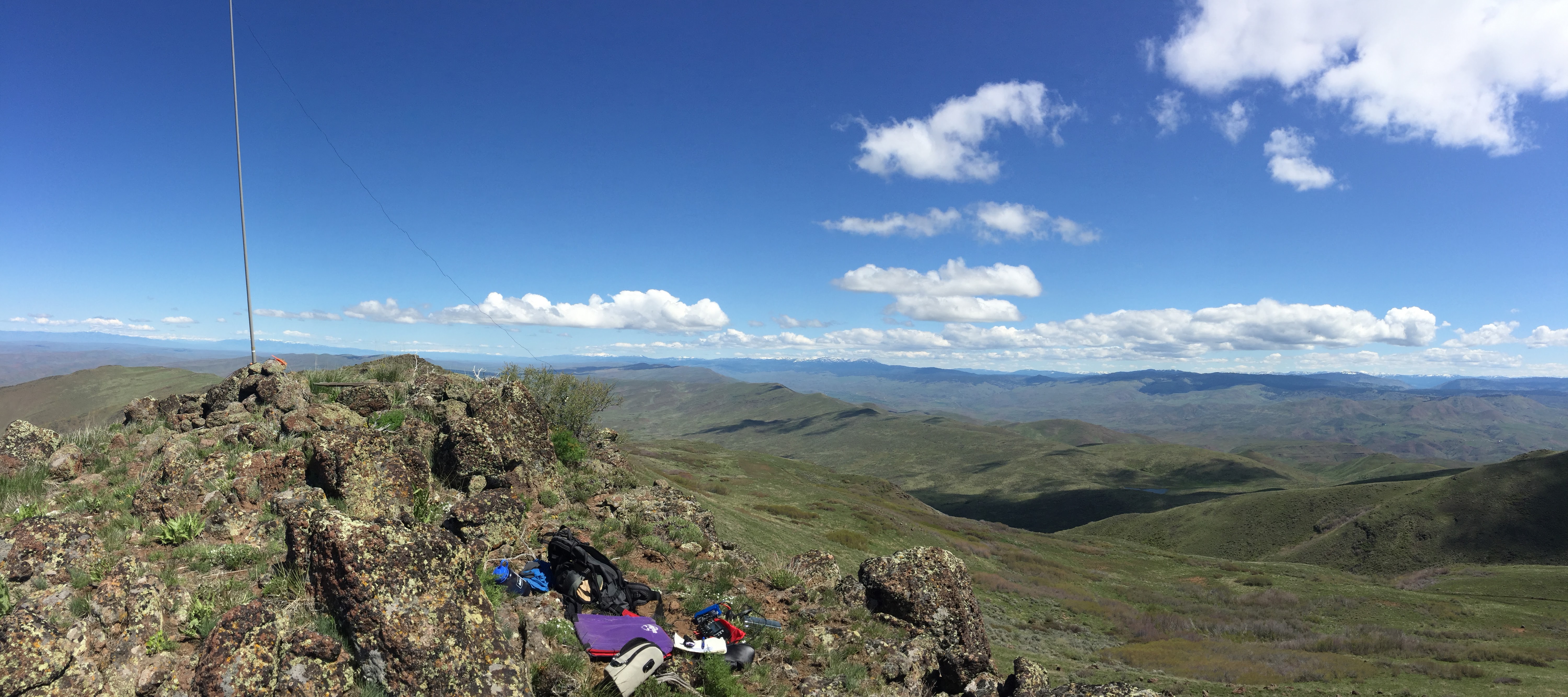
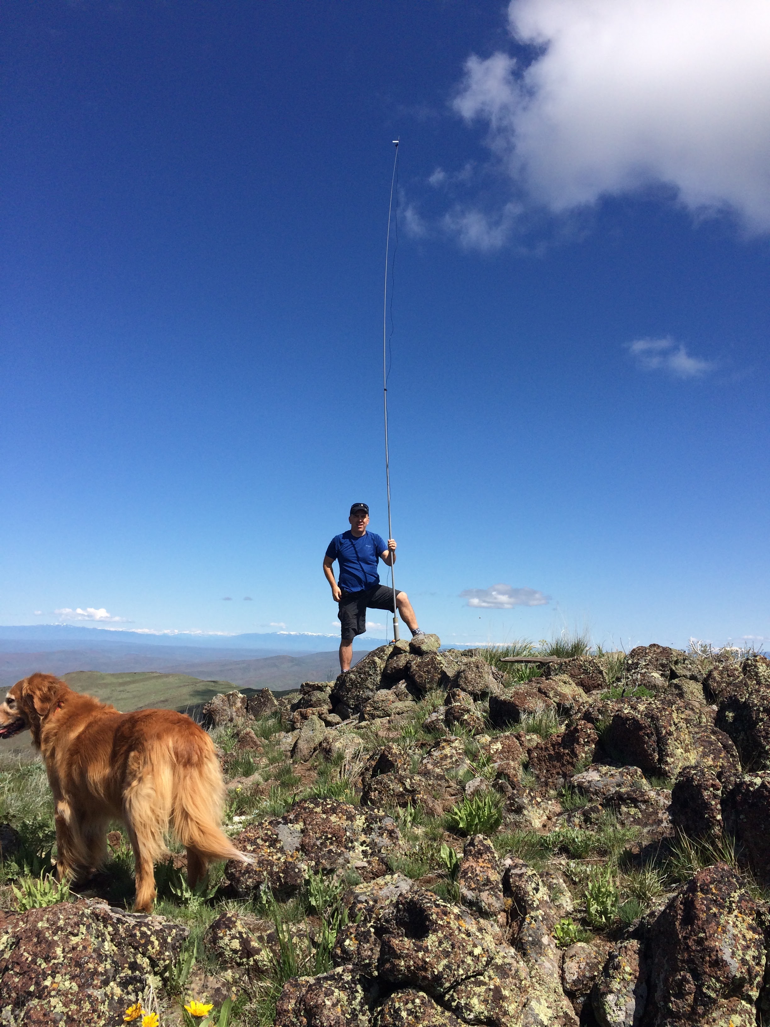
There are no trees for antenna support on the summit, but there is a nice pile of rocks that can be used to hold a sotapole or similar for an endfed wire or dipole.
Views are amazing in all directions from the summit.
Thanks to K7ATN for his previous trip report as it helped us route find once the trail took off in an unexpected direction. The roads depicted on my Garmin GPS didn't actually exist so it was good to have K7ATN's overview.
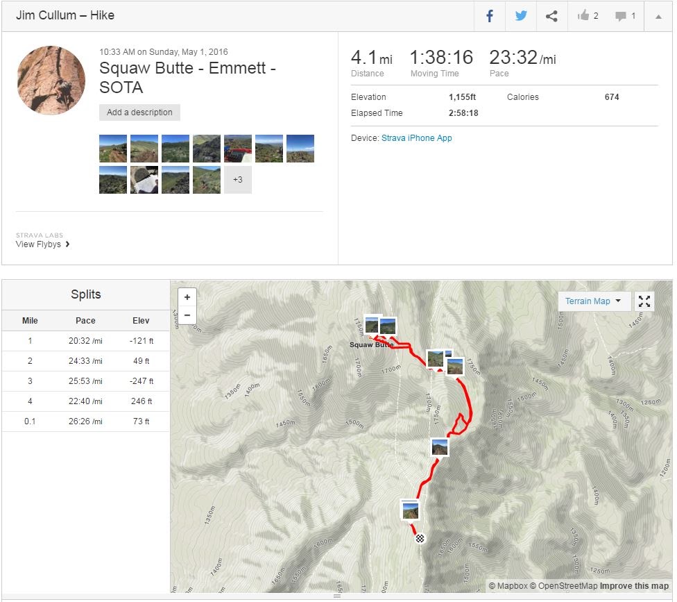
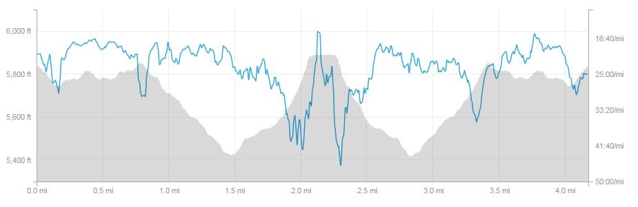
Strava Report here: https://www.strava.com/activities/562556457
Additional Photos here: https://goo.gl/photos/HYtAUiX8j1cuesoM7
73, Jim K7MK