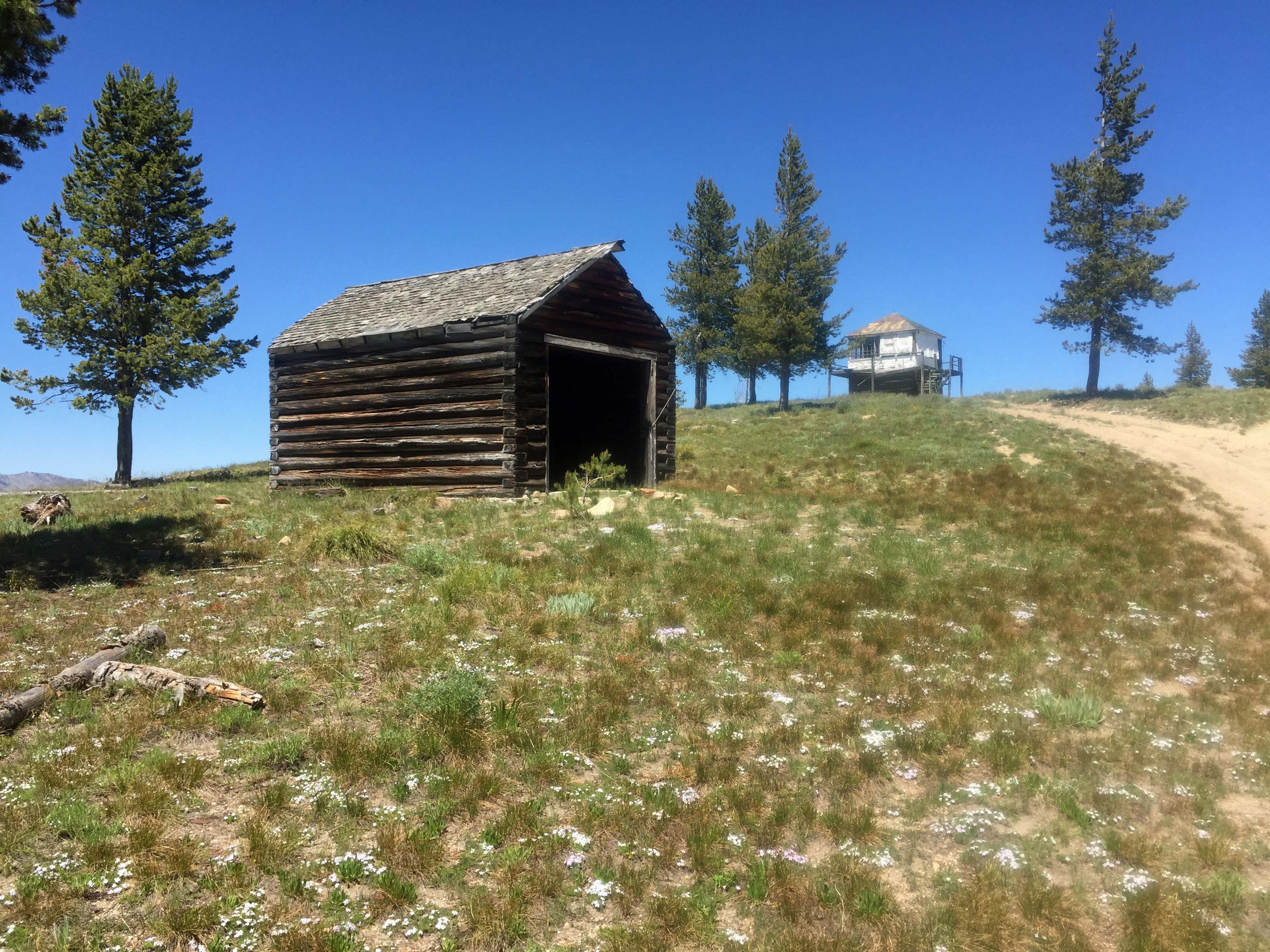
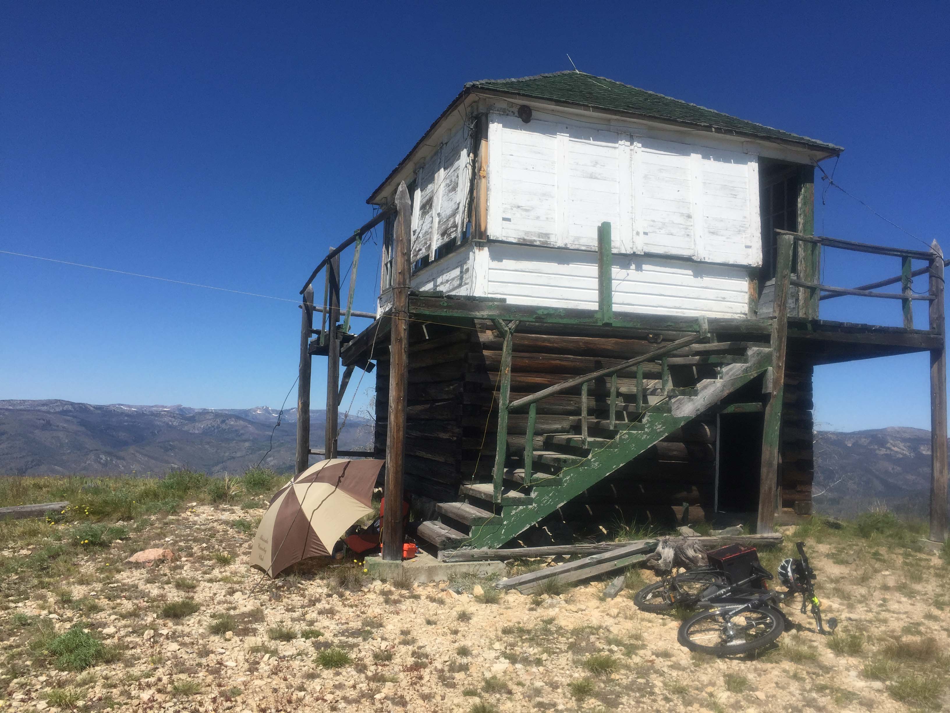
Oreana Ridge is a picturesque summit with scattered trees, grass/forb land, an old US Forest Service L-4 Lookout and a log garage. There are fine views of high peaks in the Frank Church River of No Return Wilderness and the steep slopes of Salmon River breaks. The lookout built in 1934 has been abandoned and is in very poor shape. Though the stairs look inviting, the decking is rotten and hazardous to walk on. Trees are available to string wire antennas.
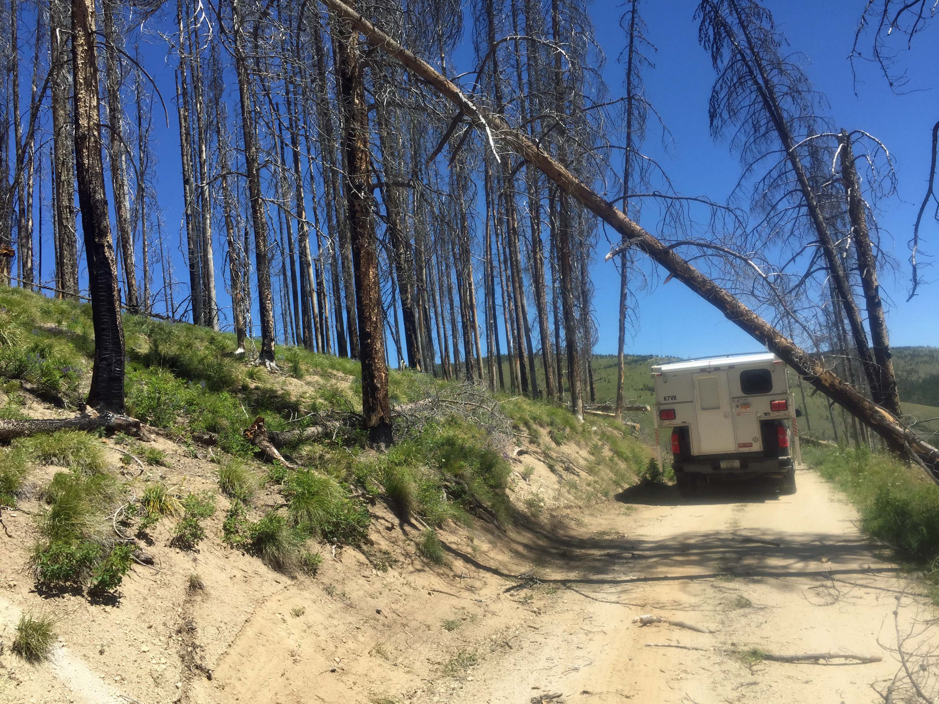
A dispersed camping site is at the junction of FS #123 and FS# 067. There are a few other sites along the main roads. Many areas seemingly suitable for dispersed camping have standing dead trees so use caution. Large areas of this landscape have been burned in wildland fires. Travel at times is through snag-filled forest. Beware of where you park, camp and travel especially on windy days. A saw can be handy in case fallen trees block your route.
A developed Campground, Alta is located approximately 4 miles south of Painted Rocks Reservoir, approximately 30 miles from Highway #93. It has potable water. Elsewhere water is available only at a few small stream crossings. It is best to bring water with you. The road is paved to this campground.
Elevation gain: 0’ if you drive up FS# 067. This road gains approximately 700’ from the main road FS#123.
Water: There is no water source.
Bear Pepper Spray: Highly recommended in all North Idaho/Montana summits.
Maps: US Forest Service, Salmon-Challis National Forests
Directions: 4 miles south of Darby, turn south onto the West Fork Road #473/9600 to Painted Rocks Reservoir. Continue up the east side of the reservoir for approximately 13.5 miles to the junction of FS #91. Travel up #91 for approximately 9 miles to Horse Creek Pass. Turn east on FS#44. Travel southeast approximately 3 miles to the junction of FS#44, FS#038 & FS#123. Take Spring Creek Road #123 approximately 6.5 miles to the junction of FS# 067. This road had a large wash gulley near the beginning, so I opted to ride a mountain bike to the summit. Above the wash the road is in good shape. This road is suitable for an ATV. It is 3 miles to the Oreana summit.
Alternatively one could come via Salmon Idaho to the North Fork Junction on Highway #93, go down the Salmon River to FS#038. Then climb FS038 to the junctions of FS#123.