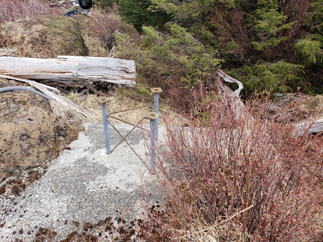
Summary: West Onion Peak is a great activation if you don't mind the 13 mile round trip hike. Also the final bit of the hike requires a bushwhack/boulder scramble but the activation zone is a cleared bolder area which is also the location of an old fire lookout with nothing but some tower bases and the cement pad left.
Cell Reception: Cell reception for the hike is extremely poor but in the activation zone it was quite good and useable (I use Verizon) so you should be able to self spot but don't expect it on the hike.
APRS: APRS didn't start giving me good echoes until about half way through the hike but its very useable at the summit and I used it to spot myself when my cell phone died.
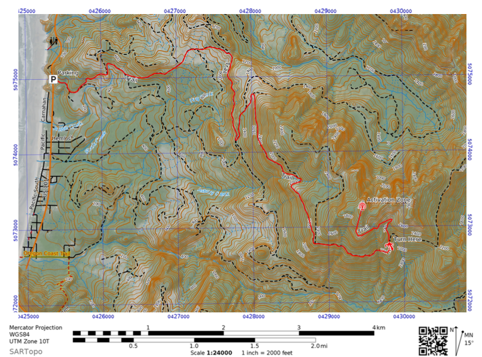
Parking: Parking is just off Highway 101 south of Arch Cape on Hug Point Road. The position is 45.824462, -123.960788 and a couple of vehicles can likely park there.
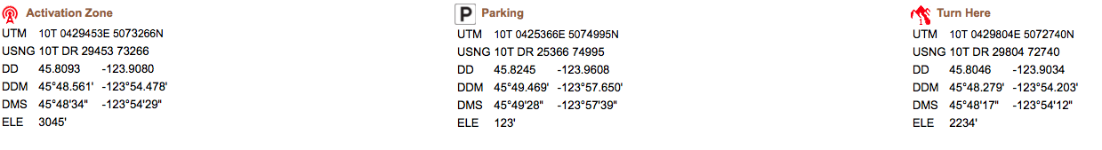
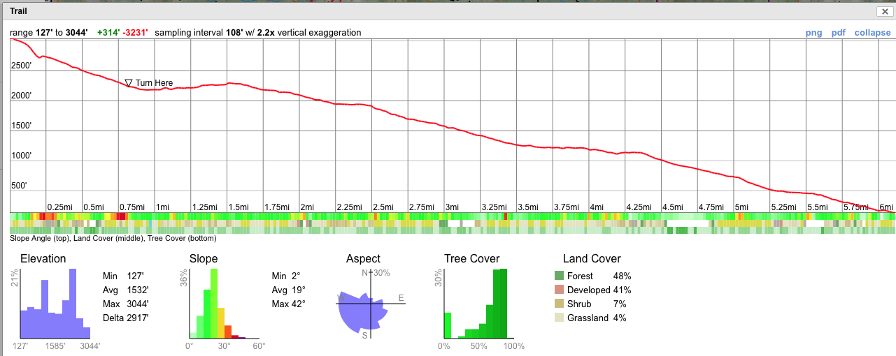
Trail Summary: The trail is around 6.1 Miles with just over 2900' of elevation gain. The first 5.27 miles are on logging roads and fairly easily navigated via google maps or any other mapping service or via the map I provide below. Don't believe the topo maps which make it look like accessing the summit from the west is easy I tried it and it sucked...The preferred access is the trail I have outlined it is an old Jeep trail likely from when the lookout was active the turn-off the logging road is located at 45.8046, -123.9034. Follow the jeep trail for ~.6 miles until you come out on a landing. The summit is nearly directly to your north and is around .24 miles of bushwhacking and boulder scrambling to get there.


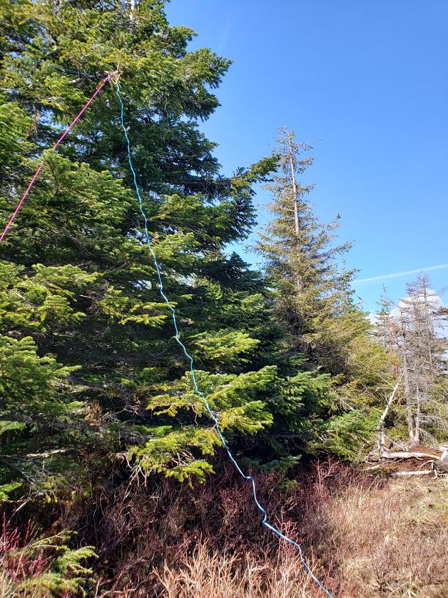
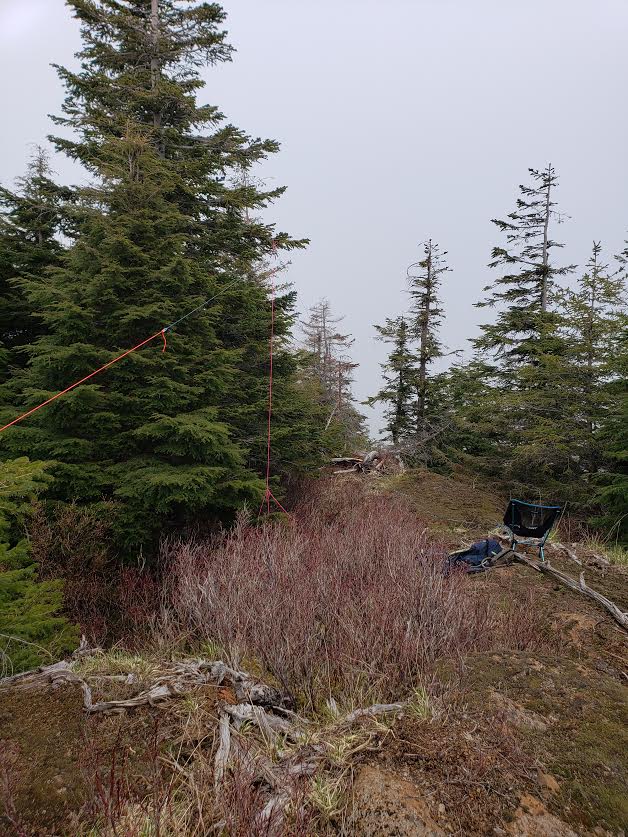
Activation Zone: The activation zone is the site of the old fire lookout just to the north of the old lookout towers foundation is a nice large long rocky area a few feet higher than the foundation. This is where I setup my antenna. Its flat enough you could set up a tripod if you decided to lug one up. There are also plenty of places to guy out a mast. I chose to use a speaker wire dipole and was able to get it up into one of the pine trees without too much issue.
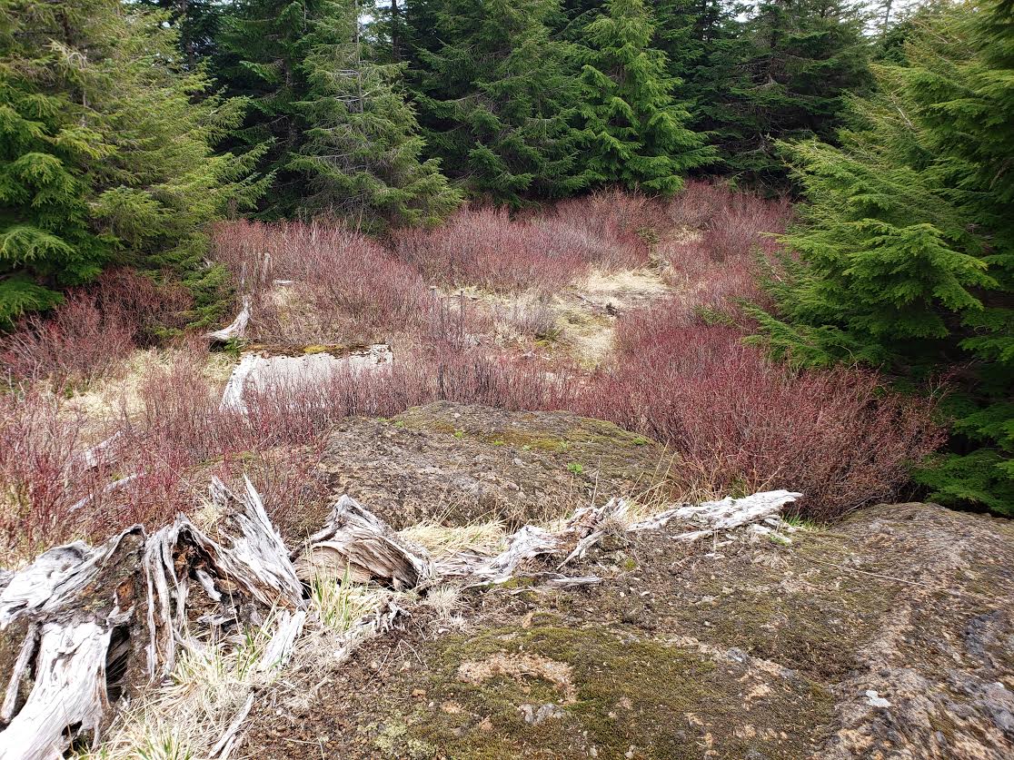
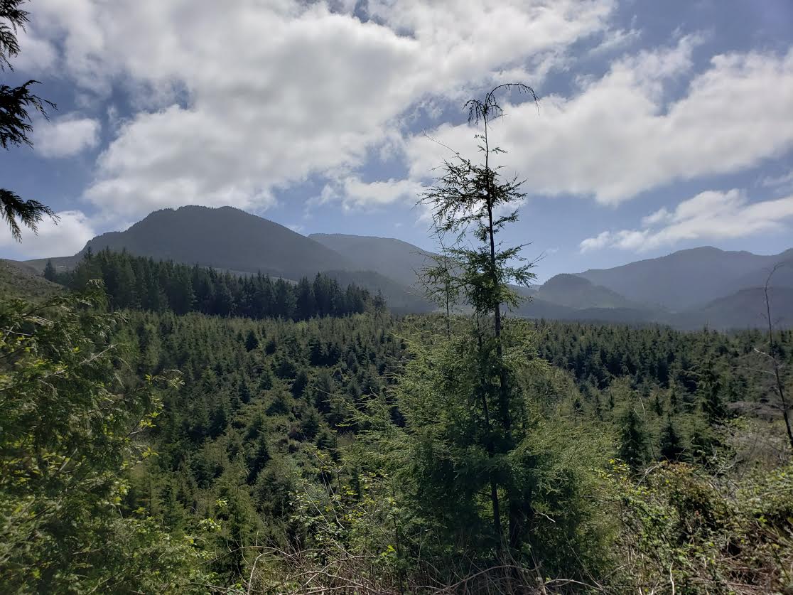
Views: Views from the true activation zone aren't all that great due to trees that have grown up but the hike is very scenic with the first half having great views of the ocean and coast with Tillamook head visible. Farther in the mountains all around are amazing and you can also see Angora peak to the south (Another yet to be activated as of today sota summit). This area is also full of massive boulders which I quite enjoyed.
Conclusion: If you're up for the long 12+ Mile hike with 2900' of elevation gain and are comfortable completing the off trail bushwhack/boulder scramble this is a great peak to activate. I was able to get a second QSO with New Zealand while on this summit it the ocean only a few miles below you to the west and no major obstructions to the east you should be able to work all over from this summit.