Summit:
W7O/NC-010
Summary: West Onion Peak is a great activation if you don't mind the 13 mile round trip hike.

Summary: West Onion Peak is a great activation if you don't mind the 13 mile round trip hike.
While completing my activation of West Onion Mountain W7O/NC-010 I noticed that closure signs were posted that all access to Onion Peak (Summit refrence W7O/NC-011) Is closed until further notice due to it being a 'Sensative Area'. The area is managed by EFM (which I believe is Evergreen Forest Management aka lewis and clark?). I just wanted to post this to stop anyone from making the drive to the coast hoping to activate it only to get skunked. With that being said go check out my write up on West Onion which is accessible and is a good one!
Having completed an activation on Lone Ridge yesterday (22APR2019) I just wanted to post a quick update to the previous activation report on this site. The hike from the suggested parking area to the summit can be completed 100% on logging roads at this time but the total distance is 4.6 miles. You can significantly shorten the hike with a fairly steep/sketchy hike through a clearcut but this isnt required. Also the activation zone is now a large cleared gravel spot with decent views.
I just wanted to post a quick update on W7O/NC-044 the previous write up is still accurate but as I understand some people have found it posted no tresspassing I just wanted to post an update from my recent activation there.
Summary: On 31MARCH19 I decided to complete the first activation of W7O/NC-072 currently called only '2905' I had briefly attempted this summit for the S2S party on 23MAR19 but found the road covered in snow. Today however I was able to drive the majority of the way up with the actual hike portion being fairly short but sweet. I made the mistake of completing the activation during a big CQ competition so the entire 20m band was full of signals but I was still about to get 18 contacts including 3 s2s contacts.
Summary: On 28MAR19 I decided to knock out the first activation on Field Effect Hill (aka Megler Mountain). The weather started out beautiful and sunny but I ended up having to complete my activation in the rain which contiuned until I had started the hike back down when the sun returned. Overall, the hike isnt bad but the the horrible wide band RFI in the vincinity of the summit made this less fun for an HF activation than most summits which tend to be far quieter.
After abortive failures earlier in the day due to lack of access I finally completed an activation on this awesome summit on a beautiful day.
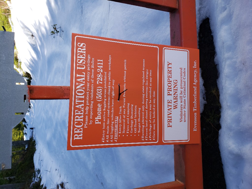
Access to the summit is via gated logging roads with recreation use permitted signs and no motor vehicles allowed.
Parking is directly off Highway 47 south of Clatskanie at position: 46.041460, -123.248066
There is ample parking for multiple vehicles as seen below:
I completed the first activation on Doppler Shift on 04MAR2019. The hike is roughly 2 miles from a logging gate. In my case this gate was open however as with all these gates they can be closed and locked at any time so pass them at your own risk. I was able to drive about 3/4 of the way up before finding a 'Unauthorized Motor Vehicle Access Prohibited' sign. At that point I found a spot to park and hiked the rest of the way to the activation point.