Scouting Report
TL;DR version: Parking for one or two rigs outside the gate. Broken rock road to lookout, 2.75 miles, path to true summit forks off from LO road at ~ last 1/4 mile. LO area was forested, true summit likely is also. Good opportunities for hanging wire, limited view. All in all, a lovely walk in the forest.
I've tried twice now to activate Sisi Butte. For last year's Willamette Valley 2m Party, I couldn't find the right spur road; thought I had the map clear in my head, but no topo in hand. This year, I had the topos, but underestimated the drive time. Thought I'd drop a scouting report here for those that might try it later.
SiSi Butte (pronounced Sigh-sigh according to the good folks at the Ripplebrook RS.)
Last year, the folks at the Ripplebrook RS said the recreation area permits (right term?) weren't needed. Said no one would be enforcing in that area and insisted I'd not need one. I agreed to go bare, YMMV. This year I stopped at the Detroit RS on the way in but they were closed so I figured I had a get-outta-jail-free card to play, again.
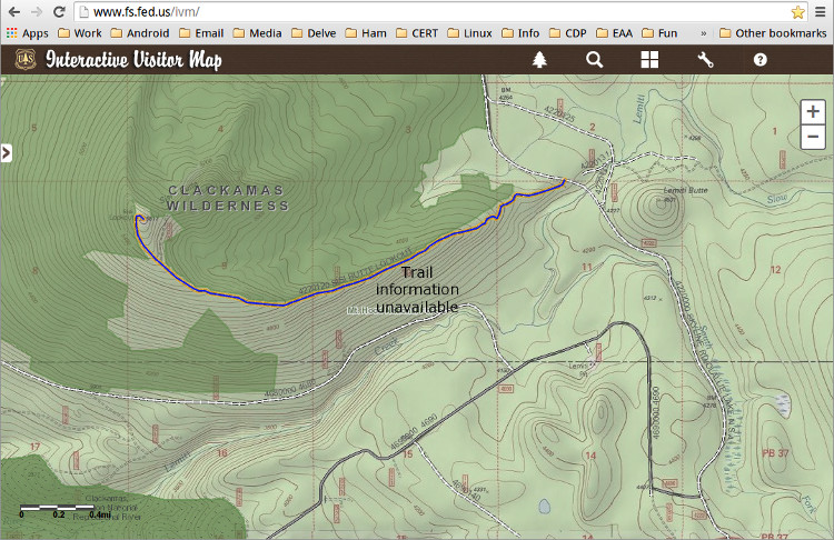
The USFS has a neat 'Interactive Visitor Map' at www.fs.fed.us/ivm. The 'four panes' icon lets you select different overlays. Picking 'USGS Topo' makes 'Sisi Butte' searchable.
Last year, I went up through Estacada, RD-46, to RD-4680 but missed dropping onto RD-4690 and RD-4220. This time I went south to Salem and hooked a left up the Santiam Hwy. That was waaay south to pick up RD-46 to RD-4690 to RD-4620. (Think I got that right.) The upshot is that the spur road up to the lookout is on RD-4220, about 2 mi north of the intersection with RD-4690.
Arriving late, my only hope to make the party even 'fashionably late' was that the gate might be open. 'Twas not to be, so I parked the truck at the gate. Just outside the gate there's space for maybe two cars without blocking. Wished the gate was a little further up the spur, to leave my truck more out of sight but ces't la vie. Hurriedly gathered up the gear into my day pack and started hoofin' it up the lookout road. The road is broken rock and well maintained. On the map, it looks close to three miles; my pocket pedo said four, but I was prolly making less than my usual stride on the road... and pausing to catch breath. I took 1:45 walking up, through about 1300-ft elevation gain. (I'm out of shape and was one sore puppy for a couple 'a days after.)
The LO road forks about a quarter mile short of the lookout tower with the left tine continuing up to the lookout in good form, the right tine heads towards the true summit. On 16may15, I walked up the right side about 200-300-ft, it's clearly NOT maintained, with a wind-fall tree across the road at about 50-ft in, and 'Christmas tree's growing up in the middle of that road a little further on. Off camber slides on a narrow dirt/mud road that could leave a jeep hurtin, even if you took along a chain-saw to clear the other obstacles. Looks from the map like the old road goes most of the way to the summit and should be a short bushwack from there. It's only 5600-ft elevation so I'd expect lots of trees for hanging wire, it was forested at the area of the lookout. There wasn't much of a panorama at the LO, but with the clouds scudding through at my elevation, there wouldn't have been much of a view, even without the trees.
I did manage to get at least one text-msg out w/ AT&T, so while the phone reception wasn't strong, it was at least somewhat available. Two bars at the time I checked.
I did turn on my radio while at the LO, but realized in my haste to get going I'd left my BNC-UHF adapter in the box at the truck. Having humped the Diamond X-50 up hill, there was no way to attach it to the HT. A dongle short...
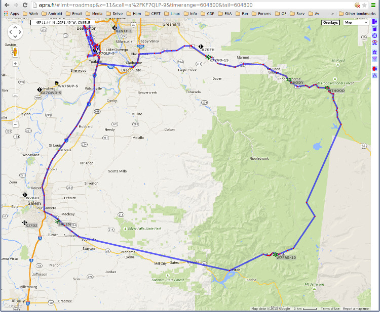
The APRS track was from my truck-mounted radio, running 15 W. Coverage along the I-5 and Hwy 26 corridors was fine, but pretty marginal up Hwy 22, and except for one digi-peater/i-gate beyond Detroit lake, pretty sparse. Coverage would likely be better at the summit. I didn't have APRS during the walking portion.
If you have family not into playing radio, you could consider sending them along to the lookout. I didn't check whether there is LO access or even up the stair flights but I didn't see any obstacles from the road. The LO and the true summit should be within FRS radio range.
Upshot is... I had a fine time in the woods, didn't meet any rain, just a brief and welcome misting from a low-flying cloud on our party, Saturday. Didn't see any large game and that's fine, didn't have spray nor arms along. If the gate's open (and you're confident it'll stay open) it'd be an easy drive up to the fork with several places to drop your vehicle out of the way. Otherwise, next time, I'll try it with a mountain bike. And since I don't own a mtn-bike, it won't be soon.